
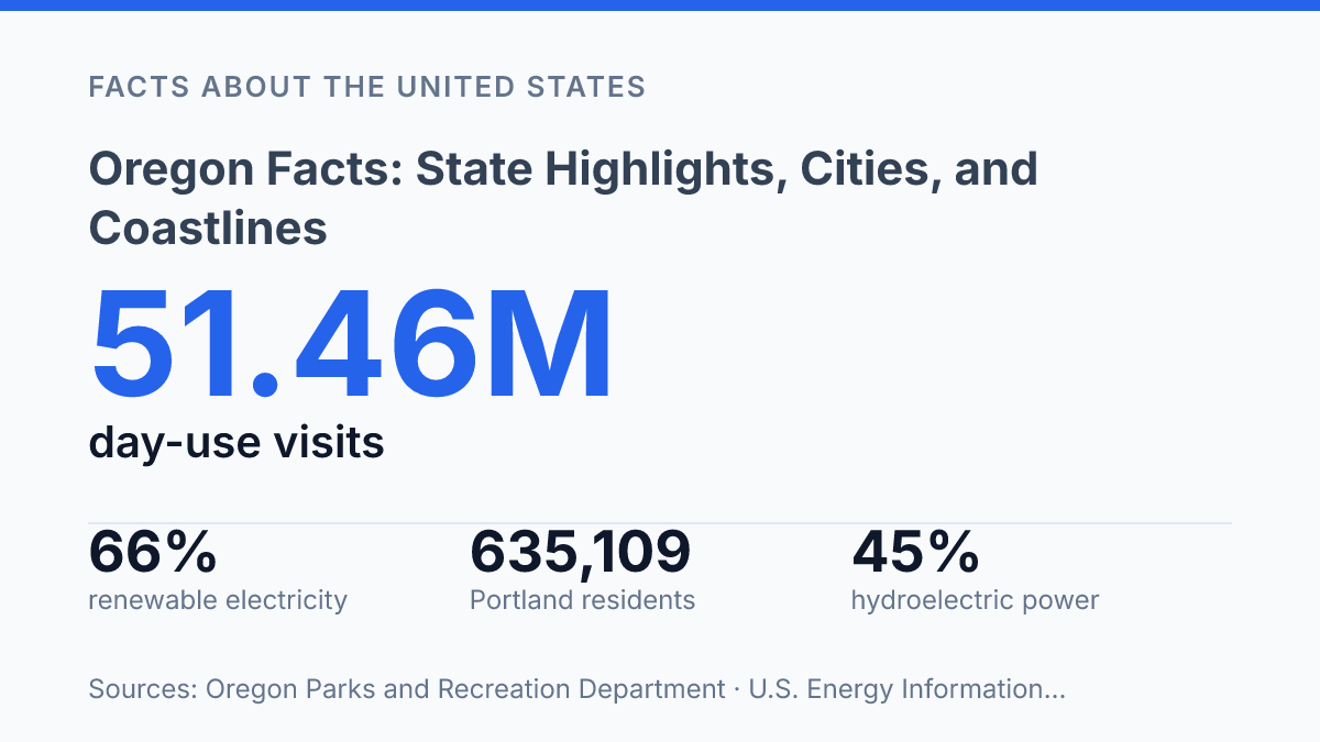
Oregon logged 51.46 million day-use visits to its state parks in 2025, and 30.65 million of them were tied to the state’s 362 miles of publicly managed beaches. That split says something useful right away: the coast isn’t just scenery, it’s a major part of how people use and understand the state. The same pattern shows up in less obvious places, too.
Rivers still shape the power grid, with hydro supplying about 45% of electricity generation in 2025, while farms, forests, ports, and semiconductor plants all pull the state in different economic directions. Oregon facts get more interesting when you put those pieces side by side: a famous outdoor identity, a changing Portland, a serious export economy, and a history that includes both 1859 statehood and exclusion laws written into the original constitution.
What makes Oregon stand out?
The state is often reduced to Portland, but its outline is really set by a publicly managed Pacific Ocean shoreline and the Cascade Range. Those two features give it a clear west-to-east identity: ocean edge on one side, mountain spine through the interior, and a mix of valleys, forests, high desert, and farm country beyond the best-known urban image.
Geographically, it sits in the Pacific Northwest, with Washington to the north, California to the south, Idaho to the east, and Nevada touching its southeastern edge. That position matters because the state is both coastal and inland, tied to the Pacific while also connected to the broader Intermountain West. It isn’t just a rainy corner of the map, even if that stereotype sticks.
That coastal identity shows up in public use, not just scenery: state parks recorded 51.46 million day-use visits in 2025, and the coast’s 362 miles of publicly managed beaches drew 30.65 million of those visits, according to the Oregon Parks and Recreation Department. In other words, the shoreline is one of the state’s defining public spaces, not a narrow strip reserved for a handful of beach towns.
The name people reach for first is Portland, and that makes sense because it’s the largest city. Still, Salem is the state capital, and the state’s identity isn’t centered on one metro area alone. The coast, the Cascades, the Willamette Valley, and the drier country to the east all help explain why quick assumptions about the place often miss a lot.
How the state’s geography shapes daily life
A rainy valley morning and a dry sagebrush afternoon can belong to the same weather map here, because elevation and mountain barriers matter as much as latitude. West of the main mountain spine, moist marine air brings frequent rain, greener forests, and a climate that often feels milder. Much of eastern Oregon, by contrast, sits in a drier high desert where open range, colder winter nights, and bigger seasonal swings are part of normal life.
That split affects ordinary decisions, from what roads stay reliable in winter to where farming, housing, and daily commutes make the most sense. Still, it isn’t a simple wet-versus-dry line. Conditions shift by season and elevation, so a valley town, a mountain pass, and a plateau community can have very different weather on the same day.
Mount Hood is one of the clearest examples of how geography shows up in daily routines, not just on maps. Its height helps shape snowpack, road conditions, and water timing for nearby communities. Crater Lake, set high in the south, makes the same point in another way: elevation can create long-lasting snow and cooler conditions even when lower areas are warming up.
The Columbia River carries that geography into the state’s economy and infrastructure. It forms a major border line, but it’s also a transportation corridor for freight and a major source of power. According to the U.S. Energy Information Administration in 2026, hydroelectric power supplied about 45% of the state’s total electricity net generation, which shows how rivers still shape everyday systems, not just scenery.
The coast adds another layer. Marine air can soften temperature extremes, while wind, fog, rain, and steep coastal terrain can affect travel and where communities fit. Put together, the state’s geography doesn’t create one shared experience; it creates several, often within a relatively short drive.
Which cities and industries drive the state?
A state long associated with forests now gets much of its trade punch from electronics and machinery, which accounted for 50% of exports over the previous three years, according to a 2025 state economic development report. That shift doesn’t erase timber, farming, or recreation. It just shows how broad the state’s business base has become.
Portland still anchors the main urban economy, even after its U.S. Census Bureau 2025 city estimate fell to 635,109 residents from the 2020 estimate base. Its metro area is where corporate offices, port-related trade, creative services, health care, and a large share of technology activity cluster.
Nearby Washington County is especially tied to the “Silicon Forest,” with Intel playing a major role in the state’s semiconductor profile. Nike, based in Beaverton, gives the region another nationally recognized business name, this time in sportswear, design, and global branding.
Outside the Portland area, the pattern changes but doesn’t become less important. Eugene functions as a southern Willamette Valley hub, with education, health care, food, arts, and outdoor-oriented businesses supporting the local economy.
Salem concentrates public-sector work and also sits in a fertile valley where nurseries, vineyards, seed crops, and food processing connect city jobs to surrounding farmland. Medford serves southern communities through health care, retail, logistics, agriculture, and tourism tied to the Rogue Valley and nearby public lands.
Manufacturing is part of the same mix. Computer and electronic product manufacturing contributed $14.43 billion to state GDP in 2024, according to Federal Reserve Economic Data using U.S. Bureau of Economic Analysis figures updated in 2025. That number helps explain why semiconductors matter so much to exports and wages, even though the sector is concentrated in specific metro areas rather than spread evenly across the map.
Rural areas still carry the older economic story in a real way. Timber remains important in forested counties, agriculture covered 35,500 farm operations managing 15.3 million acres in 2024, according to USDA/NASS, and outdoor recreation supports outfitters, lodging, restaurants, guides, and seasonal work.
So the state’s economy is not simply urban tech on one side and rural resources on the other. It’s a layered mix, with cities driving population and services while land-based industries continue to shape many communities outside the biggest job centers.
What people often want to know about Oregon history
Congress admitted the state on February 14, 1859, but its founding document also included exclusion laws aimed at keeping Black people from living there, according to the Secretary of State and the state encyclopedia. Those sources describe it as the only state admitted with that kind of exclusion language in its constitution. The numbers show how sharply that policy shaped early demographics: the 1860 census counted 128 African Americans in a total population of 52,465.
The Oregon Trail is still one of the best-known historical references tied to the region, and for good reason. It served as a major 19th-century migration route for settlers moving into the Pacific Northwest, influencing land claims, towns, transportation routes, and the way later generations pictured the state’s frontier past. But it’s only one chapter, not the opening chapter.
Long before wagon migration became part of the public story, Indigenous peoples had lived across the region for thousands of years. That history continues through tribal nations and communities today, including the Confederated Tribes of Grand Ronde and the Confederated Tribes of Warm Springs. Their presence is not just background context; it’s central to understanding land, treaties, culture, governance, and survival through major political change.
So, if you’re trying to place the state’s history in a few anchors, the useful ones are statehood in 1859, the migration story of the trail, and the much deeper Indigenous history that predates both. Holding those pieces together gives a more accurate picture than treating westward expansion as the whole story.
What the next set of numbers will reveal
The next layer is adjustment. A state built around rain, rivers, forests, farms, and an open coast now has to plan around warmer temperatures, thinner snowpack, wildfire smoke, housing pressure, and trade cycles that can shift quickly. That doesn’t make the familiar image of the state wrong, but it does make it incomplete.
If you’re trying to understand where the state is headed, watch the practical indicators: park use, water supply, electricity generation, export data, and city population estimates. Those numbers will say more than slogans, especially in a place where beaches, chips, wheat fields, and constitutional history all sit inside the same story.
Frequently Asked Questions
Q: What is Oregon best known for?
A: Oregon is known for its varied scenery, from the Pacific coastline to forests, mountains, and high desert. People also associate it with Portland, Crater Lake, and a strong outdoor culture. That mix makes it appealing if you want both city life and easy access to nature.
Q: Which city is the largest in Oregon?
A: Portland is the largest city in Oregon and the best-known urban center in the state. It’s a major hub for food, arts, and business, while still being close to rivers, trails, and mountain areas. If you’re comparing cities, Portland usually comes up first because of its size and influence.
Q: Does Oregon have a coast?
A: Yes, Oregon has a long Pacific coastline with beaches, cliffs, sea stacks, and small coastal towns. The coast is one of the state’s biggest draws because it’s scenic and publicly accessible in many places. It’s a popular choice for day trips, road trips, and outdoor recreation.
Q: What are some popular places to visit in Oregon?
A: Some of the most visited spots include Crater Lake, the Oregon Coast, Mount Hood, and Portland. These places give you a good cross-section of what the state offers, from volcanic landscapes to ocean views and city experiences. If you’re planning a trip, that range makes it easy to build an itinerary around your interests.
Q: Is Oregon a good state for outdoor activities?
A: Yes, Oregon is a strong choice if you like hiking, camping, fishing, skiing, or beach travel. The state’s geography gives you a lot of variety without having to go far between regions. That means you can plan very different kinds of trips within one state.