
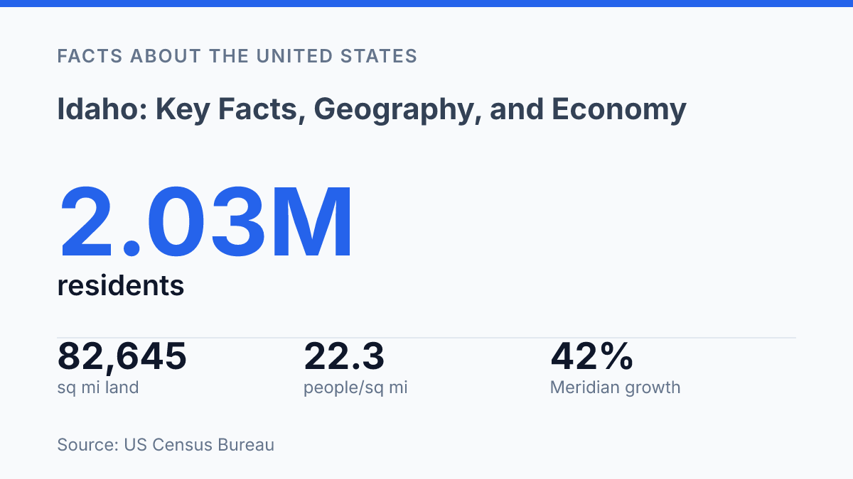
Idaho had 2,029,733 residents as of July 1, 2025, a 10.4% increase from its 2020 estimates base, yet its 2020 density was only 22.3 people per square mile across 82,645.14 square miles of land. That contrast explains much of the state’s current profile: rapid growth, large open areas, and development pressure concentrated in specific corridors rather than spread evenly.
Boise City grew just 1.1% from its 2020 base, while nearby Meridian grew 21.4%, showing how suburban expansion is reshaping the state’s largest metro area. The same pattern of contrast runs through the rest of the state, from wet northern mountains to dry southwestern valleys, from potatoes to a dairy sector worth more by production value, and from rural land uses to major employers tied to technology, logistics, agriculture, and government.
Idaho at a glance
A state with more than 2 million residents can still average only 22.3 people per square mile, a contrast that explains much of Idaho’s basic profile. The U.S. Census Bureau estimated 2,029,733 residents as of July 1, 2025, up 10.4% from the April 1, 2020 estimates base, while the state covered 82,645.14 square miles of land in 2020. That combination means recent growth has not erased the state’s broad pattern of concentrated settlement and large sparsely populated areas.
Located in the northwestern United States, the state borders Washington, Oregon, Nevada, Utah, Wyoming, Montana, and the Canadian province of British Columbia. Its admission to the Union came on July 3, 1890, a useful marker for basic reference without needing a detailed historical account here.
The capital is Boise, which is also the state’s largest city and the anchor of the Boise metropolitan area. U.S. Census Bureau QuickFacts reported 238,429 residents in Boise City and 1.1% growth from its 2020 estimates base, while nearby Meridian reached 142,988 residents after growing 21.4% over the same period. Those figures show that the state’s population and political influence are centered heavily in the Boise area, but the fastest urban growth has been especially visible in surrounding communities rather than in the capital city alone.
Geography, climate, and major regions
The state’s most heavily used settlement and travel axis is not a mountain valley but the broad arc of the Snake River Plain, a lower-elevation corridor that cuts across the south and gives the region its main east-west continuity. Highways, irrigation districts, towns, and cultivated land follow this plain because its terrain is more open than the surrounding uplands and because the Snake River system supplies the water infrastructure that makes intensive land use possible in an otherwise dry interior. This geography helps explain why a state strongly associated with mountains also has a large share of its people and farms tied to a comparatively open southern belt.
Mountain country dominates much of the north, center, and east. The Rocky Mountain regions include high ranges, forested basins, and headwater areas that shape recreation, timberland, grazing, and seasonal travel conditions.
The Sawtooth area, part of the central mountain belt, is one of the clearest examples of this terrain: steep granitic peaks, alpine lakes, and narrow valleys limit large-scale settlement but support tourism, public lands, and water storage functions. Farther east, ranges and valleys connect toward Wyoming and Montana, creating a landscape where passes, river corridors, and winter weather matter as much as straight-line distance.
Climate varies sharply with elevation and exposure. According to the NOAA/NCEI State Climate Summary, annual precipitation ranges from more than 40 inches at some northern mountain sites to less than 10 inches in parts of the southwest, while snowfall can be modest in southern lowlands and exceed 100 inches in higher mountains. These contrasts influence where dryland farming is feasible, where irrigation is essential, and where snowpack becomes a critical seasonal water source.
Regional orientation also matters. The western side connects physically and commercially toward Washington and Oregon, while the southern boundary faces Nevada and Utah across drier basin-and-range terrain. The northern panhandle narrows between Washington and Montana and points toward British Columbia as a nearby Canada-facing reference, giving that part of the state a different geographic relationship than the Snake River Plain or the eastern highlands.
Agriculture, minerals, and major employers
Milk, not potatoes, produced the larger farm cash value in the state’s recent agricultural accounts. USDA/NASS reported 17.022 billion pounds of milk worth $3.881 billion in 2024, compared with 135.235 million hundredweight of potatoes worth $1.220 billion. Potatoes remain the best-known crop and the state ranks among the leading U.S. producers, but the figures show that the farm economy is broader than its public image suggests.
Other agricultural outputs reinforce that diversity. Dairy production supports processing plants, feed demand, trucking, and export-oriented food supply chains. Barley is tied both to livestock feed and malting markets, while sugar beets support specialized processing capacity.
Cattle operations remain another major part of rural income, linking grazing, feed production, meat markets, and related services. Taken together, these sectors make agriculture a large production system rather than a single-crop identity.
The nonfarm economy has become especially visible in and around metropolitan labor markets. Micron Technology is one of the clearest examples: state Commerce officials reported a $35 billion Boise expansion expected to add 3,000 jobs. That investment places semiconductor manufacturing alongside agriculture and food processing as a defining part of the employment base, particularly in the Boise area. The same source cited Tractor Supply’s $225 million Nampa investment, expected to create 500 jobs, which illustrates the role of logistics, retail distribution, and regional service activity in job growth.
Mining remains another long-running economic pillar, especially where mineral deposits have supported extraction and processing industries. Its statewide employment footprint is smaller than broad service categories, but it matters locally because mines, suppliers, equipment firms, and transport operators can anchor work in areas with fewer large private employers.
According to the state Department of Labor’s 2024 economic report, the state economy was estimated at $128.1 billion in GDP, and real GDP growth averaged 3.9% versus 2.8% nationally. That wider growth pattern helps explain why farming remains central without being the only major driver.
People, cities, and places to know
The official 2020 Census count of 1,839,106 residents helps explain why a state known for wide rural areas can still feel increasingly metropolitan in a few corridors. By July 1, 2025, the estimate had reached 2,029,733 residents, up 10.4% from the April 1, 2020 estimates base, according to U.S. Census Bureau QuickFacts. That gain reinforces a pattern already visible on the ground: growth has clustered around established urban areas rather than spreading evenly across the map.
Population is most visibly concentrated around Boise, Meridian, and Nampa, which together define much of the state’s southwestern urban growth. Meridian represents the suburban expansion side of that pattern, while Nampa remains one of the major communities in the same regional orbit. Idaho Falls plays a different role in the east, functioning as a prominent regional center rather than an extension of the southwest’s growth zone.
Outside those population centers, many counties remain thinly settled, with communities separated by long travel distances and large areas of public or rural land. This contrast shapes public services, transportation planning, housing pressure, and political representation: urban counties often face growth-management questions, while rural areas tend to focus more on access, distance, and retaining local services.
Several places also serve as shorthand for the state’s public identity. Coeur d’Alene is closely associated with the northern lake region and acts as a recognizable reference point for the Panhandle.
Sun Valley is nationally known as a mountain resort community, while the Salmon River is one of the state’s best-known river corridors and a common geographic marker for central and northern interior areas. Together, these cities and landmarks show how the state is understood through both its growing urban hubs and its widely recognized regional places.
Where the growth pressure shows next
The next test for the state is not whether it can keep attracting residents, employers, and investment, but whether growth can be matched with housing capacity, water planning, wildfire resilience, and infrastructure in the places absorbing the most change. A year with 17,944 building permits signals active construction, yet median owner-occupied housing values of $418,600 show that supply alone does not erase affordability pressure.
Climate exposure adds another constraint, especially where drought and wildfire risks intersect with farms, forests, and expanding communities. The practical consequence is clear: the state’s geography still shapes its economy, but population growth is now shaping how that geography is used.
Frequently Asked Questions
Q: What is Idaho best known for geographically?
A: Idaho is known for its varied terrain, which includes mountain ranges, forested highlands, river valleys, and extensive public lands. The state’s geography supports outdoor recreation, agriculture, and hydroelectric development, each shaped by its elevation and water resources.
Q: What are the main industries in Idaho?
A: Idaho’s economy is led by agriculture, manufacturing, technology, and mining. Potatoes remain the state’s best-known crop, while semiconductor production, food processing, and data-related services have become increasingly important in urban areas.
Q: Why is agriculture so important in Idaho?
A: Agriculture matters because Idaho has a strong irrigated farming system and a climate that supports a range of crops and livestock. The industry contributes to exports, food processing, and rural employment, making it one of the state’s most influential economic sectors.
Q: Which cities are most important to Idaho’s economy?
A: Boise is the largest economic center and the main hub for government, corporate services, and technology. Other cities, including Idaho Falls, Pocatello, and Twin Falls, play important roles in energy, education, manufacturing, and agriculture.
Q: How does Idaho’s geography affect daily life and development?
A: Idaho’s mountain terrain and river systems influence where people live, how goods move, and how water is managed. These conditions also shape settlement patterns, transportation routes, and the balance between urban growth and resource-based industries.