
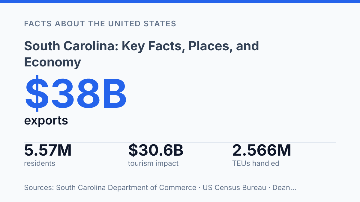
South Carolina is not only a historic Atlantic state; its estimated 5,570,274 residents in 2025 marked an 8.8% rise from the 2020 estimates base, placing recent growth at the center of its modern story. The state’s scale is compact, but its profile is unusually layered: 2,876 miles of coastline, a port system that handled 2,566,764 TEUs in fiscal 2025, and export strengths led by passenger vehicles and tires. Its identity also rests on older foundations, from the founding of Charles Towne in 1670 to state ratification of the U.S. Constitution in 1788.
Understanding the state requires connecting geography, settlement patterns, urban centers, tourism, logistics, and manufacturing rather than treating them as separate facts. That connection explains why Charleston, Columbia, coastal resorts, inland rail links, and factory towns all matter to the same economic picture.
Where South Carolina is located and what defines it
South Carolina compresses Atlantic beaches, pine lowlands, rolling Piedmont, and a small Blue Ridge foothold into a compact southeastern state with unusually sharp regional contrasts. It borders North Carolina to the north, Georgia to the southwest across the Savannah River system, and the Atlantic Ocean to the east. That position places it between the Appalachian foothills and the coastal Southeast, so travel routes, weather patterns, and settlement corridors tend to run across a clear inland-to-coast gradient rather than through one uniform physical setting.
The Coastal Plain covers much of the eastern and southern part of the state and includes tidal marshes, barrier islands, river mouths, and broad lowland areas. According to the NOAA Office for Coastal Management, the state’s coastal zone includes 1,473,500 coastal residents and 2,876 miles of coastline, a figure that reflects bays, inlets, islands, and tidal edges rather than a simple straight shoreline. This helps explain why the coast functions as both a residential region and a major environmental boundary, with Atlantic exposure shaping hurricane risk, humidity, fisheries, and beach-based travel.
Farther inland, the Sandhills form a transitional belt of older, sandy terrain between the Coastal Plain and the Piedmont. The Piedmont rises into rolling uplands, where firmer ground and river crossings have long made north-south and east-west movement more practical than in wetter coastal areas. The Congaree River and related river systems reinforce this midland pattern by linking interior drainage with routes toward the coast.
At the far northwestern edge, the Blue Ridge area introduces the state’s smallest but most distinct upland environment. Higher elevations bring cooler conditions and steeper terrain, setting this corner apart from the flatter coastal and midland regions. The result is a state that is geographically modest in size but divided into clear coastal, central, and upland zones, each with different implications for climate, transportation, land use, and where people concentrate.
A brief history of settlement and statehood
A settlement founded in 1670 at Albemarle Point became the institutional ancestor of Charleston and, within a few generations, one of British North America’s wealthiest slaveholding colonies. According to the South Carolina Encyclopedia, English settlers established Charles Towne in April 1670 before the town later developed at its more enduring site and became Charleston. Its early growth depended on Atlantic trade, plantation agriculture, and enslaved labor, especially as rice and indigo production expanded in the lowcountry.
Colonial prosperity gave the coastal elite unusual influence, but it also tied political power to a plantation system whose legacy remains central to historical interpretation. Wealth generated through coerced labor shaped landholding, representation, and social hierarchy long before independence. That history helps explain why museums, archives, public monuments, and school curricula in the state often treat the colonial period not only as an era of settlement and commerce, but also as the origin of enduring racial and political structures.
After the American Revolution, the state joined the new federal system through constitutional ratification. South Carolina ratified the U.S. Constitution on May 23, 1788, entering the Union as the eighth state, according to the South Carolina Encyclopedia. Statehood preserved many existing institutions while placing them inside a new national framework, creating continuing debates over federal authority, state power, and the protection of property interests.
Those tensions became most visible in December 1860, when the state became the first to secede from the United States after Abraham Lincoln’s election. The act did not by itself define the entire Civil War, but it fixed the state’s place in the conflict’s origins and left long political and social consequences. Reconstruction, disfranchisement, segregation, and later civil rights struggles all drew part of their force from decisions made in the antebellum and secession eras, making this period central to public memory as well as to the evolution of state institutions.
Major cities, ports, and tourism centers
Charleston has become the state’s best-known urban calling card because it combines a working harbor, a preserved historic core, and one of the region’s strongest visitor markets. The city’s estimated population reached 159,423 in 2025, compared with 147,035 in Columbia, according to U.S. Census Bureau QuickFacts, placing Charleston slightly ahead among the state’s most prominent municipalities. Its port function remains central to that profile: the state Ports Authority reported 2,566,764 TEUs handled in fiscal year 2025, a scale that links the city’s public image with freight movement rather than tourism alone.
Columbia serves a different role as the capital and main inland administrative center. State government, higher education, courts, and public institutions give the city a steadier civic function than coastal resort markets, and its position in the Midlands makes it a practical meeting point for statewide administration. This distinction matters because the state’s urban identity is not concentrated in one metropolitan area; Charleston may draw more national attention, but Columbia anchors government and institutional activity.
Myrtle Beach represents the most recognizable resort corridor, with its hotels, entertainment venues, golf courses, and beach-oriented travel economy drawing large seasonal flows. A 2024 tourism impact report prepared by Dean Runyan Associates for the state parks, recreation, and tourism agency found that travel-related activity generated $30.6 billion statewide and supported 241,330 jobs. Myrtle Beach is one of the clearest examples of how that visitor economy becomes visible through lodging demand, short-term employment, traffic patterns, and local public-service needs.
Greenville shows the state’s urban growth from another angle. As a major Upstate city, it is associated less with beach travel and more with downtown redevelopment, regional services, corporate offices, and population growth across the surrounding metropolitan area. The contrast among Greenville, Columbia, Charleston, and Myrtle Beach helps explain why growth pressures are uneven: visitor-heavy coastal communities, administrative centers, and expanding inland cities face different demands for housing, roads, utilities, and public services.
What drives the state’s economy today
Completed passenger vehicles now account for a larger export value than many traditional farm categories combined, showing how far the state’s economy has moved beyond older agricultural shorthand. The state Department of Commerce reported $38 billion in export sales in 2024, including $10.9 billion in completed passenger vehicles and $1.8 billion in tires. That export mix reflects a manufacturing base anchored by BMW in the Upstate, Boeing’s aircraft work in the Lowcountry, and Michelin’s long-standing tire production network, with suppliers clustered around assembly plants, industrial parks, and interstate corridors.
Population growth helps explain part of the economic momentum, but it also adds pressure on housing, roads, and workforce availability. The U.S. Census Bureau estimated 5,570,274 residents as of July 1, 2025, up 8.8% from the April 2020 estimates base. For manufacturers and logistics firms, that growth can widen the labor pool and consumer market, while also making recruitment, training capacity, and commuting infrastructure more consequential.
Agriculture remains a practical part of the economy rather than merely a historical reference. Poultry production supports processing and distribution jobs, peaches connect farming with packing, retail, and seasonal markets, and tobacco continues to be grown even though its role is smaller than in earlier eras. These products matter because they link rural counties to food manufacturing, trucking, cold storage, and wholesale networks rather than standing apart from the broader industrial economy.
The Port of Charleston gives the manufacturing economy its most important international outlet, especially for vehicles, tires, aircraft-related cargo, retail goods, and industrial inputs. Inland rail connections extend that reach beyond the coast; the state Ports Authority reported 205,523 rail moves at Inland Port Greer in fiscal year 2025, up 9.5% from the prior year. This system ties factories and distribution centers to regional and global trade routes, but it also makes the economy sensitive to shipping rates, fuel costs, rail capacity, labor availability, and shifts in overseas demand.
What the next phase of growth will test
South Carolina’s next test is how well growth can be absorbed without weakening the assets that produced it. A larger population increases demand for housing, roads, water systems, and coastal protection, while port expansion and export manufacturing depend on reliable freight corridors and skilled labor. The same shoreline that supports tourism, marine activity, and real estate also concentrates exposure to storms, flooding, and insurance pressure.
Future performance will likely depend less on a single industry than on coordination between coastal management, inland infrastructure, workforce training, and city planning. The practical consequence is clear: the state’s strongest advantages are physical places, and those places will require active management as growth continues.
Frequently Asked Questions
Q: What is South Carolina known for?
A: South Carolina is known for its Atlantic coastline, historic cities, and strong tourism appeal. Charleston is often associated with preserved architecture and port history, while coastal areas such as Myrtle Beach draw large visitor numbers. The state also has a long agricultural and manufacturing background that shapes its identity beyond tourism.
Q: What are the largest cities in South Carolina?
A: Columbia is the state capital and one of the largest cities, followed by Charleston and North Charleston among the most populous urban areas. Greenville is also a major population and business center in the upstate region. These cities anchor much of the state’s employment, education, and transportation activity.
Q: What drives South Carolina’s economy?
A: Manufacturing, tourism, transportation, and agriculture are among the main drivers of the state economy. Automotive production and aerospace-related activity have become especially important in recent decades, while coastal tourism supports service-sector jobs. Agriculture remains significant in rural areas, with poultry, peaches, and other crops contributing to output.
Q: What is the climate like in South Carolina?
A: South Carolina has a humid subtropical climate across most of the state, with hot summers and generally mild winters. Coastal areas are more exposed to hurricanes and tropical storms, while inland areas can see colder winter nights. The climate supports a long growing season, which helps both agriculture and outdoor tourism.
Q: What historic places in South Carolina are most visited?
A: Charleston’s historic district is among the most visited areas because of its preserved homes, churches, and waterfront streets. Fort Sumter and other Civil War sites also attract visitors interested in U.S. history. Plantations, museums, and state parks add to the range of heritage sites across the state.