
Montana is the fourth-largest U.S. state by land area, yet its 2020 population density was only 7.4 people per square mile. That contrast explains much of the state’s geography, economy, and public life: large distances, major public-land holdings, concentrated urban growth, and industries tied closely to land and visitors. Federal figures show more than 17.2 million National Forest System acres in the state, while USDA data count 57.4 million acres in farms and ranches.
At the same time, growth is not evenly distributed. Bozeman grew 9.7% from 2020 to 2025, while Great Falls edged down by 0.5%. This profile examines how location, settlement patterns, resource use, tourism, agriculture, manufacturing, history, symbols, and state government fit together in one of the nation’s most spacious and least densely settled states.
Where Montana sits and what defines its geography
145,550.2 square miles of land make Montana the fourth-largest U.S. state, according to U.S. Census Bureau profile data, and that scale is central to understanding why its regions function so differently. The state sits in the northern Rocky Mountain West, with Idaho to the west and southwest, Wyoming to the south, North Dakota and South Dakota to the east, and Canada to the north. Along the international boundary, it meets the Canadian provinces of British Columbia, Alberta, and Saskatchewan, placing the state between Pacific-influenced mountain systems and the interior plains of North America.
Western counties are defined by the Rocky Mountains, high valleys, forested slopes, and the Continental Divide. This terrain concentrates roads, rail lines, towns, and agricultural land in valleys where grades are lower and water is more accessible. Glacier National Park, in the northwest, is one of the clearest expressions of this mountain geography, with steep relief, alpine basins, and headwaters that help shape drainage patterns across the region. Public land is also a major geographic fact: the USDA Forest Service’s 2024 Land Areas Report counts 17,254,317 National Forest System acres in the state, a figure that explains why forest management, recreation access, wildfire risk, and watershed protection are closely tied to land-use decisions in the west.
East of the mountains, the state opens into the Great Plains, where rolling prairie, broad river valleys, and long distances replace the tight topography of the west. The eastern region generally has drier conditions, fewer natural barriers to overland movement, and a land base more suited to large-scale grazing and crop production than to mountain-valley settlement. This contrast does not split the state into separate identities, but it does create different physical constraints: western routes must account for passes, snow, and narrow corridors, while eastern routes contend more with distance, exposure, and sparse service points.
The east-west divide also helps explain why maps of climate, land ownership, transportation, and settlement do not align neatly across the state. Mountain counties have more vertical variation over short distances, while prairie counties are shaped by horizontal scale and open terrain. As a result, the same state contains both alpine headwaters and semi-arid grasslands, making geography one of the main reasons its communities, land uses, and infrastructure patterns vary so sharply from west to east.
Population, cities, and settlement patterns
The state’s largest city would rank as a midsize suburb in many metropolitan states. Billings is the leading population center, with an estimated 121,239 residents in 2025, and it functions as a major service, medical, retail, and transportation hub for a wide surrounding region. Helena, by contrast, is most significant civically rather than numerically: as the state capital, it concentrates state government, public administration, and related legal and professional activity.
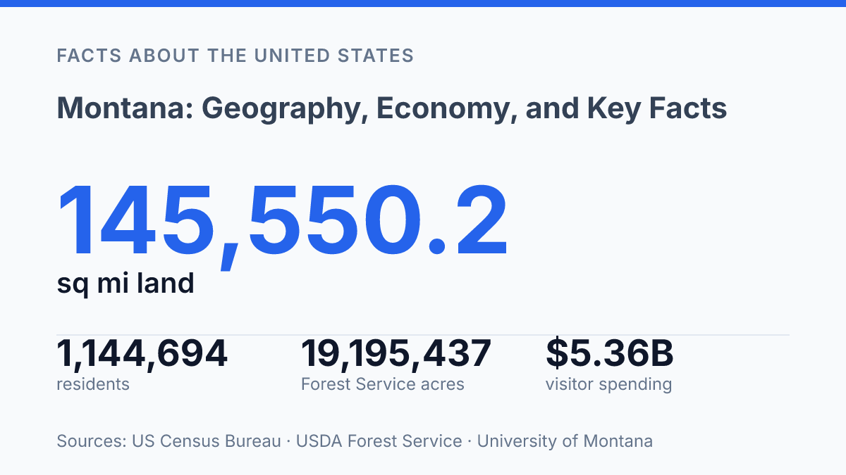
Scale makes the settlement pattern unusually thin: the state contains 145,550.2 square miles of land and 1,493.0 square miles of water, making it the fourth-largest U.S. state by area, according to U.S. Census Bureau profile data. The Census Bureau estimated 1,144,694 residents as of July 1, 2025, and its 2020 density figure was 7.4 people per square mile. That density is far below the pattern in more urban states, where large metropolitan corridors place many more residents within short distances of hospitals, campuses, airports, courts, and public offices.
The main urban network is concentrated in a small group of cities rather than spread evenly across the state. Billings remains the largest, Missoula had an estimated 78,903 residents in 2025, Great Falls had 60,208, Bozeman had 58,814, and Helena anchors the capital region. These places matter because many smaller communities depend on them for specialized health care, higher education, regional shopping, air connections, and state or federal services that cannot be duplicated in every county.
Recent growth has been uneven, which complicates any simple reading of a small statewide population. Census Bureau city estimates show Bozeman up 9.7% from its 2020 estimate base, Missoula up 6.4%, and Billings up 3.5%, while Great Falls was down 0.5%.
College towns and expanding metro areas have therefore absorbed growth faster than many rural counties, affecting housing demand, commuting patterns, school enrollment, and infrastructure planning. In low-density areas, the same distances also shape daily life: public services often cover large territories, emergency response can require longer travel, and routine trips for work, appointments, or supplies may involve regional rather than local destinations.
Industries that drive the state economy
Hospitality generated more base earnings than any other sector in the state in 2024, which shows how far the economy extends beyond raw resource extraction. A 2025 MSU/MMEC report ranked hospitality first at $2.469 billion, or 22% of base earnings, while manufacturing ranked second at more than $2.0 billion, or 18%. That pairing matters because visitor services, food processing, wood products, machinery, and other manufacturing activities often depend on the same natural assets, transport routes, and regional labor pools as older resource industries.
Agriculture remains one of the clearest links between land use and economic output. USDA NASS’s 2024 State Agriculture Overview counted 23,800 farm operations working 57.4 million acres, with an average operation size of 2,412 acres; wheat production alone was valued at $1.010 billion.
Cattle ranching is central across large grazing areas, while wheat, barley, and pulse crops such as lentils, dry peas, and chickpeas are important in dryland farming regions. These commodities support elevators, rail shipment, equipment dealers, feed suppliers, and food-processing activity, so agriculture’s influence extends well beyond farm receipts.
Mining and energy production add another resource-based layer, led by coal, oil, natural gas, and metals. Coal has long supported power generation and industrial employment, while oil and gas activity rises and falls with drilling economics, pipeline access, and national fuel prices. Metal mining and related processing can bring high-wage work, but permitting, reclamation standards, water protection, and nearby land uses shape where extraction remains viable.
Tourism and outdoor recreation create a different kind of dependence on natural resources. ITRR estimated $5.36 billion in statewide nonresident visitor spending when averaged over 2024 and 2025, a scale large enough to affect lodging, restaurants, guiding, retail, construction, and seasonal hiring. Yellowstone National Park and Glacier National Park anchor much of this demand, but the benefits spread through gateway towns and travel corridors.
The main contrast is not between resource industries and services, but between their risk profiles. Agriculture, mining, and energy can produce large gains when prices are favorable, yet they are exposed to commodity cycles, weather, and land-use rules. Visitor and service employment can be steadier in some communities, but it is also seasonal and sensitive to travel costs, wildfire smoke, snowpack, and housing availability for workers.
State history, symbols, and government basics
On November 8, 1889, Montana entered the Union as the 41st state, a legal milestone that turned a vast western territory into a full participant in federal representation and state self-government. The date is the core reference point for its civic history, but the state’s public identity has often been expressed less through institutions than through place-based imagery. The nickname Big Sky Country captures that association with open horizons, long distances, and a political culture that often emphasizes independence and local control.
State symbols reinforce the same identity in simpler civic language. The state bird is the meadowlark, a grassland songbird closely associated with open country across the northern plains and interior West. Such symbols do not describe government power or economic output, but they show how official identity often distills a state into recognizable natural and cultural references.
The government structure is conventional by U.S. standards even when the state’s self-image stresses space and autonomy. The state has a bicameral legislature made up of a Senate and a House of Representatives; in the 2025 legislature, according to the Montana Legislature, there were 50 senators and 100 representatives, for 150 total lawmakers. Executive authority is headed by a governor, who serves as chief executive and works within the same separation-of-powers framework used in most states.
Its modern constitutional framework is comparatively recent. According to the Secretary of State, the current state constitution was adopted on March 22, 1972, and ratified on June 6, 1972, replacing an older governing document from the early statehood period. One distinctive legal detail is that the official state seal is required to be 2½ inches in diameter, a small specification that illustrates how state identity is preserved not only through broad civic principles but also through precise statutory forms.
Why scale does not remove local constraints
The state’s key facts point to a practical tension that will shape future decisions more than any single statistic. Montana has room on the map, but not every community has the same housing capacity, labor supply, infrastructure, water access, or public-land pressure. Growth in Bozeman and Missoula does not mean the same thing as slower change in Great Falls or the wide agricultural counties that define much of the interior.
The next phase of the state’s development is likely to depend on how well policy, local planning, and private investment account for distance, seasonality, and land use. A state with 145,550.2 square miles of land still faces very specific limits in the places where people, jobs, and visitors actually concentrate.
Frequently Asked Questions
Q: What is Montana known for geographically?
A: Montana is known for its large areas of open land, mountain ranges, prairies, and major protected areas such as Glacier National Park and parts of Yellowstone National Park. Its geography creates strong regional contrasts, with rugged western terrain and broader plains in the east.
Q: What are the main industries in Montana?
A: Agriculture, tourism, energy, and natural resource extraction are among Montana’s major industries. The state’s economy is shaped by livestock production, wheat and barley farming, outdoor recreation, and mineral and energy development.
Q: Why is Montana called Big Sky Country?
A: The nickname refers to the state’s wide horizons and expansive views, especially across its plains and mountain valleys. The phrase reflects a geographic feature rather than an official designation, and it has become closely associated with the state’s identity.
Q: What is Montana’s climate like?
A: Montana has a continental climate with cold winters, warm to hot summers, and notable seasonal variation. Conditions differ by region, with drier plains in the east and cooler, wetter mountain areas in the west.
Q: What are some key facts about Montana’s population and size?
A: Montana is one of the largest U.S. states by area but has a relatively small population density. That combination means settlements are spread out, and much of the state remains rural or lightly developed.