
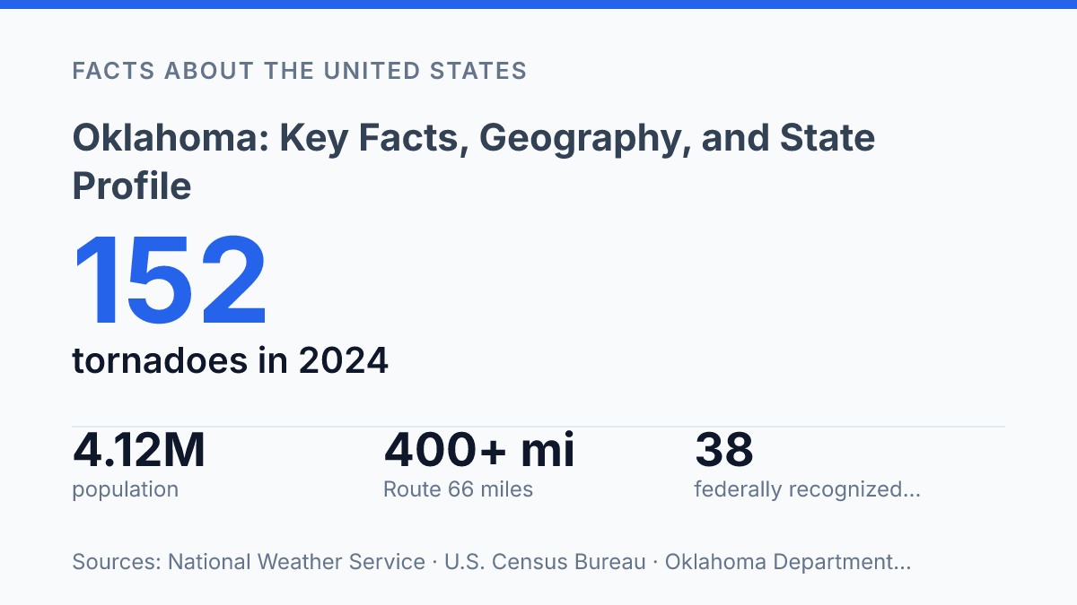
Oklahoma carries more than 400 drivable miles of Route 66, the longest stretch in any state, yet that familiar highway crosses a place defined as much by 12 ecoregions and record-setting weather as by roadside heritage. In 2024, the state recorded at least 152 tornadoes and tied its warmest year in records dating to 1895, while precipitation ranged from 58.78 inches at Idabel to 18.87 inches at Eva. Those contrasts help explain why a state profile cannot rest on a single image of plains, oil, football, or the Mother Road.
The state’s identity also depends on its 38 federally recognized tribes headquartered within its borders, a 1907 statehood story shaped by Indian and Oklahoma Territories, and a population that reached an estimated 4,123,288 in 2025. The sections ahead connect those facts to geography, history, cities, and the modern economy.
What Oklahoma is known for
With more than 400 drivable miles of Route 66, the longest stretch in any state, the Sooner State has made the highway part of its public identity, including a 2025–2026 official map designed around the route’s centennial, according to the Oklahoma Department of Transportation.
Geography, climate, and natural regions
Few U.S. states show as much weather contrast across short distances as this one did in 2024, when annual precipitation ranged from 58.78 inches at Idabel to 18.87 inches at Eva, according to the state Mesonet and Climatological Survey. That variation reflects a position between humid air from the Gulf region, drier air to the west, and fast-moving frontal systems from the north. The result is a climate with hot summers, periodic winter cold, drought episodes, heavy rain, hail, and rapid temperature shifts within the same season.
The state sits in the south-central United States, bordered by Texas to the south and west, Kansas to the north, Missouri and Arkansas to the east, Colorado to the northwest, and New Mexico at the far western edge of the Panhandle. This location places it at a physical transition point rather than in a single uniform zone. Broad plains dominate much of the center and west, while the east becomes hillier, wetter, and more wooded.
Several natural regions help explain those differences. The Great Plains extend across much of the western and central portion, where open, relatively flat terrain supports extensive cropland, pasture, and long-distance transportation routes.
Along the Red River, the southern border area is lower, warmer, and strongly tied to river drainage patterns. In the northeast, the Ozark foothills create a more broken terrain, while other eastern uplands add forested ridges and valleys that contrast sharply with the open west.
The state Conservation Commission identifies 12 unique ecoregions, a high level of variety for an interior state. It also reports that wetlands cover about 2% of the state’s land area, or roughly 950,000 acres, and that about 67% of historic wetlands have been lost since the 1780s. Those figures show that water, soil, and elevation differences matter as much as simple east-west distance in shaping natural conditions.
Severe weather is one of the clearest consequences of this setting. The National Weather Service confirmed at least 152 tornadoes in the state in 2024, surpassing the previous record of 149 set in 2019. The same broad, open terrain that makes large-scale farming and grazing practical also leaves many areas exposed to thunderstorms, strong winds, and fast-changing weather, especially during spring and early summer.
History, statehood, and Native nations
Statehood joined Oklahoma Territory and Indian Territory into one state, bringing together jurisdictions that had been shaped by very different federal policies. Voters in the two territories approved statehood on September 17, 1907, and President Theodore Roosevelt admitted the new state as the 46th state on November 16, 1907, according to the National Archives. The merger created a single state government, but it did not erase the deeper history of Native governance that had developed in Indian Territory before statehood.
The forced relocation of Native peoples is central to that history because Indian Territory became a destination for nations removed from homelands in the Southeast. The Trail of Tears is most closely associated with the Cherokee removal of the 1830s, but it forms part of a broader federal removal policy that also displaced the Choctaw, Chickasaw, Muscogee (Creek), and Seminole peoples. These nations rebuilt governments, schools, courts, farms, towns, and diplomatic institutions after removal, making Indian Territory a place of political reconstruction rather than simply a holding area for displaced communities.
Those five Native nations remain especially significant because their histories predate statehood and their political identities did not depend on it. The Cherokee, Choctaw, Chickasaw, Muscogee (Creek), and Seminole nations are often described together because of their southeastern origins, treaty histories, and long-standing governmental institutions. Their presence helps explain why state history cannot be understood only through settlement, land openings, or admission to the Union; it also has to account for treaty relationships, removal, allotment, and the persistence of Native self-government.
Modern tribal sovereignty gives this history continuing legal and civic relevance. According to the Department of Libraries on the state’s official website, 38 federally recognized tribes are headquartered in the state, along with one headquartered there that is not federally recognized.
Tribal governments and state institutions operate across the same geographic space, but their authority can differ by subject, location, citizenship, and federal law. That overlap affects courts, taxation, public services, cultural preservation, natural resources, and intergovernmental agreements, making Native nations active governing authorities rather than historical background alone.
Population, cities, and the modern economy
The growth gap between the two largest cities is already measurable: the U.S. Census Bureau estimated Oklahoma City at 719,849 residents in 2025, up 5.7% since 2020, while Tulsa was estimated at 416,209, up 0.8%. For the state as a whole, QuickFacts estimated 4,123,288 residents on July 1, 2025, a 4.1% gain from the 2020 estimates base.
Settlement follows that imbalance, with the capital metro drawing much of the recent population and job growth through state government, health care, higher education, housing development, and corporate offices. The Tulsa metro remains the other large employment basin, with long-standing strengths in manufacturing, finance, aircraft maintenance, and regional services. Smaller cities and towns still support local schools, hospitals, retail, and county services, but they generally do not have the same scale of in-migration or diversified hiring as the two largest metro areas.
Agriculture remains a major part of the economy outside the largest urban labor markets, especially through cattle production, wheat farming, and poultry operations. Cattle connect ranching areas with feed, processing, and livestock markets, while wheat is tied to broad-acre farming in the plains. Poultry production is more concentrated in the eastern part of the state, where contract growing and processing link rural communities to regional food supply chains.
Modern employment is broad, but several industry anchors explain why the largest metros have stronger growth prospects. Oil and natural gas producers, pipeline companies, and field-service firms support energy employment, with Cushing serving as a nationally recognized crude-oil storage and trading hub.
Defense and federal aviation work are centered in major facilities such as Tinker Air Force Base and the FAA Mike Monroney Aeronautical Center, which support aircraft maintenance, logistics, training, and technical occupations. Transportation employment is reinforced by interstate corridors, rail freight, airport operations, trucking, and inland waterway access through the Tulsa Port of Catoosa.
This creates a practical urban-rural contrast. Metro economies can absorb workers across professional services, public-sector employment, logistics, and specialized technical fields, while many rural counties are more exposed to cattle prices, grain markets, input costs, and weather conditions. The result is not a single economic pattern, but a state economy in which population momentum and employment diversity are most visible in the largest metropolitan areas.
Where the state profile will need sharper data next
Oklahoma’s next chapter will likely be shaped by how well public policy, infrastructure, and local economies respond to uneven growth and environmental stress. Oklahoma City’s faster population gains, Tulsa’s slower pace, shifting water conditions, and repeated severe-weather records all point to a state where averages can hide sharp regional differences. Tribal governments will remain central to that picture, not as historical context alone, but as present-day political, cultural, and economic institutions.
A useful state profile, then, is not a fixed portrait. It is a framework for tracking how land, climate, sovereignty, transportation, and city growth keep changing the practical meaning of the 46th state.
Frequently Asked Questions
Q: What is Oklahoma known for?
A: Oklahoma is known for its mix of Great Plains, Native American heritage, and energy production. The state has long been associated with cattle ranching, oil and natural gas, and a strong presence of tribal nations. Its identity reflects both its geographic position and its layered historical development.
Q: Where is Oklahoma located in the United States?
A: Oklahoma is in the south-central part of the United States. It borders Kansas, Missouri, Arkansas, Texas, New Mexico, and Colorado. This location gives it a transition zone between the Plains, the Southwest, and the lower Midwest.
Q: What kind of climate does Oklahoma have?
A: Oklahoma has a humid subtropical climate in the east and a more semi-arid climate in the west. The state is also part of Tornado Alley, which means severe thunderstorms and tornadoes occur more frequently than in many other states. These conditions shape both daily weather patterns and long-term planning.
Q: What are the major cities in Oklahoma?
A: Oklahoma City is the state capital and largest city, while Tulsa is the second-largest metropolitan center. Other important cities include Norman, Broken Arrow, and Lawton. These cities anchor the state’s population, education, and regional economies.
Q: Why is Oklahoma significant in Native American history?
A: Oklahoma has a large Native American population and is home to many federally recognized tribal nations. Its history is closely tied to forced relocation, tribal governance, and the development of reservation and jurisdiction systems. That legacy remains central to the state’s cultural and political identity.