
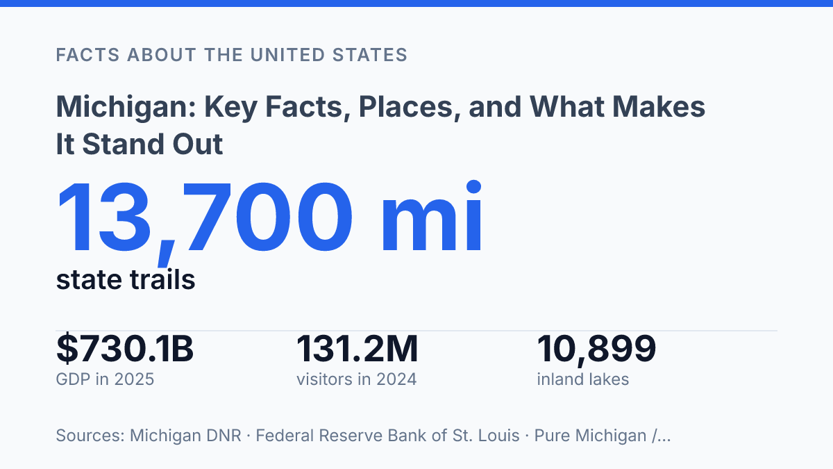
Michigan puts water closer to daily life than almost anywhere in the United States: it has 10,899 inland lakes of at least 5 acres, 3,300 miles of Great Lakes shoreline, and no point is more than 85 miles from a Great Lake. That single fact explains a lot, but not everything. The state is also home to more than 10.1 million people, a $730.1 billion economy, major auto and mobility employers, heavy tourism traffic, and farms producing apples, blueberries, and tart cherries at serious scale.
What makes the place interesting is the contrast: Detroit and the Upper Peninsula, factory floors and beach towns, EV sales data and snowmobile trails. This guide looks at the facts, places, economic shifts, and local details that help explain why the state is so easy to recognize and harder to reduce to one simple label.
What makes Michigan unique?
No point in the state is more than 6 miles from a body of water or more than 85 miles from a Great Lake, according to the state Department of Natural Resources. That one fact says a lot about how the place works. Water isn’t just along the edges; it shapes weather, settlement patterns, local identity, and the way communities relate to one another across the state.
The state is split into two main land areas: the Upper Peninsula and the Lower Peninsula. They’re connected by the Mackinac Bridge, which opened in 1957 and remains the physical link between two regions that can feel quite different in distance, pace, and geography. The Lower Peninsula holds most of the population and major metro areas, while the Upper Peninsula is larger, more spread out, and much less densely populated.
The Great Lakes connection is unusually broad. The state borders four of the five Great Lakes: Superior, Michigan, Huron, and Erie. The Department of Natural Resources also counts 10,899 inland lakes of at least 5 acres and 3,300 miles of Great Lakes shoreline, which helps explain why water access feels like a normal part of life rather than a special feature reserved for one corner of the map.
That geography also makes the state feel less centralized than many others. Detroit is the largest city, but Lansing is the capital, and neither fully represents the Upper Peninsula, the west coast communities, the northern Lower Peninsula, or the smaller lake-country towns scattered inland. The long shoreline, the two-peninsula layout, and the spacing between major population centers all create a state identity that’s regional as much as statewide.
How Michigan’s economy took shape
In 2024, the state’s mobility sector employed just over 495,600 people, which means the auto story is still a jobs story, not just a museum piece. According to the state’s 2025 Mobility Report, that was 13.0% of statewide employment, while transportation equipment manufacturing alone accounted for 182,300 jobs with an average annual wage of $91,350. Those numbers help explain why cars, trucks, suppliers, and engineering talent still shape how the state thinks about work.
Detroit became the historic center of the U.S. auto industry because major automakers and the supplier network grew around the same region. Ford helped define mass production, General Motors became one of the world’s largest automakers, and Stellantis remains part of the city’s modern auto identity through the Chrysler lineage. The result wasn’t just car factories; it was a whole ecosystem of tool-and-die shops, parts makers, designers, logistics firms, and skilled trades.
The economy was never only about cars, though. Manufacturing also took root in machinery, office furniture, food processing, chemicals, and metal products.
Places such as Grand Rapids became closely associated with furniture and design, while Battle Creek built a national reputation in cereal and packaged foods. That broader base matters because it shows how industrial know-how spread into different products, not just different vehicle models.
Still, the shift away from older labor-intensive factory work hit some communities hard. Cities such as Flint and Detroit felt the effects through plant downsizing, layoffs, shrinking tax bases, and neighborhoods left with vacant industrial land.
The auto industry still carries real weight, but the kind of work attached to it has changed: more automation, more advanced manufacturing, more software, and more competition for technical talent. That’s why the state’s economic identity today is both familiar and in motion, tied to its manufacturing roots while trying to widen the base around mobility, technology, services, and specialized production.
Best-known places and places locals care about
A summer weekend can make Traverse City feel like a much larger city, while Ann Arbor and Grand Rapids carry far more year-round weight than many vacation brochures suggest. That contrast is useful because the state’s best-known places don’t all matter in the same way. Some are regional job and education centers, some are seasonal magnets, and some are everyday anchors for people who live far from the biggest metro areas.
Ann Arbor is the clearest college-town example: compact, research-oriented, and shaped by a large student and faculty population that gives it an outsized cultural footprint. Grand Rapids plays a different role on the west side, with a larger urban core, major medical institutions, a strong arts scene, and neighborhoods that draw people for restaurants, concerts, and local events rather than just one landmark.
Traverse City, by comparison, is the name many visitors connect with bay views, wineries, cherry country, and a downtown built for walking. Marquette matters in another way: it’s one of the Upper Peninsula’s main urban anchors, with a working waterfront feel, university life, trail access, and the sense of being a hub for a wide rural region.
The natural place that often gets the biggest reaction is Sleeping Bear Dunes National Lakeshore, where steep sand bluffs, forested trails, and wide lake views make it one of the state’s signature outdoor destinations. It’s not just a pretty stop on a map; it helps explain why beach towns, campgrounds, boat launches, and trailheads become part of the rhythm of life across northern Michigan.
Seasonal travel brings real money and real pressure. In 2024, the state drew 131.2 million visitors, who spent $30.7 billion, according to Tourism Economics in a 2025 report prepared for the state tourism office.
For lakefront communities, that can mean packed restaurants, short-term rental demand, busy marinas, and summer jobs that help local businesses survive the quieter months. It can also mean crowded roads, higher housing costs, and a local economy that has to stretch to serve both residents and visitors at the same time.
Quick facts that help put the state in context
A state can top 10 million residents and still feel surprisingly local, and that contrast is one of the easiest ways to remember its scale. Admitted as the 26th state on January 26, 1837, it has been part of the Union long enough to have older industrial cities, long-settled farming areas, college towns, resort communities, and small rural places that don’t all feel like versions of the same thing.
The 2020 Census put the population at about 10 million residents; by July 1, 2025, the state’s estimated population was 10,127,884, up 0.5% from the April 1, 2020 estimates base, while Detroit’s estimate was 649,095, up 1.5% from its 2020 base, according to U.S. Census Bureau QuickFacts. That size makes the state one of the country’s major population centers, but the way people are spread across cities, suburbs, farm counties, and northern communities keeps daily life from feeling uniform.
The nickname The Great Lakes State is more than a tourism phrase; it’s the shortest way to capture how strongly water shapes the state’s identity. For a quick symbol to remember, the state bird is the American robin, a familiar backyard bird whose arrival is often associated with spring across much of the Midwest.
If you’re trying to keep the basics straight, think of the state in three simple anchors: it joined the Union in 1837, it has roughly 10 million people, and its public identity is tied closely to the Great Lakes. Those facts don’t explain everything, but they give you a useful frame for understanding why the state feels both large and highly regional.
Where the next changes are most likely to show up
The next chapter for the state will probably be shaped by the same tension that has always defined it: how to protect what makes the place distinctive while adapting the industries and communities that keep it working. Water access, tourism, vehicle production, agriculture, and outdoor recreation don’t sit in separate boxes for residents, planners, or businesses.
They overlap in land use, labor needs, infrastructure, and local identity. If you’re trying to understand the state beyond the usual shorthand, watch the practical signals: where people are moving, how mobility jobs change, how lake communities handle growth, and whether smaller cities can turn regional strengths into year-round opportunity.
Frequently Asked Questions
Q: What is Michigan known for most?
A: Michigan is best known for the Great Lakes, especially its long shoreline and access to both Lake Michigan and Lake Superior. It’s also known for auto manufacturing, outdoor recreation, and cities like Detroit and Grand Rapids. If you’re comparing states, Michigan stands out for combining industrial history with a lot of water and natural scenery.
Q: Is Michigan a good place to visit in the summer?
A: Yes, summer is one of the easiest times to enjoy the state because the weather works well for beaches, hiking, boating, and small-town festivals. The lakes make a big difference, since many visitors plan trips around shoreline drives and waterfront stays. If you want the classic experience, the Upper Peninsula and the western coast are especially popular.
Q: What are the main regions of Michigan?
A: Michigan is usually thought of as two main parts: the Lower Peninsula and the Upper Peninsula. The Lower Peninsula holds most of the population and major cities, while the Upper Peninsula is known for forests, lakes, and a more remote feel. That split is a big part of how people talk about the state.
Q: Which cities should I visit in Michigan?
A: Detroit is a top choice if you want history, sports, music, and a look at the state’s industrial roots. Grand Rapids is popular for food, beer, and easy access to nearby outdoor spots, while Ann Arbor has a strong college-town feel. If you want something quieter, Traverse City is a favorite for lake views and nearby wine country.
Q: What makes Michigan different from other Midwest states?
A: Michigan’s location on the Great Lakes gives it more shoreline than most people expect, and that shapes travel, weather, and local life. The state also has a distinct two-peninsula geography, which makes it feel different from its neighbors. For many people, that mix of water, industry, and outdoor space is what makes Michigan stand out.