
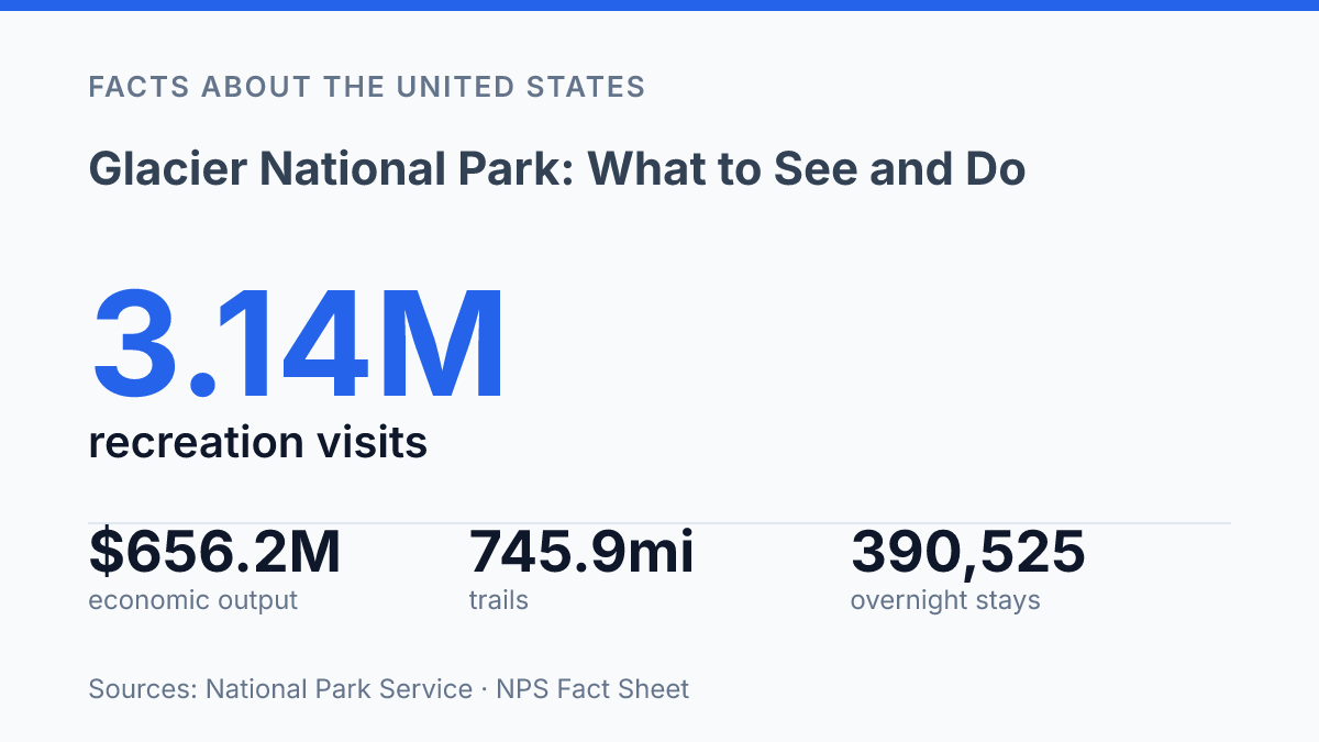
Glacier National Park drew 3,136,557 recreation visits in 2025, but more than 1.48 million of those visits arrived in July and August alone. That concentration explains why a trip here is shaped as much by timing and access as by scenery. The park’s best-known corridor, Going-to-the-Sun Road, runs 50 miles across the mountains and reaches 6,646 feet at Logan Pass, yet its full seasonal opening can depend on snow clearance well into June.
Beyond the road, Glacier functions as a major overnight and wilderness destination, with 390,525 total overnight stays recorded in 2025 and a trail network measured in hundreds of miles. The most useful way to understand the park is not as a single scenic drive, but as a set of choices between road access, short alpine hikes, backcountry routes, wildlife viewing, cycling windows, and camping near the Canadian border.
Why the park stands out in Montana
The park’s mountains do not simply rise above Montana; they carry glacier-scoured valleys north until the terrain meets British Columbia. Glacier National Park spans 1,583-square-mile in Montana’s Rocky Mountains, placing it among the largest protected mountain areas in the Lower 48. Its position along the northern Rockies gives the park a distinctly borderland character, with peaks, drainages, and high valleys extending toward Canada rather than forming a compact scenic enclave.
That geography is measurable as well as visible. The National Park Service’s 2025 fact sheet lists a 31-mile, or 50-kilometer, boundary shared with British Columbia, which helps explain why the park feels connected to a broader Rocky Mountain system rather than isolated within Montana. Elevation, exposure, and long north-south valleys create sharp contrasts over relatively short distances, so the terrain can shift from forested valley bottoms to bare alpine slopes in a compressed vertical range.
Glacier-carved landforms are the main reason the scenery has such strong definition. Ancient ice widened valleys, steepened walls, carved basins, and sharpened ridgelines, leaving a landscape where lakes often sit below abrupt cliffs and mountain faces appear more sculpted than rounded. These forms shape not only what is seen from overlooks and valley floors but also how the park is physically experienced: sightlines are dramatic because the land drops and rises so quickly.
The same topography that gives the park its visual force also limits easy movement through it. Broad wilderness on a map does not translate into broad access on the ground, because steep slopes, high passes, snowfields, and narrow valleys restrict where roads and developed corridors can go. As a result, visitor use tends to concentrate in a small number of accessible areas, while much of the park remains defined by rugged, glacier-shaped terrain rather than built infrastructure.
Driving the Going-to-the-Sun Road
A complete traverse of Going-to-the-Sun Road covers only 50 miles, yet the National Park Service estimates the drive takes about two hours even without stops. That timing reflects the character of the route: narrow mountain engineering, steep grades, overlooks, wildlife slowdowns, and frequent pullouts all make it a crossing to experience rather than a road to rush.
The route is the park’s best-known drive because it links the west and east sides through some of the most concentrated scenery accessible by vehicle. It climbs from lower forested areas toward alpine terrain, reaches Logan Pass at 6,646 feet, and gives motorists a compressed view of the park’s interior without requiring a long backcountry trip. According to the National Park Service, Logan Pass sits 32 miles from the west entrance and 18 miles from the east entrance, which makes it a natural midpoint for many day itineraries.
Seasonal access is the main planning constraint, not distance. The National Park Service reported that the road fully opened for the 2026 season on June 22, 2026, a reminder that snow removal and mountain weather can delay access well into early summer. Even after opening, conditions can change quickly at higher elevations, so a route that appears short on a map can require flexible timing.
Vehicle rules also shape how the crossing works. For the 2026 season, the National Park Service continued to prohibit vehicles longer than 21 feet or wider than 8 feet between Avalanche Creek and Rising Sun, the central mountain section where the road is most constrained.
That restriction helps explain why shuttle use, early starts, and careful vehicle planning matter on this route. The road delivers many of the park’s signature views from behind the windshield, but its elevation and geometry make it slower and more weather-sensitive than a typical scenic highway.
Hiking routes, Hidden Lake, and backcountry options
The same park can offer a boardwalk-style alpine walk, a lake overlook reached before lunch, and multi-night wilderness travel because its trail system is both broad and unevenly distributed across terrain. The National Park Service lists 158 trails totaling 745.9 miles, which is commonly described as more than 700 miles of hiking routes. That scale matters less as a raw total than as a planning variable: distance, elevation gain, exposure, and crowding can change sharply from one route to another, even when trailheads are relatively close together.
The route to Hidden Lake is one of the park’s clearest examples of how a short distance can still deliver high visual reward. From the high-elevation visitor area where the trail begins, the overlook is 1.3 miles one way with 608 feet of elevation gain, according to the National Park Service’s 2026 trail information. Continuing from the overlook to the lake extends the hike to 2.5 miles one way, with 639 feet of gain and 921 feet of descent, so the full trip asks more of hikers than the initial overlook statistics suggest.
Backpacking broadens the experience beyond popular day-use corridors by allowing longer routes through valleys, passes, and remote lake basins. National Park Service visitor-use data recorded 34,147 backcountry camper nights in 2025, showing that overnight foot travel is a substantial part of how people experience the park rather than a niche add-on. Permits, campsite availability, food storage rules, and seasonal trail conditions shape those trips, so route selection is partly an itinerary decision and partly a risk-management process.
Heavy trail demand also connects park use to nearby towns that provide lodging, food, gear, transportation, and guide services. In 2024, visitors spent $457.955 million in gateway communities, supporting 5,188 jobs and generating $656.188 million in total economic output, according to the National Park Service, 2024 National Park Visitor Spending Effects, published. For hikers, that economic footprint is most visible in the practical infrastructure around a trip: shuttles, resupply stops, campgrounds, outfitters, and the seasonal services that make both day hikes and longer backcountry routes more accessible.
Wildlife, cycling, and camping near the border
A roadside pullout in Glacier can produce a mountain goat sighting in one hour and a bear-related area closure in the next, which is why wildlife viewing here is both an attraction and a condition that shapes access. National Park Service planning documents estimate 70-plus mammal species and 275 bird species in the park, a range that reflects the meeting of alpine, forest, wetland, and prairie-edge habitats. Mountain goats are closely associated with steep high-country terrain, while grizzly bears, black bears, moose, bighorn sheep, elk, and smaller mammals occupy different elevations and drainages across the year.
Large animals also place clear limits on how wildlife watching should occur. According to National Park Service guidance, visitors must remain at least 100 yards from bears and wolves and at least 25 yards from other wildlife, and food storage rules apply in developed and undeveloped camping areas. These requirements are not incidental etiquette; they reduce the chance that animals become habituated to people, which can lead to management removals or temporary closures.
Cycling offers a quieter way to experience park roads, especially during periods when plowing or seasonal access patterns limit motor traffic on certain routes. The activity is concentrated on paved roads and designated bicycle routes rather than natural-surface footpaths, so timing, visibility, and traffic volume matter. The National Park Service posts seasonal bicycle restrictions on busy road sections, meaning cycling plans often depend as much on access rules as on distance or fitness.
Camping extends visits beyond the main daytime viewpoints and gives the park a different rhythm at dawn and dusk, when wildlife activity can be more apparent. The NPS fact sheet lists 65 backcountry campgrounds with 208 sites, while developed campgrounds serve car and RV travelers in more accessible districts.
Along the northern edge, Glacier meets Canada near Alberta’s Waterton Lakes National Park; together they form the Waterton-Glacier International Peace Park, established in 1932. That border setting reinforces the park’s ecological continuity, since wildlife, watersheds, and mountain habitats do not conform neatly to the international line.
Why timing still shapes the visit
The park rewards planning because its constraints are part of the experience, not separate from it. A road that may open fully in late June, a high pass with timed parking, and trailheads that fill quickly all point to the same practical reality: the best itinerary is the one matched to season, daylight, transportation, and tolerance for uncertainty. The 2026 shift away from vehicle reservations toward a ticketed-only shuttle system and limited three-hour parking at Logan Pass shows how access rules will keep adapting as visitation stays high.
For nearby communities, that pressure is tied to a large economic role as well, with visitors spending $457.955 million in 2024. In Glacier, logistics and wildness remain closely connected.
Frequently Asked Questions
Q: What is Glacier National Park known for?
A: Glacier National Park is known for its glacier-carved peaks and valleys, which extend to the Canadian border. The park covers 1,583 sq. mi. in Montana’s Rocky Mountains and is one of the region’s most scenic protected areas.
Q: Is Going-to-the-Sun Road worth driving?
A: Yes. Going-to-the-Sun Road crosses the park through mountainous terrain and is one of the main ways to see its high-country scenery. The route connects major viewpoints and trail access points, so it often shapes how visitors experience the park.
Q: What are the best hikes in Glacier National Park?
A: The park has more than 700 miles of hiking trails, ranging from short walks to longer backcountry routes. Hidden Lake is one of the better-known destinations because it is especially photogenic and accessible from established trailheads.
Q: What wildlife can be seen in the park?
A: Wildlife in Glacier National Park includes species such as mountain goats and grizzly bears. Other animals also live in the park’s varied habitats, so wildlife viewing is often a major part of a visit, especially in open alpine and valley areas.
Q: What activities are available besides hiking?
A: Backpacking, cycling, and camping are all common activities in the park. These options make it possible to spend more time in different parts of the wilderness, from roadside areas to remote backcountry settings.