
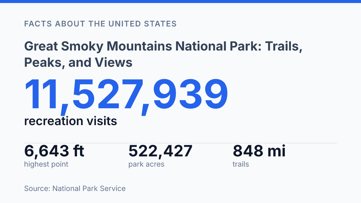
Great Smoky Mountains National Park drew 11,527,939 recreation visits in 2025, a level of use that made it the most visited U.S. national park and placed it ahead of far larger western parks in annual traffic. Its appeal is not explained by popularity alone. The park covers 522,427 acres across North Carolina and Tennessee, yet its 384 miles of roads, 70 scenic overlooks, and dense trail system make high-elevation ridges, stream valleys, and old-growth forest remnants unusually reachable.
That combination of scale and access shapes nearly every experience in the Smokies, from roadside views to long-distance hiking on the Appalachian Trail. The park’s ecological range is equally central: 96% forest cover, more than 1,500 kinds of flowering plants, and 2,900 miles of streams create a setting where scenery and biodiversity are closely linked. The highest point, Kuwohi, adds a final measure of elevation and visibility to that broader pattern.
Border location and why the park stands out
In 2025, Great Smoky Mountains National Park recorded 11,527,939 recreation visits, making it the most visited U.S. national park and the third-most visited unit in the National Park System, according to the National Park Service. That level of use reflects a broad appeal: visitors come for scenic drives, day hikes, wildlife viewing, historic mountain settings, and easy access from gateway communities on both sides of the state line.
The park straddles the border between North Carolina and Tennessee in the southern Appalachian Mountains, with its acreage divided almost evenly between the two states. NPS figures place it at 522,427 acres, or about 800 square miles, a scale that allows for long ridgelines, deep valleys, and large forested areas without requiring visitors to travel far from public roads. Its 384 miles of roads help explain why the park can receive exceptionally high visitation while still giving many visitors a sense of entering a remote mountain environment.
Accessibility is only part of the park’s distinction. The Smokies are also known for a persistent misty look created by frequent cloud cover, high humidity, and abundant moisture moving through the mountains.
This visual character is especially tied to elevation and weather: humid air rises, cools, and often forms low clouds or haze along the ridges. The result is a place that can feel atmospheric even from roadside pullouts, not only from backcountry settings.
The central contrast is that the park is both heavily visited and comparatively undeveloped in feel. Roads and overlooks make it approachable, but the surrounding forests, folds of mountain terrain, and weather-shaped views preserve the impression of a broad Appalachian refuge rather than a built resort corridor.
Forests, wildflowers, and streamside scenery
A single walk can shift from tulip-poplar cove forest to darker hemlock ravines and, higher up, red spruce and Fraser fir, making elevation one of the park’s most visible natural forces. According to the National Park Service, eight major forest types cover 96% of the park, with 79 vegetation communities identified in current park statistics. That range is not only botanical detail; it explains why roadside pullouts, creekside paths, and higher forest corridors can feel markedly different even when they are only a short drive or hike apart.
Wildflowers add a second layer of seasonal change, especially in the lower and middle elevations where spring light reaches the forest floor before tree canopies fully close. The park has more than 1,500 kinds of flowering plants, the highest total recorded for any North American national park, according to NPS.
Spring ephemerals such as trillium, bloodroot, hepatica, and trout lily typically appear from February through April, with lower-elevation peak bloom often arriving in mid- to late April. Later in the year, displays shift toward species such as rhododendron, mountain laurel, jewelweed, asters, and goldenrod, so the same path may be defined by pale spring flowers on one visit and dense summer or early autumn color on another.
Water shapes many of the most memorable lowland and mid-elevation scenes. NPS statistics list 2,900 miles of streams in the park, and those waterways support mossy banks, footlogs, cascades, and shaded pools along numerous walking routes.
Named destinations such as Laurel Falls, Grotto Falls, Abrams Falls, and Deep Creek show how varied the water scenery can be, from broad waterfall drops to sequences of smaller cascades. Seasonal conditions matter here as much as they do for flowers: spring rain and snowmelt can make streams louder and waterfalls fuller, while drier periods reveal more rock, root, and streambed detail along the same corridors.
Hiking routes and the Appalachian Trail segment
The park’s trail system is large enough that its Appalachian Trail miles form only one part of the hiking experience, rather than the whole story. According to the National Park Service, the park contains 848 miles of trail across 150 trails, with Appalachian Trail footpath accounting for 74 miles inside the boundary. That long-distance corridor gives thru-hikers and section hikers a direct way to cross high ridges, but most day hikers encounter the park through shorter routes that branch into coves, creek valleys, waterfall approaches, and wooded slopes.
Route choice matters because the scenery is not limited to summit viewpoints. Many popular walks are built around moving through shaded forest, crossing foot logs, following ridgelines, or reaching falling water, so the reward may be sound, grade, and enclosure rather than a single panoramic endpoint. NPS trail infrastructure also reflects that variety, with 155 foot logs and 60 trail bridges helping routes pass through wet and uneven terrain without turning every hike into a peak climb.
Difficulty varies widely across the network, from short walks suitable for a brief stop to strenuous ascents that gain elevation quickly and take much of a day. Distance alone can be misleading, since a modest mileage total may feel harder when the route climbs steadily, crosses slick rock, or moves through exposed high-country weather. Crowding can also change the pace on heavily visited trailheads, where parking delays and narrow paths may add time before the hike itself becomes demanding.
Backcountry travel forms a separate layer of the trail system. The National Park Service recorded more than 71,000 overnight backcountry visits in 2024, showing that the footpath network serves both casual day use and multi-day travel. That range is central to how hikers experience the park: the same map can support a short waterfall walk, a ridge traverse, or a longer itinerary tied into the Appalachian Trail corridor.
Clingmans Dome and the highest overlook
At 6,643 feet, the summit long known as Clingmans Dome is the highest point in the park and one of the few places where the Smokies can be read as a broad system of ridges rather than as isolated valleys and peaks. The National Park Service notes that the mountain’s Cherokee name, Kuwohi, was officially restored in September 2024, adding updated cultural context to a viewpoint that was already among the region’s best-known high-elevation landmarks.
An observation tower crowns the summit and is the main reason the overlook has such a distinct identity. Built in 1959, the tower lifts visitors above the immediate high-country terrain, opening sightlines across layered mountain ranges in several directions. Its elevated platform changes the scale of the view: nearby slopes drop away quickly, while more distant ridges appear as repeating bands that fade into blue and gray with distance.
The same atmospheric character that makes the overlook memorable can also make it unpredictable. Mist-covered ridges are central to the summit’s visual appeal, especially when clouds settle low enough to soften the mountains without fully hiding them.
On other visits, cloud cover, fog, or changing high-elevation weather can reduce visibility and turn the tower from a long-distance panorama into a close study of moving vapor and wind. That variability is part of the overlook’s identity rather than a separate condition; the summit is prized not only for how far it can see, but for how visibly the mountains’ weather passes through it.
Access to the tower involves a short, steep paved walk, according to the National Park Service, but the route is secondary to the summit’s role as a visual landmark. Its significance lies in combining the park’s highest elevation, a purpose-built viewing structure, and the familiar Smokies pattern of ridges dissolving into mist.
Why access defines the Smokies experience
The Smokies are often described through their visitor numbers, but the more useful measure is how many types of access fit inside one protected area. A short paved climb reaches the 6,643-foot summit of Kuwohi, while more than 800 miles of trails lead into forested watersheds where conditions change by elevation, season, and rainfall. That accessibility brings pressure as well as benefit: nearby communities saw more than $2 billion in visitor spending in 2024, while park staff manage heavy use across roads, overlooks, bridges, streams, and backcountry routes.
The practical consequence is clear. Future visits to the Smokies will depend less on discovering a hidden park than on distributing attention across a very large one.
Frequently Asked Questions
Q: What is the best time of year to hike in Great Smoky Mountains National Park?
A: The park offers hiking year-round, but trail conditions vary by season. Wildflowers bloom throughout the year, which gives many routes changing scenery across different months. Weather, fog, and trail surfaces should be checked before setting out because they can affect visibility and footing.
Q: Which trail has the best views in the Smokies?
A: Clingmans Dome is the highest peak in the park and is known for wide scenic views from its observation tower. On clear days, it provides long-range views over the mist-covered mountains. Trails that reach higher elevations often offer the broadest outlooks, especially in open or exposed areas.
Q: Does the Appalachian Trail go through Great Smoky Mountains National Park?
A: Yes, a segment of the Appalachian Trail passes through the park. That section is part of the larger long-distance route and gives hikers access to mountain scenery, forested stretches, and changing elevation. It is one of the park’s best-known trail connections for through-hikers and day hikers alike.
Q: Are there waterfalls and streams on Smoky Mountain hikes?
A: Many hiking routes in the park follow or cross streams, rivers, and waterfalls. These water features are a common part of the trail experience and can make shorter hikes especially scenic. Water levels and trail conditions can vary, so route selection matters after heavy rain.
Q: Where is Great Smoky Mountains National Park located?
A: Great Smoky Mountains National Park straddles the border between North Carolina and Tennessee. That location makes it accessible from both states and gives the park a mix of eastern mountain landscapes. Its position across the border is one reason the park has such varied terrain and viewpoints.