
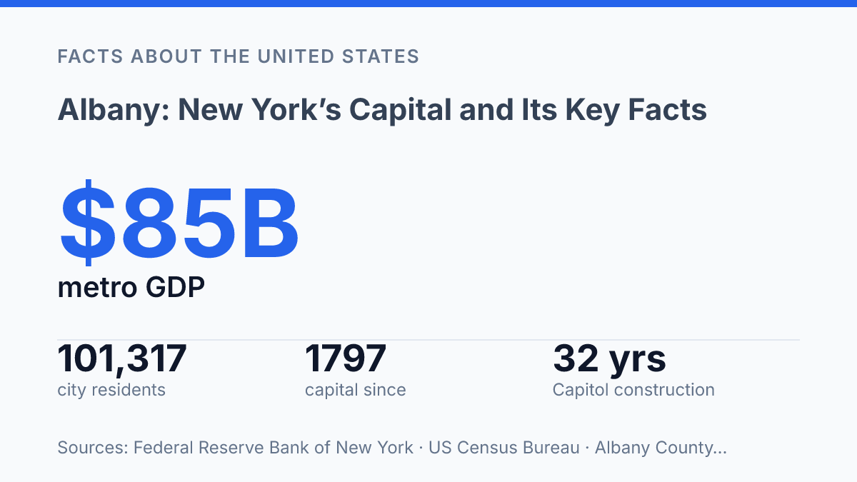
Albany occupies just 21.40 square miles and has 101,317 residents, yet it anchors a metro economy valued at $85 billion in 2023. That contrast explains why the city cannot be understood only by its population count. Its authority comes from a legal role fixed in state law, a capital function dating to 1797, and institutions whose effects extend well beyond city boundaries.
The same pattern appears in its built environment: the New York State Capitol took 32 years and $25 million to complete, while the downtown historic district contains 160 buildings that preserve layers of political, commercial, and civic development. The article traces how geography, government, landmarks, regional employment, and higher education combine to make a relatively small city one of the main administrative and economic centers of New York State.
Why Albany matters as New York’s capital
Albany carries statewide authority that New York City and Buffalo do not: it is the capital of New York State, and state law formally identifies it as such. That legal status gives the city a role disproportionate to its size, because the decisions made there affect taxation, infrastructure, education, health policy, and public spending across the entire state. The city has held this capital function since 1797, according to county history materials and NYSenate Open Legislation, making its importance both historic and statutory rather than merely symbolic.
The main physical expression of that authority is the New York State Capitol on State Street, the seat associated with the state’s legislative work and one of the defining landmarks of the downtown government district. The New York State Senate Historical Timeline records that the Capitol was declared completed on January 1, 1899, after 32 years of construction at a cost of $25 million. The scale and expense of the building reflect the ambitions of a state government serving far more than the city around it.
Geography also helps explain why the capital’s influence extends beyond a compact urban core. Its position along the Hudson River links the city to a long north-south corridor that connects the upper Hudson Valley with the downstate region, giving the capital a setting that is both inland and closely tied to one of New York’s major waterways. This combination of statutory authority, a concentrated government district, and river-corridor location is why the city matters as more than a smaller upstate municipality.
Location, population, and regional setting
A city of just over one hundred thousand residents anchors a regional network that is many times larger than the municipality itself. The city of Albany has 101,317 residents and 21.40 square miles of land area, according to U.S. Census Bureau QuickFacts, 2024/2020 data, which makes its local footprint relatively compact for a state capital.
Within Albany County, the city functions as the principal urban center, but its practical reach is better understood through the wider Capital Region. That regional setting includes nearby cities such as Schenectady to the northwest and Troy to the northeast, along with suburbs, smaller towns, and employment centers that are closely tied by commuting patterns and shared institutions.
The contrast between municipal size and regional influence is central to understanding the city’s position in New York. The broader capital-area metropolitan profile is far larger than the city population alone, with 913,485 residents, reported 3.0 percent population growth over ten years, and $85 billion in gross domestic product in 2023. Those figures show that the city’s role is not based simply on population rank within the state, but on its position as the administrative and economic center of a multi-county urban region.
This regional geography also helps explain why adjacent cities remain part of the same civic and economic frame rather than separate reference points. Schenectady and Troy have distinct histories and identities, yet together with the central city they form a tri-city core often used to describe the Capital Region. The result is a place whose importance is distributed across county lines, transportation corridors, labor markets, and institutions, even though the municipality itself remains geographically small.
History and landmarks that shaped the city
The city’s commercial identity predates its capital identity by more than a century, beginning with Dutch fur-trade networks rather than legislative chambers. In the seventeenth century, the area developed around Fort Orange and the settlement of Beverwyck, a Dutch West India Company community tied to trade with Indigenous nations and European merchants. After English control replaced Dutch authority in 1664, the settlement took the name Albany, marking a political change while preserving its role as a trading town.
Formal municipal status reinforced that early importance. The city’s original charter was issued on July 22, 1686, according to the Albany County official history page, making it one of the older chartered cities in what became the United States. That long civic timeline helps explain why its historic core includes layers of colonial, commercial, civic, and later institutional architecture rather than a single period of development.
The Erie Canal altered the city’s scale and function after it opened in 1825. By linking inland markets to Atlantic trade routes, the canal made the city a major transfer point for grain, lumber, manufactured goods, and passengers. This shifted the local economy beyond fur trading and river commerce into warehousing, finance, industry, and transportation services, creating the conditions for nineteenth-century urban growth.
Several landmarks matter because they preserve or interpret those layers rather than simply decorate the city. The New York State Museum, housed in the Cultural Education Center, presents archaeology, natural history, Indigenous history, immigration, industry, and state political history in one institution, making it a public archive of the forces that shaped the city and the state around it. The downtown historic core also shows that density in built form: the Downtown Historic District contains 160 buildings, with locally designated and National Register landmarks, according to the city’s Downtown Historic District page.
This older commercial past is sometimes overshadowed by the city’s modern association with state government. Yet the surviving street patterns, institutional collections, entertainment venues such as the Palace Theatre, and historic commercial buildings all point to a broader identity: a capital city built on trade, transit, and civic continuity before it became best known for public administration.
Economy, education, and what drives the city today
Government and government enterprises made up 24.3% of the county’s current-dollar GDP in 2024, a share that gives the local economy a public-sector weight not seen in many similarly sized U.S. cities. Federal Reserve Economic Data, using U.S. Bureau of Economic Analysis figures, put that government component at $11.21 billion out of $46.13 billion in total county GDP.
Employment data point in the same direction: the New York State Department of Labor counted 570,100 nonfarm jobs in the Capital Region in August 2026, with government the largest sector at 120,400 jobs, or 21.1% of the total. State agencies, courts, legislative offices, and related contractors therefore do more than support civic operations; they shape commuting patterns, office demand, and professional services activity.
Higher education gives the city a second major economic anchor. The University at Albany, SUNY is both a large employer and a source of spending tied to instruction, research, construction, student life, and events.
A 2024 economic-impact study by the university and the Capital District Regional Planning Commission estimated that UAlbany generates $1.1 billion in annual Capital Region economic activity, including $813 million from operations, $211.7 million from construction-related activity, and $80 million from student spending. Those figures show how a public university can operate as both an educational institution and a regional economic engine.
Technology and research activity broaden the area’s profile beyond government and education. The Capital Region is part of New York’s Tech Valley corridor, a term commonly associated with research institutions, nanotechnology, advanced manufacturing, and semiconductor-related activity.
Nearby assets such as GlobalFoundries in Malta and NY CREATES’ NanoTech facilities connect the region to chip research and production networks, while local universities supply graduates and research partnerships. The result is a diversified economy for a capital city, although public-sector employment still gives it a more government-centered character than many mid-sized urban economies.
What the city limits do not show
City-limit figures explain only part of Albany’s role. The more useful frame is institutional reach: state agencies, public institutions, construction activity, university spending, and regional employment connect a 21.40-square-mile municipality to an economy far larger than the city itself. That distinction matters for interpreting future population trends, budget debates, housing demand, and transportation needs.
A flat city population would not necessarily mean a weaker capital if county GDP, government employment, and university activity continue to carry regional weight. The practical measure is not size alone, but how much public administration, education, and private activity the capital continues to concentrate and coordinate across the Capital Region.
Frequently Asked Questions
Q: What is Albany best known for?
A: Albany is best known as the capital of New York State and as a center for state government. Its role in politics has shaped its economy, institutions, and downtown development for decades.
Q: Is Albany the largest city in New York State?
A: No. Albany is the state capital, but it is much smaller than New York City and several other major New York municipalities. Its importance comes more from government and regional services than from population size.
Q: When did Albany become New York’s capital?
A: Albany became New York’s capital in 1797. That decision helped fix its long-term role as the state’s administrative center and gave it a lasting political function.
Q: What county is Albany in?
A: Albany is the county seat of Albany County. This means it serves as the administrative center for county government as well as for state government.
Q: What is Albany’s location in New York State?
A: Albany is in eastern New York, near the Hudson River and the junction of major transportation routes. Its location has supported trade, travel, and government access across the capital region.