
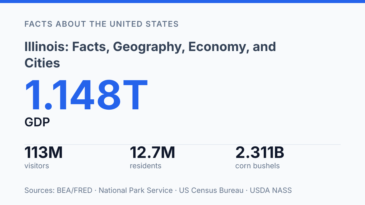
Illinois combines 55,513.1 square miles of land, 2,400.3 square miles of water, and a $1.202 trillion economy, so its importance is not limited to Chicago’s skyline or political symbolism. The state held 12,719,141 residents as of July 1, 2025, even after a slight decline from the 2020 Census, and its largest city still outweighs every other municipality by a wide margin.
Chicago’s 2024 estimate of 2,721,308 residents contrasts sharply with Aurora’s 180,710, a gap that helps explain how one state can contain a global city, midsize industrial centers, major farmland, and small historic communities at the same time. This article examines the state through geography, population, economic production, agriculture, government, history, and landmarks, with attention to the numbers that explain why its role remains unusually broad.
Where Illinois sits and what the state covers
Few U.S. states combine a Great Lakes shoreline, Mississippi River frontage, and direct borders with five states in such a clear north-south corridor. The state sits in the Midwest near the center of the continental United States, bordered by Wisconsin to the north, Iowa and Missouri to the west, Kentucky to the south, and Indiana to the east, with a short but strategically important shoreline on Lake Michigan in the northeast.
According to the U.S. Census Bureau, the state has 55,513.1 square miles of land and 2,400.3 square miles of water, making it the 24th-largest state by area in 2024. That scale gives the state several distinct physical settings, from the Lake Michigan edge and northeastern urban counties to broad interior plains and river-defined borders in the west and south.
Chicago dominates the northeastern corner, where the Lake Michigan shoreline and regional rail, highway, air, and water routes converge. Springfield, located farther south and west in the central part of the state, serves as the state capital, placing the seat of government outside the largest metropolitan area.
This geography helps explain the state’s long role as a transportation corridor rather than only a place between larger regions. Routes through the state connect the Great Lakes with the Mississippi and Ohio river systems and link the Upper Midwest with the South and East. The main geographic contrast is that the state is centrally positioned, but its population and much of its commercial activity are not evenly distributed; they are heavily concentrated in the Chicago metropolitan area while large central and southern areas remain more open, agricultural, and smaller-city in character.
Population, major cities, and demographic scale
Chicago had about fifteen times as many residents as Aurora in the latest city estimates, a scale gap that explains why statewide population comparisons are often shaped by a single metropolitan area. The U.S. Census Bureau estimated the state’s population at 12,719,141 residents as of July 1, 2025, down from 12,812,508 at the 2020 Census, a 0.8% decline. That small statewide drop masks sharper local differences between suburban growth areas, large urban centers, and smaller communities outside the main metropolitan orbit.
The largest city tier shows a highly uneven distribution rather than a balanced network of similarly sized places. According to U.S. Census Bureau 2024 city estimates, Chicago had 2,721,308 residents, followed by Aurora at 180,710, Naperville at 153,124, Joliet at 151,837, and Rockford at 147,486. Aurora, Naperville, and Joliet are significant not only because they rank near the top statewide, but because they sit within the broader Chicago-area population system; Rockford, by contrast, represents a major population center outside that immediate suburban structure.
Cook County gives this pattern its strongest demographic weight. With Chicago and many inner suburbs inside its boundaries, the county holds more than 5 million residents, or roughly two-fifths of the state’s population, according to Census estimates. This concentration means that shifts in Cook County and nearby suburban counties can strongly influence statewide totals, even when many downstate counties move in different directions or change more slowly.
Demographic scale also shows up in cultural and household indicators. Census Bureau QuickFacts reports that in 2020–2024, 24.0% of residents age 5 and older spoke a language other than English at home, and 14.7% of residents were foreign-born. Those figures reflect the state’s role as both a large urban destination and a broad regional population center, with diversity most visible in metropolitan counties but relevant to the statewide labor force, schools, and consumer markets.
What drives the state economy
A current-dollar GDP of $1.202 trillion in 2025 makes the state one of the largest subnational economies in the United States, according to U.S. Bureau of Economic Analysis data reported through FRED. That scale does not come from a single dominant sector. It reflects a broad mix of finance, business services, manufacturing, transportation, food processing, agriculture, health care, education, and government activity spread across metropolitan and rural regions.
Chicago gives the economy much of its national and international reach. The city is a major financial center, with deep roles in banking, insurance, commodities trading, asset management, and professional services, and it also anchors a large concentration of corporate headquarters and regional offices. Its freight function is equally significant: rail, trucking, air cargo, warehousing, and distribution networks converge around the metropolitan area, giving companies access to both domestic and overseas markets.
Agriculture remains a separate pillar rather than a background activity. USDA National Agricultural Statistics Service data show that state farms produced 2.311 billion bushels of corn for grain and 688 million bushels of soybeans in 2024, with corn production valued at $9.66 billion.
Much of that output comes from downstate farmland, where large-scale row-crop agriculture supports grain handling, food manufacturing, biofuel production, equipment sales, and export logistics. The Office of the U.S. Trade Representative reported that the state ranked third among U.S. agricultural exporting states in 2024, with $11.1 billion in domestic agricultural exports, including $4.0 billion in soybeans.
Major infrastructure helps explain why these sectors reinforce one another. O’Hare International Airport supports passenger travel, air freight, corporate connectivity, and time-sensitive shipping, while the Port of Chicago area links lake, river, rail, and truck movements for bulk and industrial cargo.
This transport base gives manufacturers and agricultural exporters practical access to national supply chains, but the economy is not without strain. Long-term manufacturing job losses in some communities and persistent fiscal pressure at the state and local levels complicate the otherwise diversified profile.
History, government, and well-known landmarks
The state’s best-known historical figure built his national career from a legal and legislative base before he became president. Admitted to the Union in 1818, the state became closely associated with Abraham Lincoln through his work as a lawyer, legislator, congressman, and political leader. That connection is preserved most visibly in Springfield, where the Abraham Lincoln Presidential Library and Museum serves as a major research and public-history institution rather than only a memorial site.
State government is organized around a conventional three-branch structure. The Illinois General Assembly is the bicameral legislature, made up of the Senate and the House of Representatives, and it works alongside the governor-led executive branch and the state court system. Springfield remains the seat of this structure, which gives the city a civic role distinct from the state’s larger commercial and cultural centers.
Lincoln heritage also extends beyond one city or museum. The Abraham Lincoln National Heritage Area covers 43 counties, according to the National Park Service, reflecting the breadth of places tied to his legal practice, political campaigns, and public memory. This wider geography helps explain why the state’s historical identity cannot be reduced to a single building or birthplace-style landmark.
Well-known modern landmarks add a different civic dimension. Millennium Park is recognized for public art and urban design, particularly as a gathering space associated with contemporary architecture and large-scale cultural events. Taken together, Lincoln sites, state institutions, and urban landmarks show a political and historical identity broader than the two symbols most often used nationally: Lincoln and the state’s largest city.
What the state’s scale means for what comes next
The state’s future is likely to be shaped less by a single identity than by how well its connected parts keep reinforcing one another. A slight population decline does not erase the weight of a trillion-dollar economy, but it does make migration, workforce depth, housing patterns, and city-suburb relationships more consequential. For Illinois, agriculture also remains tied to forces beyond county lines, since soybeans, corn, transportation networks, and export demand connect rural production to global markets.
The same pattern applies to tourism and public memory: Lincoln sites, Chicago attractions, and regional destinations work best when treated as part of one statewide system. The practical consequence is clear: decisions about infrastructure, education, land, and trade will determine how much of this scale remains an advantage.
Frequently Asked Questions
Q: What is Illinois best known for geographically?
A: Illinois is known for its broad mix of Great Lakes shoreline, prairie land, river corridors, and major urban centers. Its location in the Midwest has made it a transportation and trade link between eastern and western markets. That geography also helps explain the state’s strong agricultural base alongside its large metropolitan economy.
Q: What is the largest city in Illinois?
A: Chicago is the largest city in Illinois and the main population center of the state. It anchors the state’s economy through finance, transportation, manufacturing, and professional services. The city’s size and reach make it the primary hub for business and international connections in Illinois.
Q: Which industries drive the economy of Illinois?
A: Illinois has a diversified economy shaped by manufacturing, agriculture, finance, transportation, and services. The state’s central location supports freight movement and logistics, while its farmland contributes to major crop production. Chicago also adds national strength in business, insurance, and corporate headquarters activity.
Q: What are some important cities in Illinois besides Chicago?
A: Several cities play important regional roles, including Springfield, Aurora, Rockford, Joliet, and Naperville. Springfield is the state capital, while other cities support manufacturing, education, healthcare, and suburban growth. Together they reflect the state’s balance between one dominant metro area and a network of smaller urban centers.
Q: Why is Illinois considered important in the United States?
A: Illinois is significant because it combines population concentration, agricultural output, and a central transportation position. Chicago strengthens the state’s national influence by connecting rail, air, shipping, and financial activity. That combination gives Illinois an outsized role in the Midwest and the wider U.S. economy.