
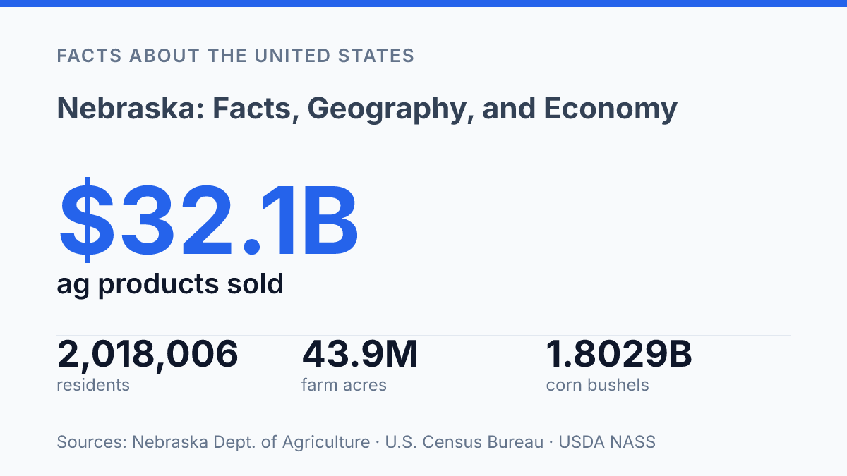
Nebraska puts 89% of its land into farms and ranches, yet its 2,018,006 residents were spread at a 2020 density of just 25.5 people per square mile. That contrast explains much of the state’s character: large-scale production, long travel distances, water-dependent settlement, and towns tied closely to grain, cattle, rail, roads, and regional services. The state’s story is not limited to cornfields.
The Sandhills cover about one-quarter of the land area while holding only 1.2% of the population, and insurance carriers and related activities contributed $18.738 billion to state GDP in 2024. This article examines the facts that make the state distinct, from geography and population patterns to agriculture, exports, landmarks, wildlife migration, and the industries that give its economy more range than its rural image suggests.
Nebraska at a glance
The U.S. Census Bureau estimated the state at 2,018,006 residents as of July 1, 2025, up 2.9% from the April 1, 2020 estimates base, while its 2020 population density was just 25.5 people per square mile. The official 1,961,504 count from the 2020 census places the state among the less densely settled parts of the country, especially given its area of roughly 77,000 square miles. That combination of broad territory and modest population is central to its at-a-glance profile.
Lincoln is the state capital, while Omaha is the largest city and the main metropolitan anchor. The contrast matters because the state is often associated with open rural space, yet Omaha and Lincoln concentrate a large share of its population, public institutions, universities, health systems, finance, and transportation links. In practical terms, the state is not defined only by small towns and wide plains; its two largest cities shape statewide administration, employment, and cultural life.
Nebraska sits in the Great Plains, a central position that helps explain its open horizons, long travel distances, and role as a connector between the Midwest and the interior West. It borders six states: South Dakota to the north, Iowa and Missouri to the east, Kansas to the south, and Colorado and Wyoming to the west. This location gives the state a distinctly inland profile, with regional ties extending in several directions rather than toward a single coastal market.
Why the state’s geography shapes daily life
A state often pictured as flat is interrupted by grass-stabilized dunes that cover about a quarter of its land. The Sandhills are not loose desert sands but a large dune region held in place by native grasses, which makes the area better suited to rangeland than intensive row-crop farming. They cover about 25% of the state’s land area, according to a 2024 University of Nebraska–Lincoln analysis, so their influence is not a scenic exception but a major factor in how the north-central region is used.
Water access creates a different pattern in the east and along the main river valleys. The Missouri River forms a major feature on the state’s eastern edge, where floodplains, bluffs, crossings, and river access have long shaped settlement and movement. Farther inland, the Platte River valley has served as a natural east-west corridor because its broad, relatively gentle route is more practical for roads, rail lines, irrigation works, and nearby agricultural settlement than the more broken dune country to the north.
The extent of agricultural land shows how closely terrain and water are tied to daily use of space. Farms and ranches occupy 43.9 million acres, equal to 89% of the state’s total land area, and the state has nearly 80,000 miles of rivers and streams, according to the state Department of Agriculture. Those figures help explain why land management, groundwater access, flood risk, and irrigation are not abstract environmental topics but routine considerations for communities and producers.
Climate sharpens the east-west contrast. The eastern part of the state is generally wetter, supporting more dependable rain-fed cropping and denser networks of towns and farm infrastructure.
The western half is drier, so land use shifts more strongly toward irrigation where water is available and grazing where it is not. This variation makes the flat-state image only partly accurate: river valleys, dunes, and moisture gradients create meaningful differences in transportation routes, settlement patterns, and agricultural choices.
Main industries and what drives the economy
A farm economy built on cattle and corn sold $32.1 billion in agricultural products in 2024, yet one of the state’s largest nonfarm engines is insurance. According to the state Department of Agriculture, livestock accounted for 63% of agricultural sales that year, while crops accounted for 37%, showing how cattle production and feed-crop production reinforce one another rather than operating as separate economies.
Corn, cattle, and soybeans remain the core outputs because they connect production, processing, transportation, and exports. The USDA National Agricultural Statistics Service reported 1.8029 billion bushels of corn for grain in 2024, valued at $7.8066 billion, along with 301.3 million bushels of soybeans valued at $2.9497 billion. The same overview counted 6.05 million cattle and calves as of January 1, 2025, a figure that helps explain why beef and feed demand shape so much of the state’s agricultural market.
Food processing and meatpacking convert those farm outputs into higher-value industrial activity. Cities such as Omaha and Lexington are closely associated with meatpacking, cold storage, transportation, and related services, linking rural production areas with urban labor markets and rail or highway distribution. This processing layer is one reason the farm sector supports jobs beyond farming itself, including plant operations, equipment maintenance, logistics, inspection, and wholesale trade.
The export profile also shows how concentrated strengths reach beyond the region. The state Department of Agriculture reported $8.189 billion in agricultural exports in 2024, led by beef and veal at $1.661 billion, corn at $1.655 billion, and soybeans at $1.612 billion. Those near-equal export values point to an economy balanced across livestock, feed grains, and oilseed crops rather than dependent on a single commodity.
Finance and insurance give the economy another major pillar, especially in Omaha. Mutual of Omaha anchors a long-established insurance presence, while Berkshire Hathaway adds national visibility through its headquarters, investment operations, and insurance holdings. U.S. Bureau of Economic Analysis data published through FRED put insurance carriers and related activities at $18.738 billion in state GDP in 2024, which helps explain why the state is better understood as a mixed agricultural, processing, financial, and service economy than as a purely farm-based one.
History, landmarks, and culture that stand out
A federal law signed in 1862 left one of its clearest physical and civic imprints on the state through private land claims and a national historical park near Beatrice. The Homestead Act offered eligible claimants 160 acres of public land if they lived on and improved it, turning federal land policy into a direct mechanism for settlement and ownership.
Its legacy is preserved at Homestead National Historical Park, which marks the area associated with Daniel Freeman’s claim, often identified by the National Park Service as the first under the act. The policy helped define the state’s public memory of migration, landholding, and the transformation of prairie into farms, towns, and county institutions.
Trail history gives the state another nationally recognizable marker. Chimney Rock, a narrow spire rising above the North Platte River valley, became one of the most recorded landmarks for emigrants traveling west on the Oregon Trail, as well as related overland routes.
Its value was practical and symbolic: it helped travelers measure progress across the plains, but it also became an image of the westward journey itself. That dual role explains why the formation remains prominent in museums, school materials, highway signs, and public heritage sites long after wagon migration ended.
Omaha’s College World Series gives the state a different kind of national visibility, rooted not in settlement history but in recurring mass attention. The NCAA men’s baseball championship has been held in Omaha since 1950, making it one of the longest-running associations between a major college sports event and a single host city. Each June, the event draws teams, fans, broadcasters, and alumni networks into a city whose name becomes closely tied to the final stage of the college baseball season.
These symbols explain why the state’s public identity is broader than population size or industry rankings suggest. Homesteading links it to land ownership and federal settlement policy; Chimney Rock ties it to overland migration; and the College World Series gives Omaha an annual place in the national sports calendar. Together, they create a recognizable cultural profile built from durable places, institutions, and rituals rather than constant national attention.
Why the land-use numbers matter next
The next useful question is not whether the state is agricultural or diversified, but how those two realities will interact as conditions change. Water availability, export demand, cattle and grain prices, insurance risk, and rural population patterns all shape the same economic system. A county with irrigated cropland, a migration route, or a regional service center may respond very differently to the same statewide trend.
That makes local context essential for interpreting future data. The clearest practical consequence is that Nebraska’s development will likely be measured less by a single headline industry than by how well land, water, transport, finance, and community institutions keep reinforcing one another.
Frequently Asked Questions
Q: What is Nebraska best known for?
A: Nebraska is widely known for its central Plains geography, large agricultural output, and role as a major livestock and grain producer. Its economy is closely tied to farming, food processing, and transportation services that support agricultural trade.
Q: What kind of climate does Nebraska have?
A: Nebraska has a continental climate with hot summers, cold winters, and wide seasonal temperature swings. Precipitation is generally higher in the east than in the west, which affects crop patterns and water management across the state.
Q: Which industries are most important in Nebraska?
A: Agriculture remains one of Nebraska’s most important sectors, especially corn, soybeans, cattle, and pork production. Manufacturing, finance, insurance, and transportation also contribute significantly to the state economy, particularly in larger urban centers.
Q: What are the largest cities in Nebraska?
A: Omaha is the largest city and a major business center, while Lincoln is the state capital and another key economic hub. Other cities play smaller regional roles, but Omaha and Lincoln account for much of the state’s population and commercial activity.
Q: How does Nebraska’s geography affect its economy?
A: Nebraska’s broad plains and fertile soils support large-scale agriculture, which shapes employment, land use, and trade patterns. Its central location also helps connect freight and logistics routes, making transportation a practical extension of the state’s farm-based economy.