
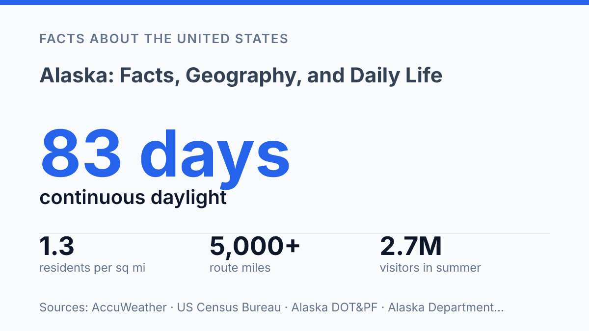
Alaska contains 571,241.6 square miles of land and 94,483.3 square miles of water, yet the U.S. Census Bureau estimated only 740,133 residents in 2024. That works out to about 1.3 residents per square mile of land, a density that turns distance into a daily fact rather than a map detail.
Scale also explains why the state resists easy description: cruise ships concentrate in summer ports while many communities depend on aircraft for year-round access, and Utqiaġvik can go 83 days without a sunset while Southeast towns live with maritime rain. This guide treats the state as a set of connected regions, examining how geography, climate, transportation, wildlife, and economic activity shape daily life across places that can share a state government but operate under very different conditions.
Where Alaska sits and how large it is
At 665,384 square miles, Alaska is more than twice the size of Texas, large enough that its map scale can distort how close or far apart places actually are. The state occupies the far northwestern corner of North America, with Canada along its eastern land boundary, the Arctic Ocean to the north, and the Pacific Ocean and Gulf of Alaska to the south. Its western edge faces Russia across the Bering Strait, while the contiguous United States lies far to the southeast beyond Canada rather than across a direct land connection.
That total area includes both immense landmass and extensive coastal waters. According to the U.S. Census Bureau, the state has 571,241.6 square miles of land and 94,483.3 square miles of water, making it No. 1 among U.S. states by area; its 2024 population estimate of 740,133 works out to about 1.3 residents per square mile of land. The number helps explain why distance, rather than simple population size, often defines public services, travel, and access.
The capital, Juneau, sits in the southeastern part of the state near the Inside Passage, separated from many other communities by water, mountains, and long travel routes. Anchorage, by contrast, is the largest city and serves as the main urban and logistical center. This split between political capital and largest city is not unusual in the United States, but the scale of the surrounding territory gives it unusual practical significance.
Large area does not mean even settlement. Much of the state consists of remote terrain, islands, peninsulas, mountains, tundra, and long coastlines, so communities are distributed unevenly across a space comparable to a large region of the continent. As a result, basic facts about location and size are not background trivia; they shape how the state is governed, supplied, mapped, and experienced in daily life.
Climate, daylight, and major regions
Utqiaġvik ended an 83-day stretch of continuous daylight on August 1, 2024, after the sun had last set on May 10, 2024, according to AccuWeather. That same far-northern setting also brings polar night, when communities north of the Arctic Circle go for weeks without the sun rising above the horizon. The midnight sun is therefore not just a tourism phrase; in places on the North Slope, daylight and darkness shape work schedules, school routines, travel timing, and community life in ways that are hard to compare with lower-latitude states.
Regional climate differences are just as significant as the daylight extremes. The North Slope has an Arctic climate, with long, very cold winters, short cool summers, tundra landscapes, and sea ice conditions that influence coastal weather.
The Interior is generally subarctic, with large seasonal temperature swings: winter cold can be severe, while summer days can become surprisingly warm because the region is far from the moderating effects of the ocean. Southcentral Alaska sits between mountain ranges, the Gulf, and interior air masses, so its conditions can shift sharply over short distances.
Maritime patterns dominate much of the southern and southeastern coast. In the Inside Passage and along Gulf-influenced areas, the ocean tends to moderate temperatures while increasing cloud cover, precipitation, and storm exposure.
This is one reason coastal communities may have milder winters than inland locations at similar latitudes, yet also face wetter weather and lower visibility. Travel Alaska divides the state into five visitor regions: Inside Passage, Southcentral, Interior, Arctic, and Southwest, a useful shorthand for understanding why a single statewide climate label can mislead.
Recent climate data add context without erasing those regional contrasts. NOAA’s National Centers for Environmental Information reported the state’s January–December 2024 average temperature at 28.9°F, which was 2.9°F above the long-term average and ranked in the warmest third of the 100-year record. That statewide number indicates a warmer-than-average year, but it does not mean every region experienced the same conditions or impacts.
People, economy, and transportation challenges
The 2020 Census counted 733,391 residents in a state where many settlements are not connected to one another by road. The settlement pattern is sparse even by western U.S. standards, with people concentrated in a limited number of road-linked corridors, coastal towns, river communities, and regional service centers. That distribution affects public services as much as daily errands, since medical care, freight, school travel, and government administration often require long-distance movement rather than a simple drive between towns.
The economy is broad, though resource extraction has an outsized fiscal role. Oil and gas production supports high-wage jobs, pipeline-related activity, and a major share of state revenue, while commercial fishing and seafood processing anchor many coastal economies.
Tourism is another large seasonal force: the Department of Commerce reported 2,702,900 out-of-state visitors in summer 2024, including 1,785,000 cruise passengers, or 66% of the total. Public employment also matters because federal, state, local, and tribal government functions support schools, transportation, public safety, health services, and land management across widely separated communities.
Transportation shows the practical cost of distance. The state Department of Transportation and Public Facilities says 82% of communities depend on aviation for year-round access, and the rural aviation system includes 235 airports. Small aircraft may carry passengers, mail, groceries, medical supplies, and replacement parts on routes that would be ordinary highway trips elsewhere.
Roads still matter where they exist, but the network does not reach many communities, especially in island, coastal, and river regions. Ferries help fill that gap through the Alaska Marine Highway System, which the state DOT&PF reported as covering more than 5,000 route miles with 9 vessels in 2024.
That system carried more than 118,000 passengers and 53,000 vehicles that year, showing its role as practical infrastructure as well as a visitor route. The tradeoff is that air and marine transportation can be expensive to operate, difficult to schedule, and sensitive to severe weather, leaving many communities dependent on systems that are essential but costly.
Wildlife, protected areas, and state identity
Few U.S. state symbols are as astronomical as the Alaska state flag, which places the Big Dipper and the North Star on a blue field rather than centering a person, building, or seal. Its design came from Benny Benson, an Indigenous teenager who won a territorial flag contest in 1927. That origin helps explain why official identity in the state is often tied not only to wilderness imagery, but also to Indigenous heritage, navigation, and northern geography.
The protected-area system gives physical form to that identity. Denali National Park and Preserve contains North America’s highest peak and protects broad habitat for large mammals, migratory birds, and alpine and boreal ecosystems. Glacier Bay National Park and Preserve is associated with tidewater glaciers, marine waters, rainforest, and continuing scientific observation of glacial retreat and ecological succession. The Arctic National Wildlife Refuge is especially prominent in national conservation debates because it includes sensitive Arctic habitat as well as areas that have long been discussed in relation to energy development.
Wildlife is one of the clearest ways these places enter public memory. Brown bears, moose, salmon, and bald eagles are commonly associated with the state, but they are not only symbols for postcards or visitor campaigns.
Salmon connect rivers, coastal ecosystems, commercial harvest, and subsistence traditions, while large mammals and raptors depend on habitat that extends far beyond park boundaries. According to a 2025 proclamation from the Office of the Governor, the state is home to all three North American bear species, including approximately 30,000 brown bears.
The same wild places that support conservation and tourism also raise recurring questions about access, development, and local use. Protected areas can preserve habitat and cultural resources, yet management decisions must account for subsistence practices, scientific research, visitor pressure, and resource proposals. That tension is part of the state’s public identity: wilderness is treated as a defining feature, but it is also a lived and managed place rather than an untouched abstraction.
Why distance still defines Alaska’s choices
The most useful way to understand the state is not as remote, but as distance-dependent. Roads, ferries, aircraft, shipping schedules, fuel costs, and seasonal daylight do more than affect convenience; they shape school calendars, food prices, medical access, tourism timing, and public spending. Climate trends add another layer, because warmer averages, changing ice conditions, and shifting wildlife patterns can alter systems that were already expensive to maintain.
The practical consequence is that ordinary planning carries unusual weight here. A ferry route, a rural runway, or a protected habitat boundary can determine whether a community remains connected, affordable, and resilient over the next decade.
Frequently Asked Questions
Q: What is Alaska best known for?
A: Alaska is best known for its large size, cold climate, and extensive wilderness. It is the largest U.S. state by area and has a long coastline, major mountain ranges, and many national parks and protected lands.
Q: How cold does Alaska get in winter?
A: Winter temperatures vary widely across Alaska, but interior areas can drop far below zero for long periods. Coastal places are usually milder because the ocean moderates temperature, though snow, ice, and strong winds remain common.
Q: Do people live all year in remote parts of Alaska?
A: Yes, many communities are occupied year-round, including some that are not connected by road to the rest of the state. Daily life in these places often depends on air travel, boats, snow machines, or seasonal ice roads for transport and supplies.
Q: What is the geography of Alaska like?
A: Alaska includes mountains, tundra, forests, glaciers, river systems, and thousands of islands. Its geography varies sharply by region, with some areas shaped by ocean climates and others by arctic or subarctic conditions.
Q: How does Alaska affect daily life for residents?
A: Daily life in Alaska is shaped by weather, distance, and the cost of moving goods and people. Housing, transportation, and access to services can be more difficult in remote areas, while local communities often adapt with strong seasonal planning and self-sufficiency.