
Columbus exists as Ohio’s capital because lawmakers turned geography into policy: a February 20, 1810 law required the permanent seat of government to sit within 40 miles of the state’s “common center.” That decision still shapes how the city is read, from the Statehouse site donated by Franklinton-area landholders to the rebuilt riverfront that now anchors downtown public space.
The result is a capital where civic planning, science education, neighborhood preservation, and art institutions sit close enough to form a coherent visitor route rather than separate attractions. This article traces how the city’s official role became visible in stone, parks, museums, and restored streets, with attention to the Scioto Mile, COSI, German Village, and downtown cultural spaces that show how public investment and local preservation continue to define the city.
Why Columbus is Ohio’s capital city
Ohio’s capital was not inherited by accident; it was drawn toward the state’s center by law. Columbus is the capital of Ohio, and its position in central Ohio gives the city a civic role that is geographic as well as administrative. A February 20, 1810 law required Ohio’s permanent capital to be within 40 miles of the state’s “common center,” and on February 21, 1812 lawmakers created Columbus; four Franklinton-area landholders donated two 10-acre parcels for a statehouse and penitentiary, according to the Ohio Legislative Service Commission.
That origin explains why the city works well as the anchor point for a guide to parks, art, and historic districts. Capital-city status gives it the formal weight of state government, but the experience of the place is not limited to offices, legislative buildings, or official ceremonies.
Its central location makes the city a practical starting point, while its public spaces, cultural institutions, and older neighborhoods shape how visitors and residents move through it. The sections that follow build outward from this civic center into the riverfront, science attractions, and historic streets that give the capital a broader identity.
What to see along the Scioto River
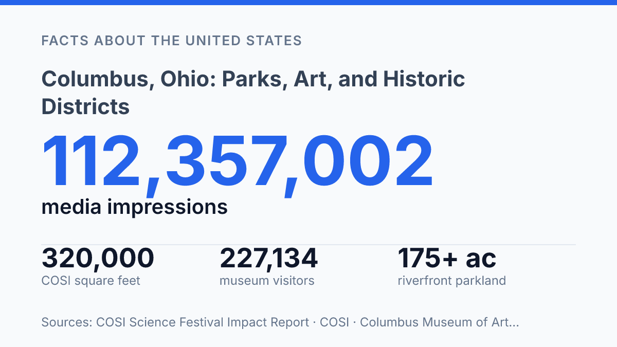
More than 175 acres of downtown riverfront parkland now sit where the Scioto River was once treated more as an edge than a public center. The Scioto Mile is arranged as a linked sequence of parks on both sides of the water, stretching from the Arena District to the Whittier Peninsula, according to Scioto Mile and Columbus Recreation and Parks. That layout matters because it turns the riverfront into a continuous civic space rather than a single overlook, allowing lawns, promenades, plazas, and viewing points to work together across several blocks.
One of the most visible features is the large interactive fountain at Bicentennial Park, a warm-weather draw that shifts the riverfront from passive scenery to active recreation. Its appeal is especially practical for families and event crowds, since the surrounding hardscape and open areas can support both informal play and programmed gatherings. The park system is open daily from 7:00 a.m. to 11:00 p.m., which also makes the riverfront usable beyond a short midday visit, particularly for evening walks and summer events.
The trail network gives the riverfront its strongest everyday function. The Scioto Trail runs 5.6 miles, and from downtown it connects directly to the Olentangy Trail before continuing north another 4 miles to West 5th Avenue, according to the Columbus Recreation and Parks Department. Those links make the parks useful not only for sightseeing but also for commuting, running, cycling, and longer recreational routes that extend well beyond the central riverfront.
A major redesign shaped the riverfront visitors see now. After a public-feedback process that drew more than 1,100 comments, the Main Street Dam was removed in late 2013, helping create 33 acres of new green space along the Scioto, according to Scioto Mile and Columbus Recreation and Parks. The result is a public space built for repeated daily use as much as special events, though its value depends on season, weather, and how much time visitors can reasonably spend outdoors.
Hands-on science at COSI
A 320,000-square-foot science center sits just across the Scioto River from downtown, making riverfront history and laboratory-style learning part of the same short visit. The Center of Science and Industry, better known as COSI, occupies a prominent site on the west bank of the Scioto River and functions less like a gallery of objects than a place built around experiments, demonstrations, and physical participation.
According to COSI in 2026, the building includes 300+ interactive experiences, nine galleries, and education programs that reach more than 300,000 students annually. That scale matters because the exhibits are designed to turn scientific ideas into actions: testing forces, exploring energy, examining living systems, or working through engineering problems by manipulating real components. The result is a museum visit shaped by doing rather than only observing, which helps explain why it is often treated as one of the city’s core family and education attractions.
The planetarium is one of COSI’s major features because it extends the hands-on model into immersive astronomy. Dome-based programming can show planetary motion, deep-space imagery, and sky patterns at a scale that is difficult to convey through wall text or small displays. For visitors interested in space science, it adds a structured presentation component to a center otherwise known for open-ended exploration.
The experience can vary by timing. Rotating exhibitions may shift the emphasis from one branch of science to another, while crowded periods can affect how easily groups move through high-demand activities. Those variables do not weaken COSI’s educational role, but they do make it a more dynamic attraction than a fixed collection, with each visit shaped by programming, attendance, and the exhibits currently on view.
Historic streets and downtown art spaces
A single arts-and-preservation circuit can move from a downtown collection that drew 227,134 total visitors in FY24 to residential streets where 19th-century immigrant building patterns remain visible. The Columbus Museum of Art, located downtown, anchors the institutional side of that cultural identity with collections that include American and European paintings as well as sculpture and works on paper. Its FY24 impact report also recorded 76,018 Free Sunday visitors, a figure that shows how access programs can turn a formal museum collection into a regular civic resource rather than a one-time destination.
By contrast, German Village expresses history through the scale and texture of everyday streets. The neighborhood is known for restored brick houses built by German settlers in the 1800s, giving the area a residential character that differs from downtown’s civic and museum architecture. Preservation there has been organized as well as aesthetic: according to the German Village Society and the Advisory Council on Historic Preservation, the German Village Society formed in 1960 after urban-renewal campaigns in the 1950s had demolished one-third of the old German neighborhood.
The two places show different ways a city preserves culture. The museum selects, conserves, and interprets art within a curated setting, with American and European paintings placing local audiences in conversation with wider art histories.
German Village, meanwhile, preserves a built environment shaped by settlement, demolition pressures, and neighborhood advocacy. Taken together, they show that the city center’s cultural value comes not only from major institutions, but also from older streets where lived history remains part of the urban fabric.
What the city’s public places reveal
The clearest pattern is not that the city has many attractions, but that its strongest places were shaped by deliberate choices about access, land, and public use. A capital selected for centrality later removed a downtown dam, protected a 233-acre historic district, and supported free museum admission at meaningful scale.
Those decisions affect how residents and visitors experience the city: as a set of connected civic spaces rather than isolated stops. Future changes along the riverfront, in museum programming, or in neighborhood preservation will matter because they will decide whether that connection remains broad and public, or becomes harder to see from the sidewalk.
Frequently Asked Questions
Q: What is the Scioto Mile in Columbus known for?
A: The Scioto Mile is a series of parks along both sides of the Scioto River. It is known for its trails and a large interactive fountain that draws steady visitor traffic. The riverfront setting also makes it one of the city’s main outdoor recreation corridors.
Q: What can visitors see at COSI in Columbus?
A: COSI is a science center on the west bank of the Scioto River. It features hands-on exhibits and a planetarium, which makes it a strong stop for visitors interested in interactive learning. Its location also places it close to the Scioto Mile area.
Q: What kind of art collection does the Columbus Museum of Art have?
A: The Columbus Museum of Art includes American and European paintings. It also has a sculpture garden, which expands the visit beyond gallery spaces. Together, these features make it one of the city’s main cultural institutions.
Q: Why is German Village a notable historic district in Columbus?
A: German Village is known for its restored brick houses built by 1800s settlers. The district preserves a clear physical record of the city’s immigrant-era development. Its architecture is a major reason it remains historically significant.
Q: Is Columbus a good city for combining parks, museums, and historic neighborhoods?
A: Yes. Columbus brings together riverfront parks, major museums, and preserved historic districts within the same city center. That combination makes it possible to experience outdoor space, arts, and local history in a single visit.