
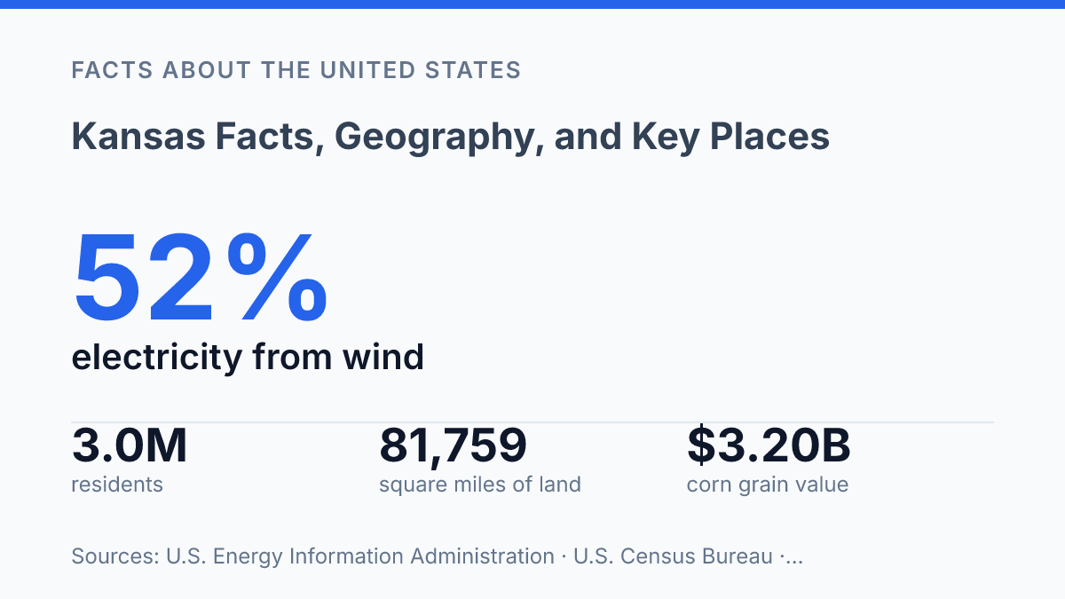
Kansas covers 81,758.6 square miles of land, making it the 13th-largest state, yet its common image is often reduced to a flat agricultural middle. The numbers point to a broader and more varied place: Mount Sunflower rises to 4,039 feet, the Verdigris River sits at 679 feet, and nearly 3 million residents are distributed across farm counties, Wichita, Topeka, and fast-growing Kansas City suburbs. The state’s identity is also less fixed than familiar wheat-field imagery suggests.
Corn recently surpassed winter wheat in crop value, wind produced 52% of electricity net generation in 2024, and Brown v. Board of Education National Historical Park ties a national civil-rights landmark to measurable local tourism. These facts frame the state through terrain, settlement, production, and memory rather than a single stereotype.
Where Kansas Sits and What Its Terrain Looks Like
Between Mount Sunflower and the Verdigris River, Kansas spans 3,360 feet of elevation change, a quiet rebuttal to the idea that the state is simply flat. The U.S. Geological Survey places the high point at 4,039 feet and the low point at 679 feet, meaning the state’s relief is subtle rather than absent. That gradual rise is easiest to understand from east to west, where lower, wetter terrain gives way to higher and drier plains near the Colorado line.
The state sits in the central United States, with Nebraska to the north, Missouri to the east, Oklahoma to the south, and Colorado to the west. Its position within the Great Plains gives it a broad, open physical character, but that region is not uniform.
According to the U.S. Census Bureau’s 2024 profile, the state has 81,758.6 square miles of land and 519.6 square miles of water, making it the 13th-largest state by area. The limited water area helps explain why rivers, reservoirs, and groundwater sources carry outsized importance in how land is used.
Eastern Kansas is generally more humid and prairie-oriented, with rolling ground, deeper soils, and more tree cover along stream corridors. This eastern belt forms part of the transition from the tallgrass prairie toward the more heavily settled Midwest, and its higher rainfall supports a different mix of vegetation and farming conditions than the western counties. The terrain still includes broad uplands and river valleys, but it does not match the simplified image of an uninterrupted level plain.
Western Kansas is higher, more open, and drier, reflecting the state’s approach toward the High Plains and the rain-shadow influence of the Rocky Mountains farther west. The change is gradual enough to be easy to miss on a highway map, yet it strongly affects climate, vegetation, and land use. In practice, the east-to-west rise helps separate the state into wetter prairie country and a more arid western zone where water availability and wind exposure become defining geographic factors.
Population, Cities, and Regional Centers
The state’s population pattern is striking because a large physical footprint supports a comparatively modest number of residents: it has 81,758.6 square miles of land and 519.6 square miles of water, making it the 13th-largest state by area, according to the U.S. Census Bureau’s 2024 ACS/Census profile. Census Bureau QuickFacts estimated the state’s population at 2,977,220 as of July 1, 2025, up 1.3% from the April 2020 estimates base. That combination of scale and modest growth helps explain why civic, commercial, and health-care activity is concentrated in a limited number of urban corridors while many counties remain sparsely settled.
Wichita is the largest city and the clearest single urban anchor, with an estimated 400,991 residents in 2024. Its size gives it a different role from smaller county seats: it functions as a major employment, aviation, medical, education, and retail center for a broad surrounding region. The gap between Wichita and most other municipalities is central to understanding the state’s settlement pattern, because one city carries a share of metropolitan activity that many states distribute across several similarly sized urban areas.
On the eastern edge, the Kansas City metro area forms the state’s largest cross-border urban system through its connection with Missouri. The state-side suburbs are major population centers in their own right, led by Overland Park at an estimated 202,893 residents in 2024 and Olathe at 149,035. This metro pattern links residents to jobs, airports, cultural institutions, and corporate offices across a state line, making the region economically integrated even though local governments remain separate.
Topeka serves a different function as the state capital, anchoring government, courts, public administration, and related professional services. Other regional centers, including university and market towns, support surrounding rural areas, but they do not match the scale of Wichita or the eastern metro suburbs. The overall pattern is therefore not urban versus rural so much as a small set of metropolitan hubs supporting a wide rural footprint.
Economy, Agriculture, and Major Industries
Corn grain out-earned winter wheat in 2024, at about $3.20 billion versus $1.67 billion, yet wheat remains the crop most closely tied to the state’s agricultural identity. USDA-NASS reported 55,500 farm operations working 44.8 million acres that year, with an average operation size of 807 acres, which shows that farming is not a niche sector but a dominant use of land and a major influence on local economies. Wheat production still matters because winter wheat is well suited to dryland farming, storage, milling, grain handling, and export-oriented supply chains, but the crop-value ranking makes clear that the farm economy is broader than a single grain.
The clearest city-based counterweight to the statewide farm economy is Wichita’s aviation sector. Cessna, now part of Textron Aviation, and Spirit AeroSystems anchor a manufacturing cluster built around aircraft assembly, components, engineering, skilled machining, and supplier networks. This industrial base differs from agriculture not only by product but by geography: aviation employment is concentrated in and around Wichita, while farm income and farm-related services are spread across rural counties, grain elevators, equipment dealers, and processing facilities.
Energy production adds another regional layer to the economy, especially in the western part of the state. According to the U.S. Energy Information Administration’s state energy profile, wind supplied 52% of the state’s electricity net generation in 2024, the third-highest share in the country after Iowa and South Dakota. Utility-scale wind projects convert open land and strong wind resources into lease income, construction activity, and tax revenue, while oil production remains an older but still relevant part of the western resource economy through drilling, field services, royalties, and local public finance.
The result is an economy shaped by agriculture but not confined to it. Farming gives the state much of its land-use pattern and public identity, aviation gives Wichita a specialized manufacturing role, and energy production links rural regions to modern power markets as well as long-running petroleum activity.
Notable Places, History, and Cultural Identity
A single preserved school building in Topeka connects the state’s public memory to a Supreme Court decision that reshaped American education. Brown v. Board of Education National Historical Park is centered on the former Monroe Elementary School, one of the places associated with the challenge to legally segregated public schools.
The ruling in 1954 gives the site national significance rather than merely local interest, and the National Park Service reported 18,800 visitors in 2023, along with $1.3 million in local visitor spending and a $2 million total local economic benefit. That combination of civic meaning and measured tourism impact makes the park one of the clearest examples of how historical memory can shape a present-day place.
Popular culture has given the state a narrower but more widely repeated identity through The Wizard of Oz. L. Frank Baum’s 1900 novel and the 1939 film made the prairie home of Dorothy Gale one of the most recognizable fictional references to the state, especially through the phrase “not in Kansas anymore.”
The connection remains visible in museums, roadside attractions, festivals, and state branding, but it works best as a cultural shorthand rather than a complete account of the state’s history. Its durability shows how a fictional setting can influence public perception long after the original work appeared.
Tallgrass Prairie National Preserve offers a different kind of landmark because it protects an ecosystem rather than a monument or myth. Located in the Flint Hills, the preserve represents one of the most important remaining examples of native tallgrass prairie, a habitat that once covered much of central North America but has been largely converted to farms, towns, and roads.
According to the National Park Service, less than 4 percent of the continent’s tallgrass prairie remains, which makes preservation in this region especially significant. The site also includes ranching history, so it links natural conservation with the human use of prairie land.
Other historical markers broaden the state’s public identity beyond its most familiar symbols. Nicodemus National Historic Site preserves the legacy of an African American settlement founded during Reconstruction, while Fort Larned National Historic Site interprets military, trade, and Plains history along the Santa Fe Trail. Together with Topeka’s civil-rights landmark, the Oz association, and prairie conservation in the Flint Hills, these places show a state remembered through law, literature, land, migration, and contested national history.
What the numbers change about the state’s image
The most useful way to read the state is through connections rather than categories. Elevation changes help explain regional terrain, farm acreage shows how land use still shapes daily economics, and city population figures reveal why influence is concentrated in several metro areas rather than one dominant center. The next questions will be practical ones: whether modest population growth continues, how wind generation affects local tax bases and infrastructure, and how historical sites such as Brown v.
Board of Education National Historical Park are maintained as both public memory and economic assets. A county map, a crop report, and an elevation table now say more about the state than any single roadside view.
Frequently Asked Questions
Q: What is Kansas best known for geographically?
A: Kansas is best known for its broad Great Plains setting and largely flat to gently rolling terrain. The state sits in the central United States and is often associated with agriculture because much of its land is suitable for farming and ranching.
Q: What are the largest cities in Kansas?
A: The largest cities are Wichita, Overland Park, and Kansas City, Kansas. Wichita is the largest by population and serves as a major economic center, while the Kansas City area connects the state to a larger metropolitan region across the Missouri border.
Q: Does Kansas have any notable natural landmarks?
A: Kansas has several notable natural sites, including the Flint Hills, which preserve one of the largest remaining tallgrass prairie ecosystems in North America. The western part of the state also features more arid scenery and wide-open prairie views that contrast with the eastern region.
Q: What is the climate like in Kansas?
A: Kansas has a continental climate with hot summers, cold winters, and frequent weather changes. Storms can be severe, especially in spring, because the state lies in a region where warm, moist air and cooler, drier air often meet.
Q: Which places are important to visit in Kansas?
A: Popular places include the Flint Hills, Monument Rocks, Tallgrass Prairie National Preserve, and historic downtown areas in cities such as Lawrence and Topeka. These sites show the state’s range from natural scenery to civic and cultural landmarks.