
Kentucky shares borders with seven states, yet even after it entered the Union, its edges were unresolved enough that lawmakers did not approve a joint Indiana boundary survey until 1878. That mix of defined place and unfinished boundary work helps explain why geography, politics, and movement are central to the state’s story. A commonwealth covering 39,485.8 square miles of land became the 15th state on June 1, 1792, after Congress approved its separation from Virginia territory and George Washington signed the consent legislation.
Its modern profile is just as layered: bourbon tourism, horse racing, cave systems, river cities, and rural supply chains all contribute to an identity measured not only in symbols but in visitors, spending, and regional influence. The sections ahead connect location, statehood, present-day reputation, and notable places without treating them as separate facts.
Where Kentucky is located and what borders it
Few U.S. states touch as many different regional identities as Kentucky, whose northern edge follows the Ohio River while its far western tip reaches the Mississippi River. That position helps explain why the state is commonly associated with the South, yet also remains closely tied to Midwestern river routes and Appalachian mountain counties.
The state borders 7 states: Illinois, Indiana, and Ohio across or near the Ohio River; West Virginia and Virginia to the east; Tennessee along the long southern boundary; and Missouri at the far west near the Mississippi River and Missouri Bootheel area. According to the Kentucky Historical Society, some boundary questions remained unsettled long after statehood, and the legislature did not approve a joint Indiana boundary survey until 1878. The detail matters geographically because several borders are not simple straight lines but follow rivers, older surveys, and negotiated boundary understandings.
Physical regions add another layer to that border position. The eastern counties are part of Appalachia, with hillier terrain and closer cultural and travel connections to the central Appalachian states. In contrast, the Bluegrass area in the north-central part of the state is known for rolling pastureland and has stronger links to the Ohio River corridor and nearby urban markets.
Farther west, broad lowlands and river access connect the state more directly with the Mississippi Valley. Together, these regions make the state less a single geographic type than a meeting point between river country, upland Appalachia, and the interior South.
How Kentucky became a state
Congress approved statehood before the new state’s first constitution took effect, creating a carefully staged separation from its parent commonwealth rather than a sudden break. According to the U.S. Senate, President George Washington signed the consent legislation on February 4, 1791, and Kentucky entered the Union on June 1, 1792, as the 15th state. That sequence matters because admission required both federal approval and a local constitutional framework, not simply population growth on the frontier.
Before statehood, the area was politically attached to Virginia, even as its settlements developed at a distance from the older centers of colonial and state authority. Frontier communities had to manage land claims, defense, courts, roads, and trade across difficult terrain, which encouraged a strong preference for local decision-making. This did not erase legal ties to Virginia, but it made separate statehood increasingly practical as settlement expanded and local institutions matured.
The move toward independence took shape through a series of statehood conventions, many associated with Danville, where delegates debated how separation should proceed and what kind of government the future state would adopt. Virginia’s consent was essential, since the territory was not being taken by conquest or carved out without permission. Once that consent aligned with congressional approval, delegates adopted a state constitution, giving the new commonwealth the governing structure it needed when admission became official.
The result was an early identity with two connected features: political legitimacy inherited through an orderly legal process, and a frontier culture shaped by distance, migration, and local self-reliance. That combination helps explain why statehood was both a constitutional transfer and a recognition that the region had already developed a distinct civic life of its own.
What the state is known for today
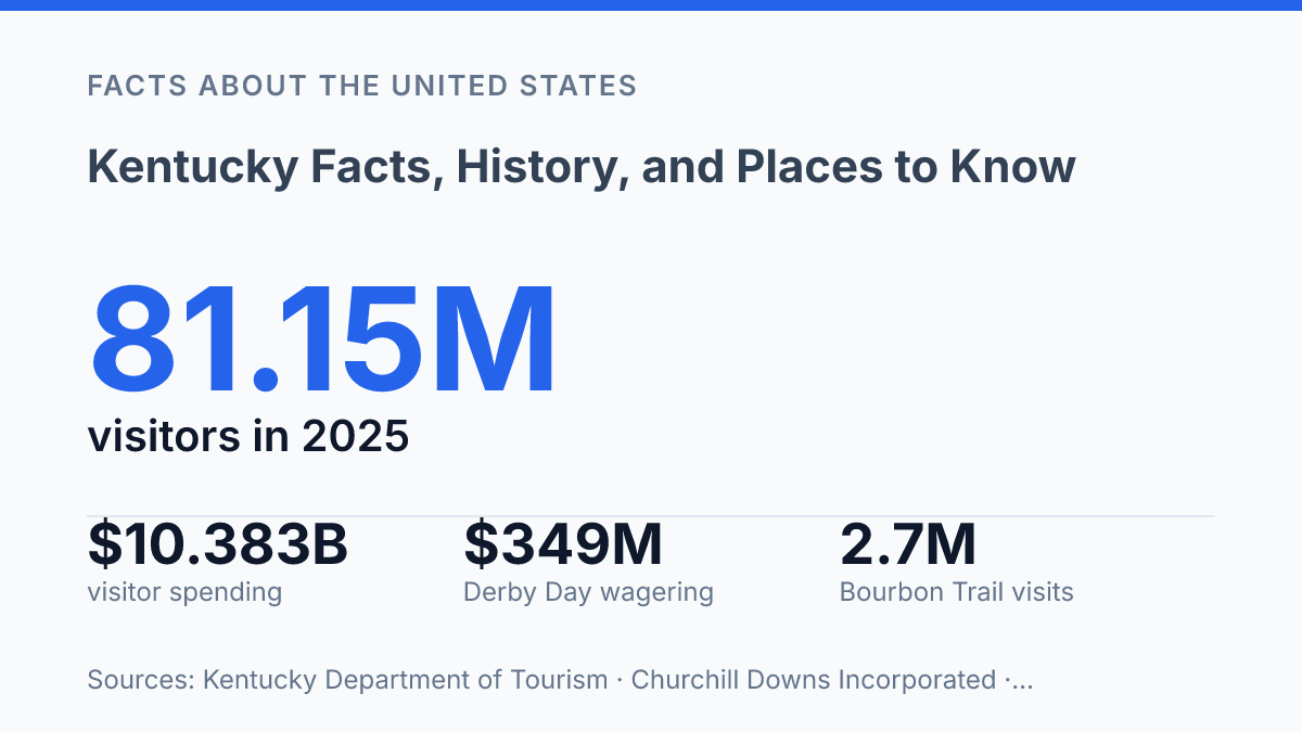
The 151st Kentucky Derby drew over 147,000 fans to Churchill Downs and set an all-sources Derby Day wagering record of $349 million on May 3, 2025, according to Churchill Downs Incorporated. That scale explains why horse racing remains one of the state’s strongest public associations, especially through the annual Louisville race, its surrounding events, and the equine farms, sales, and breeding operations tied to the sport.
Bourbon production is the other signature marker, with tourism now closely linked to distilling as well as to the drink itself. The Kentucky Bourbon Trail reported a record 2.7 million visitor experiences in 2024 during its 25th anniversary year, according to the trail and the state distillers’ association.
The industry also connects tourism to agriculture: association members reported buying 84% of their corn from in-state farms in 2024, equal to about 10% of the state’s total corn output. That supply-chain link helps explain why bourbon is both a cultural label and an agricultural-industrial product.
The state’s wider economy is broader than its best-known symbols. Manufacturing is a major pillar, including motor vehicles, aerospace-related production, food and beverage processing, and other durable goods.
Agriculture remains visible through corn, soybeans, cattle, poultry, horses, and tobacco, while coal is still part of the state’s industrial identity even as mining’s role has changed over time. These sectors show why bourbon, tobacco, and horses function as shorthand rather than a full economic description: they are nationally recognizable, but they sit within a more varied mix of production, farming, energy, tourism, and services.
Cities, landmarks, and places often visited
A single itinerary can link downtown riverfront museums with the world’s longest known cave system in the time it takes to drive across a large metropolitan area. Louisville is the principal urban entry point for many visitors, with institutions such as the Muhammad Ali Center and the Louisville Slugger Museum & Factory connecting national sports, biography, manufacturing heritage, and civic memory in one city setting. Lexington offers a different urban profile as a university city and cultural anchor for the central part of the state, while Frankfort is smaller but major in administrative terms because it is the capital and home to the State Capitol.
For natural landmarks, Mammoth Cave National Park stands apart because it protects the world’s longest known cave system rather than a single scenic overlook or trail corridor. In 2024, the National Park Service recorded 747,042 visitors there and estimated that they spent $73,238,000 in nearby communities. That scale shows why the park is not only a geologic landmark but also a travel anchor for towns outside the largest urban centers.
Outdoor destinations add another dimension to the state’s public image. Red River Gorge is widely associated with sandstone arches, cliff lines, hiking routes, and rock climbing, which gives it a different appeal from cave tourism because much of the experience is above ground and trail-based.
Cumberland Gap also carries national significance as a mountain pass tied to early westward movement, making it both an outdoor site and a historical place. Taken together, the cities, caves, gorges, and passes explain why the state’s best-known places are split between urban culture and distinctive natural terrain.
What the numbers reveal about place and identity
The clearest way to understand Kentucky is to treat its identity as an active system rather than a fixed label. Tourism figures, bourbon supply chains, Derby wagering records, and national park spending show how history and geography still produce measurable effects in farms, cities, and small communities. That also means the state’s most recognizable places are not just attractions; they are economic and cultural anchors whose value depends on preservation, access, and local participation.
Future growth will likely sharpen that balance, especially where visitor demand meets fragile cave environments, agricultural capacity, and historic urban districts. The practical consequence is simple: the places most associated with the commonwealth will matter most when their surrounding communities can benefit from them without being reduced to backdrops.
Frequently Asked Questions
Q: What is Kentucky best known for?
A: Kentucky is best known for horse racing, bourbon production, and bluegrass music. The state also has a strong agricultural profile, with tobacco, cattle, and corn historically shaping its economy. Its reputation is tied to a mix of cultural traditions and rural as well as urban regions.
Q: What is the capital of Kentucky?
A: Frankfort is the capital of Kentucky. It is smaller than the state’s largest cities, but it holds the main offices of state government. That distinction often surprises people who assume the largest city is also the capital.
Q: Which city is the largest in Kentucky?
A: Louisville is the largest city in Kentucky. It is a major center for shipping, manufacturing, health care, and the Kentucky Derby. Its size and economic role make it the state’s most widely recognized urban area.
Q: What are some famous places to visit in Kentucky?
A: Popular places include Mammoth Cave National Park, the Kentucky Horse Park, and Cumberland Falls. Mammoth Cave is known for its extensive cave system, while Cumberland Falls is often associated with its scenic waterfall views. These sites show the state’s range from geology and wildlife to equestrian culture.
Q: What is Kentucky’s history known for?
A: Kentucky’s history is shaped by frontier settlement, the Civil War era, and later industrial and agricultural growth. It entered the Union in 1792 as the 15th state, which places it among the early additions to the United States. That early statehood helped position Kentucky as a border state with long-standing regional importance.