
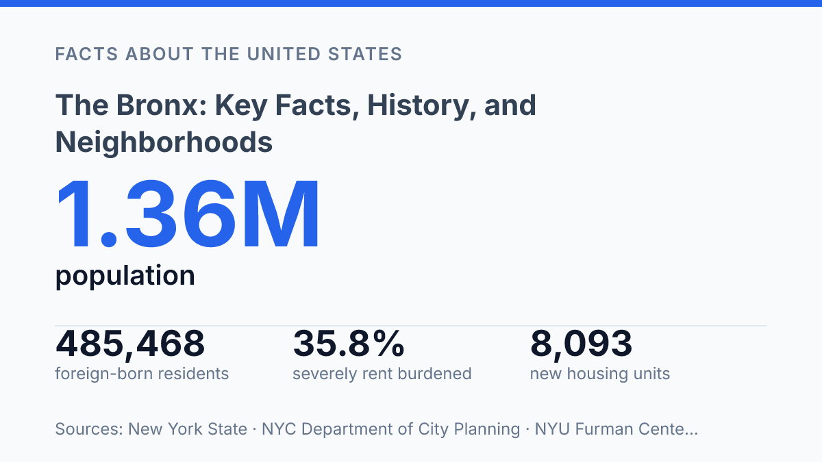
The Bronx packs 1,356,476 residents into 57 square miles while reserving roughly one-quarter of its land as open space, a combination that makes the borough unusually dense and physically varied within New York City. Its profile is not explained by any single identity: a county formed in 1914, a major home for Dominican-born New Yorkers, a place adding 8,093 housing units in 2024, and a borough where 35.8 percent of renter households still spent more than half their income on rent. Those contrasts shape how its geography, history, neighborhoods, institutions, and daily routines fit together.
The story moves from rivers, parkland, and transit corridors to waves of development, immigration, cultural production, and public investment. It also explains why current projects, including four planned Metro-North stations in the East Bronx, are not just transportation upgrades but potential shifts in access, housing demand, and economic connection.
Where the borough sits and what defines it
Only one New York City borough sits mainly on the North American mainland, a geographic fact that gives the borough a different physical relationship to the city than Brooklyn, Queens, Manhattan, or Staten Island. The Bronx is one of New York City’s five boroughs and is coterminous with Bronx County, meaning the borough and county share the same boundaries for most practical administrative purposes. According to the New York State county profile, 2026/current, it covers 57 square miles, became a county in 1914, had a 2023 population of 1,356,476, and has open space across about one-quarter of its land area.
Its position is defined by both separation and connection. Manhattan lies to the southwest across the Harlem River, while Westchester County borders the borough to the north, making the city-county edge here feel more like a mainland boundary than an island shoreline. The Bronx River runs through the borough rather than simply around it, giving the area a major natural corridor that helps organize its geography without functioning as its outer limit.
That mainland setting can make the borough appear distinct from the rest of New York City on a map, but administratively it is fully part of the same municipal system. It is governed through New York City’s borough framework, represented in citywide institutions, and tied into the broader urban network through roads, bridges, rail lines, and public services. The result is a borough with a clear physical identity of its own and a civic identity that remains inseparable from New York City.
How the borough evolved over time
Between 1900 and 1930, U.S. census counts show the borough’s population rising from about 201,000 to more than 1.26 million, a surge that turned former commuter villages into a tightly built urban district. That transformation began before the population boom, when the western portion of the area was annexed to New York City in 1874. In 1898, the consolidation of Greater New York made it one of the city’s five boroughs, while its later separation from New York County in 1914 gave it a distinct county government identity.
Transit expansion made the early 20th-century growth possible at a scale that horse cars and ferries could not support. Elevated railways and subway extensions connected new apartment corridors to Manhattan jobs, encouraging speculative development and replacing estates, farms, and small settlements with dense residential blocks. The Interborough Rapid Transit network, later joined by other subway routes, did more than shorten commutes; it changed land values and made large-scale middle- and working-class housing practical across wide areas of the borough.
After World War II, the same urban fabric faced severe stress from job losses, suburban migration, highway construction, redlining, and shrinking public and private investment. The South Bronx became the national symbol of this decline during the 1960s and 1970s, when abandonment, landlord neglect, and arson destroyed thousands of buildings and displaced many residents. The crisis was not simply a story of crime or fire; it reflected a broader collapse in the financial logic that had supported older rental housing in low-income neighborhoods.
Recovery was uneven, but it was real. Community organizations, tenant groups, nonprofit developers, and public housing programs helped rebuild vacant land into apartments, schools, and local services from the 1980s onward.
Large planning efforts such as Melrose Commons showed how redevelopment could combine housing production with community input rather than only clearance. The borough’s history is often reduced to images of postwar devastation, but that framing misses the longer arc: annexation, transit-driven urbanization, disinvestment, and reinvestment each reshaped the same neighborhoods over time.
Neighborhoods, landmarks, and institutions
A single Yankees season can put more than half a billion dollars into the local economy, which helps explain why Yankee Stadium functions as more than a sports venue. NYCEDC projected $606 million in economic impact from 2024 Yankees home games, tying the ballpark in Concourse to jobs, visitor spending, transit use, and the public image of the borough. Its significance is partly symbolic as well: few places in New York are as closely associated with one team, one neighborhood, and a nationally recognized address.
Neighborhood identity is more varied than the borough’s most famous landmarks suggest. Fordham is anchored by Fordham Road, one of the city’s major outer-borough shopping corridors, and by nearby Fordham University, giving the area a mix of retail, students, commuters, and long-established residential blocks. Riverdale presents a different profile, with hillside apartment buildings, single-family houses, schools, and access to Hudson River views, while the South Bronx includes communities such as Mott Haven, Port Morris, Hunts Point, and Longwood, where residential life, industrial uses, arts spaces, and waterfront redevelopment exist side by side.
Large cultural and scientific institutions give the borough a role that extends well beyond local recreation. The New York Botanical Garden reported more than 1.2 million visitors to its 250-acre campus in calendar year 2024, according to NYBG, making it both a tourist destination and an educational center for plant science, exhibitions, and public programming. Nearby, the Bronx Zoo serves families, school groups, and researchers through animal exhibits and conservation education, adding another major institution to the borough’s concentration of green, cultural, and scientific assets.
Everyday neighborhood institutions are just as important to how residents experience place. Public libraries, community colleges, parks, schools, commercial corridors, houses of worship, and local cultural organizations create routines that rarely receive the same outside attention as stadium crowds or major attractions. This contrast matters because The Bronx is not defined only by destinations that draw visitors; it is also shaped by residential communities whose identities come from daily services, local gathering places, and neighborhood-scale economies.
Economy, transit, and daily life
Severe rent pressure is one of the clearest measures of everyday economic strain: 35.8% of renter households were severely rent burdened in 2024, meaning they spent more than half of household income on rent, according to the NYU Furman Center. That figure helps explain why new construction does not automatically translate into broad affordability, even when housing supply is expanding. The New York State Comptroller reported that the borough added 8,093 housing units in 2024, with most of those new units in mid-sized multifamily buildings of 20 to 99 apartments.
Work in the borough is anchored less by a single central business district than by a mix of institutional, neighborhood, and service employment. Healthcare and social assistance are major job sources, supported by hospitals, clinics, nursing facilities, and home-care work.
Retail, education, food service, building maintenance, logistics, and small local firms also shape the employment base, particularly along commercial corridors and near transit nodes. Labor-market conditions remain uneven: the New York State Department of Labor reported a 7.1% unemployment rate for Bronx County in November 2024, compared with 5.5% for the wider New York City region.
Transit access connects residents to jobs well beyond borough boundaries while also shaping where housing and commerce concentrate. Multiple subway lines link the borough with Manhattan, and bus routes serve east-west trips that rail does not always handle efficiently. Metro-North service provides regional connections, and planned Penn Station Access is expected to add four accessible East Bronx stations, with service scheduled for November 2027 and travel-time savings of up to 50 minutes, according to the MTA.
Road connections reinforce the borough’s metropolitan role but also create daily burdens. The Cross Bronx Expressway carries regional traffic through dense residential areas, while bridges such as the Robert F. Kennedy, Bronx-Whitestone, Throgs Neck, and Henry Hudson connect the borough to Manhattan, Queens, Long Island, and the lower Hudson Valley. The result is a borough with strong access to the city’s labor market, but one where congestion, rent burdens, and uneven neighborhood conditions remain central to daily life.
What faster connections could change by 2027
The next measure of the borough’s trajectory will be whether growth changes household security as well as the map. New stations, cultural anchors, and housing construction can expand access, but their effects will depend on rents, job quality, public services, and who can remain near new opportunities.
The scheduled 2027 Penn Station Access opening gives planners, employers, and residents a rare fixed deadline: land use and affordability decisions made before then will shape whether faster travel times translate into broader economic reach. A borough can gain regional connection without gaining stability; the practical test is whether new investment reduces the distance between daily life and opportunity.
Frequently Asked Questions
Q: What is the Bronx best known for?
A: The Bronx is known for its role in New York City history, its cultural institutions, and its long association with music, sports, and immigrant communities. It is also home to major attractions such as Yankee Stadium, the Bronx Zoo, and the New York Botanical Garden. These landmarks make the borough a significant cultural and recreational center.
Q: Which neighborhoods are in the Bronx?
A: The Bronx includes a wide range of neighborhoods, from Riverdale and Fordham to Morrisania, Hunts Point, and the South Bronx. Each area has a distinct housing pattern, commercial corridor, and community profile. This diversity is one reason the borough is often discussed by neighborhood rather than as a single uniform area.
Q: Is the Bronx considered part of New York City?
A: Yes. The Bronx is one of the five boroughs of New York City and also one of the city’s counties. It sits north of Manhattan and is connected to the rest of the city through bridges, tunnels, subway lines, and highways.
Q: Why is the Bronx historically significant?
A: The Bronx has played a central role in New York City’s growth, especially through waves of migration, industrial development, and later urban change. It is also closely linked to the emergence of hip-hop in the 1970s, which gave the borough global cultural visibility. That history continues to shape how the area is understood today.
Q: What are some major attractions in the Bronx?
A: Major attractions include Yankee Stadium, the Bronx Zoo, the New York Botanical Garden, and the Bronx Museum of the Arts. These sites draw visitors for sports, wildlife, horticulture, and art, reflecting the borough’s wide cultural range. Together, they make the Bronx one of the city’s most visited outer boroughs.