
Guam sits less than four hours by air from Manila and Narita, a fact that explains why the island functions less as a remote Pacific edge than as a working link between the United States and Asia. Its position also carries military weight: federal planning now describes a Guam Defense System spread across 16 sites, with initial deployment planned for FY2027 and final elements by FY2032. Those two realities, mobility and defense, frame much of the territory’s modern profile.
This overview traces how a place of 153,836 people became a U.S. territory, how citizenship and representation work under the Organic Act and Congress, and why tourism, public revenue, and military investment shape daily life. The central question is not simply where the island is on a map, but how location, legal status, and regional economics combine to define its role.
Where Guam is and why it matters
A direct flight from the island takes 45 minutes to Saipan, 3 hrs 50 min to either Manila or Narita, and 7 hrs 10 min to Honolulu, according to the Guam Economic Development Authority. Those flight times show why the island is best understood as a western Pacific connector: close to major Asian and Micronesian points, but still far from the nearest U.S. state.
The territory sits in Micronesia in the western Pacific Ocean, east of the Philippines and south of Japan. On a map centered on the continental United States, Hawaii often appears to be the main American Pacific reference point, yet this island lies much farther west, beyond Hawaii and closer to East and Southeast Asia. That position gives it unusual practical value for movements across the Philippine Sea, the Mariana Islands, and the broader western Pacific.
Military planning reflects the same geography. Apra Harbor provides a major deep-water port for naval logistics, repair access, fuel, and maritime movement, while Andersen Air Force Base supports long-range air operations from a location well west of Hawaii. Together, the harbor and air base give U.S. planners fixed infrastructure inside the region rather than relying only on forces operating from the mainland or mid-Pacific bases.
Recent defense plans underline how central the island has become to U.S. posture in the Pacific. Existing missile defense is built around a THAAD battery with 6 launchers and 1 radar, and a planned islandwide defense system would be distributed across 16 sites, with first deployment scheduled for FY2027 and final elements expected by FY2032. The scale of that planning indicates that the island is not merely a stopover point; it is a forward operating and protection hub.
Distance creates a clear tradeoff. The same location that gives U.S. forces strategic reach also lengthens shipping routes, supply chains, medical evacuation options, and post-disaster response timelines from the mainland. For commercial activity and emergency planning, the island’s value as a regional gateway is therefore inseparable from the cost and complexity of sustaining it across the Pacific.
How Guam became a U.S. territory
A single sentence in the 1898 Treaty of Paris converted a Spanish colony captured in wartime into an American possession. U.S. forces took the island during the Spanish-American War in 1898, and the peace settlement made the transfer permanent: the treaty signed on December 10, 1898 ceded the island, Puerto Rico, and the Philippines to the United States, according to the U.S. Department of State’s Office of the Historian. The Senate ratified the agreement on February 6, 1899, by a margin of one vote, underscoring how narrow the domestic approval was for acquiring overseas territories after the war.
American administration did not mean uninterrupted American control on the ground. Japanese forces occupied the island during World War II, beginning in 1941, and U.S. forces retook it in 1944. That wartime occupation was a decisive event in local history, but it did not create the territory’s current legal framework; the legal relationship rested on the earlier cession and later congressional action.
The major civilian turning point came with the Organic Act of Guam in 1950. According to the U.S. Department of the Interior’s Office of Insular Affairs, the act conferred U.S. citizenship on Guamanians, created the territorial government, and transferred federal administrative responsibility from the Navy to the Department of the Interior. This changed the island from a primarily naval-administered possession into an organized unincorporated territory with a civilian government established by Congress.
That framework provides local self-government, but it is not equivalent to statehood. Congress retains authority over territorial law, and residents do not receive the same federal political rights as residents of states, including voting representation in Congress. The present status therefore reflects two linked developments: acquisition through the 1898 peace settlement and civilian territorial organization through the 1950 act.
Government, citizenship, and representation
A person born on the island is a U.S. citizen by federal statute, but that citizenship does not provide a voting member of Congress or a role in the Electoral College. The controlling citizenship provision is 8 U.S.C. § 1407, which places birth in the territory within federal nationality law rather than treating political rights as identical to those in a state.
Local self-government operates through an elected executive and legislature. The governor heads the territorial executive branch, with authority over administration, budgeting proposals, public agencies, and implementation of local law. Lawmaking rests with the elected Guam Legislature, a unicameral body of 15 senators, which passes territorial statutes, appropriates local funds, and conducts oversight of executive agencies within the limits set by federal law.
Federal representation is narrower than citizenship might suggest. The territory sends a delegate to the U.S. House of Representatives, and James Moylan serves in that role in the 119th Congress, according to his congressional office in 2025.
A delegate may introduce legislation, participate in debate, and serve on committees; Moylan’s office lists service on 3 committees: Armed Services, Foreign Affairs, and Education and the Workforce. The core limitation is that the delegate cannot cast a vote on final passage of legislation on the House floor.
Presidential elections mark the clearest difference between territorial and state political rights. Residents may participate in party processes such as presidential primaries or caucuses when parties allow them, but the territory has no Electoral College votes. As a result, U.S. citizens living there do not vote for president in the general election unless they establish voting residence in a state or the District of Columbia under applicable election rules.
Population, economy, and daily life
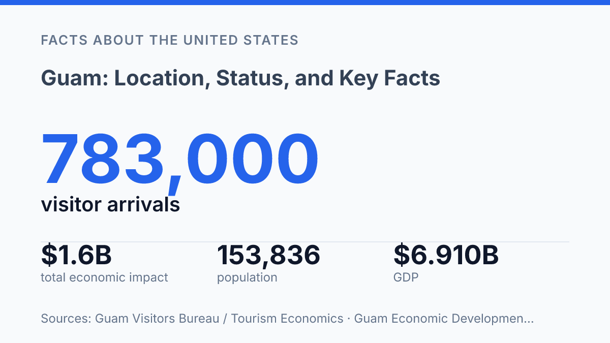
A population of 153,836 makes the island smaller than many U.S. cities, yet its job market is tied to two globally exposed sectors: tourism and the U.S. military. The 2020 U.S. Census count, reported in Guam Economic Development Authority materials, provides the main population benchmark for understanding the scale of public services, housing demand, schools, and the labor force. GEDA also reported nominal GDP of $6.910 billion in 2022, a figure that reflects an economy with a compact resident base but unusually large outside inflows from visitors and federal activity.
Tourism remains one of the clearest measures of economic dependence on external demand. The 2025 Tourism Satellite Account from the Guam Visitors Bureau and Tourism Economics reported 783,000 visitor arrivals, $1.2 billion in direct visitor spending, $1.6 billion in total economic impact, 15,100 jobs supported, and $163 million in government revenues.
Those figures show why hotels, restaurants, transportation, retail, and public budgets are closely linked to travel patterns across the western Pacific. They also explain why airline capacity, exchange rates, storms, health restrictions, and shifts in major source markets can quickly affect employment and tax receipts.
The U.S. military forms the other major economic pillar through payrolls, construction, procurement, contracting, and demand for local services. Defense-related activity can stabilize income when visitor markets weaken, but it also leaves parts of the economy sensitive to federal appropriations, construction schedules, and policy decisions made outside the island. This dual dependence creates a practical mix in daily life: a private service economy oriented toward visitors and a public-contracting economy shaped by defense needs.
Language is central to local identity as well as public life. English is widely used in government, education, business, and media, while Chamorro remains an official language and a marker of Indigenous heritage, family identity, place names, ceremonies, and cultural instruction. In 2020, that linguistic mix reflected a broader daily pattern: U.S. institutions, Pacific Islander identity, Asian regional ties, and a service-based economy operating side by side on a small island with global strategic and commercial links.
Why the next decade matters beyond the map
The practical consequence is that future debates about the island are likely to be measured in schedules and appropriations as much as in constitutional language. A defense buildout moving from first deployment in FY2027 toward final elements in FY2032 will affect land use, labor demand, infrastructure planning, and federal attention. Tourism data will remain just as revealing, because visitor spending translates directly into jobs and public revenue rather than abstract economic activity.
The status question also remains structurally unresolved: residents are U.S. citizens, but national representation is still limited. Any serious reading of the territory has to hold those facts together, because the same location that brings regional access also brings exposure to decisions made far beyond the island.
Frequently Asked Questions
Q: Where is Guam located on the map?
A: Guam is an island in the western Pacific Ocean and part of the Mariana Islands. It sits southeast of the Philippines and south of Japan, which places it within Micronesia. Its position makes it a strategic Pacific waypoint for travel and military operations.
Q: Is Guam a U.S. state or a territory?
A: Guam is an unincorporated U.S. territory, not a state. Federal law applies there, but residents do not have full voting representation in Congress and cannot vote in U.S. presidential elections while living on the island. This status affects local self-government and federal political rights.
Q: What country governs Guam?
A: Guam is governed by the United States. The island has its own elected local government, including a governor and legislature, but Congress retains authority over major territorial matters. Day-to-day administration is therefore local, while ultimate sovereignty rests with the United States.
Q: What language is spoken in Guam?
A: English and Chamorro are the official languages of Guam. English is widely used in government, schools, and business, while Chamorro remains an important Indigenous language and cultural marker. Other Pacific and Asian languages are also heard on the island because of its diverse population.
Q: Why is Guam strategically important?
A: Guam has major military significance because of its location in the western Pacific. U.S. bases on the island support force projection, logistics, and regional deterrence across Asia and the Pacific. Its location also makes it important for shipping, aviation, and communications.