
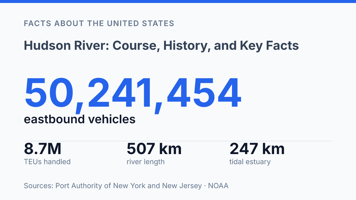
The Hudson River runs 315 miles from Lake Tear of the Clouds to Upper New York Bay, yet its influence is concentrated in a tidal estuary that reaches 247 miles north from Manhattan to the Troy Dam. That mix of mountain headwaters, ocean tides, inland trade, and urban infrastructure explains why one river can connect Adirondack geology, New York Harbor shipping, and seahorses recorded near Manhattan piers. Its course helped turn New York into a national trade center after the Erie Canal opened in 1825, and the same corridor still supports port activity measured in millions of containers.
The river is also a living estuary, with recent surveys documenting fish diversity, oyster habitat work, and restored bottom habitat near major crossings. Its geography is straightforward on a map, but its role in commerce, ecology, and movement is much larger than its length suggests.
Where the Hudson River starts and ends
For much of its lower route, the Hudson is not simply flowing downhill; ocean tides push upriver as far as the federal dam at Troy. According to the NOAA / Hudson River National Estuarine Research Reserve, the Hudson River runs 507 km, or 315 miles, from Lake Tear of the Clouds in the Adirondack Mountains to its confluence with Upper New York Bay.
Why the river shaped New York’s growth
The same water route that helped New York City pull commerce from the interior also made the colony a military objective, because whoever controlled it could control movement between the coast and inland settlements. In 1609, Henry Hudson sailed the Half Moon under commission from the Dutch East India Company, searching for a route to Asia but instead strengthening Dutch interest in the river valley. His voyage helped anchor Dutch claims that led to New Netherland, where river access supported fur trading posts, settlement, and a port economy tied to Atlantic shipping.
New York’s commercial advantage grew because the river formed the seaward leg of a route into the continent. From the upper river region, goods and travelers could move toward the Mohawk Valley, the main lowland passage through the Appalachian barrier in New York.
The Erie Canal system turned that geographic opening into an engineered trade route after the canal opened in 1825 following eight years of construction, according to the New York State Canal Corporation. The result was not just faster movement of grain, timber, manufactured goods, and people, but a shift in national trade patterns: New York City handled just over one-third of U.S. imports in 1821 and more than two-thirds by 1860, according to the NYC Department of Records & Information Services.
Military planners understood the same logic in reverse during the American Revolution. British control of river access would have helped separate New England from the other colonies and allowed troops, supplies, and communications to move along a north-south axis.
Forts at key points, including Fort Montgomery, Fort Clinton, and later the heavily defended position at West Point, reflected the effort to deny that passage. The river therefore shaped New York in two connected ways: it concentrated trade around a coastal port with inland reach, and it made that reach strategically valuable enough to fight over.
Natural features and wildlife along the river
A single lower-river genetic survey found 95 unique fish taxa, a reminder that the Hudson’s ecology is broader than the species visible from its shoreline. The 2025 eDNA report, based on 77 samples collected at four lower-river sites during 2021–2024, detected far more biological variety than a casual observer would expect in a heavily used urban waterway.
The river’s habitats shift sharply between its freshwater reaches and its tidal, brackish lower sections. Upriver areas support freshwater fish, wooded banks, floodplain habitats, and tributary mouths, while the lower estuary mixes river flow with seawater and creates conditions used by marine, estuarine, and migratory species. That gradient matters because species do not use the river uniformly: striped bass move through the estuary during seasonal migrations, while Atlantic sturgeon depend on riverine habitat during key parts of their life cycle.
Wetlands, marshes, shallow coves, and tributaries function as nursery and feeding areas rather than as scenery alone. Marsh edges shelter young fish from stronger currents and larger predators, while tributary confluences bring cooler water, sediment, organic matter, and insects into the main channel. These same habitats support birds that track fish abundance, including bald eagles and osprey, both of which rely on open water and nearby nesting or perching sites.
Urban and industrial use has altered many shoreline areas, especially in the lower estuary, but monitoring still shows substantial biological activity. The Manhattan waterfront park’s 2024 Fish Survey recorded 309 fish catches across 20 species, with oyster toadfish forming 25.6% of the catch and lined seahorses representing 22 individuals, according to the survey report published in 2025.
Habitat restoration has also added measurable bottom habitat in the harbor and Tappan Zee reach, including oyster and benthic habitat projects tracked by New York State environmental agencies. The result is not an untouched river system, but a working estuary where remnant, restored, and seasonal habitats continue to support fish, raptors, and migratory life cycles.
Famous places and crossings along the river
More than 50,241,454 eastbound vehicles crossed the George Washington Bridge in 2024, according to Port Authority of New York and New Jersey financial statements, making the lower river as much a transportation corridor as a geographic landmark. The George Washington Bridge links Manhattan and New Jersey at one of the most recognizable river crossings in the United States, while the Tappan Zee crossing, now carried by the Governor Mario M. Cuomo Bridge, anchors travel farther north between Westchester and Rockland counties. Together, these crossings help define the heavily developed lower section, where highways, commuter routes, and freight movement meet the river at frequent intervals.
The Palisades provide one of the clearest visual markers along the lower west bank. Their steep cliffs face the New York City side of the river and create a sharp contrast with the dense road and bridge network nearby. Farther upstream, West Point remains a major point of orientation because it occupies a commanding bend in the river, making the site visually prominent as well as historically recognizable from road, rail, and water routes.
Several river communities function as practical reference points for locating the waterway within the wider region. Albany marks the state-capital end of many north-south travel associations, while Kingston connects the river to older settlement patterns and routes leading into the Catskills. Poughkeepsie sits between those poles and is widely associated with mid-valley crossings and rail access, placing it in the part of the corridor where commuting, tourism, and historic river towns overlap.
The Hudson Valley is the broader name that ties these places together, but it does not describe a single kind of setting. Near New York City, the river is framed by dense infrastructure and major crossings; farther north, the same corridor is more closely associated with scenic overlooks, institutional landmarks, older towns, and historic land use. That contrast is one reason the river is easy to place on a regional map: its landmarks change character as it moves from metropolitan gateway to valley corridor.
Where the river’s evidence points next
The river’s future will be shaped less by any single landmark than by how its uses are measured together. Shipping data, bridge traffic, fish surveys, eDNA sampling, and oyster restoration records all describe the same corridor from different angles, and none gives a complete picture alone. A practical next step for understanding the river is to track where those indicators overlap: places where transportation demand, habitat repair, water quality, and public access meet.
That is where planning choices become most concrete. A restored oyster bed near a major bridge is not just an environmental detail; it shows how infrastructure and ecological repair now occupy the same stretch of water.
Frequently Asked Questions
Q: Where does the Hudson River begin and end?
A: The Hudson River begins at Lake Tear of the Clouds in the Adirondack Mountains of New York. It flows south through eastern New York before emptying into Upper New York Bay between New York City and New Jersey. Its course makes it one of the most significant river corridors in the northeastern United States.
Q: How long is the Hudson River?
A: The river is about 315 miles long. That length helps explain why it has served both as a transportation route and as a major geographic divider in New York State. Its size also gives it a wide range of ecological and economic uses along the way.
Q: Why is the Hudson River historically important?
A: The Hudson River was central to early exploration, trade, and military movement in colonial America and the Revolutionary era. It linked inland settlements with the Atlantic coast, which made it strategically valuable for commerce and defense. That role helped shape the growth of New York and the wider region.
Q: Is the Hudson River saltwater or freshwater?
A: The Hudson River is a tidal estuary for much of its lower course, so it contains a mix of freshwater and saltwater. Tides from the Atlantic can influence water levels far inland, which affects navigation and local ecosystems. This mixing zone is one reason the river supports such varied plant and animal life.
Q: What cities and landmarks are along the Hudson River?
A: Major places along the river include Albany, Poughkeepsie, and New York City. Well-known landmarks include the Hudson Valley, the Palisades, and the estuarine section near the harbor at New York City. These locations reflect the river’s importance for settlement, scenery, and regional identity.