
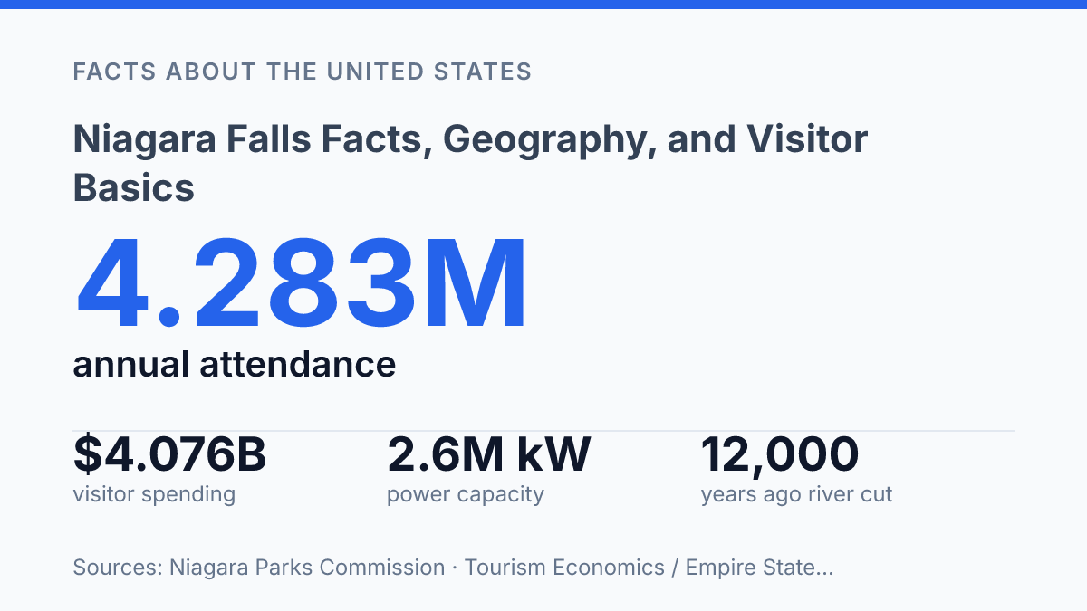
Niagara Falls is not one waterfall but three, and the size difference is substantial: Canadian Horseshoe Falls spans about 670 metres, while Bridal Veil Falls is only about 15 metres wide. That uneven geography helps explain why the Ontario side offers broad panoramic views, while the New York side places visitors closer to the American and Bridal Veil drops. The falls also combine two very different timescales. Their rock layers were deposited roughly 440–425 million years ago, but the Niagara River began cutting through the escarpment only about 12,000 years ago.
The modern scene is not purely natural, either. Under the 1950 Niagara Treaty, daytime tourist-season flow must stay far higher than off-hour minimums, reflecting the constant balance between scenery and hydroelectric use. The result is a landmark shaped by geology, border politics, engineering, and visitor movement.
Where the falls are and how the border divides them
The international boundary does not sit beside the falls; it runs through the river system that gives Niagara Falls its name. The waterfall system spans western New York state and southern Ontario, so the same geographic feature is also a border feature, divided between the United States and Canada rather than contained wholly within either country.
On a map, the Niagara River is the connecting waterway between Lake Erie to the south and Lake Ontario to the north. The falls sit along that river corridor, where islands and channels split the flow before it drops over the escarpment. This river-based location is why the name can refer at once to a natural feature, a cross-border region, and the adjacent communities on either side of the line.
The falls are three separate drops: Canadian Horseshoe Falls, with a crest width of 670 m / 2,200 ft; American Falls, 260 m / 850 ft; and Bridal Veil Falls, 15 m / 50 ft, with Bridal Veil on the U.S. side, according to the Niagara Parks, 2022–23 Tour Study Guide. The size contrast is central to the geography: Horseshoe Falls forms the broad curving cataract most closely associated with the Canadian side, while American Falls and Bridal Veil Falls occupy the New York side of the river system.
This division gives the place a layered identity. In ordinary usage, the name often sounds like a single destination, but geographically it is a set of waterfalls within an international river, shared by two jurisdictions and described through both physical and political boundaries.
How the falls formed and why they keep changing
A geologically young gorge was cut into rocks hundreds of millions of years older than the waterfall itself. According to the New York State Museum, the river began cutting through the escarpment about 12,000 years ago, after Pleistocene ice sheets retreated and meltwater reorganized drainage across the region. The bedrock exposed at the falls is far older, deposited roughly 440–425 million years ago during the Silurian Period, which means the modern gorge is a recent incision into an ancient rock platform.
The main agent of change is the erosion of the Niagara Escarpment, a resistant ridge that the river has been cutting back over time. Water plunging over the crest attacks weaker lower layers, while spray, turbulence, freezing, thawing, and falling debris enlarge cracks and cavities. As the softer rock beneath is removed, harder caprock loses support and breaks away in blocks, causing the lip of the falls to retreat upstream rather than simply wear down in place.
Rock layering explains why the falls have a steep face instead of a smooth slope. Harder dolostone and limestone near the top resist erosion more effectively, while softer shale below is more easily undercut by moving water. This structure creates a self-reinforcing pattern: the unsupported upper ledge eventually collapses, debris is carried or broken down by the river, and the exposed face begins the same process again.
The falls therefore appear fixed on ordinary human timescales but remain mobile over geologic time. Modern water flow still shapes the rock face, even though the rate of retreat is not the same as it was when postglacial discharge was less managed and the gorge was younger. The visible cliff, plunge pools, and gorge walls are the cumulative result of water volume, bedrock resistance, and repeated collapse acting together over thousands of years.
Historic power source and modern hydroelectric use
By 1896, electricity generated at Niagara was being transmitted to Buffalo, proving that alternating current could serve customers well beyond the immediate falls district. The early project is closely associated with Nikola Tesla because his alternating-current motor and polyphase system, licensed through Westinghouse, helped make long-distance transmission practical at a scale direct-current systems could not match. Niagara therefore became more than a scenic landmark; it became a public demonstration that falling water could support urban and industrial electrification across a region.
Modern hydroelectric development on both sides of the border reflects that same principle at far larger scale. On the U.S. side, the Robert Moses Niagara Power Plant forms the core of the New York Power Authority’s Niagara Power Project, which is 4.5 miles downstream from Niagara Falls and can produce up to 2.6 million kilowatts, according to the New York Power Authority. The authority says the project uses 25 turbines driven by 748,000 gallons of water per second, a figure that shows why the infrastructure is placed away from the brink and integrated into a managed diversion system rather than relying only on water passing visibly over the crest.
Across the border, Ontario’s Sir Adam Beck I, Sir Adam Beck II, and Sir Adam Beck Pump generating stations perform a comparable role in the Canadian power system. Ontario Power Generation reports that the stations and pump facility have a combined generating capacity of about 2,400 megawatts, enough to supply more than 2 million homes each year. The paired U.S. and Canadian systems show how the hydropower value of the site depends on coordinated engineering as much as on the natural drop itself.
Regulated diversion is the mechanism that links energy production with preservation of the falls’ visible flow. Under the 1950 Niagara Treaty, the International Joint Commission states that at least 100,000 cubic feet per second must pass over the falls during daytime tourist-season hours, while the minimum is 50,000 cubic feet per second at other times. Those rules formalize a long-running compromise: the same water that generates a dramatic cataract is also an energy resource, so power production is limited by agreed flow requirements that maintain the landmark’s appearance.
What visitors usually see on each side
The U.S. experience is unusually park-centered because Niagara Falls State Park predates every other state park in the country, having been established in 1885. Its public overlooks, walking paths, and landscaped islands place visitors close to the brink and near the American-side drops, so the dominant impression is proximity rather than a single sweeping panorama. Two of the best-known attractions reinforce that close-range perspective: Maid of the Mist takes passengers by boat into the spray zone below the falls, while Cave of the Winds brings visitors by walkways and decks near the base of Bridal Veil’s cascade.
Across the river, the Canadian side is organized around broad frontal viewing areas and attractions built into or below the escarpment edge. Journey Behind the Falls gives access to tunnels and observation areas near the base of the main drop, and the Hornblower Cruise provides a boat-based view from the Canadian side of the gorge. According to the Niagara Parks Commission Annual Report for 2024–25, Journey Behind the Falls drew 917,075 visits, which indicates how central below-and-behind viewing remains to the Canadian visitor experience.
The practical difference between the two sides is therefore less about seeing separate natural features than about how public access is arranged. The New York side emphasizes state-park circulation, close overlooks, and spray-level attractions, while the Ontario side combines promenade-style viewpoints with major paid attractions and a larger tourism district nearby. Both sides show the same waterfall system from different angles, and that difference shapes the experience more than any simple comparison of which side is preferable.
Why the Managed River Matters as Much as the View
The falls are best understood as a natural feature whose public face is negotiated every day. Flow rules protect daytime visibility while major power stations downstream draw enormous volumes for electricity, and visitor patterns shift with border conditions, seasonal access, and regional travel demand. That makes the site less static than postcard images suggest.
Future decisions will likely turn on how agencies balance erosion control, energy needs, public access, and the economic weight of tourism on both sides of the river. For practical planning, the most relevant details are often current ones: flow schedules, attraction openings, transit options, and border conditions can shape the experience as much as the viewing platform chosen.
Frequently Asked Questions
Q: How tall is Niagara Falls?
A: Niagara Falls is not a single waterfall but a group of three falls with different heights. The Horseshoe Falls, which is the largest, drops about 57 metres on the Canadian side and 53 metres on the U.S. side because of the riverbed shape. That height helps explain why the site produces such a powerful curtain of water and spray.
Q: Where is Niagara Falls located?
A: Niagara Falls sits on the Niagara River between Ontario, Canada, and New York, United States. The river connects Lake Erie to Lake Ontario, which is part of the Great Lakes system. Its border location is the main reason the area is managed and accessed from both countries.
Q: What are the three waterfalls at Niagara Falls?
A: The site consists of Horseshoe Falls, American Falls, and Bridal Veil Falls. Horseshoe Falls is the largest by volume, while American Falls and Bridal Veil Falls are on the U.S. side. Together, they form the best-known section of the Niagara River drop.
Q: When is the best time to visit Niagara Falls?
A: Late spring through early autumn is the most popular period because temperatures are milder and more visitor services operate at full capacity. Summer offers the fullest range of activities, but it also brings the largest crowds. Shoulder seasons can be less busy, though weather and operating hours may be more variable.
Q: Can visitors see Niagara Falls from both Canada and the United States?
A: Yes, the falls are visible from both sides, and each side offers a different viewing angle. The Canadian side typically provides a broader panoramic view, while the U.S. side is closer to the base of the falls and nearby trails. Viewing preferences often depend on whether the priority is a wide scenic outlook or a more direct look at the water.