
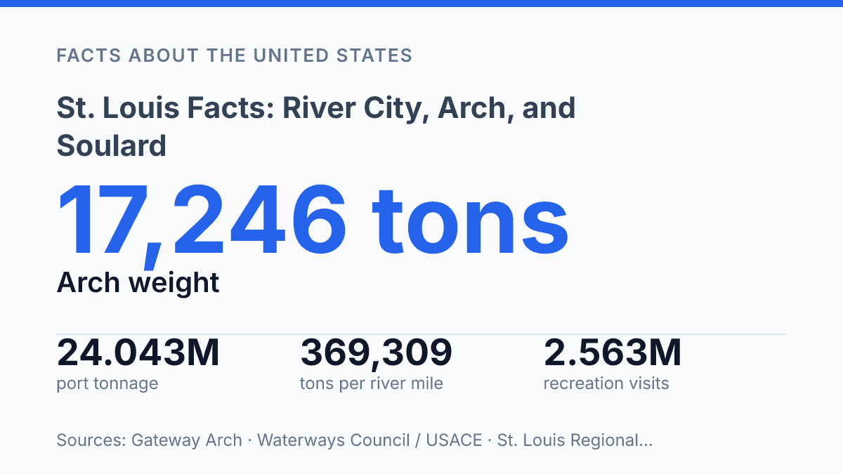
St. Louis moves far more than nostalgia along the Mississippi: in 2022, its five-port metro system handled 369,309 tons per river mile, nearly four times the average of other major inland port districts. That scale explains why the city’s river identity cannot be reduced to postcards of the Gateway Arch or steamboat imagery. Its location grew from a practical advantage at a key crossing, then produced engineering milestones such as the Eads Bridge, completed in 1874 as the first bridge across the Mississippi at the city.
The same geography now supports freight movement, national park tourism, riverboat cruises, and neighborhood events with measurable economic effects. The story links infrastructure and culture: the Arch as a 17,246-ton landmark, the riverfront as a working visitor corridor, and Soulard as a district where food, music, and Mardi Gras extend the city’s reach beyond the region.
Why St. Louis sits at a key river crossing
Few inland U.S. cities occupy a river position as layered as St. Louis: a Missouri city on the west bank of the Mississippi River, close to the point where traffic from the Missouri and Illinois river systems could be gathered, transferred, and sent south. That geography made the city more than a shoreline settlement. It sat where east-west movement could meet north-south river travel, turning the crossing itself into an economic asset.
River transport explains why the city developed as a major inland port and trade point rather than only a local market. Before railroads and highways dominated long-distance freight, the Mississippi provided a lower-cost route for moving bulk goods, agricultural output, raw materials, and manufactured cargo through the interior.
The same logic still appears in modern freight data: the region’s five-port metro system covers 70 miles of Mississippi River frontage and moved 369,309 tons per river mile in 2022, nearly four times the average of other major inland port districts, according to the St. Louis Regional Freightway. That figure matters because it shows the river remains an active freight corridor, not only a historical explanation for growth.
The city’s strategic role is clearer when compared with other Mississippi River cities. New Orleans commanded the river’s outlet to the Gulf of Mexico, making it essential for ocean-linked trade, while Memphis became a major downstream commercial center in the Mid-South.
St. Louis, by contrast, gained importance from its upriver crossing position and its ability to connect river commerce with routes reaching west and east. The completion of the Eads Bridge in 1874, the first bridge across the Mississippi at the city, reflected that role by tying river movement to fixed rail and road connections.
That advantage changed rather than disappeared. As rail networks, interstate highways, and modern logistics shifted freight away from daily dependence on river landings, the river became less visible in ordinary commercial life. Yet its position still shapes port activity, regional identity, and the way the city functions as a meeting point between inland waterways and overland transport.
How the Gateway Arch became the city’s best-known landmark
A monument weighing 17,246 tons became the city’s clearest visual shorthand because it compresses an engineering feat and a national origin story into one riverfront form. The 630-foot Gateway Arch rises from the Mississippi riverfront with a height matched by its 630-foot width, giving the structure a simple geometric profile that is recognizable from a distance and easy to reproduce in civic imagery. According to Gateway Arch figures, it was assembled from 142 stainless-steel sections and used almost 900 tons of stainless steel, details that help explain why the monument reads as both sculpture and infrastructure.
Completed in the 1960s, the arch was conceived as a memorial to the era of Lewis and Clark and to the broader story of westward expansion. That symbolic purpose gives the structure a national frame rather than a purely local one: it marks a historical narrative about exploration, migration, federal ambition, and settlement across the continent. The monument’s meaning is therefore more specific than a generic civic landmark, even though its clean shape has allowed it to become a broad emblem of the city.
Its placement on the Mississippi riverfront strengthens that dual role. The arch stands where visitors can connect the monument’s westward-expansion symbolism with the river corridor that shaped movement, commerce, and orientation in the central United States, without requiring the structure itself to function as a transport site.
In contemporary terms, that symbolic value also has measurable tourism weight: Gateway Arch National Park recorded 2,563,052 recreation visits and $184.599 million in visitor spending in 2024, according to the National Park Service. The result is a landmark tied to a specific historical story, yet still active as a modern economic and visual anchor for St. Louis.
What riverfront sightseeing looks like today
The most visible river traffic for many visitors is not freight at all, but replica paddlewheelers moving slowly past the downtown riverfront. Riverboats at the Gateway Arch operates sightseeing cruises on the Mississippi near downtown St. Louis, turning the river into a viewing platform rather than simply a boundary at the edge of the city. From the water, the Gateway Arch is seen in a different proportion: its curve rises behind the levee and park grounds, while bridges, moored vessels, and the working river add context that is harder to read from land.
Current cruise data shows that this is a structured tourism business, not just a nostalgic side attraction. Bi-State Development’s FY2025 budget projected riverboat cruise activity at about 137,380 passengers and $2.865 million in cruise revenue, indicating steady demand for short river-based sightseeing.
The Gateway Arch newsroom said the 2025 season opened on March 6, 2025, with daily one-hour riverfront cruises; listed fares that year were $26 for adults, $16 for children ages 3–15, and $24 for seniors. Those figures place the experience in the range of mainstream urban sightseeing rather than specialty heritage travel.
The appeal depends partly on contrast. Paddlewheel styling evokes the 19th-century steamboat era, when river travel helped connect inland towns and markets, yet the modern passenger experience is primarily recreational.
Similar excursion models appear elsewhere along the Mississippi, from narrated cruises in historic river towns such as Natchez to seasonal sightseeing boats in Upper Mississippi communities. The local version fits that broader pattern while gaining a distinctive frame from the Arch and the dense downtown riverfront, making the river itself part of how the city is seen rather than only the reason it developed there.
Why Soulard stands out for food and music
Nearly 25% of Soulard Mardi Gras Grand Parade Day visitors come from outside the region, according to a 2026 media advisory from Soulard Mardi Gras. That figure helps explain why the neighborhood is treated as one of the city’s best-known entertainment districts rather than simply a local dining area. The same advisory estimated that the festival generates $20 million annually for the regional economy, showing how a compact neighborhood identity can produce effects well beyond its own streets.
Food is central to that identity, especially the district’s reputation for barbecue restaurants. In practical terms, barbecue gives Soulard a recognizable culinary anchor: smoked meats, casual service, and group-friendly restaurants fit the area’s social rhythm. The appeal is not only the food itself but the way restaurants cluster close to bars, music rooms, and event spaces, making the district easy to understand as a destination.
Music gives the neighborhood a second defining layer. Soulard has clubs that regularly feature blues, a style closely associated with the Mississippi Valley and with the city’s broader musical history. These venues help distinguish the district from a generic restaurant strip because live performance turns an evening out into a cultural experience rooted in local sound rather than only in dining or drinking.
The important qualification is scale. Soulard’s reputation is powerful because it is concentrated: a visitor can associate a few blocks with barbecue, blues, Mardi Gras traditions, and a recognizable neighborhood atmosphere. That does not make it representative of the entire city’s entertainment culture, but it does make it one of the clearest places to see how food, music, and local identity reinforce one another in a specific urban district.
Why the river identity still has practical consequences
The city’s river identity remains most useful when treated as an operating system rather than a theme. Freight terminals, bridge crossings, park visitation, cruise schedules, and Soulard events all depend on proximity to the Mississippi, but they serve different publics and move on different calendars.
That creates a practical planning challenge: preserving historic character while keeping river access productive, legible, and financially sustainable. The clearest measure of success may not be a single visitor count or tonnage figure, but whether commerce, tourism, and neighborhood culture can keep sharing the same river edge without weakening one another.
Frequently Asked Questions
Q: Why is St. Louis known as the Gateway to the West?
A: St. Louis earned that reputation because of its role in westward expansion along the Mississippi River. The city’s most visible symbol of that history is the 630-ft. Gateway Arch, which was built in the 1960s to honor Lewis and Clark’s early 19th-century explorations and westward movement more broadly.
Q: What is the Gateway Arch in St. Louis?
A: The Gateway Arch is a stainless-steel monument on the St. Louis riverfront. Built in the 1960s, it stands as the city’s best-known landmark and a memorial to the nation’s westward expansion.
Q: Can visitors see the Mississippi River from the Gateway Arch area?
A: Yes. The Arch sits along the Mississippi River, and the riverfront is a central part of the city’s historic identity. Replica paddlewheelers also operate on the river, giving visitors another way to view the Arch from the water.
Q: What is Soulard in St. Louis known for?
A: Soulard is a historic district associated with food and music. It is especially known for barbecue restaurants and clubs that play blues music, which makes it one of the city’s most distinctive nightlife areas.
Q: Is St. Louis considered a major city in Missouri?
A: Yes. St. Louis is one of Missouri’s major cities and a key urban center along the Mississippi River. Its river location has shaped both its economy and its historical importance.