
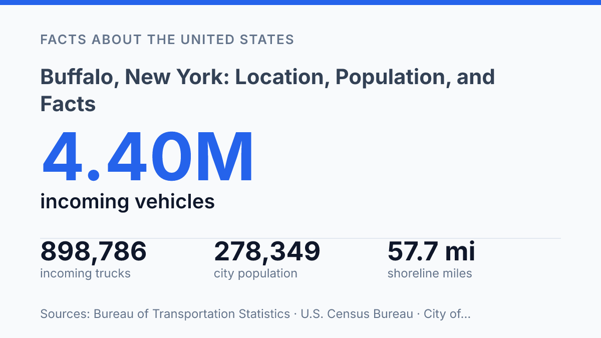
Buffalo occupies only 40.4 square miles of land, yet its influence is measured across a metro area of 1,155,653 residents and one of the busiest U.S.-Canada freight corridors. The city’s 2020 Decennial Census population was 278,349, while the July 2025 estimate placed it slightly lower at 274,613, creating a useful contrast between official census growth and newer post-census estimates. Its position as the Erie County seat, within a 1,058-square-mile county, also helps explain why the city matters beyond its municipal boundaries.
The facts become more revealing when geography is added: 57.7 miles of shoreline, proximity to Canada, and $70.076 billion in 2025 freight through the Buffalo–Niagara Falls port. The article examines how location, population, and setting connect, rather than treating them as separate facts.
Where Buffalo sits in Western New York
Few New York cities are positioned so close to both a Great Lake and an international river crossing: Buffalo sits in western New York at Lake Erie’s eastern end, where water routes begin turning north toward Canada. Its placement is not central within the state in a geographic sense; it is a western-edge city whose orientation is shaped by the lake, the Niagara corridor, and proximity to Ontario.
The city lies on the eastern shore of Lake Erie, one of the Great Lakes, and at the head of the Niagara River near the Canada–United States border. That combination gives the city a geographic identity distinct from inland upstate communities: it faces a major freshwater shoreline while also marking the point where travel and commerce can move toward the Niagara frontier.
County context helps fix its position within Western New York. According to the New York State Erie County profile, Erie County covers 1,058 square miles and has 3 cities and 25 town governments; Buffalo is the county seat and the second largest city in New York State. The profile, published in 2023, places the city within a county-scale framework rather than treating it as an isolated point on the map.
This setting creates a clear geographic advantage for trade and travel, because routes can connect lakefront, river corridor, interstate, and cross-border movement in a relatively compact area. The same location also means the city’s identity is tied less to statewide centrality and more to its role as a western gateway between New York, the Great Lakes, and Canada.
Population size and census context
The official city count was 278,349 residents in the 2020 Decennial Census, according to the U.S. Census Bureau, making the figure a fixed census count rather than a model-based estimate. That distinction matters because decennial census numbers serve as the baseline for many public datasets, funding formulas, planning documents, and comparisons over time.
Within upstate New York, the city remains one of the region’s major urban centers by population, with a municipal population large enough to anchor government, employment, transportation, and cultural institutions beyond its own boundaries. The same census profile lists the city’s land area at 40.4 square miles, which helps clarify that the population figure refers only to residents inside the municipal limits, not to the broader built-up region around it.
A census count is precise in purpose but limited in what it describes. It captures where people were officially counted at a set point in the census cycle; it does not, by itself, measure short-term migration, seasonal residence patterns, daily commuting, or the full reach of the metropolitan area. For that wider context, regional datasets are useful: the Buffalo-Cheektowaga metropolitan statistical area was listed at 1,155,653 residents in 2025 in Census Bureau data published through FRED, showing that the city proper represents only part of the area’s population base.
Why the city’s setting matters
A single border port in the region handled $70.076 billion in U.S.–Canada freight in 2025, a scale that shows why the city’s geography matters beyond its municipal limits. According to the Bureau of Transportation Statistics, the Buffalo–Niagara Falls port accounted for 17.7% of the top-10 U.S.–Canada port freight total that year, with flows split 53.2% exports and 46.8% imports. That balance indicates a two-way trade function rather than a one-direction shipping role, linking the city’s setting to cross-border commerce and regional supply movements.
Water access gives the city a second layer of connectivity. The municipal waterfront includes about 57.7 linear miles of shoreline across Lake Erie, the Niagara River, the Buffalo River, and Scajaquada Creek, according to the city’s 2020 Local Waterfront Revitalization Program document.
This does not by itself prove economic growth, but it does explain why land use, transportation planning, and regional access are closely tied to waterways. Lake Erie connects the city to the Great Lakes system, while the Niagara River reinforces its role in the corridor between western New York and southern Ontario.
Border proximity also affects everyday movement, not only freight. Bureau of Transportation Statistics border-crossing data show that the regional port processed 898,786 incoming trucks from Canada and 4,395,496 incoming personal vehicles in 2024, representing 23.4% of top-five northern-border truck volume and 32.9% of top-five incoming personal-vehicle volume. These figures place the area among the more active northern-border gateways for both commercial and personal travel.
The same setting that supports regional links can make local activity more exposed to external conditions. Cross-border policy, inspection capacity, exchange-rate effects, and Great Lakes transportation conditions can all influence the ease with which people and goods move through the area. The city’s location is therefore best understood as a practical connector: water routes, border crossings, and nearby Canadian markets combine to shape its regional significance.
Why the city’s position carries more weight than its footprint
The most useful way to read the city’s numbers is relational: city limits explain governance, the metro explains labor and housing markets, and the border explains why transportation data can matter as much as population rank. Future changes are likely to be judged less by whether the city adds a few thousand residents than by how effectively its waterfront, crossings, and surrounding county absorb movement.
A place with 57.7 miles of shoreline and billions of dollars in annual cross-border freight cannot be understood only as a dot on a state map. Its location turns local planning decisions into regional and international consequences.
Frequently Asked Questions
Q: Where is Buffalo located in New York?
A: Buffalo is in Western New York on the eastern shore of Lake Erie. It also sits at the head of the Niagara River, which places it near the Canada–United States border.
Q: What is Buffalo, New York known for geographically?
A: Its geography is defined by its position on Lake Erie and its connection to the Niagara River. That location has made the city a key point between inland western New York and the Great Lakes border region.
Q: What was Buffalo’s population in the 2020 census?
A: Buffalo had a population of 278,349 at the 2020 census. That figure places it among the larger cities in New York State, though far smaller than New York City.
Q: Is Buffalo close to Canada?
A: Yes. Buffalo is on the Canada–United States border, near the northern edge of the city’s metro area. Its border location has shaped travel, trade, and regional connections.
Q: What body of water is Buffalo on?
A: Buffalo lies on the eastern shore of Lake Erie. It is also located where the Niagara River begins, linking the city to one of the Great Lakes’ major waterways.