
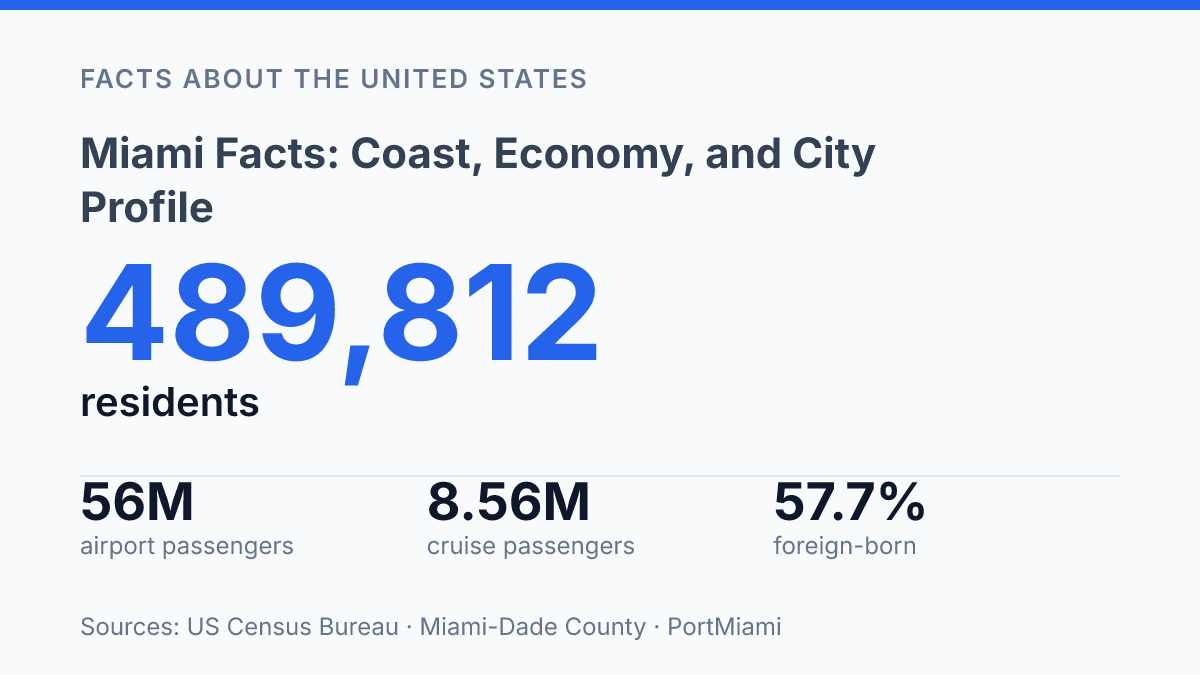
Miami compresses an estimated 489,812 residents into 36.00 square miles, yet the city functions inside a county system that spans more than 2,000 square miles and reaches into Everglades National Park. That scale mismatch helps explain why the city often appears larger in national and international affairs than its municipal footprint suggests. Its facts are not only beach or tourism facts: transportation and warehousing receipts reached $17.0 billion in 2022, and the airport ranked first among U.S. airports for international cargo in 2024.
At street level, the profile is equally distinctive, with 57.7% of residents foreign-born and 77.2% of residents age 5 and older speaking a language other than English at home. A clearer city profile comes from holding these scales together: municipal boundaries, regional infrastructure, international migration patterns, and the climate pressures that increasingly shape everyday planning.
Where Miami Is and what defines the city
A city of fewer than half a million residents occupies just 36.00 square miles at the core of one of the best-known urban regions in the United States. The City of Miami had an estimated 489,812 residents on July 1, 2025, up 10.8% from its April 2020 estimates base, while its 2020 land area was 36.00 square miles, according to U.S. Census Bureau QuickFacts. That compact footprint helps explain why the city is often discussed together with its wider metropolitan surroundings, even when the legal municipality is the subject.
The city sits in southeastern Florida on the Atlantic coast, where Biscayne Bay, barrier islands, canals, and low-lying coastal land shape the pattern of development. Its civic role is also specific: it serves as the county seat of Miami-Dade County, making it the administrative center for a much larger county system. This distinction matters because the city name is frequently used informally for the broader urban area, while local government, planning, taxation, and services depend on municipal and county boundaries.
Coastal geography has strongly influenced where settlement concentrated and how movement is organized. The bay and shoreline support marine access, bridge connections, waterfront districts, and transport corridors that link the urban core with surrounding communities.
The same setting also creates long-term planning constraints: exposure to tropical storms, tidal flooding, and sea-level rise affects infrastructure design, drainage, insurance, land use, and emergency management. The city’s location is therefore both a source of connectivity and a practical limit that shapes how growth can be managed over time.
Why the city matters for finance and trade
Transportation and warehousing businesses inside the city generated $17.0 billion in receipts in 2022, exceeding retail sales and accommodation and food services, according to U.S. Census Bureau QuickFacts. That scale helps explain why the local economy is often understood through movement: money, passengers, cargo, and cruise traffic all pass through institutions that connect the city to national and international markets.
The financial role is concentrated in cross-border banking, wealth management, real estate finance, and professional services tied to Latin America and the Caribbean. The Brickell district is especially associated with banks, investment firms, law offices, and corporate offices serving clients with international assets or operations. This gives the city a function beyond its municipal size: it acts as a financial gateway where multilingual professional services, air links, and regional business relationships reinforce one another.
Trade is anchored by air and sea infrastructure rather than by port activity alone. In 2024, Miami International Airport handled nearly 56 million passengers and 3 million tons of cargo, according to county airport data.
Airports Council International data cited in county bond documents ranked it No. 1 among U.S. airports for international cargo and No. 2 for international passengers in calendar year 2024. Those rankings matter because high-value and time-sensitive goods, international travelers, and business traffic all support the city’s logistics and service economy.
Port-linked commerce adds another layer. PortMiami reported 1,115,058 TEUs in fiscal year 2025, its eleventh consecutive year above one million TEUs, along with 8,564,225 cruise passengers. Container activity ties the city to import-export networks, while cruise traffic links transportation directly with hotels, restaurants, ground travel, and visitor services.
Tourism remains a major economic pillar, but its strength also creates exposure. Large visitor flows support jobs and business revenue, while shifts in travel demand, exchange rates, airline capacity, or global trade conditions can affect multiple sectors at once. The city’s distinct economic position comes from that combination of finance, trade, and travel rather than from any single industry operating in isolation.
Population, culture, and international reach
Few large U.S. cities are as linguistically international at the household level: in 2020–2024 Census data, 77.2% of residents age 5 and older spoke a language other than English at home, according to U.S. Census Bureau QuickFacts. The same source reported that 57.7% of city residents were foreign-born and that 71.5% identified as Hispanic or Latino. Those figures explain why Spanish-speaking communities are central to daily commerce, local media, schools, health care, and civic communication rather than being a narrow cultural enclave.
The international profile is reinforced by migration networks that connect households, employers, faith institutions, and arts organizations with countries across Latin America and the Caribbean. Cuban, Haitian, Venezuelan, Colombian, and other diasporic communities have helped make the city a practical U.S. entry point for regional business, media, legal services, education, and family travel. This gateway role is cultural as well as commercial, because language skills, professional contacts, and cross-border familiarity reduce the friction of operating between the United States and nearby regions.
That diversity also creates a governance demand that differs from cities where English dominates public life. Public agencies, hospitals, courts, emergency managers, and schools must communicate across languages and immigration backgrounds, including with residents who may be navigating U.S. institutions for the first time. The result is an identity shaped less by a single origin story than by repeated cross-border movement, where culture, language, and migration continually renew the city’s international public profile.
Climate, hazards, and everyday planning
A 46-day run of heat-index readings at or above 100°F in 2023 shows that the city’s climate risks are already measured in operating conditions, not only in future projections. The city has a tropical climate, with warm temperatures supporting outdoor dining, beachgoing, construction activity, and tourism across much of the year. That same warmth increases cooling demand, raises heat exposure for outdoor workers and transit riders, and places more pressure on shaded streets, tree canopy, emergency response, and public buildings used as cooling sites.
Hurricane exposure gives short-term weather planning a hard edge. Tropical storms and hurricanes can bring wind damage, storm surge, heavy rainfall, power outages, and interruptions to transportation systems.
For housing and commercial development, this risk affects roof standards, window protection, backup power, drainage capacity, insurance costs, and the siting of critical equipment above likely flood levels. Roads, bridges, pump stations, hospitals, and water systems require continuity planning because a storm can disrupt basic services even when direct structural damage is limited.
Sea-level rise has turned routine flooding into a long-term design issue for southeastern Florida. The municipal Climate Resilience Committee reported in 2024 that the city has about 130 days per year at or above 90°F, projected to rise to about 180 days by 2080.
County flood-criteria work uses sea-level-rise scenarios through 2040, 2060, 2080, and 2100, including a 2-foot-plus rise expected by 2060, according to county environmental and resource-management materials. Those planning horizons matter because roads, drainage projects, seawalls, and public facilities are built for decades of use, not a single budget cycle.
Practical adaptation is visible in development review and capital planning. New projects may face higher finished-floor elevations, stormwater retention requirements, flood-resistant materials, and limits on placing electrical or mechanical systems at ground level.
Public agencies also have to decide where to raise streets, improve outfalls, expand pumps, protect shorelines, or avoid over-investing in assets that could become harder to maintain. Warm weather remains one of the city’s economic advantages, but the cost of managing heat, flooding, and storm disruption is now part of ordinary infrastructure and housing policy.
What the growth numbers mean for planning
Planning the next phase of the city will depend on treating growth and risk as connected facts rather than separate policy files. By 2080, about 180 days a year at or above 90°F would make shade, drainage, building standards, transit access, and emergency planning part of ordinary civic capacity, not special resilience projects.
The practical test is whether public investment can match the speed of population growth and trade activity while accounting for water and heat at the block level. In a compact coastal city, a two-foot-plus sea-level-rise scenario by 2060 is not an abstract forecast; it is a design constraint for roads, housing, insurance, utilities, and public budgets.
Frequently Asked Questions
Q: What makes Miami important as a city?
A: Miami is a major coastal city in southeastern Florida and the county seat of Miami-Dade County. Its importance comes from its role in finance, tourism, and international trade, which gives it influence well beyond its local population.
Q: Is Miami a major port city?
A: Miami functions as a key coastal gateway for southern Florida. Its location supports trade and travel activity, which has helped the city develop a strong international profile.
Q: Which industries are strongest in Miami?
A: The city is especially known for finance, tourism, and international trade. These sectors shape both employment patterns and Miami’s broader economic identity, linking local services with global business activity.
Q: What county is Miami in?
A: Miami is the county seat of Miami-Dade County. That role makes it the administrative center for the county and a focal point for regional government activity.
Q: Why is Miami considered a global hub?
A: Miami is considered a global hub because it connects coastal access with international business, travel, and commerce. Its position in southeastern Florida helps it serve markets across the Americas and beyond.