
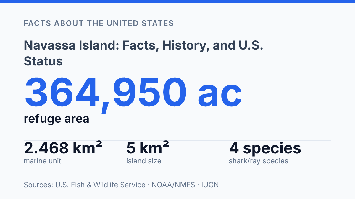
Navassa Island occupies about 5 km² of land, yet U.S. Fish & Wildlife Service records list its National Wildlife Refuge at 364,950 acres as of September 30, 2024. That contrast explains why a small, uninhabited island between Haiti and Jamaica carries weight beyond its cliffs and scrub vegetation. U.S. authority traces back to an 1857 claim under the Guano Islands Act, while Haiti’s amended 1987 Constitution and May 2025 draft constitution both name La Navase as part of Haitian territory.
Conservation policy adds another layer: NOAA’s 2024 critical habitat rule covers waters from the shoreline to the 30 m isobath and assigns projected incremental costs of about $440,000 over 10 years. The island’s status is therefore not a single question of ownership, but a meeting point of legal history, constitutional claims, refuge management, and marine protection.
Where Navassa Island Is and Why It Matters
A land area of just 5.2 square kilometres anchors a federal refuge footprint recorded at 364,950.00 acres, making the island’s mapped importance far larger than its exposed limestone surface. As of September 30, 2024, Navassa Island National Wildlife Refuge covered 364,950.00 acres with a $0 purchase cost because it was listed under federal jurisdiction rather than acquired by the Fish and Wildlife Service, according to the U.S. Fish & Wildlife Service, 2024 Annual Report of Lands Data Tables.
Navassa Island sits in the Caribbean Sea between Haiti, Jamaica, and the southeastern edge of Cuba, near the western approaches to the Windward Passage. That location gives the island geographic relevance beyond its small land area, because the passage is one of the main sea routes between the Caribbean and the Atlantic. The island is not part of a large settled archipelago; it is an isolated limestone outcrop separated from the nearest populated coasts by open water.
Physical conditions have limited sustained human use. The terrain is steep, rocky, and largely composed of uplifted limestone, with cliffs and difficult landing conditions around much of the shoreline. Fresh water is scarce, which has made permanent settlement impractical even though the island has attracted periodic attention for strategic, extractive, and conservation reasons.
Under U.S. administrative classification, the island is designated as one of the United States Minor Outlying Islands. This category places it alongside other small, remote U.S.-claimed island possessions rather than within a state or ordinary territory. The classification helps explain why a place without residents can still appear in federal land, wildlife, and maritime records: its significance rests less on settlement than on jurisdiction, surrounding waters, and ecological management.
How the United States Came to Claim the Island
A fertilizer statute, rather than a purchase or wartime cession, supplied the main U.S. legal theory for claiming the island. The Guano Islands Act of 1856 allowed U.S. citizens to take possession, in the name of the United States, of unclaimed and uninhabited islands containing guano deposits, subject to presidential recognition. According to a 2022 Yale Law Journal article, the island became the first claim under that law when the American claimant Peter Duncan made his filing in 1857, part of a wider pattern in which more than 100 rocks, islands, and outcroppings were eventually claimed under the statute.
The legal claim was closely tied to nineteenth-century commerce because guano was valuable as agricultural fertilizer before synthetic alternatives became dominant. American-backed mining operations treated the deposits as a commercial resource, not merely a symbol of possession, and private extraction helped turn a remote Caribbean rock into a matter of federal legal interest. That commercial origin explains why the U.S. claim developed outside the more familiar routes of annexation, treaty purchase, or conquest.
Control later shifted away from private mining and toward federal custodianship. Guano operations declined by the end of the nineteenth century, with the Spanish-American War era marking the practical end of sustained extraction, and the island’s federal role became tied more to navigation and administration than to mining rights. In the twentieth century, responsibility passed through federal hands associated with lighthouse and maritime functions before moving to the Interior Department and, later, wildlife-oriented management.
This administrative chain is central to the island’s unusual status because U.S. authority exists largely through statutes, designations, and agency responsibility rather than settlement or ordinary territorial government. The claim should still be described with qualification: the United States administers the island on paper and through federal designation, while Haiti has long rejected that position. The result is a legal history rooted in guano-era commercial law but still relevant to present-day sovereignty arguments.
Why Haiti Disputes Navassa Island
Haiti’s claim is unusually explicit: its constitutional texts name La Navase rather than leaving the issue only to diplomatic correspondence. Article 8 of Haiti’s 1987 Constitution, as amended in 2012, lists the island among Haiti’s adjacent islands, according to Haiti-Référence.
The May 2025 draft constitution published through HaitiDocs repeats the name in Article 8, while Article 8-1 states that Haitian territory cannot be alienated in whole or in part by treaty or convention. Those provisions do not settle the international legal question, but they show that Haiti treats the claim as a matter of constitutional territory, not merely as a historical grievance.
Geography gives the dispute practical weight. The island lies roughly 55 kilometres west of Haiti’s Tiburon Peninsula, close enough for the claim to carry coastal, maritime, and administrative significance for Haiti. That proximity supports Haiti’s position that the island belongs with its adjacent territory and helps explain why the disagreement has remained more than a technical map dispute.
The unresolved sovereignty issue affects governance mainly through access, authority, and enforcement. U.S. agencies regulate visits and conservation activity from the American administrative position, but Haiti’s standing objection gives such decisions a diplomatic dimension. Scientific expeditions, landings, patrols, and marine protections therefore operate in a setting where practical control and asserted sovereignty are not accepted by both sides.
The lack of permanent civilian settlement limits day-to-day political pressure. There is no resident electorate demanding services, no municipal government, and no ordinary property market requiring routine civil administration.
At the same time, the absence of a fixed population can make oversight thinner: a 2024 IUCN-linked conservation chapter noted that the United States maintains no fixed presence or surveillance there. The dispute persists most visibly in law, maps, conservation management, and diplomatic posture rather than in daily local politics.
What Is on the Island Today
The clearest modern U.S. footprint on the island is a wildlife-refuge designation, not a town, port, or garrison. The U.S. Fish and Wildlife Service describes it as an uninhabited area administered within the National Wildlife Refuge System, with the 1999 establishment of Navassa Island National Wildlife Refuge marking the current conservation-based phase of federal management. That status gives the United States a formal administrative structure for the territory while leaving the land itself without a resident population or ordinary civic infrastructure.
Refuge management centers on habitat rather than development. Federal descriptions emphasize protection for nesting seabirds, native vegetation, and other terrestrial wildlife, and the Fish and Wildlife Service notes that pre-refuge U.S. Geological Survey expeditions documented more than 600 terrestrial species. That figure matters because the island’s value is not tied to human settlement; it is tied to the concentration of biological resources on a small and isolated landform.
Protection also extends offshore. In a 2024 Federal Register final rule, NOAA’s National Marine Fisheries Service identified a Navassa unit of 2.468 square kilometres covering waters from the shoreline to the 30-metre isobath as part of a critical-habitat designation.
The same rule estimated incremental costs of about $440,000 over 10 years, or $62,000 annualized, and stated that no areas were excluded for economic or national-security reasons. Those details show that federal policy treats the surrounding marine environment as part of the island’s conservation significance, not merely as adjacent water.
Access limits reinforce the practical emptiness of the place. Scientific, conservation, and official activities may occur under controlled conditions, but ordinary public use is highly restricted, and the refuge framework is not built around recreation or settlement. This creates a durable contrast: the island remains legally and diplomatically consequential, yet its day-to-day function is largely to remain undisturbed for seabirds, native plants, and marine habitat.
Why authority at sea matters more than the island’s size
The next practical question is less about whether the island appears on a map than how authority can be made meaningful offshore. A refuge boundary, a critical habitat unit, and a constitutional claim each express control in different legal languages, but none by itself guarantees routine monitoring, species recovery, or accepted sovereignty.
The 2024 conservation assessment noting no fixed U.S. presence or surveillance underscores that gap. If climate stress, coral decline, or shark and ray protection become more urgent around the island, the unresolved status will shape who collects data, who enforces limits, and whose claim carries operational force at sea.
Frequently Asked Questions
Q: Where is Navassa Island located?
A: Navassa Island is a small Caribbean island in the passage between Haiti and Jamaica, west of the Tiburon Peninsula of Haiti. It is uninhabited and has no permanent civilian settlement, which shapes how it is discussed in geography and legal sources.
Q: Who claims sovereignty over Navassa Island?
A: The United States administers Navassa Island as an unincorporated, unorganized U.S. territory, while Haiti has also historically asserted a claim. The status has remained politically sensitive because the island is uninhabited but strategically placed in the Caribbean.
Q: Why is Navassa Island important in U.S. history?
A: Navassa Island became significant after guano was discovered there in the 19th century, because guano was then a valuable fertilizer ingredient. That history links the island to U.S. territorial expansion and to labor and resource extraction in the Caribbean.
Q: Can people visit Navassa Island?
A: Access is highly restricted, and there is no regular public tourism infrastructure. Because the island is a protected and uninhabited territory, visits generally require official permission and are uncommon.
Q: Is Navassa Island inhabited today?
A: No, Navassa Island does not have a permanent resident population. Its lack of habitation means there are no local services, civic institutions, or ongoing commercial settlements on the island.