
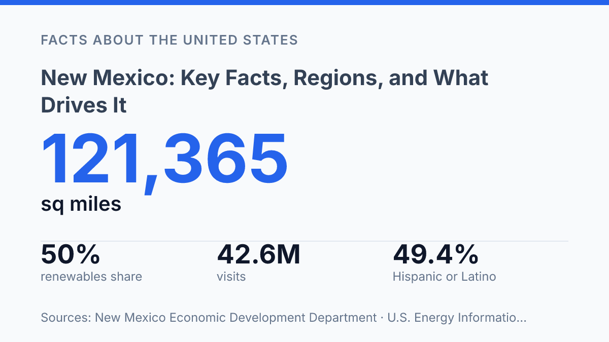
New Mexico is one of the few U.S. states where demography, sovereignty, altitude, and energy markets all exert visible force on daily life. Nearly half of residents, 49.4%, identify as Hispanic or Latino, while state government maintains formal relationships with 23 federally recognized Nations, Tribes, and Pueblos. That is not background color; it changes language, law, land management, education, and the interpretation of public history.
Physical scale sharpens the contrast: 121,365 square miles stretch from Red Bluff Lake at 2,817 feet to Wheeler Peak at 13,161 feet, producing sharp differences in climate and travel across a single state. The result is a place where chile fields, UNESCO sites, oil basins, wind farms, and high desert tourism are not separate stories. They are competing and connected forces that explain how the state works.
What shapes New Mexico’s identity
New Mexico stretches across 121,365 square miles yet counted only 2,117,522 residents in the 2020 Census, a ratio that makes distance a defining civic fact rather than a background detail. That scale helps explain why public services, transportation planning, health care access, and political attention must account for sharp differences between metropolitan centers and widely separated rural communities. The state is not simply sparsely populated; it is unevenly connected, with daily life organized around a few major hubs and many smaller places separated by terrain and time.
Santa Fe, the state capital, gives political and administrative weight to the north-central part of the state, while Albuquerque functions as the largest city and the main population and economic center. Their different roles matter: Santa Fe anchors state government and a long-established cultural identity, while Albuquerque concentrates jobs, higher education, health services, and transport links at a scale not matched elsewhere in the state. This division reinforces a pattern in which statewide decisions often have to bridge urban capacity and rural distance.
Cultural identity is equally structural, not decorative. Native American, Hispanic, and Anglo heritage shape law, land relationships, language, education, foodways, and public institutions. The state government works with 23 federally recognized Nations, Tribes, and Pueblos, which means Indigenous sovereignty is a practical governance reality as well as a central part of identity.
Hispanic heritage is also demographically central: 49.4% of residents are Hispanic or Latino, according to the U.S. Census Bureau. Anglo settlement and institutions later became part of the same civic structure, producing a state identity defined less by a single majority tradition than by overlapping histories with continuing political force.
The result is a state whose distinctiveness comes from the interaction of space and culture. Low population density raises the cost of connection, while deep cultural plurality shapes what connection must respect. That combination distinguishes the state from neighbors that may share desert terrain, energy resources, or borderland history but do not share the same balance of scale, settlement pattern, and governing relationships.
How geography affects climate, land use, and travel
Few U.S. states combine alpine headwaters, gypsum dunes, and desert caverns under such a consistently dry sky. The state’s high average elevation makes temperature and weather less predictable than latitude alone would suggest, while its arid climate sharply limits where intensive farming, settlement, and road networks can expand. Elevations run from 2,817 feet at Red Bluff Lake to 13,161 feet at Wheeler Peak, according to the state Economic Development Department, a vertical range that turns geography into a practical constraint rather than a backdrop.
The Rio Grande is the organizing line through much of the central corridor because water, valley floors, and transportation routes converge there. Interstate and rail corridors follow the easiest grades where possible, while the Sangre de Cristo Mountains force steeper, narrower connections in the north. This pattern concentrates movement along valleys and passes, which reduces route choices and raises the cost of linking remote communities, ranches, public lands, and energy sites.
Climate data confirm why water remains the decisive limiting factor. 2025 tied 2024 as the state’s second-warmest year on record, with an average temperature of 56.2°F and only 12.52 inches of precipitation, according to NOAA and the National Weather Service in Albuquerque. That dryness supports rangeland, solar exposure, and outdoor recreation, but it also narrows the margin for irrigated agriculture and makes long-term growth more dependent on water management than land availability.
The southern basins show the contrast most clearly where the Chihuahuan Desert shapes land use through heat, sparse vegetation, and limited surface water. White Sands National Park and Carlsbad Caverns National Park are major federal land examples, but their importance is not confined to scenery.
They reflect a broader pattern in which protected areas, military ranges, forests, and other public holdings structure access, conservation, tourism, and infrastructure planning. Rugged terrain and scarce water create economic value through outdoor industries and distinctive federal lands, yet the same conditions constrain agriculture, lengthen travel distances, and make development decisions more selective.
Which industries matter most today
A state often associated with art markets and desert scenery now supplies 15% of all U.S. crude oil production, according to the U.S. Energy Information Administration. The decisive source is the Permian Basin in the southeast, where oil and natural gas development drives high-wage work, royalty income, and a large share of public revenue. The same concentration that makes the energy sector powerful also makes state finances sensitive to commodity prices, drilling cycles, and federal rules affecting leasing, emissions, and land management.
Natural gas reinforces that exposure. In 2024, the state ranked third nationally for natural-gas production, providing 8% of U.S. gross withdrawals, according to the U.S. Energy Information Administration.
That scale gives the economy national significance, but it does not create broad stability by itself. When prices rise, severance taxes and related activity strengthen budgets; when prices fall, the effect moves quickly through revenue forecasts, service companies, and local governments in producing counties.
Federal spending forms the second major pillar, especially through research and defense institutions. Los Alamos National Laboratory and Sandia National Laboratories anchor advanced scientific employment, attract contractors, and support specialized supply chains that would be difficult for a small private market to sustain on its own. Their presence raises the state’s technical capacity, but it also ties a meaningful share of income and procurement to congressional appropriations, national-security priorities, and federal workforce decisions.
Tourism is the broadest-facing sector, translating the state’s cultural and natural assets into spending across lodging, food service, transportation, guiding, and retail. The state recorded $8.8 billion in direct visitor spending and 42.6 million visits in 2024, the first year above 42 million, according to the state Tourism Department. Santa Fe and Albuquerque concentrate much of that activity through arts, events, cuisine, museums, and air access, while national parks extend visitor spending into rural areas that have fewer large employers.
The modern economy is therefore not defined by a single industry. Energy brings large revenue swings, federal facilities bring high-value employment with policy dependence, and tourism spreads income more widely but remains sensitive to travel costs and seasonal demand. The strongest reading is one of productive imbalance: the state has unusually valuable economic anchors, yet its fiscal and job base remains exposed to forces largely set outside its borders.
Why the state stands out in U.S. history and culture
Few U.S. states entered the Union with a written record of Spanish colonial administration that reached back more than three centuries. Spanish colonial rule began in 1598, long before the region became a U.S. territory, and statehood arrived on January 6, 1912.
That long interval gives the state a historical profile unlike most western states: political boundaries changed, but place names, land-grant memory, religious architecture, and legal traditions continued to influence public culture. Statehood did not erase those earlier frameworks; it layered U.S. institutions over older Indigenous and Hispano systems of community life.
Pueblo communities anchor this deeper chronology through living governance, language, ceremony, and land relationships rather than through heritage display alone. The Pueblo Revolt of 1680 remains one of the most consequential Indigenous uprisings against European colonization in North America, and its memory gives the state’s colonial history a sharper national significance.
Spanish-language heritage works in a comparable way: it survives not only in speech, music, literature, and worship, but also in public names and local institutions. These traditions are enduring cultural forces, but they are not uniform across the state; each community carries its own history, dialect, and political context.
Cultural institutions have turned this layered past into national visibility. The Georgia O’Keeffe Museum is not merely a shrine to an artist; it reinforces how the state became a reference point in American modernism, where regional materials, light, and forms reshaped national art narratives. UNESCO recognition of Chaco Culture and Taos Pueblo places parts of this history in a global frame, confirming that the state’s significance extends beyond regional identity.
The public image is often framed through art, architecture, and heritage, yet that image is incomplete without the institutions tied to science, defense, and energy. This contrast is not a contradiction. It shows a state whose national role comes from unusual layering: ancient communities, Spanish colonial history, U.S. statehood, modern research systems, and energy infrastructure occupy the same civic space without collapsing into a single story.
What the next decade will test
The state’s central question is no longer whether heritage, extraction, tourism, agriculture, and renewable power can coexist; they already do. The harder test is whether public policy can manage their unequal pressures as heat rises, water remains scarce, and national demand keeps drawing value from the same land. A year with 42.6 million visits, 50% renewable in-state electricity generation, and No. 2 crude-oil output shows an economy moving in several directions at once.
New Mexico’s advantage is that its identity is not easily reduced to one sector or one story. Its risk is the same: decisions made for energy, water, or land use will rarely stay confined to a single map.
Frequently Asked Questions
Q: What is New Mexico known for?
A: New Mexico is known for its desert scenery, Native American and Hispanic cultural heritage, and strong public-land access. The state’s identity is shaped by a mix of art, archaeology, ranching, and outdoor recreation, which gives it a distinct profile in the Southwest. That combination makes culture and geography inseparable from how the state is understood.
Q: What are the main regions of New Mexico?
A: The state is commonly grouped into the northwest, north-central, northeast, central, southeast, and southwest regions, each with a different economic and physical profile. Higher-elevation forest and mountain areas contrast sharply with lower desert basins and plains. That variation matters because population, water access, and industry are not distributed evenly across the state.
Q: What drives the economy in New Mexico?
A: Major economic drivers include energy production, federal spending, tourism, agriculture, and aerospace-related activity. The state’s dependence on public-sector and extractive industries means its economy can be more exposed to policy shifts and commodity cycles than states with broader private-sector bases. That structure helps explain both growth opportunities and recurring instability.
Q: Why does New Mexico have a large Native American population?
A: New Mexico has a large Native American population because many tribal nations have lived in the region for centuries and maintain sovereign lands there today. This long continuity is visible in place names, governance, and cultural institutions across the state. The result is a stronger tribal presence than in many other states, with direct effects on identity, land use, and policy.
Q: What is the climate like in New Mexico?
A: New Mexico has a generally arid to semi-arid climate, but elevation creates major local differences. Northern mountains can be much cooler and wetter than southern deserts, which affects water supply, agriculture, and settlement patterns. That climate contrast is a central reason the state’s regions function so differently from one another.