
West Virginia entered the Union through a four-step Civil War sequence, from Virginia’s secession vote on April 17, 1861, to federal recognition of the new state on June 20, 1863. That legal path was not a minor procedural detail; it shaped borders, political identity, and the state’s relationship to the Union before Berkeley and Jefferson Counties were formally settled in 1866. The same pattern of complexity appears in the physical and economic record. Spruce Knob rises to 4,861 feet while Harpers Ferry sits at 247 feet, a contrast that helps explain why settlement, transportation, and industry developed unevenly across counties.
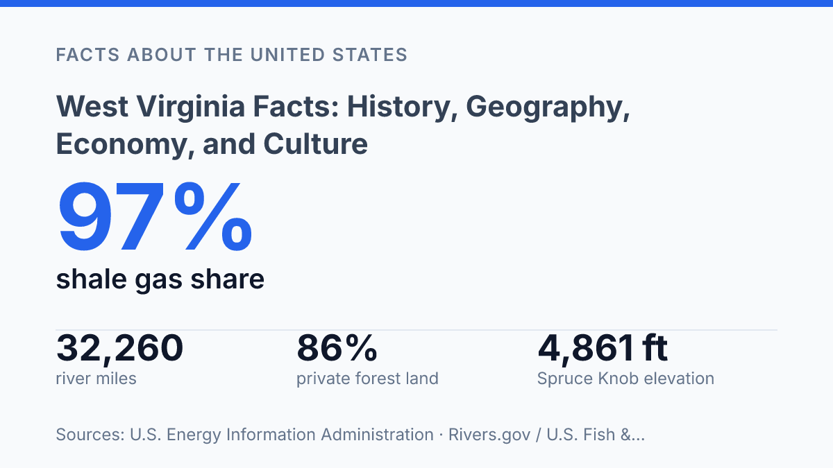
Coal remains a major force, but shale gas now accounts for roughly 97% of total gross gas withdrawals. The useful facts are not isolated trivia. They show how law, terrain, energy, and local tradition produced a state whose identity is more precise than the usual Appalachian shorthand allows.
How the State Was Formed During the Civil War
The 35th state was created not by frontier settlement but by a wartime legal maneuver inside a state that had voted to leave the Union. Its origin explains why its borders follow political loyalties as much as terrain: many northwestern Virginia counties had stronger commercial and cultural ties to the Ohio River system than to Richmond, and secession turned those differences into a constitutional break.
The timeline moved with unusual speed because war changed the legal stakes. Virginia’s legislature passed secession on April 17, 1861; Unionist Virginians formed the Restored Government of Virginia on June 17, 1861; Lincoln signed the admission bill for the new state on December 31, 1862; and, according to the National Archives, West Virginia was officially recognized on June 20, 1863.
That sequence shows why statehood cannot be reduced to a simple local vote. It required Union recognition of an alternative Virginia government capable of giving the consent that the federal Constitution demands when a new state is formed from an existing one.
By 1862, the Wheeling Convention process had shifted Unionist resistance from protest to institution-building. Delegates meeting in Wheeling helped create a loyal state government, then advanced a constitution for the proposed state. Congress accepted admission only after the slavery question was addressed through gradual emancipation language, which made the constitution process not merely administrative but central to federal approval.
The result was legitimate in federal practice but contested in origin. Wartime necessity supplied the mechanism: the Restored Government claimed to speak for Virginia, while Confederate authorities rejected that claim.
Even after admission, the map remained unsettled in places; Berkeley and Jefferson Counties voted to join the new state on February 4, 1863, but Congress did not formally recognize their transfer until March 10, 1866. Statehood therefore emerged through a layered process of county loyalty, convention authority, presidential approval, congressional action, and postwar border settlement.
Mountain Terrain, Rivers, and Forested County-by-County Patterns
A 1,500 feet average altitude gives the state the highest mean elevation east of the Mississippi River, according to the state legislature, and that single measure explains much of its settlement pattern. Within the Appalachian Mountains, the Allegheny Highlands create short distances between very different elevations: Spruce Knob rises to 4,861 feet, while Harpers Ferry sits at 247 feet. That vertical range has compressed weather, road design, farming conditions, and town sites into a tightly folded physical setting where valleys often matter more than straight-line distance.
Rivers provide the clearest breaks in that terrain. The Ohio River forms the dominant western waterway and has long offered a navigable edge where movement is easier than across the interior ridges.
The Kanawha River performs a different function by cutting an interior corridor through the central part of the state, concentrating settlement and transport where the mountains otherwise restrict routes. Rivers.gov and the U.S. Fish & Wildlife Service report roughly 32,260 miles of rivers statewide, but only 10 miles are designated Wild and Scenic, or about 0.03% of the total; the contrast shows abundant water without extensive federal river protection.
Forest patterns follow the same physical logic, but ownership determines how much of that forest is managed. The USDA Forest Service’s 2024 FIA data estimate that 86% of forest land is privately owned, compared with much smaller federal and state or local shares.
County figures sharpen the point: McDowell and Webster Counties were each estimated at 93% forested, while the far eastern edge of the state includes the only counties where forests cover less than half of land area. Relief, access, and development pressure therefore produce county-by-county differences rather than a uniform mountain forest.
New River Gorge National Park and Preserve is significant because it makes the state’s physical structure visible in one concentrated place: a deep river gorge cut through hard upland terrain. Its importance is not merely scenic; it demonstrates how river incision, forest cover, and steep slopes combine to shape land use. The same rugged terrain that protects large wooded areas also narrows transportation corridors, raises infrastructure costs, and makes economic development more dependent on the few valleys and river passages capable of carrying roads, rail lines, and dense settlement.
Coal, Natural Gas, and the Shift in the State Economy
By 2024, shale wells supplied about 97% of the state’s gross natural gas withdrawals, a share that shows how completely modern gas production has shifted toward horizontal-drilling-era geology. According to the U.S. Energy Information Administration, total gross gas withdrawals reached 3,417,995 million cubic feet that year, with shale gas wells contributing 3,327,415 million cubic feet. Development in the Marcellus and Utica shale formations has therefore become a central force in the state economy, especially where leasing, pipeline work, processing, and service activity connect rural mineral ownership to national energy markets.
Coal remains the older industrial foundation, particularly in southern coalfield counties such as Boone, Logan, and McDowell. The EIA reported 62.865 million short tons of coal production in 2024, with 39.991 million short tons from the northern part of the state and 22.875 million from the southern part. That north-south split matters because counties historically identified with coal mining are not necessarily the same places capturing the largest share of current output, which complicates any simple reading of coal’s continuing importance.
Employment has changed more sharply than production totals alone suggest. Mechanization increased the amount of coal that could be mined by fewer workers, while mine closures and changing power-sector fuel choices reduced the number of jobs tied directly to extraction. The result is not the disappearance of energy from the economy, but a thinner employment base around activities that once supported households, county budgets, and local services across the coalfields.
Natural gas has partly offset that shift in production value, but it has not recreated the same labor structure. Shale development tends to generate concentrated phases of drilling, construction, and midstream investment, followed by lower ongoing staffing needs than traditional community expectations often imply. The defining economic change is therefore a move from labor-intensive coal communities toward a more capital-intensive energy economy, where output can remain high even as direct extraction employment and local revenue stability become more uneven.
Population Centers, Traditions, and Public Identity
The state’s public identity is not produced mainly in isolated hollows; it is concentrated in a capital city, two university-linked urban centers, and statewide rituals that turn local culture into civic memory. Charleston remains the seat of government and the symbolic center of public administration, where the statehouse, agencies, courts, and statewide politics give the city influence beyond its population size. Huntington and Morgantown carry different forms of weight: Huntington through Marshall University, health care, and a long-standing urban role in the western part of the state, and Morgantown through West Virginia University, research, medical services, and the large student population that reshapes the city’s economy and public life each year.
That urban-and-institutional pattern complicates the state’s rural reputation. Marshall University and the Morgantown flagship institution do more than educate residents; they anchor hospitals, athletics, arts programming, professional networks, and regional labor markets. The result is a public identity split between small-town and county traditions on one side and concentrated civic, medical, and cultural capacity on the other.
This contrast does not weaken the state’s identity. It explains why much of its modern public life is carried by campuses and city centers even when its national image remains strongly rural.
Cultural traditions retain force because they function as living practices rather than decorative folklore. Mountain music, especially old-time string-band traditions and bluegrass performance, continues through festivals, radio, community venues, and university-affiliated arts programming. Regional cuisine works in the same way: pepperoni rolls, ramps, and soup beans are not merely nostalgic markers, but everyday foods tied to work patterns, seasonal gathering, and local restaurants.
The State Fair of West Virginia, held in Fairlea and dating to 1924 according to the fair’s own history, gives those traditions an annual public stage through agriculture, livestock competition, concerts, and foodways. As a ten-day event, it condenses rural production, entertainment, and statewide recognition into one recurring institution, which is why it matters as culture as much as recreation.
Why the County Lines Still Carry the Argument
The sharper reading of the state is not nostalgia versus modernization, but control over assets that are unevenly distributed and often privately held. Forest policy depends heavily on landowners because 86% of forest land is private. River protection remains limited because only 10 of more than 32,000 river miles carry Wild and Scenic designation.
Energy planning is now tied less to whether extraction continues than to how coal regions, shale counties, and population centers absorb different risks and gains. The practical consequence is clear: future debates will be decided county by county, not by a single statewide identity. A place formed through contested borders still faces its hardest questions through boundaries on maps, mineral rights, watersheds, and local economies.
Frequently Asked Questions
Q: Why is West Virginia a separate state from Virginia?
A: West Virginia became a separate state during the Civil War because many western counties opposed Virginia’s decision to leave the Union. The split was driven by political loyalty, geography, and competing regional interests. That origin still shapes the state’s identity as a border state with a distinct historical path.
Q: What are the major physical features of West Virginia?
A: The state is defined by the Appalachian Mountains, deep river valleys, and extensive forest cover. This terrain limits large-scale flatland development but supports forestry, outdoor recreation, and a strong sense of regional distinctiveness. Geography has therefore shaped both settlement patterns and the modern economy.
Q: What industries drive the economy in West Virginia?
A: Coal has historically been central, but the economy now depends on a broader mix that includes energy, manufacturing, healthcare, and tourism. That shift reflects long-term pressure on extractive industries and the need for more diversified employment. The result is an economy that is still resource-linked but less dependent on a single sector than before.
Q: What is West Virginia best known for culturally?
A: The state is widely associated with mountain traditions, folk music, and strong local ties to place and family. Appalachian culture remains a defining influence in food, storytelling, and community life. Those traditions matter because they preserve continuity in a state often shaped by economic change and out-migration.
Q: What are some important facts about West Virginia’s history and identity?
A: West Virginia’s history is marked by Civil War division, industrial growth, labor संघर्ष, and long-term adaptation to economic change. Its identity reflects both independence and resilience, which helps explain why local culture remains strongly tied to place. That combination distinguishes the state from many of its neighbors.