
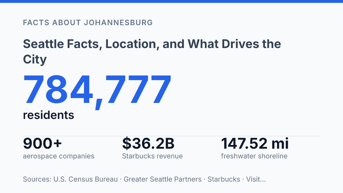
Seattle occupies 83.9 square miles between Puget Sound and Lake Washington, yet it contains 147.52 miles of freshwater shoreline and 53.38 miles of saltwater shoreline. That ratio helps explain why the city is best understood as a water-shaped urban center rather than a simple dot on the Washington map. Its position at 47.39°N, 122.17°W places it on Puget Sound’s eastern shore, about 90 air miles from the Pacific coast and 113 miles south of the U.S.–Canada border.
The same compact geography that defines its neighborhoods also frames its growth, economy, and public identity. This profile examines the city’s location, population scale, official status, “Emerald City” name, and the industries that turned a regional port city into a global reference point for technology, aerospace, and coffee culture.
Where Seattle sits in Washington State
Few major U.S. cities are shaped as literally by water as Seattle, which occupies an isthmus between Puget Sound to the west and Lake Washington to the east. Its location at 47.39°N, 122.17°W places it on Puget Sound’s eastern shore, about 90 air miles east of the Pacific coast and 113 miles south of the U.S.–Canada border, according to Visit Seattle, 2026/accessed. That position gives the city a coastal orientation without placing it directly on the open ocean, connecting it instead to sheltered inland marine routes that lead toward the Pacific.
This geography helps explain why the city developed as both a port and a regional center. Puget Sound offered deep, protected water access, while Lake Washington and nearby land routes connected the settlement to inland areas of western Washington.
In regional terms, the city sits within the broader Pacific Northwest, a cross-border zone defined by mountains, forests, inland waterways, and maritime access. The result is a location suited to exchange between waterborne traffic and inland movement, rather than a simple coastal edge settlement.
The same setting also limits how the city can spread. Water on two sides, hills, and north-south corridors have made expansion more dependent on constrained land routes than in cities with broad, open hinterlands.
That physical narrowing affects transport planning, waterfront use, and the concentration of activity near key crossings and approaches. The city’s regional role is therefore tied not only to access, but also to the pressures created by fitting major urban functions onto a comparatively narrow strip of land.
Population, size, and city status
With fewer than one million residents, the city is still the most populous municipality in the Pacific Northwest, a ranking that gives it outsized weight in regional planning and economic decision-making. According to U.S. Census Bureau QuickFacts, its estimated population was 784,777 as of July 1, 2025. That figure describes the city proper rather than the wider metropolitan area, so it is a measure of municipal scale, service demand, and local governance responsibility rather than the full population tied to the regional economy.
Physical size adds important context to that population total. Official visitor statistics list the city’s area at 83.9 square miles, which means a large population is concentrated within a relatively limited municipal footprint. This helps explain why housing supply, zoning decisions, and neighborhood density are central civic issues: population growth is not only a matter of adding residents, but of deciding where homes, services, and public space can fit within the existing city.
Scale also changes the stakes for transportation. A city of this size depends on coordinated bus, light rail, ferry, street, bicycle, and pedestrian systems to move residents and workers across daily commuting patterns. When population increases, the effect is felt not just in traffic volumes, but in transit capacity, curb use, freight movement, and access to job centers.
The same population base strengthens regional influence. As the largest city in its part of the country, it anchors public institutions, employment networks, cultural venues, and policy debates that extend beyond municipal boundaries. That status brings visibility and investment, but it also concentrates pressure around affordability, infrastructure maintenance, and mobility planning.
Why the city is called the Emerald City
A nickname chosen in 1982 still fits because the city’s public identity is anchored in evergreens rather than skyline imagery. Seattle is known as the Emerald City, a label that points to the green visual character created by conifers, street trees, parks, and the wider evergreen setting associated with western Washington. HistoryLink attributes the nickname’s adoption to the local convention and visitors bureau after a 1981 slogan contest, but its durability comes from how closely the phrase matches the city’s common civic image.
The greenery behind the nickname is measurable as well as symbolic. Municipal tree-canopy reporting listed canopy cover at 28.1% in 2021, with a stated goal of reaching 30% by 2037. That figure helps explain why the nickname reads as more than a decorative phrase: trees and year-round green vegetation are visible parts of the urban environment, and they shape how official descriptions, cultural references, and regional profiles commonly present the city.
Even so, the name should not be read as meaning the city is primarily natural space. The same place described through evergreen imagery is also a dense urban center with a large metropolitan footprint, layered transportation demands, and heavily developed neighborhoods. The nickname works because it compresses both realities into a recognizable civic shorthand: a major city whose public identity remains closely tied to a lush regional setting.
Technology, aerospace, and coffee influence
A single Pike Place Market coffee shop opened in 1971 grew into a company that ended fiscal 2024 with 40,199 stores worldwide and $36.2 billion in consolidated net revenue, according to Starbucks fiscal reporting and company history. Starbucks did not create the city’s entire coffee culture, but it gave that culture a global symbol: the idea of the local espresso bar, adapted into a mass consumer brand. The result is a rare case in which a neighborhood retail origin became part of an international image of place.
The technology sector gives the city one of its clearest international business profiles. CBRE reported that the Puget Sound tech-talent workforce grew 5.1% between 2021 and 2024 to nearly 185,000 specialists, with the region ranking as the third-largest AI-specialty talent cluster in the United States at 32,965 workers. Those figures describe the wider regional labor market rather than only the city government boundary, but they help explain why the city is viewed as a global technology center rather than simply a West Coast office market.
Aerospace gives that newer technology profile an older industrial counterpart. A 2024 regional aerospace report using Lightcast 2025 data counted more than 900 aerospace companies, about 114,000 aerospace employees, an estimated $37.1 billion in aerospace gross regional product, and $64 billion in aerospace exports over the previous five years. The sector’s long association with Boeing remains central to the area’s identity because aircraft production depends on deep supplier networks, engineering labor, and specialized manufacturing capacity.
These three influences give the city global visibility across software, aircraft, and consumer culture, but they also make local conditions sensitive to high-value industry cycles. Technology hiring slowdowns, aerospace production shifts, and the wage premiums attached to specialized work can affect office demand, household incomes, and cost pressures. The same concentration that raises the city’s international profile can therefore intensify exposure to employment swings and affordability strain when major sectors change direction.
What the city’s geography means for its next chapter
The next question is not only how the city became influential, but how much pressure its compact form can absorb. A population of 784,777 in 2025, a shoreline-heavy footprint, and tree-canopy goals all point to the same constraint: growth has to fit into a place with strong physical edges.
The industries that give the city its reach, from AI talent to aerospace exports and global coffee branding, depend on that same concentration of people, infrastructure, and reputation. Future change is likely to be measured less by whether the city keeps growing than by how carefully it manages the limited land and distinctive natural setting that made that growth possible.
Frequently Asked Questions
Q: Where is Seattle located?
A: Seattle is in Washington State on an isthmus between Puget Sound and Lake Washington. That position gives the city access to both saltwater and freshwater corridors, which has shaped its growth and transportation patterns.
Q: How many people live in Seattle?
A: Seattle has an estimated population of 784,777. It is the most populous city in the Pacific Northwest, which helps explain its regional influence in business, culture, and public services.
Q: Why is Seattle called the Emerald City?
A: Seattle is known as the Emerald City because of its evergreen setting and frequent greenery. The nickname reflects the region’s natural environment more than its urban development.
Q: What industries is Seattle known for?
A: Seattle is a major global hub for technology, aerospace, and coffee culture. These sectors have shaped the city’s economy, labor market, and international reputation.
Q: Is Seattle considered part of the Pacific Northwest?
A: Yes. Seattle is the largest city in the Pacific Northwest and one of the region’s defining urban centers. Its scale and economic reach make it a central reference point for the area.