
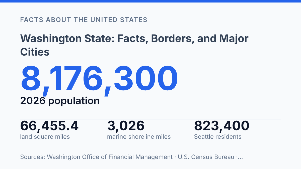
Washington counted 8,176,300 residents on April 1, 2026, but its identity is still shaped as much by borders, naming choices, and capital-city decisions as by population growth. The state added about 61,200 residents in one year, with net migration accounting for 72% of that increase, according to the state Office of Financial Management. Yet the map tells a different part of the story: a Pacific state with 3,026 miles of marine shoreline, a land area large enough to rank 20th nationally, and a name that still creates confusion with the nation’s capital.
This article explains how the state is positioned, why Congress gave it its name in 1853, and why Olympia rather than Seattle became the seat of government. The result is a clearer view of a state whose geography, political history, and city hierarchy do not always point in the same direction.
Where Washington Is and What It Borders
With 66,455.4 square miles of land, Washington is a full Pacific Northwest state rather than a shorthand for the national capital, according to U.S. Census Bureau data for 2024. Its position is in the northwestern corner of the contiguous United States, where coastal, inland, and international boundaries meet within one state map. That geographic setting is the starting point for distinguishing it from other U.S. places that use the same name.
The state borders the Pacific Ocean to the west, Oregon to the south, Idaho to the east, and the Canadian province of British Columbia to the north. This combination gives it both a marine edge and an international boundary, while its eastern and southern borders connect it to neighboring U.S. states. The Pacific boundary is not incidental: the Washington Department of Ecology reports 3,026 miles of marine shoreline, a figure that reflects the state’s irregular coast, bays, inlets, and island margins rather than a simple straight-line coast.
Because the name is shared with the national capital, the phrase “Washington state” is commonly used in speech and writing when context might be unclear. The qualifier does not mark a different legal name; it functions as a practical geographic cue. In national references, that distinction matters because the state is a large Pacific Northwest jurisdiction, while the capital is a separate place on the opposite side of the country.
Why the State and the Capital Share a Name
The naming overlap is unusually literal: the state, the federal capital, and the country’s first president all carry the same surname. Both the state and the District of Columbia were named after George Washington, a Founding Father and the first U.S. president, but the similarity is nominal rather than governmental. The state is one of the 50 states, with its own constitution, governor, legislature, courts, and congressional delegation; the District is a federal district that serves as the seat of the national government.
The state’s name also came through a specific territorial decision rather than a gradual nickname. Settlers had petitioned for the name Territory of Columbia, but Congress changed the proposed name to honor the first president, and President Millard Fillmore signed the act on March 2, 1853. That origin makes the historical connection clear, while also explaining why the name can be confusing in later maps, databases, and reference works.
Scale reinforces the need for precision. The state’s official 2026 population estimate was 8,176,300 as of April 1, 2026, after adding about 61,200 residents in one year; its 0.8% growth rate was slower than its 2010–2020 annual average of 98,200 new residents, according to the Washington Office of Financial Management. In reference writing, the consequence is practical: the same name can refer either to a populous state government and its communities or to the national capital and federal institutions, so context determines the correct meaning.
Olympia, Seattle, and State Identity
Olympia is the state capital, but its 2025 population estimate was less than one-fourteenth of Seattle’s 2026 estimate. The U.S. Census Bureau QuickFacts program estimated Olympia at 56,724 residents on July 1, 2025, while the state Office of Financial Management estimated Seattle at 823,400 residents in 2026. That gap makes clear that the seat of government and the main population center are not the same place.
The distinction matters because capital status reflects political administration, not urban size. Olympia is where state government is centered, so it carries constitutional and administrative significance even though it is far smaller than the state’s largest city. Seattle, by contrast, is the most populous city and therefore has an outsized demographic profile, but population concentration does not determine where a state capital is located.
This split can affect how the state is understood in national references. Public attention often follows the largest city because it is where more residents, institutions, and economic activity are concentrated, yet official state authority is associated with the capital. Treating Seattle as the state’s civic shorthand can therefore obscure Olympia’s role in government, while treating Olympia as representative of the state’s urban scale would misread where most metropolitan population weight is concentrated.
Why Washington Is Often Written as a State Name
The same four-syllable place-name can identify either a West Coast state or the seat of the federal government, so the extra word “state” often does real clarifying work. In factual writing, Washington state is the clearest label when the national capital could be part of the reader’s frame of reference, especially in national news, education materials, maps, and general reference pages.
Geography provides the simplest anchor for that clarity. Referring to the state as part of the Pacific Northwest places it in a regional context that the national capital does not share, making the meaning clear without needing to repeat a full border description. This is especially useful when a sentence mentions government, elections, courts, capitals, or federal agencies, because those subjects can make the national capital seem plausible unless the state is named precisely.
Short forms remain common when context is already obvious. In local conversation, state-specific publications, addresses, data tables, or map labels, “WA” or the shortened state name may be enough. Reference writing has a higher burden of precision: when one name points to two prominent U.S. places, the full state label reduces ambiguity and keeps the reader oriented to the correct geography.
Why the state name still needs context
As Washington continues to add residents through migration, the distinction between place name, political identity, and urban influence becomes more than a matter of trivia. Population growth strengthens Seattle’s economic and cultural weight, while Olympia’s capital status preserves an older political decision that remains embedded in government records, maps, and civic language.
The shared name with the national capital also keeps precision necessary in education, data, mailing addresses, and news reporting. A state name is not only a label on a map; in this case, it carries evidence of congressional choice, voter preference, coastal geography, and modern demographic change in one word.
Frequently Asked Questions
Q: What state is Washington in the Pacific Northwest region?
A: Washington is a U.S. state in the Pacific Northwest region. It is commonly called Washington state to avoid confusion with Washington, D.C., the national capital. Both are named after George Washington, the first U.S. president.
Q: What borders Washington State?
A: Washington borders the Pacific Ocean to the west, Oregon to the south, and Idaho to the east. To the north, it shares an international border with the Canadian province of British Columbia. This gives the state both coastal and cross-border connections.
Q: What is the capital of Washington State?
A: Olympia is the state capital of Washington. It serves as the center of state government even though it is not the largest city. That distinction matters because capitals and population centers are not always the same place.
Q: What is the largest city in Washington?
A: Seattle is the most populous city in Washington. It is the state’s main population center, while Olympia remains the capital. This split between political and population centers is common in U.S. states.
Q: Why is Washington State called Washington and not confused with D.C.?
A: The name honors George Washington, the first U.S. president, just as the national capital does. In practice, the state is often referred to as Washington state to distinguish it from Washington, D.C. The added word helps avoid ambiguity in maps, addresses, and news coverage.