
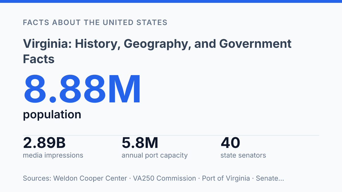
Virginia added more than 248,000 residents between the 2020 Census and July 2025, and 68.5% of that gain came from net migration rather than natural increase. That single measure explains why the state’s historical identity cannot be separated from its current geography: growth is concentrating in metropolitan corridors while public commemoration is pushing attention back across older regional routes and institutions. The VA250 program shows the scale of that effort, with a 64-page passport planned for 70 museums and historic sites across five regions and 250,000 copies scheduled for distribution beginning Nov. 11, 2025.
The same state that framed early American government now operates under a constitution that limits governors to one consecutive four-year term, while its economy is tied to a port expansion measured in millions of TEUs. The result is a state best understood through evidence rather than shorthand.
Virginia’s place in U.S. history
Before there was a United States, Jamestown made English colonization in North America a permanent political and economic fact rather than a failed experiment. Founded in 1607, the settlement became the first permanent English settlement in North America, giving England a durable base from which to expand its claims, institutions, and commercial ambitions along the Atlantic coast.
The Virginia colony’s influence grew because tobacco turned survival into an export system. Tobacco cultivation tied land acquisition, labor demand, Atlantic trade, and colonial law into a single economic order.
That success carried a defining cost: plantation wealth increasingly depended on coerced labor and enslaved people, embedding racial slavery into the colony’s development and shaping the political power of its landholding elite. The colony’s early prominence, therefore, cannot be separated from the labor system that financed much of that prominence.
Williamsburg later became a key setting for revolutionary politics because it concentrated colonial institutions, elite debate, and resistance to imperial policy in one place. Its importance was not merely symbolic; it helped connect local grievances to a wider argument over representation, authority, and rights. That political culture produced leaders and ideas that moved from colonial protest into the architecture of independence.
Yorktown gave that political transformation its decisive military consequence. The 1781 siege ended with the surrender of a major British army, a result that made continued British control of the colonies far less viable.
In practical terms, Yorktown converted years of rebellion into a diplomatic and strategic turning point. The state’s historical weight rests on this combination: an early English foothold, a plantation economy that shaped colonial power, and Revolutionary War sites where arguments over empire became a new national order.
Geography, regions, and major cities
Across the 39,481.4 square miles of land reported in the U.S. Census Bureau’s 2024 ACS profile, the state compresses Atlantic ports, Appalachian valleys, federal suburbs, military-oriented harbors, and farm counties into one political unit. That compact variation explains why regional identity carries unusual weight: economic life, commuting patterns, housing pressure, and public priorities differ sharply depending on whether a community faces the ocean, the mountains, or the Washington metropolitan edge.
The east is defined by the Atlantic coastal plain, where low elevation, tidal waterways, and access to Hampton Roads support dense settlement and maritime infrastructure. Norfolk functions as a major urban and naval center, while Virginia Beach stands as one of the state’s largest population centers and a defining city of the southeastern coast. Richmond, the capital, sits inland on the James River and occupies a more central position between the coastal plain and the Piedmont, giving state government a geographic midpoint rather than a purely coastal or mountain orientation.
West of the Piedmont, the Blue Ridge Mountains form a physical and cultural divide before the land opens into the Shenandoah Valley. That valley’s long northeast-to-southwest corridor has historically favored agriculture, road movement, and distinct local economies rather than the dense urban pattern found near the capital region and Hampton Roads. Beyond it, the Appalachian portions of the state connect more closely with Kentucky, Tennessee, and West Virginia than with the metropolitan orbit of the east.
Border geography reinforces this divided but connected structure. The northern edge ties the state to Washington, D.C., and Maryland across the Potomac, while the southern line links it to North Carolina and Tennessee. Kentucky and West Virginia shape the western connections, creating a map in which national government, Atlantic commerce, Appalachian communities, and southern interstate movement all meet inside one state boundary.
Regional division is formal enough to shape statewide public programming: the 250 Passport is a 64-page booklet covering 70 museums and historic sites across five regions, with 250,000 copies distributed beginning Nov. 11, 2025, and discounts of up to 15% plus prize drawings available through December 2026, according to the Virginia Tourism Corporation. The administrative choice to organize sites by region reflects a larger geographic fact: the state cannot be understood through one dominant urban core.
Population data sharpens the contrast. The Weldon Cooper Center estimated that about 88% of residents lived in metropolitan areas in 2025, and those metro areas accounted for 97.6% of population growth from 2020 to 2025. Growth therefore concentrates around urban and suburban corridors, while rural and mountain regions retain distinct needs around transportation access, income opportunity, land use, and political representation.
State government and political structure
Few state political systems separate local government as sharply as the commonwealth’s, where cities are not subordinate parts of counties but primary local jurisdictions in their own right. That structure gives state politics a local map that differs from most county-centered states, because population, taxation, school administration, courts, and service delivery are often measured through separate city and county governments rather than through a single county framework.
State authority is divided among three branches: an executive branch led by the governor, a legislative branch vested in the General Assembly, and a judicial branch headed by the state’s court system. The state constitution gives the governor a four-year term and bars the governor from serving the next succeeding term, a limit that makes the office unusually constrained compared with many other governorships. The practical effect is a stronger incentive for governors to act within a short policy window rather than build a two-term program around reelection.
The General Assembly is bicameral, consisting of the Senate and the House of Delegates. According to the Senate’s Key to the General Assembly, it has 40 senators and 100 delegates; senators serve four-year terms, delegates serve two-year terms, and regular sessions begin each January for either 45 or 60 days. Those compressed sessions place unusual weight on committee work, bill drafting, and negotiation before and during the formal legislative calendar.
Richmond is the seat of state government, concentrating the executive offices, legislative sessions, and much of the administrative apparatus in one city. Its role is not merely ceremonial; the location shapes lobbying, agency coordination, and the regular interaction between lawmakers and statewide officials.
The independent-city system is the clearest structural distinction. Cities such as Richmond, Norfolk, and Alexandria operate outside county government rather than within it.
That status clarifies local authority inside city boundaries, but it also complicates comparisons with states where cities are usually nested within counties. A fiscal or demographic comparison that treats counties as the standard unit can understate urban weight or misclassify local capacity unless independent cities are counted on their own terms.
Economy, institutions, and modern profile
Northern Virginia’s office economy is tied less to a single downtown than to the federal payroll, procurement cycle, and daily movement of workers around Washington, D.C. The northern suburbs house employees and contractors who serve civilian agencies, defense commands, and intelligence missions, so changes in federal budgets can affect hiring, leasing, and household income more quickly there than in many rural counties. That dependence is an advantage when federal spending is stable and a constraint when shutdowns, procurement delays, or security-clearance backlogs interrupt work.
The commonwealth’s major institutions function as economic infrastructure, not merely as landmarks. The Pentagon in Arlington anchors defense administration, while Langley is associated with national-security and aerospace activity through the CIA headquarters and NASA’s Langley Research Center. Virginia Tech and the University of Virginia strengthen the labor pipeline through research, engineering, medicine, public policy, and technology transfer, which helps explain why the U.S. Census Bureau’s 2024 ACS profile reported that 43.3% of residents held a bachelor’s degree or higher.
Private industry gives the state a broader base than federal employment alone can provide. Defense contracting supports cybersecurity, systems engineering, and shipbuilding, with Hampton Roads and Newport News Shipbuilding playing a central role in naval construction and maintenance.
Technology firms cluster near federal customers and research universities, while agriculture remains economically significant in less urbanized areas through poultry, cattle, grains, wine, and specialty crops. These sectors do not operate in isolation; they reinforce one another through supply chains, workforce training, and public procurement.
Logistics adds another layer to the modern profile. According to the port authority’s March 2026 announcement, a completed 55-foot-deep channel and harbor formed part of a $1.4 billion Gateway Investment Program, and the port expects annual capacity of 5.8 million TEUs when the North Berth project is completed in mid-2027. That investment matters because port capacity affects manufacturers, exporters, retailers, and military logistics at the same time.
This breadth should not be mistaken for uniform growth. The northern region often moves with federal contracting, technology demand, and Washington-area commuting patterns, while southwest and southside communities are more exposed to manufacturing shifts, agricultural margins, and workforce retention challenges. The state’s modern economy is therefore diversified but uneven, with institutional strength concentrated where government, research, transportation, and private capital intersect.
What the Next Growth Cycle Will Reveal
The practical question is no longer whether the state can trade on history; it is whether it can align commemoration, migration, infrastructure, and governance at the same pace. VA250 will turn historic sites into a statewide public test through 2026, while the state port system’s planned 5.8 million-TEU capacity in 2027 will measure a different kind of reach.
Those tracks are connected by policy choices: transportation funding, land use, education, and legislative timing will decide whether growth strengthens the whole state or deepens the metro-rural divide. The facts point to a state with unusual assets, but assets require coordination before they become durable public advantage.
Frequently Asked Questions
Q: What is Virginia best known for historically?
A: Virginia is best known as one of the original English colonies and a central site in early U.S. history. Its role in colonial settlement, the Revolution, and the Civil War gives it unusual historical weight. That legacy still shapes how the state is studied and remembered.
Q: Why is Virginia called the “Mother of Presidents”?
A: Virginia earned that label because it has produced more U.S. presidents than any other state. The concentration of presidents reflects the state’s early political influence in the republic. The phrase signals historical prestige, not current political dominance.
Q: What regions make up Virginia’s geography?
A: Virginia spans several distinct regions, including the Appalachian Mountains, the Piedmont, the Blue Ridge, the Shenandoah Valley, and the coastal Tidewater area. That variation creates sharp differences in climate, terrain, and land use across the state. Geography has therefore shaped settlement patterns and economic development.
Q: How is Virginia’s state government organized?
A: Virginia has the standard three branches of state government: executive, legislative, and judicial. The General Assembly serves as the lawmaking body, while the governor leads the executive branch. This structure balances statewide administration with constitutional checks on power.
Q: What role does Virginia play in the federal system today?
A: Virginia remains politically significant because it is home to major federal installations, defense activity, and a large public-sector workforce. Its proximity to Washington, D.C., also gives it outsized influence in national policy debates. That combination makes the state important beyond its historical record.