
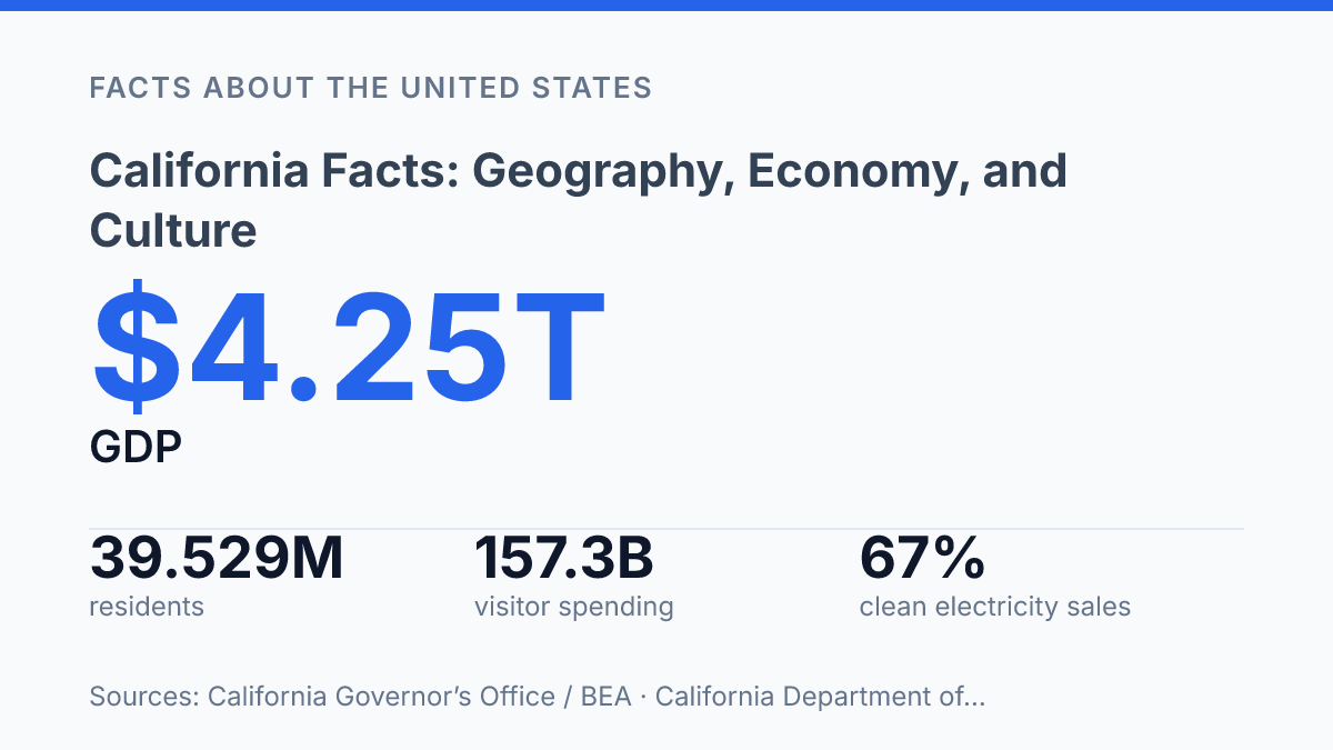
California combines the area of a large nation with the output of a major world economy: in 2025, it had nearly 39.5 million residents and a reported GDP of $4.25 trillion. That scale explains why basic state facts often lead quickly into larger questions about land, water, energy, food, migration, and cultural influence. The state covers more than 155,000 square miles of land, borders Oregon, Nevada, and Arizona, and contains sharp contrasts within a single political boundary, from coastal cities to the Sierra Nevada and Death Valley.
Its economy is just as varied, with major roles for technology, agriculture, tourism, entertainment, trade, and clean energy. This article examines the state through those connected facts: where it sits, how its economy operates, how its physical geography shapes daily life, and why its culture and policy choices often carry influence beyond the West Coast.
State profile and location
With 39,529,000 residents estimated as of July 1, 2025, California has more people than many countries and remains the most populous U.S. state. Its political capital is Sacramento, while Los Angeles is its largest city and the main population center of Southern California.
The state sits on the Pacific Coast of the western United States, with a long ocean-facing edge and land borders that connect it to several distinct regions. Measured by area, the U.S. Census Bureau lists the state at 155,859.2 square miles of land plus 7,834.6 square miles of water, making it the third-largest U.S. state by area. Its southern boundary also meets Mexico, giving the state an international border as well as a major Pacific frontage.
A single statewide identity can obscure how unevenly people and places are distributed. Northern, central, and southern regions differ sharply in settlement patterns, with large metropolitan areas, inland agricultural valleys, mountain communities, and sparsely populated desert or forested areas all falling within the same state boundaries. That scale helps explain why basic facts about location and population are often essential before comparing the state’s economy, environment, or culture.
Major industries and economic scale
The state generated $4.25 trillion in GDP in 2025, according to the Governor’s Office and BEA data, making its economic scale central to U.S. output. That figure reflects more than one dominant industry: technology, agriculture, trade, entertainment, energy, professional services, health care, and manufacturing all contribute to the state’s large and varied economy.
Silicon Valley remains the best-known symbol of that scale because it concentrates major technology companies, venture capital, engineering talent, and research networks in a relatively small part of the Bay Area. Apple, Google, and Meta are among the companies associated with this cluster, and their influence extends beyond local employment into advertising, consumer electronics, cloud services, artificial intelligence, and global platform governance. The sector’s high wages and productivity help lift statewide output, although they also intensify competition for housing in the communities closest to major job centers.
Agriculture adds a different kind of economic weight. In the Central Valley, farms and related businesses produce high-value crops and livestock products such as almonds, dairy, grapes, and lettuce.
According to the Department of Food and Agriculture, farms and ranches received $61.2 billion in cash receipts in 2024, while agricultural exports reached $23.8 billion. Those figures show why the region matters beyond local food supply: its output feeds domestic markets and supports export-oriented processing, logistics, and equipment businesses.
Trade infrastructure connects these production systems to global markets. The ports of Los Angeles and Long Beach form one of the country’s most significant container gateways, especially for goods moving between the United States and Asia. Their role supports warehousing, trucking, rail, retail supply chains, and manufacturing inputs across a much wider area than the harbor itself.
High output does not erase uneven prosperity. Coastal technology hubs, inland farm regions, and port-adjacent logistics corridors operate under different wage levels, housing pressures, and infrastructure demands. The result is an economy with unusually large productive capacity, but also persistent affordability challenges and regional disparities that shape how its gains are distributed.
Natural features and climate contrasts
Death Valley National Park’s hottest meteorological summer on record came in 2024, when the average 24-hour temperature reached 104.5°F and the average summer high was 117.3°F, according to the National Park Service. That extreme sits within the same state as fog-cooled coastal bluffs, alpine snowfields, giant granite cliffs, and some of the most intensively managed water systems in North America.
The Sierra Nevada is central to that contrast because its winter snowpack acts as seasonal water storage. Storms from the Pacific drop rain at lower elevations and snow in the high country, and spring melt feeds rivers, reservoirs, farms, cities, and hydroelectric systems. Yosemite National Park, on the range’s western slope, shows the same geology at a human scale through glacier-carved valleys, sheer granite walls, waterfalls, and high-elevation meadows.
Along the Pacific coastline, climate is moderated by ocean influence, with many coastal areas experiencing Mediterranean conditions: mild, wetter winters and dry summers. Inland basins and deserts can be much hotter and drier, especially in the Mojave and Colorado deserts, where summer heat limits outdoor activity and increases demand for water and electricity. The shift from sea air to mountain passes to desert floor can occur over relatively short driving distances, which is one reason regional travel often involves major changes in weather, elevation, and road conditions.
These climate advantages carry clear tradeoffs. Dry summers help support outdoor recreation and long growing seasons, but the same seasonal dryness can leave vegetation highly flammable before autumn winds and winter rains arrive. Drought cycles deepen the risk by reducing soil moisture, stressing forests, lowering reservoir levels, and forcing tighter decisions about urban supply, irrigation, fish habitat, and hydropower.
Water management is especially complicated where local precipitation does not match demand. The Colorado River system helps supply parts of Southern California and major desert farming districts, but long-term aridity and heavy use across the basin have led to shortage rules, conservation agreements, and negotiations among states, tribes, irrigation districts, and federal agencies. In practice, the state’s natural geography is not just scenery; it determines where communities can expand, which crops can be grown, how fires spread, and how much planning is needed before a dry year becomes a statewide emergency.
Culture, tourism, and statewide influence
In 2024, travelers spent $157.3 billion in the state, a scale that makes tourism one of the clearest measures of the state’s national appeal; according to Dean Runyan Associates and the state tourism office, that spending supported about 1.2 million jobs and generated $12.6 billion in state and local tax revenue.
Much of that visibility starts with Hollywood, where film and television production, studios, unions, agents, and related creative services remain concentrated in Los Angeles. The name functions as both a neighborhood and a global shorthand for American screen entertainment, which helps explain why media images of beaches, studios, celebrities, and red-carpet events often shape outside perceptions more than everyday regional differences.
Visitor demand is also tied to destinations with very different kinds of appeal. Disneyland in Anaheim anchors theme-park travel, San Francisco draws visitors through its waterfront, neighborhoods, and landmarks, and Yosemite National Park remains one of the best-known protected natural destinations in the United States. Together, these places show how the state’s tourism identity combines entertainment, urban history, and public lands rather than depending on a single image.
The state’s influence extends through higher education and research as well. Stanford University and the University of California system attract students, faculty, medical researchers, and scientific partnerships from across the country and abroad, reinforcing the state’s role in technology, health, public policy, and the arts. Even so, tourism and media attention are selective: smaller cities and inland regions such as Fresno, Bakersfield, and Riverside contribute to the state’s cultural and institutional life without receiving the same national spotlight as coastal entertainment hubs or marquee attractions.
Why scale shapes nearly every California fact
The numbers behind the state point to a central tension: scale gives California unusual economic and cultural reach, but it also magnifies every constraint. A $4.25 trillion economy, a major farm sector, and a tourism industry tied to beaches, parks, cities, and climate all depend on land, water, energy, and transportation systems that face growing pressure.
Conservation gains and a cleaner electricity mix show measurable change, yet record heat in places such as Death Valley shows why adaptation is not a distant issue. The most useful way to read these facts is not as trivia, but as a profile of a state where geography and policy remain closely linked.
Frequently Asked Questions
Q: What is California best known for?
A: California is known for its large population, major cities, agricultural output, and entertainment industry. It also has a varied geography that includes coastline, valleys, mountains, and deserts. These features shape both its economy and its public image.
Q: Why is California’s economy so important?
A: California has one of the largest economies in the world, driven by technology, entertainment, agriculture, trade, and tourism. Its ports and business centers support national and international commerce. The state’s economic scale gives it outsized influence on U.S. markets and policy.
Q: What are the main geographic regions of California?
A: California includes several distinct regions, such as the Pacific coast, the Central Valley, the Sierra Nevada, and the Mojave and Colorado deserts. This range of environments affects climate, water use, farming, and settlement patterns. The state’s geography is one reason its resources and population are distributed unevenly.
Q: Why is California so culturally diverse?
A: California’s diversity reflects long-term migration, immigration, and economic opportunity across different eras. Large metropolitan areas have brought together communities from many language, ethnic, and religious backgrounds. That mix has shaped food, music, media, and daily life across the state.
Q: What are some major challenges facing California?
A: California faces recurring challenges related to housing costs, drought, wildfires, and infrastructure strain. These issues are tied to population size, climate conditions, and development pressure. They also affect affordability, public services, and long-term planning.