
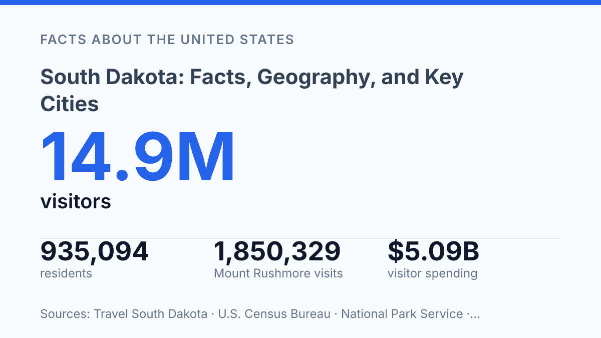
South Dakota had 935,094 residents in 2025 spread across 75,809.61 square miles, a scale that explains why the state can be growing and still feel sparsely settled. The contrast is clearest in its two largest cities: Sioux Falls and Rapid City together held about 31.5% of the state’s population in 2025, and their metro areas accounted for 87% of statewide population growth from 2000 to 2024. That pattern makes geography more than a map feature; it helps explain where jobs, housing, visitors, and public services cluster.
The same state contains high-traffic national landmarks, large corn and soybean harvests, millions of cattle, and one of the country’s best-known pheasant hunting traditions. Understanding it requires looking at land, settlement, climate, and economy as connected parts rather than separate facts.
Where South Dakota sits and what shapes it
With six state borders and a major river running roughly north-south through its interior, South Dakota is easier to understand as two adjoining regions than as one uniform plain. The state lies in the north-central United States, bordered by North Dakota to the north, Minnesota and Iowa to the east, Nebraska to the south, and Wyoming and Montana to the west. According to the U.S. Census Bureau, it covers 75,809.61 square miles of land, placing it among the larger U.S. states by area even though much of that space is rural and open.
The Missouri River is the state’s main internal geographic divider. Locally, the land east of the river is commonly called East River, while the land west of it is called West River. This distinction is more than directional: the eastern side generally has more rolling prairie and farm-oriented terrain, while the western side becomes drier and more broken, with ranchland, buttes, river breaks, and uplands becoming more prominent.
The Great Plains provide the broad physical setting for most of the state. Grasslands, low hills, and wide agricultural areas dominate much of the map, creating the open-space character often associated with the central and northern plains. The terrain is not flat everywhere, but its scale and relative openness shape travel distances, land use, and the visual identity of the region.
In the southwest, the Black Hills form the state’s most distinct physical contrast to the surrounding plains. This isolated upland region rises sharply from nearby prairie and contains forested slopes, granite formations, and higher elevations than the rest of the state. Together, the Great Plains and the Black Hills explain why the state can appear simple on a national map while containing marked regional differences on the ground.
How people and cities are distributed
The seat of government is not the main commercial hub: Pierre is the capital, while Sioux Falls is the largest city and the state’s dominant urban economy. That contrast helps explain how political authority, population, and business activity can be centered in different places within a low-density state.
The state had 935,094 residents as of July 1, 2025, a 5.5% increase from the April 2020 estimates base, while its 2020 population density was 11.7 people per square mile, according to the U.S. Census Bureau. Those figures indicate modest statewide growth, but the pattern is not evenly spread. Much of the population is concentrated in a small number of urban centers that serve as employment, health care, retail, and transportation anchors for much larger surrounding areas.
Sioux Falls is the clearest example of that concentration. Census estimates put the city at 213,748 residents in 2025, up 10.9% from 2020, making it by far the largest municipality in the state. Its size gives it a statewide role beyond population alone, since major employers, hospitals, finance, education, and regional services cluster there and draw workers and customers from a broad area.
Pierre’s role is different. As the capital, it is the center of state government, administration, and legislative activity, even though it is much smaller than Sioux Falls. The distinction matters because capital-city status does not necessarily track with market size; in this case, government functions are separated from the state’s largest concentration of people and commerce.
Rapid City is the main urban center in the western part of the state and a primary gateway to the Black Hills. With an estimated 80,589 residents in 2025, it is much smaller than Sioux Falls but still functions as a regional hub for travel, services, tourism access, and western-state commerce. Together, Sioux Falls and Rapid City accounted for about 31.5% of the state’s 2025 population, underscoring how much of the state’s urban activity is organized around two cities with distinct regional roles.
What the state is known for
Four presidential faces carved into granite draw global recognition, but they occupy land long central to Lakota history rather than a neutral national stage. Mount Rushmore National Memorial, located in the Black Hills, is the state’s best-known national symbol, and the National Park Service recorded 1,850,329 visits there in 2024. Its carvings of George Washington, Thomas Jefferson, Theodore Roosevelt, and Abraham Lincoln were completed in 1941, giving the monument a firm place in U.S. civic imagery while also tying it to unresolved questions about land, memory, and sovereignty.
Badlands National Park represents a different kind of national association: not a single monument, but a large protected federal area shaped by erosion, prairie ecology, and paleontological resources. The National Park Service describes the park as covering roughly 244,000 acres, including sharply eroded formations and mixed-grass prairie. Its significance is partly visual, but also scientific, because the area preserves fossil beds that help document ancient mammal life on the Great Plains.
Native American history is not a background detail in the state’s identity; it is one of its central historical frameworks. The Lakota, Dakota, and Nakota peoples are part of the Oceti Sakowin, often translated as the Seven Council Fires, and their political and cultural presence continues through tribal nations, reservations, languages, ceremonies, and contemporary governments. State and federal references commonly identify nine tribal nations with reservations or homelands connected to the state, reflecting a living political geography rather than only an archaeological or historical record.
These associations sit beside one another without fitting into a single simple story. Federal monuments and parks have helped make the state nationally recognizable, yet some of the same places carry different meanings for Native nations whose relationships to the land predate U.S. statehood and federal memorialization. That overlap is essential context for understanding why the state is known both for iconic national imagery and for a much deeper Indigenous history that cannot be reduced to those symbols.
Economy, climate, and practical takeaways
The 2024 state agriculture overview lists nearly 884 million bushels of corn for grain, a figure large enough to show why farming is not just a rural backdrop but a central economic system. According to the USDA National Agricultural Statistics Service, corn for grain was valued at $3.54 billion in 2024, while soybeans totaled 231.34 million bushels worth $2.24 billion.
Livestock is equally important: cattle and calves numbered 3.5 million as of January 1, 2025. Wheat remains part of the crop mix as well, especially in areas where rainfall, soil, and growing-season conditions differ from the more corn- and soybean-heavy eastern counties.
This farm-heavy economy depends on distance, land, and weather in ways that denser states often do not. Large acreages support grain production, grazing, feed supplies, and agricultural processing, but they also require long transport routes to elevators, sale barns, rail connections, repair services, and markets.
The same pattern shapes everyday public services: maintaining roads, broadband, emergency response, schools, and health care networks is more difficult when users are spread thinly across a wide area. Low density can support open land and agricultural scale, yet it raises the per-person cost and travel burden of many services.
The climate adds another layer of practical risk. The state has a continental pattern, with cold winters, warm summers, and sharp seasonal swings that affect energy use, road conditions, planting schedules, and livestock management.
Severe weather is a recurring concern, including thunderstorms, hail, high winds, blizzards, drought periods, and rapid temperature changes. SDSU Extension, citing NOAA NCEI data, reported that 2024 was the state’s fifth-warmest year in 130 years, while the Black Hills region was 4.14 inches below average precipitation and 3.7°F warmer than normal.
Taken together, the economy and climate explain much of the state’s practical character. Agricultural output is high because land is available at scale, but that same spacing makes travel, infrastructure, and service access more demanding. Weather reinforces the need for resilient roads, flexible farm operations, and reliable communication systems across long distances.
What the numbers mean for the state’s next decade
The most practical reading of the data is that future decisions will be shaped less by statewide averages than by regional pressure points. Growth in Sioux Falls and Rapid City will influence housing demand, labor markets, and transportation planning, while rural counties remain tied to agriculture, recreation, and land management. Climate variation adds another layer because warmer years and precipitation deficits affect crops, livestock, fire risk, and tourism seasons in different ways.
For residents, businesses, and public agencies, the useful question is not whether the state is rural or urban, agricultural or tourism-driven. It is how those identities interact when population growth, visitor demand, and weather risk are increasingly uneven across the map.
Frequently Asked Questions
Q: What is South Dakota known for besides Mount Rushmore?
A: South Dakota is also known for the Badlands, Custer State Park, and Native American cultural sites and reservations. Agriculture remains a major part of the state economy, especially cattle, corn, soybeans, and wheat. Tourism is strongest in the western part of the state, where several major natural and historic attractions are concentrated.
Q: What is the geography of South Dakota like?
A: The state is divided between the eastern Prairie Pothole region and the more rugged western plains and Black Hills. The Missouri River runs through the center of the state and serves as a major geographic divider. This split helps explain why the east is more farmland-oriented while the west has more hills, public lands, and tourism sites.
Q: What are the largest cities in South Dakota?
A: Sioux Falls is the largest city and the main urban and economic center. Rapid City is the second largest city and is the primary hub for western South Dakota. Other notable cities include Aberdeen, Brookings, and Pierre, the state capital.
Q: What is the climate like in South Dakota?
A: South Dakota has a continental climate with cold winters, warm summers, and large seasonal temperature swings. Conditions are generally drier in the west and somewhat wetter in the east, which affects farming patterns and vegetation. Severe weather, including snowstorms, thunderstorms, and occasional tornadoes, is part of the state’s climate profile.
Q: Why is South Dakota important in U.S. history?
A: South Dakota is significant in Native American history and in the settlement history of the northern plains. The Black Hills remain especially important because of their cultural meaning and their role in 19th-century conflict over land and sovereignty. The state also became a focal point for western expansion, rail development, and federal land policy.