
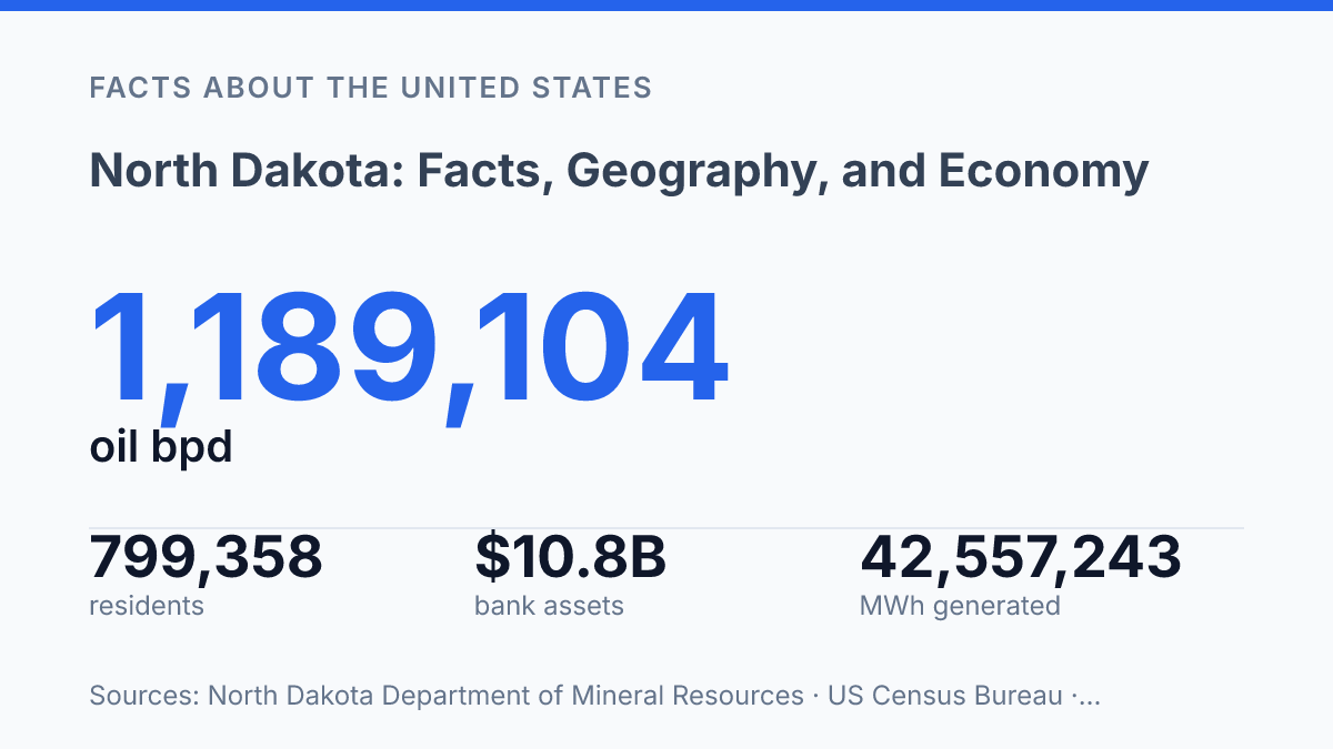
North Dakota pairs a 2025 population of 799,358 with an energy system that produced nearly 1.19 million barrels of oil per day in November 2025, a scale that makes its geography matter far beyond its headcount. The state is often described through its open space, but the more useful frame is structural: glacial terrain directs land use, oil and coal shape revenue and power costs, and farming still claims tens of millions of acres.
Its recent growth is modest in statewide terms, yet sharply uneven, with Fargo and nearby communities such as Horace expanding much faster than many rural areas. This profile explains how location, terrain, population patterns, major industries, public institutions, and state history fit together, including why a state-owned bank and unusually low electricity prices are not side details but part of the state’s wider economic model.
Where North Dakota sits and what shapes its terrain
From east to west, the state shifts from a flat, flood-prone agricultural valley to rolling glaciated uplands and drier plains, a physical change that helps explain why people and farms are not spread evenly across it.
This northern Great Plains state sits along the U.S.-Canada border, with Montana to the west, Minnesota to the east, South Dakota to the south, and the Canadian provinces of Manitoba and Saskatchewan to the north. Its position places it between the wetter upper Midwest and the drier interior plains, so the same state contains humid lowlands, rolling glacial terrain, and semi-arid western rangeland. That gradient affects soils, crop choices, drainage, and the spacing of towns more than a map of straight borders suggests.
The Missouri River is the main organizing feature across western and central areas, running through broad valleys and providing a reference line for reservoirs, transportation corridors, and irrigated or hay-producing bottomlands. In the east, the Red River of the North forms much of the boundary with Minnesota and drains northward toward Manitoba, giving the Red River Valley a different pattern of settlement and land use. Its flat floor and slow drainage favor large-scale crop farming, but they also make spring flooding a recurring geographic constraint.
Elevation changes are most visible where glacial deposits interrupt the apparent sameness of the plains. In 2024, the North Dakota Geological Survey described the Missouri Coteau as about 50 kilometers wide and extending more than 1,000 kilometers through Saskatchewan, this state, and South Dakota, with the Missouri Escarpment rising 100–150 meters above adjacent lowlands. This belt of hummocky upland, wetlands, and poor natural drainage contrasts with the more level cropland to its east and the more dissected plains farther west.
The Great Plains shape both the state’s openness and its economic geography. Broad, mechanized agriculture is easiest where soils, slope, and drainage allow large fields, so towns and roads tend to align with fertile river valleys and market corridors rather than appearing in an even grid. In the west, lower rainfall and more broken terrain support more grazing, mixed farming, and energy-related land uses, while the eastern valley remains among the state’s most intensively farmed areas.
Population, cities, and recent growth patterns
The 2020 U.S. Census counted 779,094 residents in the state, a total smaller than many individual U.S. metropolitan areas but large enough to confirm a period of continued growth. U.S. Census Bureau QuickFacts later estimated 799,358 residents as of July 1, 2025, a 2.6% increase from the April 2020 estimates base of 779,136. That pace points to gradual expansion rather than explosive statewide growth, with gains concentrated in specific labor and education markets.
Fargo is the largest urban center and the clearest example of recent metropolitan growth. A 2026 Minot Daily News report using Census estimates put Fargo at 136,275 residents in 2025, up from 125,951 in the 2020 Census, while nearby Horace rose from 3,206 to 7,001 over the same period. That pattern shows how growth around the state’s largest city is not limited to the central municipality; it also appears in surrounding commuter communities where housing and regional job access interact.
Bismarck, Grand Forks, and Minot anchor different parts of the state’s population system. Bismarck functions as the capital and an administrative and health-care center, Grand Forks is strongly shaped by higher education and research employment, and Minot serves as a regional hub for the north-central part of the state, including areas influenced by military and energy-related activity. These cities matter because they concentrate services that smaller communities often cannot support at the same scale.
Recent population change has been uneven, reflecting the combined influence of energy employment, university-linked migration, health-care and public-sector jobs, and movement within the Upper Midwest. Metro areas and selected suburban communities have tended to absorb more of the growth, while many rural counties face aging populations, thinner labor pools, and greater difficulty maintaining schools, clinics, and local services. The result is a state that is growing in aggregate, but not uniformly across its communities.
Energy, farming, and the industries that drive the state
A single oil system supplied 97.4% of the state’s crude output in the latest reported month, showing how concentrated the energy economy remains. The state Department of Mineral Resources’ January 2026 Director’s Cut reported average production of 1,189,104 barrels of oil per day in November 2025, with nearly all of it tied to Bakken–Three Forks production.
The Bakken Formation has therefore become more than a geological asset; it underpins extraction jobs, royalty income, business investment, and a major share of state and local revenue through oil-related taxes. That scale brings high-value activity, but it also exposes public finances to changes in oil prices, drilling activity, and well productivity.
Agriculture remains the other core pillar, with large operations shaping land use, exports, and rural employment. USDA/NASS estimated 24,800 farm operations in 2024 working 38.5 million acres, an average of 1,552 acres per operation.
Crop receipts show a broad grain and oilseed base: soybeans were valued at $2.34 billion in 2024, ahead of corn for grain at $2.15 billion and wheat at $2.11 billion, according to USDA/NASS. Livestock, especially cattle, adds another major income stream and helps balance crop-focused regions with ranching areas where grassland and feed availability matter.
Energy and agriculture also support industries that add value beyond extraction and harvest. Wind power has expanded the electricity mix and brings land-lease payments, construction work, and local tax revenue, even though the U.S. Energy Information Administration’s 2024 Electricity Profile still listed coal as the state’s primary generation source. The same EIA profile reported net generation of 42,557,243 megawatt-hours and an average retail electricity price of 7.93 cents per kilowatt-hour, the lowest ranking among states and the District of Columbia, a cost advantage for power-intensive processors and manufacturers.
Food processing and manufacturing convert raw production into higher-value goods and services, from grain handling and oilseed processing to meat, machinery, metal products, and energy-field equipment. These sectors broaden the employment base, but they do not remove the economy’s exposure to weather, crop prices, livestock markets, and global demand for fuels and farm commodities.
History, government, and what makes the state distinctive
The state entered the Union on the same day as South Dakota, and President Benjamin Harrison reportedly obscured the signing order so neither would be able to claim seniority. Its admission on November 2, 1889, followed the division of Dakota Territory and placed a frontier-era political boundary over lands already shaped by Indigenous nations, fur trade routes, military posts, railroads, and homesteading policy.
State government is centered in Bismarck, where the governor leads the executive branch and the Legislative Assembly writes state law through a Senate and House of Representatives. Regular legislative sessions are held every other year and are limited by the state constitution, which gives budgeting and policy debates a compressed timetable compared with states that meet annually. The governor’s powers include signing or vetoing legislation, overseeing executive agencies, and presenting budget recommendations, while the legislature controls appropriations and statutory changes.
Native American nations are not only part of the state’s past; they remain central civic actors. The Mandan, Hidatsa and Arikara Nation, the Spirit Lake Tribe, the Standing Rock Sioux Tribe, the Turtle Mountain Band of Chippewa Indians, and the Sisseton-Wahpeton Oyate all have governmental, cultural, and land-based ties within or across the state.
Their continuing presence means public affairs cannot be understood only through county, city, and state institutions. Tribal governments exercise sovereignty, provide services, maintain legal systems, and negotiate with federal and state authorities on matters ranging from infrastructure to education and natural resources.
One distinctive institution reinforces the state’s unusual civic profile: BND says it is the only state-owned bank in the United States. According to the bank’s 2025 reporting, it ended 2024 with $10.8 billion in assets, a fact that illustrates how public finance has developed differently here than in most states. Taken together, statehood-era institutions, tribal sovereignty, and distinctive public structures give the state an identity that is political and historical as much as geographic or economic.
What the state’s small scale makes possible
The state’s next chapter will likely be measured less by sudden reinvention than by how well it manages concentration. Oil production, large farms, coal-fired generation, and Fargo-area growth all create advantages, but they also tie public revenue and local planning to forces that can shift quickly, including commodity prices, technology, weather, and migration.
The unusual presence of the Bank of North Dakota gives state government a financial tool most states do not have, yet it does not remove those dependencies. The practical consequence is clear: small population does not mean simple governance when a state carries national weight in food, fuel, and public finance.
Frequently Asked Questions
Q: What is North Dakota known for?
A: North Dakota is known for its prairie geography, major agricultural output, and energy production. The state has a largely rural profile, with farming and livestock raising shaping much of its economy. Oil extraction in the western part of the state has also had a major effect on employment and state revenues.
Q: What is the climate like in North Dakota?
A: North Dakota has a continental climate with cold winters and warm to hot summers. Seasonal temperature swings are large because the state is far from ocean influences and lies in the interior of North America. Wind and winter snowfall can make cold periods feel more severe.
Q: Which industries are most important in North Dakota?
A: Agriculture, energy, and food processing are among the most important industries. The state is a major producer of wheat, soybeans, corn, cattle, and other farm products, while oil and gas development remains a significant economic driver. These sectors support both rural communities and larger service industries tied to them.
Q: How does North Dakota’s geography affect its economy?
A: The state’s flat to gently rolling plains make large-scale farming more practical, which helps explain agriculture’s central role. Mineral resources in the western region have supported energy development, especially oil production. Geography therefore shapes both the type of jobs available and where economic activity is concentrated.
Q: What are the largest cities in North Dakota?
A: Fargo is the largest city and an important regional center for business, education, and health care. Bismarck, the state capital, is another major hub, while Grand Forks and Minot also play important roles in the state’s economy and public services. These cities anchor a state that remains less urbanized than many others in the United States.