
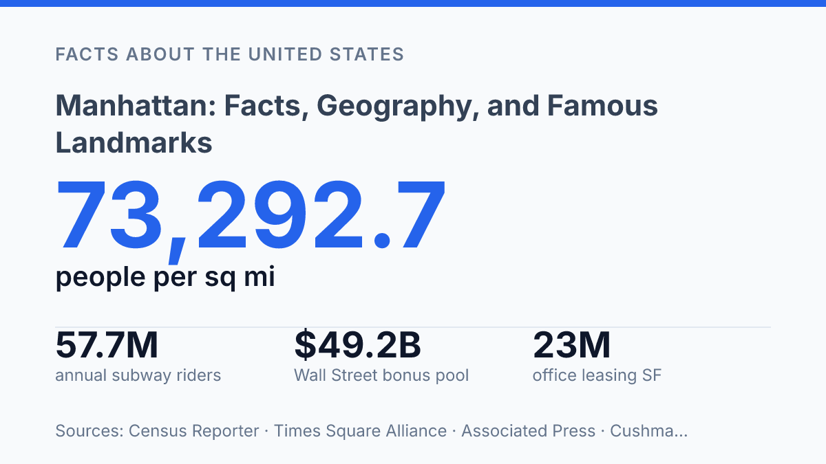
Manhattan contains 1,660,664 residents in just 22.7 square miles, a density of 73,292.7 people per square mile in the 2024 ACS profile. That compression explains why the borough is studied as both a place to live and a machine for movement, work, finance, culture, and public space. Its geography is simple at first glance: an island at the core of New York City.
Its influence is less simple, shaped by harbor access, street grids, immigrant settlement, corporate concentration, subway expansion, and institutions that became reference points far beyond New York. The facts behind the skyline show a borough whose population is growing again, whose daytime workforce is larger than its residential base, and whose landmarks function as civic infrastructure as much as tourist destinations.
Where Manhattan sits in New York City
In 2024, Manhattan borough/New York County had 1,660,664 residents on 22.7 square miles, or 73,292.7 people per square mile, according to Census Reporter. That density helps explain why a physically small part of New York City carries unusual weight in government, commerce, media, and public life.
The borough occupies the long, narrow island between the Hudson River on the west and the waterway known as the East River on the east. At its northern end, the Harlem River separates the island from the Bronx, while the southern tip faces New York Harbor. This geography gives the borough clear natural edges, which have shaped its street grid, bridge and tunnel connections, waterfront development, and role as a central point between the city’s other boroughs and the wider region.
Manhattan is one of New York City’s five boroughs, not a separate city. It is also the county seat of New York County, making the borough both a municipal division within the city and the center of county-level administration. That overlap is common within New York City’s structure, where each borough corresponds to a county, but it is especially visible here because many civic, legal, and commercial institutions are concentrated within a compact area.
The contrast between scale and influence is central to understanding the borough’s position. Its land area is the smallest of the five boroughs, yet its density and central location make it a core node in the city’s daily movement of people, business, and public services. The island’s limited space also intensifies competition for housing, offices, transportation capacity, and public land, which is why questions about development and mobility tend to have citywide effects even when they concern only this borough.
How the island became a global center
A Dutch trading settlement established in 1624 became an English-controlled city just four decades later, and that early shift tied the island’s future to Atlantic commerce rather than to a purely local colonial economy. The Dutch settlement of New Amsterdam grew around harbor trade and fortifications at the southern end of the island. In 1664, English forces took control and renamed it New York, linking the port more directly to English imperial trade networks and the legal institutions that later supported banking, insurance, and large-scale commerce.
Finance became the island’s strongest global identity through the rise of Wall Street and the New York Stock Exchange. The street’s name came to stand for a wider financial district where securities trading, investment banking, and corporate law clustered close together. That concentration mattered because financial firms benefit from proximity to clients, regulators, specialized lawyers, analysts, and competitors; over time, the district became not just a place where money was handled, but a place where market information was produced and priced.
Modern figures show that this historic role remains economically significant. The Associated Press reported that Wall Street’s 2025 bonus pool reached $49.2 billion, while profits rose more than 30% to $65.1 billion. Such numbers do not describe the whole borough economy, but they show the continuing scale of finance within it and help explain why office demand, executive services, and high-end commercial real estate remain closely tied to the securities industry.
The center of gravity later expanded north as Midtown developed into a business, entertainment, and media district. Broadway helped give the area a global cultural profile, while major corporate headquarters, advertising firms, publishers, television networks, and law firms made Midtown a second command center beyond Lower Manhattan’s financial core. This dual structure shaped the borough’s present form: finance anchored downtown, while media, corporate management, tourism, and performance clustered around Midtown.
The same concentration that made the island influential also made space unusually contested. Global finance, trade, entertainment, and corporate activity compete with housing, public infrastructure, and local services for limited land, making development decisions costly and politically sensitive.
Key places and institutions people recognize
The Metropolitan Museum of Art reported more than 5.7 million visits to The Met Fifth Avenue and The Met Cloisters in FY2025, evidence that the borough’s public identity still depends heavily on major cultural institutions as well as famous streets and towers. The Met anchors a museum corridor associated with large-scale art collections, while the Museum of Modern Art is closely identified with modern and contemporary work. Columbia University adds a different kind of recognition: as a major research university in Morningside Heights, it connects the borough’s name to scholarship, medicine, publishing, and public debate as much as to tourism.
Central Park remains the clearest example of a landmark that functions as both symbol and daily infrastructure. It is internationally recognized as an urban park, but its public value comes from routine use as much as from image: recreation, commuting on foot or bicycle, school trips, performances, and neighborhood access all overlap there. That dual role helps explain why the park is treated not merely as scenery, but as a civic institution.
A smaller set of highly visible commercial landmarks carries much of the global tourist image. Times Square is associated with illuminated advertising, mass gatherings, theaters, and constant pedestrian traffic, while the Empire State Building remains one of the most recognizable skyscrapers in the United States. These places are not representative of every block, but they are unusually efficient symbols because they condense entertainment, architecture, media, and commerce into easily recognizable settings.
The United Nations headquarters on the East Side gives the borough a distinct diplomatic profile. Its complex hosts meetings of the General Assembly and Security Council, making it one of the few sites in the city regularly tied to international law, conflict resolution, and state diplomacy. That presence broadens the borough’s identity beyond finance and culture.
Recognition is unevenly distributed. The best-known destinations cluster in a limited number of districts, while much of the borough is experienced through apartment blocks, schools, local businesses, hospitals, and subway access rather than sightseeing. This contrast is central to understanding its public image: a handful of landmarks project the borough outward, but ordinary urban systems sustain it from day to day.
Population, transit, and daily life
The 2020 Census counted 1,694,251 residents in the borough, a figure that helps explain why ordinary activities such as commuting, grocery shopping, school travel, and apartment hunting are shaped by limited space. Residential patterns vary sharply by neighborhood, but dense housing is a constant from Harlem through the Upper West and Upper East Sides, Chelsea, the Lower East Side, Tribeca, and the Financial District. That concentration supports street-level services and frequent transit, yet it also intensifies competition for apartments in both older walk-up buildings and high-rise developments.
Daily movement depends less on private cars than in most U.S. urban areas because the transit network is unusually layered. The MTA operates subway and bus service across the borough, while commuter rail, ferries, PATH trains, and regional bus links connect it with the wider metropolitan area. Bridge-and-tunnel access remains essential for freight, taxis, buses, emergency vehicles, and commuters from outside the island, but car-free living is practical for many households because many destinations can be reached by rail, bus, walking, or a short transfer.
The scale of daytime activity is larger than the resident population alone suggests. U.S. Census Bureau data reported 2,133,324 workers employed in the borough in 2023, up from 1,868,021 in 2021. This difference between where people live and where they work places heavy pressure on subway trunks, bus corridors, sidewalks, curb space, and station entrances, especially during peak periods.
Housing pressure is the central tradeoff created by that accessibility. Strong transit access, job concentration, universities, hospitals, and cultural institutions make the borough highly desirable, while the supply of land is fixed and new construction faces physical, regulatory, and cost constraints. As a result, rents remain among the highest in the United States, and daily life often involves smaller apartments, shared housing arrangements, longer searches for affordable units, or moves between neighborhoods as household needs change.
What the density makes possible
The next question is not whether the island remains central, but how much pressure its systems can absorb while still functioning as a residential borough. Recent data points in several directions at once: population growth, recovering office leasing, record cultural attendance, and new traffic rules that changed commuting patterns within days. Those trends make policy choices less abstract.
Housing capacity, subway reliability, curb management, climate resilience, and public-space design will determine whether density remains an asset rather than a strain. Few places expose those tradeoffs as clearly as this one: every gain in access, speed, or development is measured against a fixed island with limited room and global demand.
Frequently Asked Questions
Q: Where is Manhattan located in New York City?
A: Manhattan is one of New York City’s five boroughs and sits on a long, narrow island between the Hudson River and the East River. It also extends a short distance north onto the mainland at Marble Hill, which is politically part of Manhattan even though it is no longer on the island itself.
Q: Why is Manhattan so important to New York City?
A: Manhattan is the city’s main center for finance, government, media, and tourism. Its concentration of major institutions and transit links makes it the most internationally recognized part of New York City.
Q: What are the most famous landmarks in Manhattan?
A: Several landmarks define the borough, including Central Park, Times Square, the Empire State Building, the Chrysler Building, and the World Trade Center site. These places are significant because they combine commercial, cultural, and civic importance in a relatively small area.
Q: How is Manhattan divided into neighborhoods?
A: Manhattan is commonly described by areas such as Lower Manhattan, Midtown, Uptown, the Upper West Side, and the Upper East Side. These labels reflect different patterns of land use, housing, business activity, and visitor traffic rather than formal administrative districts.
Q: What makes Manhattan different from the rest of New York City?
A: Manhattan is far denser and more vertically built than the other boroughs, with a greater concentration of skyscrapers, offices, and major attractions. That density shapes daily life by increasing transit use, land values, and the pressure on public space.