
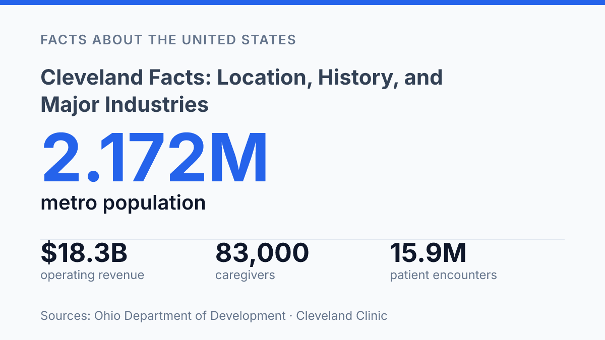
Cleveland is a regional center whose scale is easier to see from the metro map than from the city boundary: in 2024, the metropolitan area had 2.172 million people, while the city proper had 365,400 residents. That contrast helps explain why a place with a smaller municipal population than at its mid-20th-century peak still carries outsized economic and cultural weight in northern Ohio. Its position on Lake Erie, the opening of the Ohio & Erie Canal in 1827, and a manufacturing base that once employed nearly half the city’s labor force all shaped its rise.
The modern picture is different but connected. Health care, education, and research now sit beside the industrial legacy, with Case Western Reserve University and Cleveland Clinic anchoring a medical and academic network that reaches well beyond downtown.
Where Cleveland sits in northern Ohio
The city sits only about 60 miles west of the Ohio–Pennsylvania state line, yet its geographic orientation is as much north across Lake Erie as it is east or west across Ohio. Cleveland is located on the southern shore of Lake Erie in the U.S. state of Ohio, placing it within the Great Lakes region rather than the inland Midwest alone. That position helps explain why the lake is not just a boundary on a map but a defining physical feature for movement, weather, and regional connection.
Across the water lies the Canadian province of Ontario, giving the city a cross-border setting even though no land border runs through the immediate area. Lake Erie separates northern Ohio from southern Ontario, so the city faces Canada across an international freshwater route. This geography gives the area a broader Great Lakes context, linking it to other lakefront cities and ports around the basin.
The urban region extends well beyond the municipal shoreline. Encyclopaedia Britannica describes Greater Cleveland as stretching about 100 miles along Lake Erie and more than 40 miles inland, encompassing more than 70 suburban communities. That scale matters because the city’s location is best understood as the anchor of a wider lakefront region rather than as a single compact point on the shore.
Lakefront geography also has practical effects. Access to Great Lakes shipping routes supports regional transportation connections, while the lake can influence local climate patterns, including cooler lakeside conditions in warm months and lake-effect weather under the right winter conditions. The same shoreline that opens the city toward Ontario and the wider Great Lakes system also shapes how roads, rail lines, and development patterns meet the water’s edge.
How the city grew from lakefront settlement to metro center
The decisive early turn was not population size but connection: access to Lake Erie shipping and an inland canal route gave a lake harbor a commercial reach that many inland settlements lacked. When the Ohio & Erie Canal opened between Cleveland and Akron on July 4, 1827, it linked lake traffic with interior Ohio markets and helped shift the city from a small settlement into a trading center. Later rail connections, lake vessels, and port facilities reinforced that advantage by giving manufacturers and merchants several ways to move raw materials and finished goods.
Industrial expansion turned that transport position into urban scale. In the late nineteenth and early twentieth centuries, the city became one of Ohio’s main engines of urban development, drawing workers, capital, and infrastructure into a growing metropolitan economy. By 1930, it had 900,429 residents and ranked as the sixth-largest city in the United States, a measure of how strongly transportation, port access, and factory growth had converged.
That growth also shaped infrastructure beyond the central city. Streets, bridges, rail corridors, warehouses, and industrial districts expanded to serve production and distribution, while surrounding communities became increasingly tied to the same labor and transportation network. The metropolitan pattern that resulted was broader than the municipal boundary, with regional scale remaining visible even after the central city’s population peak had passed.
The scale remains clear in recent population data: the metropolitan area had 2.172 million people in 2024, making it Ohio’s second-largest metro area, while the city proper had 365,400 residents after a 6.2% decline over the decade, according to the Ohio Department of Development. This contrast reflects a longer historical pattern: the same industrial base that helped build the city’s prominence also left it exposed when manufacturing employment and urban settlement patterns shifted in the postwar period.
Why manufacturing, health care, and education matter here
Education and health services now exceed manufacturing by tens of thousands of jobs in the metro economy: in the latest U.S. Bureau of Labor Statistics table extracted Oct. 20, 2026, the sector employed 209,500 people, compared with 124,500 in manufacturing. The comparison helps explain why hospitals, medical research, universities, and related professional services carry so much weight in the area’s present-day employment base.
That shift does not mean the industrial economy disappeared. Early-20th-century manufacturing employed 223,000 workers, described as nearly half of the city’s labor force, according to the local history encyclopedia maintained by Case Western Reserve University.
This history left a durable imprint through skilled trades, supplier networks, engineering capacity, and a civic identity strongly associated with production. Manufacturing remains part of the employment mix, but it now operates alongside larger service and knowledge-based sectors rather than defining the economy by itself.
The scale of Cleveland Clinic shows why health care is more than a local service industry here. The system reported 83,000 caregivers, 15.9 million patient encounters, and $18.3 billion in operating revenue as of Dec. 31, 2025. Those figures indicate an institution with regional labor-market influence, national patient reach, and a large purchasing footprint, which can support employment beyond clinical roles through administration, technology, facilities, and research-related work.
Higher education strengthens that medical and research ecosystem rather than standing apart from it. Case Western Reserve University reported 12,145 students in fall 2026 and $642 million in FY2024 research expenditures, placing advanced training and research activity near major hospitals and professional networks.
Data USA’s 2024 figures for city residents point in the same direction: 31,457 worked in health care and social assistance, compared with 19,153 in manufacturing and 16,868 in retail trade. The resulting economy is not a clean replacement of industry by medicine and education; it is a diversified structure in which historic production capacity, clinical care, research, and higher education all shape regional influence.
What helps explain Cleveland’s regional identity today
According to NOAA, Lake Erie is the shallowest of the Great Lakes, with an average depth of about 62 feet, a physical trait that helps make the waterfront feel unusually immediate in the city’s identity. Its water moderates temperatures, supports boating and fishing, and keeps the city tied to commercial networks that extend beyond Ohio. The result is a place whose public image is not only urban or industrial, but also coastal in a Great Lakes sense, with beaches, marinas, and lakefront parks forming part of the metropolitan profile.
Regional identity also depends on scale. Within the broader Great Lakes and Midwest region, the city functions less as an isolated municipality than as one node in an urban corridor connected by freshwater, freight, universities, hospitals, and professional labor markets. That position helps explain why its influence often exceeds city-boundary measures: surrounding communities, employment centers, cultural institutions, and transport assets all contribute to the same regional identity.
The older industrial image remains recognizable because mills, bridges, rail corridors, and working riverfronts left visible marks. Yet the same geography that supported heavy industry now frames a broader civic profile. The 1969 Cuyahoga River fire, widely associated with national environmental reform, also became part of that public story: a symbol of industrial damage, but also of cleanup, regulation, and renewed waterfront use.
The city’s present identity is therefore shaped by overlap rather than replacement. Manufacturing still informs architecture, local memory, and regional reputation, while medicine, research, arts, sports, and lakefront recreation broaden the picture. Geography gave the city a Great Lakes orientation; industry gave it a durable working-city image; civic reinvention has made that identity more mixed than the older shorthand suggests.
Why the regional scale still matters
The clearest reading of the city comes from treating it as a regional system rather than a single municipality. Population decline inside the city line does not erase the influence of a metro area that extends across Lake Erie communities, suburbs, hospitals, campuses, and former industrial corridors. It does change the questions that matter.
The next stage of the region’s identity will depend less on whether it resembles its 1930 peak and more on how well its institutions, infrastructure, and neighborhoods connect economic strength to local benefit. The numbers point to a city whose past is visible, but whose present is measured across a much wider footprint.
Frequently Asked Questions
Q: Where is Cleveland located?
A: Cleveland is in northern Ohio on the southern shore of Lake Erie. It sits across the lake from Ontario and about 60 miles west of the Ohio–Pennsylvania state line.
Q: Is Cleveland on Lake Erie?
A: Yes. The city is located along the southern shore of Lake Erie, which has shaped its transportation, trade, and industrial development.
Q: How far is Cleveland from the Pennsylvania border?
A: Cleveland is approximately 60 miles west of the Ohio–Pennsylvania state line. That location places it in the northeastern part of Ohio rather than near the center of the state.
Q: What province is Cleveland across the lake from?
A: Cleveland lies across Lake Erie from the Canadian province of Ontario. The lake crossing places the city within a broader cross-border Great Lakes region.
Q: Why is Cleveland’s location important?
A: Its position on Lake Erie gave the city direct access to shipping routes and regional markets. That geography helped support its growth as an industrial and transportation center in Ohio.