
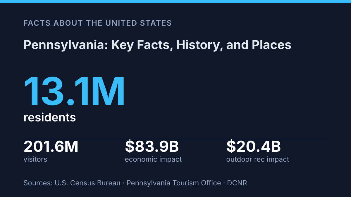
Pennsylvania had 13,059,432 residents on July 1, 2025, yet its population was only 0.4% above the April 2020 estimates base, a pairing that makes size and slow growth central to understanding the state. That contrast sits beside an unusually deep origin story: the colonial charter was signed on March 4, 1681, granting land west of the Delaware River between the 39th and 42nd degrees north latitude. The modern state is equally resistant to a single label.
Steel and coal remain part of its public memory, but 2024 employment data show health care and social assistance at 19.2% of covered jobs, more than double manufacturing’s 9.4%. The facts that follow connect population, history, work, agriculture, tourism, outdoor recreation, and cultural places into a clearer profile of a large state whose identity is still shaped by both early colonial geography and present-day economic change.
Pennsylvania at a glance
Few states connect the Atlantic seaboard to the Great Lakes as directly as Pennsylvania, which borders New York, New Jersey, Delaware, Maryland, West Virginia, and Ohio while also touching Lake Erie in its northwest corner. That position places the Commonwealth in the Mid-Atlantic by convention, but its map also ties it to the Northeast corridor and the Great Lakes region. The geographic spread helps explain why statewide comparisons can vary depending on whether the reference point is eastern cities, Appalachian counties, or the Erie shoreline.
The administrative profile is split between a relatively small capital and a much larger urban center. Harrisburg, on the Susquehanna River, is the capital, while Philadelphia is the largest city and the state’s main population center. The 2020 U.S. Census counted 13,011,844 residents, keeping the state among the nation’s most populous despite modest recent growth.
Recent estimates show that the state is large, slow-growing, and comparatively older. As of July 1, 2025, the population was 13,059,432, only 0.4% above the April 2020 estimates base, and 21.4% of residents were age 65 or older in 2020–2024, according to U.S. Census Bureau, 2025/2026 QuickFacts. Those figures give useful context for later discussion of the state’s economy, public services, and regional identity.
How the state took shape
A royal debt, rather than a military conquest, created one of British North America’s most politically distinctive colonies. King Charles II granted the province to William Penn to settle money owed to Penn’s father, and the Charter of Pennsylvania was signed on March 4, 1681 and proclaimed on April 2, according to the Commonwealth’s historical account in the Pennsylvania Manual. The grant extended west from the Delaware River across a broad tract between the 39th and 42nd degrees north latitude, giving Penn both a vast proprietary holding and a political experiment to shape.
Penn’s Quaker convictions influenced the colony’s early public identity. His plans emphasized religious toleration, representative institutions, and a written framework of government at a time when many colonies enforced narrower religious and political boundaries.
Those ideals were real, but they did not erase the inequalities of the colonial order. Political participation remained limited, land ownership carried power, slavery existed in the province, and expanding settlement placed sustained pressure on Indigenous communities.
Philadelphia soon gave the colony national significance beyond its founding charter. The city served as a principal meeting place for the Continental Congress during the imperial crisis and the break with Britain, making it central to the political coordination of the colonies. It later functioned as an early United States capital from 1790 to 1800, a decade when the new federal government operated there while a permanent capital was being prepared on the Potomac.
The nickname “Keystone State” fits both geography and history. In an arch, the keystone is the central stone that helps hold the structure together; among the original 13 colonies, Pennsylvania occupied a middle position between New England and the South and became a vital meeting ground for colonial and early national politics.
The phrase therefore points to more than a map location. It reflects the state’s role in connecting regions, institutions, and founding-era debates that shaped the United States.
Economy, industry, and major employers
In 2024, health care and social assistance employed 1,154,449 covered workers, or 19.2% of statewide covered employment, roughly twice manufacturing’s 563,835 workers, according to the state Department of Labor & Industry’s July 2025 profile. That comparison captures the scale of the economic shift: the old industrial base remains present, but hospitals, medical networks, universities, and related professional services now account for a larger share of day-to-day employment than factory production.
Coal, steel, and manufacturing shaped the state’s earlier economic identity, especially in and around Pittsburgh and Philadelphia. Anthracite coal from the northeast and bituminous coal from western fields fed railroads, ironworks, power plants, and heavy industry, while Pittsburgh became closely associated with steelmaking and Philadelphia developed a broad manufacturing base tied to textiles, machinery, shipbuilding, printing, and food processing. Industrial decline later reduced many mill and factory jobs, particularly in communities built around single employers, but it did not erase the industrial inheritance; U.S. Steel remains one of the best-known names associated with Pittsburgh’s manufacturing history.
The present economy is more diversified, with health care, education, finance, logistics, and energy all carrying substantial weight. The University of Pennsylvania Health System and UPMC illustrate the importance of academic medicine and large hospital networks, while Penn State and other universities link education, research, and regional employment. Finance is strongly represented by PNC Financial Services Group, a major banking company headquartered in Pittsburgh.
Logistics has expanded with large-scale distribution and fulfillment operations, reflected in Amazon.com Services ranking among the state’s largest named employers in the Labor & Industry Department’s Q1 2026 list. Energy remains significant through electricity generation, refining, pipeline activity, and natural gas development associated with the Marcellus Shale.
The employer mix shows why the state is no longer accurately described only through a steel-and-coal lens. The Q1 2026 employer rankings placed government at the top, followed by a combination of retail, higher education, logistics, and health institutions, including Trustees of the University of Pennsylvania, Amazon.com Services, Penn State, and UPMC Presbyterian Shadyside. This pattern reflects a broader service economy supported by large urban labor markets, research institutions, transportation assets, and legacy industrial infrastructure that continues to shape where firms operate and workers commute.
Notable places and cultural identity
Few states are publicly condensed into a cracked bell, a preserved battlefield, and a working Plain community at the same time. In Philadelphia, Independence Hall and the Liberty Bell serve as compact symbols of civic ideals, protest traditions, and constitutional memory, even when those ideals are interpreted through later debates about exclusion and rights. Gettysburg National Military Park adds a different register: not an origin symbol, but a place where battlefield preservation, mourning, and public interpretation keep the Civil War present in civic culture.
Those icons support a large visitor economy without fully explaining the state’s identity. In 2024, the commonwealth welcomed 201.6 million visitors, according to the state Department of Community & Economic Development and the state tourism office. The scale suggests that heritage sites, outdoor recreation, sports, colleges, festivals, and family travel all contribute to public recognition, rather than a single landmark or city carrying the image alone.
Lancaster County’s Amish communities are among the most recognizable rural symbols associated with the state. Horse-drawn buggies, plain dress, farmsteads, produce markets, and craft businesses have made the area central to the public image of Dutch Country.
That image can be simplified in popular culture, however, because Amish communities are religious communities with their own institutions and boundaries, not preserved exhibits. Their visibility reflects a continuing relationship between faith, agriculture, small enterprise, and tourism.
Regional variation is the main counterweight to the familiar symbols. Philadelphia is associated with dense neighborhoods, museums, rowhouse blocks, food traditions, and major civic institutions. Pittsburgh carries a different identity rooted in hills, rivers, bridges, universities, sports culture, and postindustrial reuse.
The Pocono Mountains are tied to resorts, lakes, trails, and seasonal recreation, while the Allegheny Plateau evokes forests, ridges, small towns, hunting, fishing, and rural conservation. The Department of Conservation and Natural Resources reported that outdoor recreation reached $20.4 billion in total economic impact in 2024, showing that natural settings are also part of how the state is understood. Together, these regions make the cultural identity broad, uneven, and strongly place-based.
What the state’s older identity means for its next decisions
Pennsylvania’s next test is less about preserving a single identity than managing several durable ones at once. An older, slow-growing population creates public needs that differ from those tied to university research, hospital systems, logistics networks, dairy farms, historic sites, and trail-based tourism.
The practical consequence is that state policy, local planning, and cultural investment cannot rely on the old industrial shorthand to explain where growth, pressure, or opportunity will appear. As 2026 commemorations put the 1681 charter era back in public view, the more useful question is how a place so strongly identified with its past keeps that past legible while adapting its economy, infrastructure, and communities to slower demographic change.
Frequently Asked Questions
Q: What is Pennsylvania known for historically?
A: Pennsylvania is known for its central role in early U.S. history, especially Philadelphia’s place in the American Revolution. The state was also one of the original thirteen colonies, which makes it important in the nation’s founding narrative. That history still shapes its major museums, landmarks, and civic identity.
Q: What are the biggest cities in Pennsylvania?
A: Philadelphia and Pittsburgh are the best-known urban centers, and they anchor the state’s eastern and western regions. Philadelphia is the larger city by population and is a major center for history, education, and healthcare. Pittsburgh is known for its redevelopment from heavy industry into a diversified economy.
Q: Which places do most visitors want to see in Pennsylvania?
A: Philadelphia, Gettysburg, and the Pocono Mountains are among the most commonly searched destinations. Philadelphia draws visitors for historic sites, while Gettysburg is closely associated with the Civil War. The Pocono region is popular for outdoor recreation and seasonal travel.
Q: What is the geography of Pennsylvania like?
A: Pennsylvania has a varied geography that includes Appalachian mountain areas, farmland, forests, and river valleys. This mix has shaped settlement patterns, transportation routes, and local economies across the state. It also gives the state distinct regional identities within a relatively compact area.
Q: When was Pennsylvania founded?
A: Pennsylvania was founded in 1681 when King Charles II granted the land to William Penn. That date places it among the earliest English colonies in North America. The colony’s founding principles later influenced Pennsylvania’s religious and political history.