
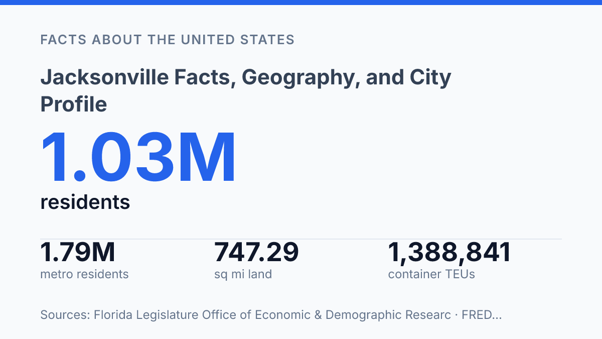
Jacksonville counted 1,032,601 residents on April 1, 2025, making it Florida’s largest municipality by state estimates and placing it in a different category from denser cities such as Miami or Tampa. The comparison is not only about population. The city covers 747.29 square miles of land, spans both banks of the 310-mile St. Johns River, and operates under a consolidated city-county structure that dates to 1968.
Those features make its rankings useful but sometimes misleading unless geography and government boundaries are considered together. This profile examines how the city’s northeastern Florida location, river access, land area, county relationship, and regional growth explain why its numbers can look unusually large, unusually spread out, or both at the same time.
Where Jacksonville sits in northeastern Florida
Few Florida city sites are as defined by a river bend as Jacksonville: the St. Johns River runs north through the peninsula, then turns east toward the Atlantic near the city. The city sits on the Atlantic coast of northeastern Florida, within Duval County, where river access and coastal proximity meet in a single location. According to the city’s official profile, the St. Johns River is 310 miles long, and its mouth lies about 20 miles from downtown, making the central city close to ocean shipping routes without being directly on the open beach.
That geography helps explain why the site developed as a regional transportation point rather than only as a seaside settlement. A navigable river created inland connections, while the nearby Atlantic opened access to coastal and international movement. The city’s position on both banks of the river also shaped its physical form, with bridges, port areas, riverfront districts, and road corridors all responding to the same basic fact: the settlement grew around a waterway that links interior Florida to the coast.
The same setting carries practical exposure. Northeastern Florida is not positioned like the state’s most hurricane-prone southern coast, but an Atlantic-facing location still leaves the area vulnerable to storm surge, heavy rain, river flooding, wind damage, and interruptions to port and road activity. The city’s map position therefore explains both its connectivity and some of its recurring weather-related risks, especially where tidal water, low-lying land, and riverfront infrastructure intersect.
Why Jacksonville stands out among Florida cities
A Florida city proper with more than one million residents is unusual, and Jacksonville reached 1,032,601 residents on April 1, 2025, according to the Florida Legislature Office of Economic & Demographic Research. That estimate made it the state’s most populous municipality, ahead of Florida cities that may be more internationally associated with tourism, finance, or media visibility. The Census Bureau’s Vintage 2025 city estimates placed the city at No. 11 among U.S. cities, with 1,017,689 residents as of July 1, 2025, reinforcing its status as a large city by national municipal rankings as well.
Population comparisons require a clear boundary between city proper and metropolitan area. A city proper is the population inside municipal limits, while a metro area includes a broader labor-market region made up of surrounding communities linked by commuting and economic activity. On that broader measure, Florida’s largest urban regions are not ranked the same way as their central municipalities, so being the state’s largest city proper does not automatically mean being the dominant metro by every indicator.
The scale of the municipality also affects how its numbers read. U.S. Census Bureau QuickFacts lists 747.29 square miles of land area and a population density of 1,270.7 people per square mile, a combination that differs sharply from smaller, denser Florida municipalities. This helps explain why the city can rank very high by municipal population while still containing a mix of urban, suburban, industrial, and lower-density areas within its limits.
The common shorthand “Jax” reflects the city’s regional identity, especially in local branding, transportation references, sports usage, and business names. The nickname is concise, but the population comparisons behind it are not: municipal size, metro scale, and density each answer a different question about the city’s standing among Florida places.
How Duval County and the city work together
A single 1968 governmental merger makes the city and Duval County overlap so closely that the municipal total represented 95.7% of county residents in July 2025 estimates. Jacksonville is the county seat, but its role is not limited to hosting county offices; since consolidation, the city has also functioned as a consolidated county-municipal government for most local purposes.
The merger combined the former city government with Duval County government, creating one primary local administration where many Florida communities would have separate municipal and county layers. According to an official city interlocal agreement, the consolidated government operates across Duval County, while Jacksonville Beach’s relationship to it is treated as that of a municipality to a county. That distinction matters because consolidation did not erase every municipal boundary inside the county, but it did change the default structure through which jurisdiction and services are organized.
In practical terms, consolidation affects which government is responsible for broad local functions such as countywide administration, service planning, infrastructure responsibilities, and jurisdictional coordination. A resident or business inside the consolidated area is generally dealing with a city government that also carries county-level responsibilities, rather than two fully separate governments dividing those roles. This structure helps explain why municipal statistics for the city often resemble county-scale figures more than the figures of a conventional city with a smaller footprint.
The arrangement simplified administration in some respects by placing many responsibilities under one consolidated authority, yet local identity remains layered. The city name carries the weight of a large municipality, while county traditions, independent beach communities, and older local distinctions continue to shape how the area is understood and governed.
What the city’s profile suggests about growth and identity
A city can rank like a major metropolis while still feeling unusually spread out, and that tension is central to how this north Florida municipality is understood. Its public profile is shaped by three forces working together: a coastal and riverfront setting, a city-proper population large enough to place it among the country’s biggest municipalities, and a consolidated structure that makes local boundaries behave differently from those of many peer cities. The result is a place often perceived less as a compact urban core than as a broad civic unit with urban, suburban, industrial, and coastal characteristics inside one municipal frame.
The city’s river identity is literal as well as symbolic: it lines both banks of the St. Johns River, which runs 310 miles north through Florida before turning east to the Atlantic at the city, with the river mouth about 20 miles from downtown, according to the city’s FY 2025–26 approved budget city profile. That geography helps explain why civic identity here is tied not only to population counts, but also to movement, waterfront land use, and regional access.
Growth reinforces that regional reading. The metropolitan area reached 1.7855 million residents in 2025, up from 1.6130 million in 2020, based on Federal Reserve Bank of St. Louis data using Census Bureau figures.
Port activity adds another layer: JAXPORT reported 1,388,841 container TEUs, 506,237 auto units, 10,230,114 tons of cargo, and 1,611 vessel calls in FY 2025. These figures place the city’s identity partly in logistics and regional connectivity, not just residential scale.
The practical implication of being a large consolidated city in Florida is that many civic questions are framed across a wide jurisdiction rather than within a narrowly drawn municipality. Planning, public services, land use, and identity all operate across a broader municipal geography than residents of many large U.S. cities might expect.
That makes the city feel expansive in everyday terms while remaining administratively unified in a way that is unusual among major American municipalities. In common speech and branding, that broad identity is often compressed into one short name: Jax.
Why the boundary question changes the comparison
The next layer of analysis is not whether the city is large, but which version of “large” is being measured. Population rank, land area, port activity, and metro growth each point to a different civic reality, and Jacksonville’s consolidated boundaries make those realities overlap more than they do in many U.S. cities.
That creates a practical consequence for comparisons: a statistic that describes the municipality may also describe most of Duval County, but not always the full regional economy. As growth continues across the metro area, the most reliable city profile will treat boundaries as part of the evidence rather than as a technical detail.
Frequently Asked Questions
Q: Where is Jacksonville located in Florida?
A: Jacksonville is on the Atlantic coast in northeastern Florida. Its position places it within the state’s northeastern corridor rather than on the Gulf side, which shapes its coastal access and regional connections.
Q: Is Jacksonville the largest city in Florida?
A: By city proper population, Jacksonville is the most populous city in Florida. That distinction refers to the boundaries of the city itself, not the wider metropolitan area.
Q: Why is Jacksonville sometimes called Jax?
A: Jax is a common colloquial nickname for Jacksonville. Shortened city names like this often develop in local speech and media because they are quicker to say and write.
Q: What county is Jacksonville in?
A: Jacksonville is the county seat of Duval County. The city and county were consolidated in 1968, which means local government functions are shared under a single consolidated structure.
Q: What does city-county consolidation mean for Jacksonville?
A: City-county consolidation means Jacksonville and Duval County merged their governments into one system in 1968. This arrangement affects how services, administration, and jurisdiction are organized across the area.