
Johnston Atoll lies 716 nautical miles southwest of Honolulu, but its significance extends far beyond its four small islands and remote position in the central Pacific. The refuge consists of Johnston, Sand, North, and East islands, on an atoll that began forming about 70 million years ago and was heavily reshaped during the 20th century. By 1964, military dredge-and-fill work had expanded Johnston Island from 46 acres to 596 acres and added two artificial islands.
That physical transformation helps explain why the atoll is both a protected wildlife refuge and a site with an unusually complex Cold War legacy. Its history includes high-altitude nuclear tests, chemical weapons storage and destruction, seabird recovery, restricted access, and renewed scientific mapping across the surrounding marine monument.
Where Johnston Atoll is and what it consists of
A land area of only 2.67 square kilometers sits inside a coral reef system more than 700 nautical miles from Honolulu, making the atoll physically tiny but geographically consequential. Johnston Atoll is an unincorporated U.S. territory in the central North Pacific, positioned southwest of Hawaii and far from other major landmasses. According to the U.S. Fish & Wildlife Service, the national wildlife refuge consists of four islands—Johnston, Sand, North, and East—located 716 nautical miles southwest of Honolulu, and the atoll began forming 70 million years ago.
The four main landforms are Johnston Island, Sand Island, Akau Island, and Hikina Island, with Akau and Hikina corresponding to the North and East island names used in some federal descriptions. Johnston Island is the principal landform, while the others are much smaller components of the same reef structure. Together, they occupy only a small fraction of the surrounding atoll environment, where coral reef, shallow marine habitat, and open ocean define the setting more than dry land does.
This imbalance between limited land and broad ocean setting helps explain why the place has drawn attention beyond its size. Its isolation made it a rare fixed U.S.-administered point in a remote part of the Pacific, while the reef system and surrounding waters gave it ecological importance separate from its administrative status. The atoll is therefore best understood not as a conventional island group, but as a small set of landforms embedded in a much larger marine system.
How the U.S. used the atoll during the Cold War
A site with only a small land footprint became one of the United States’ more consequential Cold War test and disposal locations because distance reduced immediate public exposure while allowing controlled access. During the twentieth century, U.S. military agencies developed the atoll as an isolated Pacific base, using its airfield, launch facilities, and restricted surrounding waters for defense work that would have been difficult to conduct near populated areas. That strategic value also explains why the site became associated less with conventional basing than with high-risk programs whose effects outlasted the missions themselves.
The best-known Cold War episode was Operation Fishbowl, a series of high-altitude nuclear tests conducted in 1962. According to the Nevada National Security Site, the successful tests from the Johnston area included Starfish Prime, launched from Johnston Island on July 9, 1962, and detonated at an altitude of 400 kilometers with a yield of 1.4 megatons.
The same source identifies four other rocket-launched high-altitude tests between October 20 and November 4, 1962. These tests reflected a specific Cold War concern: how nuclear detonations above the atmosphere might affect military systems, communications, and strategic operations.
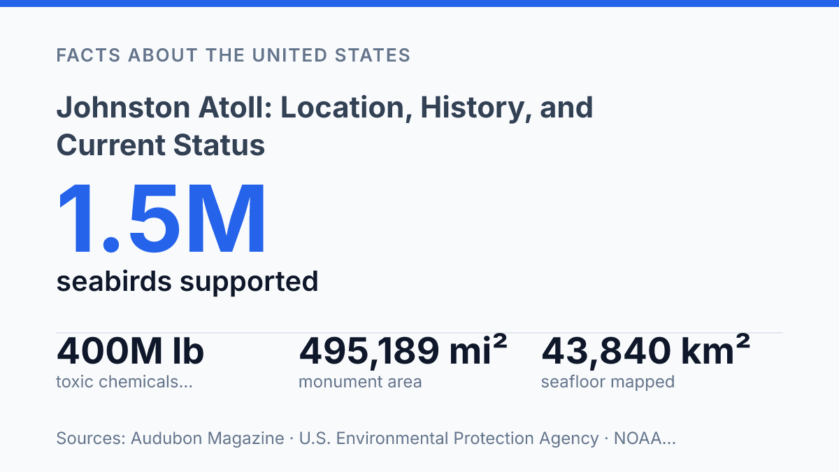
After the nuclear-testing era, the atoll’s defense role shifted toward weapons storage and destruction. The U.S. Army used the site for chemical munitions stockpiling and later for disposal through the Johnston Atoll Chemical Agent Disposal System, commonly known as JACADS. The U.S. Environmental Protection Agency archive states that JACADS construction began in 1985, the stockpile represented about 6% of the U.S. chemical arsenal in 1991, and the facility incinerated more than 400 million pounds of toxic chemicals before cleanup was completed in 2003.
The same isolation that made the atoll operationally useful also narrowed later options for remediation, monitoring, and access. Nuclear test debris, chemical weapons infrastructure, and contaminated materials turned a remote military asset into a long-term environmental management problem. As a result, much of the public understanding of the atoll is shaped by this Cold War legacy: not simply as a base, but as a place where strategic secrecy, technical experimentation, and hazardous cleanup became closely linked.
Why the atoll became a protected refuge
The formal conservation shift came only after federal managers had to treat the atoll as both habitat and a heavily modified former defense site. Control transferred from the military to the U.S. Fish and Wildlife Service in 2004, placing refuge management, wildlife protection, and habitat monitoring at the center of day-to-day decisions rather than defense operations. That administrative change did not erase the engineered character of the land, but it changed the purpose of management: the atoll became a place where access, maintenance, and research were evaluated through conservation and safety requirements.
Protection expanded again in 2009, when the atoll was included in the Pacific Remote Islands Marine National Monument. The designation mattered because the ecological value of the site extends beyond exposed land.
According to NOAA Fisheries, the broader protected marine area now recognized in agency materials as the Pacific Islands Heritage Marine National Monument contains extensive deepwater habitat, numerous seamounts, and reef communities; Johnston’s reef environment supports at least 45 coral species. This wider protection helps safeguard feeding, breeding, and shelter areas that cannot be managed effectively by focusing only on dry land.
Wildlife use explains why refuge status has practical consequences. Audubon reported in 2025 that the islands support about 1.5 million seabirds from 15 species, including large populations of red-footed boobies and a major share of the world’s red-tailed tropicbirds.
Seabirds depend on secure nesting ground and nearby marine food sources, while tropical fish and reef organisms rely on intact coral and lagoon habitats. Refuge and monument rules therefore protect connected systems: nesting sites, reefs, open-water foraging areas, and the conditions that allow wildlife populations to persist.
The result is a protected area with an unusual conservation profile. Many remote refuges are valued because they have limited human alteration; this one is valued despite substantial alteration. Its protected status reflects a practical judgment that damaged or managed places can still hold high ecological importance when they support rare habitat, concentrated wildlife populations, and marine systems with long-term scientific value.
Access, contamination, and present-day status
The practical status of the refuge is defined less by remoteness than by access control: it has zero permanent civilian residents and is not treated as a public destination. As of 2026, the national wildlife refuge is not open to general public visitation, and entry requires authorization through a Special Use Permit, according to the U.S. Fish and Wildlife Service. That system reflects both environmental sensitivity and the administrative limits of managing a remote former military site with no ordinary visitor infrastructure.
Access restrictions are tied to several overlapping constraints rather than a single rule. Legacy contamination concerns from earlier military activities still shape site management, even where cleanup work has removed major facilities or reduced known hazards.
Refuge operations must also account for unexploded or contaminated materials, invasive-species control, wildlife protection, and the high cost of moving personnel and equipment to an isolated central Pacific site. These conditions make routine public tourism impractical and help explain why visits are generally limited to permitted management, research, monitoring, or official activities.
Scientific work continues, but much of the newer information comes from offshore surveys rather than frequent on-island field presence. NOAA Ocean Exploration reported that two 2024 Okeanos Explorer expeditions near the refuge mapped 43,840 square kilometers of seafloor, about 10% of the Johnston unit of the monument, with emphasis on waters deeper than 200 meters. The scale of that offshore mapping shows how much remains to be documented, while also illustrating why direct access to the land area is far more controlled than access to remote-sensing and vessel-based research zones.
The result is a protected place that is physically present in federal conservation programs but largely absent from ordinary public experience. Isolation helps reduce disturbance to wildlife and limits casual exposure to legacy hazards, yet it also narrows the range of people who can observe conditions on the ground. Present-day use is therefore best understood as restricted refuge management, environmental oversight, and selective scientific access, not settlement, recreation, or normal island tourism.
Why restricted access still shapes the refuge
The atoll’s future is likely to be shaped less by ordinary visitation than by controlled science, long-term monitoring, and cautious decisions about any new federal use. Its protected status does not erase the practical demands created by contamination records, unexploded hazards, seabird nesting areas, and the sheer distance from Hawaiʻi.
The paused 2025 Rocket Cargo Vanguard assessment shows how even limited proposals can raise broader questions about risk, oversight, and the meaning of protection at a site with a military past. For Johnston Atoll, restricted access is not only an administrative rule; it is part of how the refuge’s ecological value and unresolved legacy are managed.
Frequently Asked Questions
Q: Where is Johnston Atoll located?
A: Johnston Atoll is a remote island group in the central Pacific Ocean, southwest of Hawaii. It is part of the United States Minor Outlying Islands and sits far from major shipping and population centers, which has shaped its historical use and restricted access.
Q: Why was Johnston Atoll used by the U.S. military?
A: Its isolation made it suitable for military operations, weapons testing, and storage activities that required separation from populated areas. That same isolation reduced direct civilian impact, but it also created long-term environmental management challenges.
Q: What happened to Johnston Atoll after military use ended?
A: After active military operations declined, the atoll entered a period of decommissioning and environmental cleanup. Access became highly restricted because of contamination concerns, infrastructure removal, and the need to manage remaining hazards safely.
Q: Is Johnston Atoll open to visitors?
A: No, public access is generally not permitted. The site remains restricted because of its history of military use and the presence of environmental and safety issues, which limits tourism and routine entry.
Q: What is the current status of Johnston Atoll today?
A: Johnston Atoll is no longer an active military base and is not a populated community. It is managed as a restricted federal area, with ongoing oversight tied to cleanup, habitat conditions, and long-term site control.