
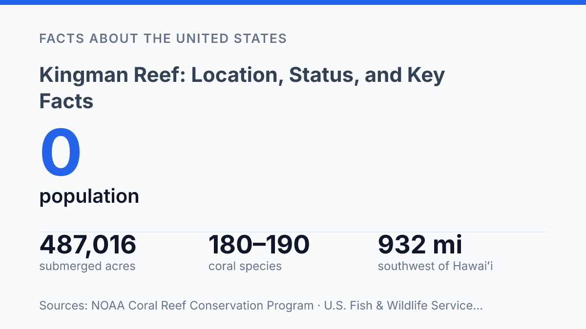
Kingman Reef occupies only 0.77 square miles of exposed land, yet its federal refuge covers 487,016 acres of submerged lands and waters around a remote point 932 miles southwest of Hawaiʻi. That contrast explains why such a small place appears in discussions of U.S. territory, Pacific geology, coral biodiversity, and marine protection.
Most of the reef sits less than 5 feet above sea level, and NOAA’s 2026 geodetic data maps it within a narrow band near 6.4°N and 162.4°W. Understanding the reef requires connecting four layers: mapped position, volcanic origin, legal status, and ecological value. Its significance is not based on settlement or land area, but on the scale of the ocean space attached to it and the unusually diverse reef system it helps anchor in the central Pacific.
Where the reef sits in the North Pacific
A reef can span 9.0 nautical miles east-west and 4.5 nautical miles north-south while showing only a small fraction of that footprint above the ocean surface. Kingman Reef lies in the North Pacific Ocean, roughly halfway between the Hawaiian Islands and American Samoa, placing it in one of the more remote central Pacific settings rather than near a continental margin or large island chain.
Its outline is commonly described as triangular, a useful detail because the reef is better understood as a broad marine feature than as a conventional island on a map. The U.S. Fish & Wildlife Service places it 932 miles southwest of Hawaiʻi and notes that most areas sit at less than 5 feet elevation. That low profile explains why its mapped scale can be misleading: the geographic footprint is sizable, but the visible land area is minimal and highly exposed to ocean conditions.
Measured north to south, the reef is about half its east-west width, giving the feature a compact but clearly elongated form within the surrounding Pacific waters. This combination of remoteness, triangular shape, and very low elevation is the essential geographic context for understanding why the reef appears prominent on nautical charts while remaining difficult to perceive as land in ordinary visual terms.
Why geologists classify it as an atoll
A feature with only 0.77 square miles of exposed land can still be classified by its submerged volcanic-and-coral framework rather than by what rises above the sea, according to the NOAA Coral Reef Conservation Program. That distinction is central to why the reef is described as largely submerged but geologically an atoll. Its scientific identity depends less on dry ground than on the reef platform, coral growth, and underlying geologic history that shape the feature below the surface.
Unlike a typical island, where exposed landforms dominate the map and support soils, vegetation, or settlement, this reef is primarily a marine structure. NOAA Coral Reef Conservation Program data describe far more shallow seafloor and reef habitat than exposed land, including reef and seafloor areas within the upper 100 feet of water. This means its physical form is better understood as a reef complex with minimal emergent land, not as a conventional island surrounded by reef.
Atoll classification also explains the ring-like pattern associated with the feature. In standard atoll development, coral growth forms around the margins of a volcanic island; over long periods, the volcanic foundation subsides or erodes while reef-building corals continue growing upward near the lighted surface. NOAA Fisheries describes the reef and nearby Palmyra as remnants of volcanoes dating from roughly 65–120 million years ago, which supports that interpretation. The result is a reef structure whose shape records an older volcanic origin even though the present-day land expression is small and discontinuous.
Status as an uninhabited U.S. territory
A place can appear in U.S. territorial lists while having a recorded population of zero, and the reef is one of the clearest examples of that distinction. NOAA’s Coral Reef Conservation Program lists it with no permanent residents, so its status is administrative rather than civic in the ordinary sense: it is tied to the United States as an outlying possession, but it does not function as a town, county, or inhabited island community.
That absence of settlement has practical consequences. There is no permanent local population to support schools, municipal services, elected local offices, housing, or a resident economy.
Governance and management are therefore handled through federal systems rather than through an on-site civil administration. In public records, the reef is often grouped with other U.S. minor outlying places because its legal status matters for jurisdiction, environmental protection, and federal responsibility even though day-to-day human activity is minimal.
Federal conservation status gives the area its clearest modern administrative footprint. The U.S. Fish & Wildlife Service states that Kingman Reef National Wildlife Refuge was established on January 18, 2001, covering submerged lands and waters around the reef rather than a settled land base. That arrangement reflects the main practical meaning of U.S. possession here: the United States can regulate access, research, and conservation responsibilities, while the site itself remains without a permanent settlement or local government.
Why this reef draws interest
A barely visible reef crest can still anchor nearly half a million acres of federally protected ocean. According to the U.S. Fish & Wildlife Service, the protected boundary includes 487,016 acres of submerged lands and waters, including more than 25,000 acres of coral reef habitat. That scale explains why public interest centers less on dry land than on the marine setting: the reef functions as a remote reference point for understanding central Pacific reef ecosystems under U.S. jurisdiction.
Scientific attention also stems from the condition of the ecosystem. Among U.S.-connected ocean places, the reef is valued as one of the least altered because isolation and formal protection have limited many forms of direct human disturbance. In practical terms, a comparatively less disturbed system can help researchers distinguish broad ocean pressures from effects more closely associated with intensive local use.
Isolation, however, also limits direct knowledge. Access depends on planned field operations rather than routine on-site observation, so monitoring tends to rely on vessel-based surveys, remote sensing, mapping records, and periodic scientific campaigns.
During a 2026 mission across remote U.S. Pacific reef sites, NOAA’s Ocean Acidification Program reported 141 fish surveys and 182 benthic surveys, along with 3D reef imaging and water sampling work. Those efforts show that the reef is not ignored, but they also illustrate the logistical demands of studying a place with few opportunities for continuous ground-level observation.
The same remoteness that helps preserve its natural state therefore creates the main constraint on research and public understanding. Its significance lies in that combination: a legally recognized U.S.-connected marine area with unusually limited alteration, set in a part of the Pacific where each well-documented survey can add meaningful evidence about reef condition, biodiversity, and ocean change.
What the protected footprint changes
The practical consequence of Kingman Reef’s status is that decisions about a nearly landless place affect a much wider marine area. Scientific surveys, refuge rules, and monument-level protections turn the reef into a reference point for measuring coral health in a remote part of the Pacific with limited direct human pressure. That does not make management simple.
Low elevation, isolation, and changing ocean chemistry mean that protection on paper must be matched by periodic field data, clear jurisdiction, and restraint in extractive use. The reef’s value is likely to grow less as a destination than as a benchmark: a small U.S. territory where the condition of corals, fish, and seawater can show what relative isolation still protects, and what it cannot.
Frequently Asked Questions
Q: Where is Kingman Reef located?
A: Kingman Reef lies in the North Pacific Ocean, roughly halfway between the Hawaiian Islands and American Samoa. It sits about 9.0 nautical miles east to west and 4.5 nautical miles north to south.
Q: Is Kingman Reef above water or underwater?
A: Kingman Reef is largely submerged, with only limited reef structure exposed at times. Its mostly underwater profile is one reason it is uninhabited and difficult to access.
Q: What shape is Kingman Reef?
A: The reef is triangle-shaped. That form is visible in its overall reef outline rather than in a broad landmass, since most of the feature lies below the surface.
Q: Is Kingman Reef an island or an atoll?
A: Geologically, Kingman Reef is an atoll, not a true island. The distinction matters because atolls are coral formations that can remain partly or mostly submerged instead of supporting extensive dry land.
Q: Can people live on Kingman Reef?
A: No permanent population lives on Kingman Reef. Its uninhabited status reflects its largely submerged nature and the lack of stable land for settlement.