
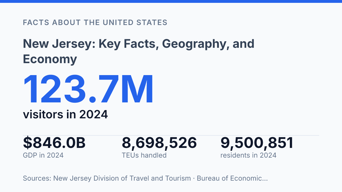
New Jersey had 9,500,851 residents on July 1, 2024, and its economy produced $846.0 billion in current-dollar GDP the same year, a scale that makes the state much larger than its land area suggests. The contrast is central to understanding the state: a compact Northeastern geography supports one of the country’s highest-income populations, a major trade gateway, dense urban and suburban settlement, and specialized industries tied to education and infrastructure.
Median household income reached $104,294 in 2024, while 44.5% of residents held a bachelor’s degree or higher, placing workforce quality near the center of its economic profile. The state’s position between New York and Philadelphia also changes the meaning of location, linking local communities to national logistics, tourism flows, and global commerce through assets such as the Port of New York–New Jersey.
State snapshot and core statistics
Few states compress as many people, borders, and transport routes into so little land as this one. According to U.S. Census Bureau QuickFacts, New Jersey had 9,500,851 residents as of July 1, 2024, up 2.3% from the April 2020 estimates base. That population sits within one of the smallest land areas of any U.S. state, making density a defining feature rather than a secondary detail.
The state entered the Union in 1787, making it one of the original states under the U.S. Constitution. Its capital is Trenton, which serves as the seat of state government even though it is not the largest municipality. That distinction matters in a snapshot because political, demographic, and economic weight are distributed across multiple urban and suburban centers rather than concentrated in a single dominant capital city.
Geographically, the state belongs to the Northeast and sits between several of the country’s most consequential regional markets. It borders New York to the north and northeast, Pennsylvania to the west across the Delaware River, and Delaware to the southwest. This compact position can make the state look simple on a map, but its dense settlement pattern and placement between major metropolitan corridors help explain why its transportation systems, labor markets, and commercial role carry weight beyond its physical size.
Where New Jersey sits and why location matters
Markets within a day’s drive of the state contain 31.1% of the U.S. population, according to the NJ Department of Labor and Workforce Development in 2025, which helps explain why its location carries unusual economic weight. The same source identified 39,000 miles of public roadways and five Foreign Trade Zones, indicating a geography organized around movement as much as settlement. Short distances to major consumer markets make warehousing, airport access, port-related activity, and commuter flows part of the same spatial pattern rather than separate issues.
The Atlantic coastline is one of the state’s defining physical features, with the Jersey Shore forming a long coastal zone of barrier islands, bays, resort communities, and year-round towns. On the western side, the Delaware River provides a separate geographic axis for communities, industry, and transport. These water edges help explain why settlement patterns are not only oriented toward nearby metropolitan centers but also toward river crossings, coastal access, and maritime commerce.
Inland geography changes quickly. The Pine Barrens occupy a large forested portion of the southern interior, creating a sharp contrast with the more urbanized northern corridor near New York City. That contrast matters because the state contains both protected or lower-density environments and intensely developed commuter zones within short driving distances, placing environmental management, suburban growth, and transportation demand in close proximity.
Major routes tie these regions together, especially the New Jersey Turnpike, the Garden State Parkway, and access to Newark Liberty International Airport. The Turnpike functions as a key north-south freight and commuter route through industrial, warehouse, and suburban areas, while the Parkway is closely associated with shore-bound and regional travel. The benefit is exceptional connectivity, but the same geography also concentrates heavy road and rail traffic, shaping daily commutes, freight schedules, and the practical experience of moving through the state.
Population, cities, and local profile
No U.S. state packs more residents into each square mile, using Census Bureau density measures, and that concentration is not confined to its best-known city centers. Newark remains the largest city, with 317,303 residents as of July 1, 2024, according to U.S. Census Bureau QuickFacts. Jersey City and Paterson are also major urban centers, especially within the northern metropolitan belt where municipal boundaries are close together and employment, housing, and transit markets often function across city lines.
The density pattern is produced as much by suburban settlement as by central-city population. Northern and central suburban counties contain many closely spaced municipalities, commuter rail stops, office parks, schools, and retail corridors, creating a form of settlement that is less dominated by a single downtown than by overlapping local centers. This helps explain why the state can support extensive labor-market connectivity while still facing persistent pressure on housing costs, roads, and local services.
Commuting patterns tie many communities to New York City and Philadelphia rather than to a single in-state hub. In the northeast, proximity to New York’s job market raises demand for housing near rail, bus, and highway routes, while employers draw from a workforce spread across city and suburban municipalities.
In the southwest, Philadelphia exerts a similar influence, shaping residential demand and daily travel patterns in nearby communities. These cross-border labor flows make local housing markets sensitive to wages, office patterns, and transit access in neighboring metropolitan economies.
Demographic indicators also point to a high-income, highly educated population profile. The state’s median household income was $104,294 in 2024, and 44.5% of residents age 25 and older held a bachelor’s degree or higher, according to U.S. Census Bureau ACS data. Those figures help explain the depth of the professional labor pool, but they also sit alongside affordability pressures in densely settled areas where land, housing, and transportation capacity are heavily contested.
Major industries and economic drivers
The state economy reached $846.0 billion in current-dollar GDP in 2024, according to the U.S. Bureau of Economic Analysis via FRED, giving a compact state an output profile comparable to much larger places. That scale reflects a mix of high-value services, manufacturing, trade, health care, tourism, and specialized research activity rather than dependence on a single dominant industry.
Life sciences are one of the clearest examples of that specialization. Pharmaceutical, biotechnology, and medical technology employers are concentrated heavily in central and northern counties, where research campuses, hospitals, universities, and executive offices sit within reach of large labor markets.
Firms such as Johnson & Johnson and Merck anchor a broader cluster of drug development, diagnostics, clinical research, and related professional services. The NJ Department of Labor and Workforce Development reported 89,005 life-sciences jobs using the most recent available 2023 data, with 70% of that workforce holding a bachelor’s degree or higher, indicating that the sector is closely tied to advanced training and technical labor supply.
Trade and distribution form a second major pillar, centered on Port Newark-Elizabeth and the wider NY-NJ port complex. The Port Authority reported that the port handled 8,698,526 TEUs in 2024, ranked third in the United States by container volume, and moved about $246 billion in goods. Those figures show why warehousing, trucking, freight forwarding, customs brokerage, cold storage, and retail distribution are not peripheral activities; they are core parts of the state’s connection to national and global supply chains.
Agriculture remains smaller in dollar terms than finance, health care, logistics, or life sciences, but it gives the economy a distinct regional dimension. Southern counties produce crops and horticultural products associated with sandy soils, open acreage, and long-established farm communities, including blueberries, cranberries, nursery plants, vegetables, and greenhouse products. This output supports food processing, seasonal labor, farm markets, and wholesale distribution, linking rural counties to the same consumer markets served by the state’s larger trade networks.
The breadth of the economy is best understood as complementary rather than accidental. Research-heavy industries depend on skilled workers and institutional networks, logistics depends on port and freight capacity, finance and professional services draw on metropolitan business demand, and agriculture supplies specialized products from less urbanized counties. For a small state, the result is an unusually diversified economic base whose strongest sectors remain closely connected to infrastructure, labor access, and proximity to major metro markets.
Where the state’s reach becomes clearest
The state is best understood as a compact economy with unusually broad reach. Its next economic question is less whether it has major assets than how those assets continue to interact as freight networks, visitor spending, and specialized labor demand shift. A port handling millions of TEUs, a tourism sector tied to roughly 1 in 12 statewide jobs, and a life sciences workforce with high educational attainment do not operate in isolation.
They depend on the same transportation corridors, population base, and regional market access. For future comparisons, the most revealing indicators will not be land area or city size alone, but whether income, GDP, port volume, and skilled employment keep rising together.
Frequently Asked Questions
Q: What is New Jersey best known for?
A: New Jersey is known for its dense population, strong transportation links, and major urban-suburban corridor between New York City and Philadelphia. It also has a large industrial and service-based economy, with significant roles in pharmaceuticals, logistics, finance, and food production.
Q: What is the geography of New Jersey like?
A: The state is small in area but highly varied, with Atlantic coastline, pine forests, wetlands, rolling hills, and river valleys. Its location between major Northeast cities has shaped settlement patterns, commuting, and land use.
Q: Why is New Jersey considered an important economic state?
A: New Jersey has a diverse economy supported by manufacturing, healthcare, pharmaceuticals, transportation, and financial services. Its position near major ports, airports, highways, and consumer markets gives it an advantage for trade and distribution.
Q: What are some major cities or regions in New Jersey?
A: Major population and economic centers include Newark, Jersey City, Paterson, Trenton, and the communities along the Jersey Shore. Northern New Jersey is closely tied to the New York metropolitan area, while southern parts of the state are generally less dense and more suburban or rural.
Q: How does New Jersey’s location affect its economy and daily life?
A: Its location in the Northeast corridor supports commuting, interstate commerce, and access to two of the largest metro areas in the United States. That proximity increases opportunity but also contributes to high land costs, traffic pressure, and intense competition for space.