
The US Virgin Islands are a 134.4-square-mile U.S. territory made up of St. Croix, St. Thomas, St. John, Water Island, and about 50 smaller islands roughly 43 miles from Puerto Rico. That compact geography carries more political, historical, and travel significance than its size suggests. The islands operate on Atlantic Time with no daylight saving time, send travelers through U.S.-linked systems, and remain outside the states while maintaining their own elected legislature.
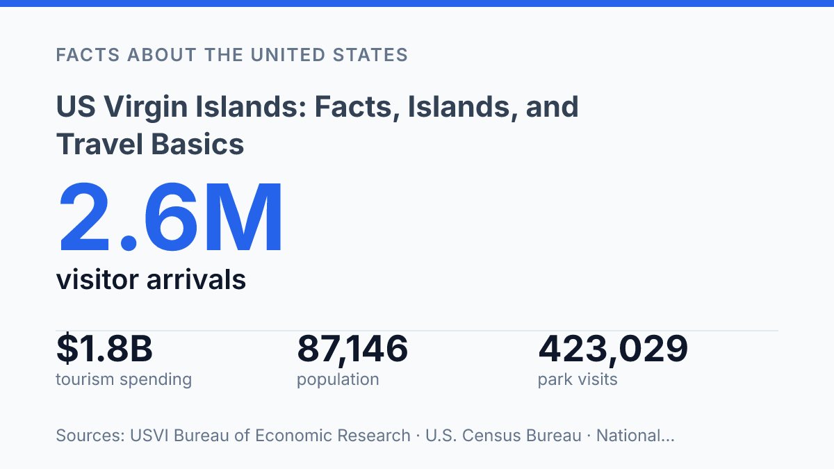
Their modern status traces to a 1917 transfer from Denmark, when the United States paid $25 million in gold coin. Tourism now gives the territory much of its public visibility: arrivals reached 2.6 million in 2024, above both 2023 and pre-2020 levels. Understanding the islands requires connecting those facts rather than treating them as trivia, because geography, governance, history, and visitor rules all shape how the territory functions.
Where the islands are and what they include
Only about 43 miles separate the US Virgin Islands from Puerto Rico, placing the territory close to the eastern edge of the Greater Antilles rather than deep in the central Caribbean. It lies in the Caribbean Sea, east of Puerto Rico and west of the British Virgin Islands, a position that explains both its geographic proximity to Puerto Rico and its association with the wider Virgin Islands chain.
The three main islands are Saint Thomas, Saint John, and Saint Croix, each forming part of the same territorial unit but sitting as separate islands rather than as one continuous landmass. A fuller geographic count includes Water Island as a fourth major island, along with many smaller islets and cays; according to the ASTDD / USVI Oral Health Needs Assessment, the territory consists of St. Croix, St. Thomas, St. John, and Water Island plus about 50 smaller, mostly uninhabited islands, sits roughly 43 miles from Puerto Rico, and uses Atlantic Time without daylight saving time.
Politically, the islands are an unincorporated organized U.S. territory, meaning they are under U.S. sovereignty and have an established local government structure, but they are not a state. That status matters for how the territory is understood: residents are connected to the United States through territorial law and federal authority, yet they do not have the same national voting rights as residents of the states, including voting representation in Congress. The geography and status are therefore linked in practical terms, because the islands are both Caribbean neighbors to Puerto Rico and a distinct U.S. jurisdiction within the Virgin Islands chain.
How the territory became American territory
A single payment of $25 million in gold coin marked the legal break between Danish rule and American sovereignty on March 31, 1917. According to the Office of the Historian at the U.S. Department of State, Denmark ceded the islands under a convention dated August 4, 1916; ratifications were exchanged on January 17, 1917, and the formal transfer took place the same day the United States made the payment. That sequence makes 1917 the decisive year in the territory’s modern political history, rather than a gradual absorption into U.S. control.
Before the transfer, the islands were known as the Danish West Indies, a colonial possession shaped by European competition, Atlantic trade, and plantation agriculture. Danish administration had developed over centuries through chartered colonial ventures and imperial governance, with sugar production and enslaved African labor central to the colonial economy. The name itself reflected Denmark’s place in the Caribbean colonial system, even though the islands’ population and culture were never simply Danish in character.
The purchase is often explained in strategic terms because it occurred during World War I, when the United States had strong reasons to secure Caribbean sea lanes and prevent another power from gaining a foothold near key maritime routes. That context helps explain why the transaction was a formal treaty-based sale rather than an internal political change. The transfer on March 31, 1917 established the basis for later U.S. administration, while the older colonial layer did not disappear.
This dual inheritance remains visible in the built environment, place names, archival records, and cultural memory. The islands became American territory through a specific diplomatic transaction, but the Danish colonial period left traces that still distinguish them from territories shaped only by Spanish, British, French, or Dutch rule.
Government, population, and official facts
Charlotte Amalie gives the territory a capital city with a larger administrative role than its size alone suggests. Located on Saint Thomas, it is the seat of territorial government and the place most often associated with official administration, courts, and inter-island public affairs. That central role does not mean all civic life is concentrated on one island, but it does make Saint Thomas the main reference point for many government functions.
Population data show a relatively small jurisdiction by U.S. standards. According to the U.S. Census Bureau’s most recent decennial figure for the United States Virgin Islands, the population was 87,146 in 2020. That count matters because many public services, federal programs, infrastructure plans, and demographic comparisons use Census Bureau figures as a baseline, especially where annual local population estimates are less prominent than in the states.
Local self-government is organized under the Revised Organic Act of 1954, which remains a central legal framework for the territory. The Legislature of the Virgin Islands has 15 senators serving two-year terms, while the executive branch is led by an elected governor. This structure gives residents local representation over many internal matters, even though the territory’s relationship with Congress and federal law differs from that of a state.
The U.S. dollar is the currency used throughout the territory, and federal law applies in many areas, including federal courts, national regulations, and programs administered by U.S. agencies. At the same time, territorial statutes, local courts, and locally elected officials shape everyday rules on matters such as public services, business regulation, and local governance. The result is a civic system that is recognizably American in currency and federal connection, but territorially distinct in legal authority and political status.
What visitors should know before going
Visitor arrivals reached 2.6 million in 2024, according to the USVI Bureau of Economic Research, a scale that reflects how much of the territory’s visitor economy is built around easy air and sea access. The main air gateways are Cyril E. King Airport on St. Thomas and Henry E. Rohlsen Airport on St. Croix, with the former handling much of the traffic for travelers continuing to nearby islands by ferry or smaller aircraft. Cruise travel is concentrated around the ports at Charlotte Amalie and Frederiksted, which serve different parts of the territory’s tourism market and help explain why short-stay excursion spending is a major part of visitor revenue.
Beaches and water access remain the clearest reasons visitors choose the islands, but the appeal is broader than resort travel. Snorkeling, sailing, diving, and calm-water beach visits are central to many trips, while Virgin Islands National Park gives St. John a protected-land draw that is unusual for a Caribbean destination. The National Park Service reported 423,029 recreation visits to the park in 2024 and notes that it covers 7,259 terrestrial acres, or about 60% of St. John’s land mass, making conservation access a defining part of that island’s visitor profile.
Entry logistics are relatively simple for U.S. citizens traveling from the mainland because a passport is not required, according to Visit USVI. Air passengers still need acceptable identification for TSA screening, and since May 7, 2025, travelers aged 18 and older have needed a REAL ID-compliant license or another TSA-accepted document at airport checkpoints. Non-U.S. citizens and travelers arriving through foreign points should check the rules that apply to their nationality and route, since those requirements can differ from domestic U.S. travel procedures.
Trip timing is shaped by practical movement between islands as much as by entry rules. Ferries, charter boats, inter-island flights, and seaplane services can make multi-island travel manageable, but schedules, weather, and luggage constraints may affect how much can reasonably fit into a short stay. Hurricane season in the Atlantic runs from June through November, so late-summer and autumn travel can require closer attention to forecasts, insurance terms, ferry changes, and airline rebooking policies.
Why the territory’s status matters in practice
The most useful way to understand the territory is to treat its legal status and island geography as practical facts, not background details. A traveler may not need a passport when arriving from the mainland or Puerto Rico, yet REAL ID rules still affect airport screening. St. John may be associated with protected land, yet Virgin Islands National Park also supports local jobs and spending.
Tourism growth points to economic strength, but it also makes infrastructure, conservation, and public services more visible parts of the visitor experience. The territory’s small land area makes these connections unusually direct: a policy rule, ferry route, park boundary, or seasonal arrival trend can shape daily movement across the islands.
Frequently Asked Questions
Q: What islands make up the US Virgin Islands?
A: The territory consists of three main islands: St. Thomas, St. John, and St. Croix. Several smaller cays and islets are also part of the group, but the three main islands account for most visitor activity and population.
Q: Do travelers need a passport to visit the US Virgin Islands?
A: U.S. citizens generally do not need a passport when traveling directly from the mainland United States to the territory. A government-issued photo ID is typically sufficient, although travel documents may be required for some connecting itineraries.
Q: What is the best island in the US Virgin Islands for first-time visitors?
A: St. Thomas is often the easiest starting point because it has the busiest airport, the most frequent ferry connections, and the widest range of hotels and services. St. John is better known for beaches and national park access, while St. Croix offers a quieter, more spread-out experience.
Q: Is it expensive to travel to the US Virgin Islands?
A: Prices are often higher than on the mainland because many goods must be imported. Accommodation, transportation, and dining costs can vary widely by island and season, so early booking usually helps control the total trip cost.
Q: What is the weather like in the US Virgin Islands?
A: The islands have a tropical climate with warm temperatures throughout the year and a distinct wetter season in late summer and fall. Hurricane season runs from June through November, which can affect travel planning and insurance decisions.