
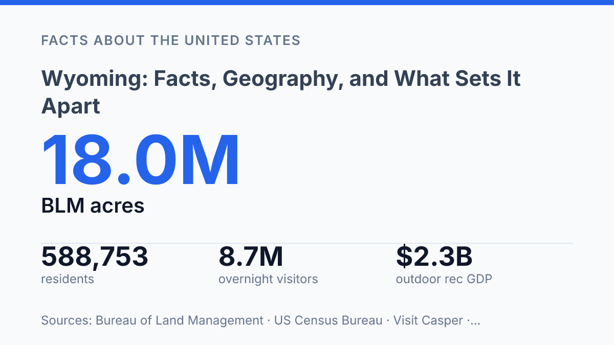
Wyoming had an estimated 588,753 residents in 2025 across 97,088.76 square miles, a density of just 5.9 people per square mile according to U.S. Census Bureau QuickFacts. That ratio explains more about the state than population rank alone: large distances, federal land ownership, ranch acreage, mineral production, and seasonal visitor flows all shape how communities function. The same place that supports 10,500 farm operations on 28.8 million acres also drew 8.1 million national park visitors in 2024, while supplying almost two-fifths of all U.S. coal mined.
These contrasts make the state difficult to reduce to a single identity. Its geography helps explain why settlements remain far apart, why public access is central to daily life and tourism, and why energy, livestock, and recreation carry unusual weight in the economy.
Wyoming at a glance
Fewer than six people occupy each square mile on average in Wyoming, a scale that makes distance one of the state’s basic civic facts. The state entered the Union on July 10, 1890, and Cheyenne is both the capital and largest city, with Casper serving as another major population and commercial center. That distribution gives the state a different reference point from places where one large metropolitan area concentrates most public institutions, employment, and transportation links.
The U.S. Census Bureau QuickFacts, 2025 estimate placed the population at 588,753 residents on July 1, 2025, up 2.1% from April 2020, across 97,088.76 square miles, or 5.9 people per square mile. The population figure is small in absolute terms, but the land area is vast enough that density becomes one of the most useful ways to understand the state.
Low density affects more than settlement patterns. Public services often cover long routes, regional hospitals and courts serve wide territories, and travel between communities can involve distances that would cross multiple counties in denser states.
Representation also has a distinctive shape: a small population gives the state limited delegation size in the U.S. House, while its Senate representation is equal to that of every other state. The result is a political and administrative profile defined as much by space as by population count.
Why the state is sparsely populated
Among the 50 states, it ranks last in total population despite occupying an area larger than the United Kingdom. That contrast is not just a demographic curiosity; it reflects a settlement pattern shaped by mountains, altitude, dry plains, and land uses that require space rather than density.
The Rocky Mountains dominate the western and northwestern parts of the state, where steep terrain, protected watersheds, and high-elevation valleys limit the amount of land suited to dense urban growth. Settlement has tended to cluster where transportation routes, water, and flatter land coincide, rather than spreading evenly across the map. In the east and center, the high plains and interior basins provide more open terrain, but they also favor widely spaced ranches, energy sites, and small service towns over large metropolitan areas.
Climate reinforces that pattern. The state has an average elevation of roughly 6,700 feet, among the highest state averages in the country, which contributes to cold winters, shorter growing seasons, and weather that can make long-distance travel difficult.
Much of the state is also semiarid, so reliable water access has historically mattered as much as open land. Strong winds on exposed plains and winter storms at higher elevations further shape where roads, housing, and year-round economic activity can be concentrated.
Land use helps explain why low population density is persistent rather than accidental. Wide-open rangeland supports grazing across large acreages, while extensive public and resource lands are managed for purposes that do not resemble suburban expansion. The same conditions that constrain dense settlement also support ranching, open-space conservation, energy production, and outdoor access, so sparse settlement is better understood as a product of geography and land use than as simple emptiness.
Public lands, parks, and outdoor access
A single federal agency manages 18,049,385 acres in the state, according to Bureau of Land Management Public Land Statistics for 2024. That figure covers only BLM-administered land; national forests, national parks, wildlife refuges, and other federal holdings bring federally managed property to a very large share of the state’s land base. This ownership pattern makes land policy inseparable from recreation, grazing, habitat management, mineral leasing, and county finance.
Yellowstone National Park and Grand Teton National Park give the northwestern part of the state global visibility, but they also sit within a broader federal land system. Park boundaries protect geothermal basins, mountain ecosystems, river corridors, and wildlife migration routes while concentrating visitor spending in gateway communities.
The National Park Service reported that 8.1 million visits to national parks in the state generated $1.2 billion in visitor spending and a $1.5 billion economic benefit in 2024. The figures show that protected land is not simply removed from the economy; it supports a recreation and service economy tied to scenery, wildlife, trails, and public access.
Beyond the parks, public lands function as both working ground and recreational space. BLM and Forest Service areas support permitted cattle grazing, big-game hunting, fishing, hiking, camping, horseback travel, off-road access where allowed, and seasonal outfitting. These uses depend on access rules, seasonal closures, habitat conditions, and permit systems, so the practical meaning of public access varies by place and land manager.
The same access creates persistent policy tradeoffs. Grazing permits can support ranching continuity, while conservation rules may restrict timing or intensity to protect riparian areas and wildlife.
Energy development can generate royalties and jobs, but roads, leases, and transmission routes may conflict with habitat or recreation values. Because large federal holdings are not managed like private taxable property, local governments also weigh the benefits of visitors and federal payments against limits on conventional property-tax growth.
Energy, ranching, and the state economy
A state that produces about 12 times more energy than it consumes is exposed not only to local demand but to national fuel markets. According to the U.S. Energy Information Administration, the state was the fourth-largest net energy supplier among states and, in 2024, supplied almost two-fifths of all coal mined in the United States. Coal, oil, and natural gas therefore matter beyond direct extraction jobs: they support rail movement, equipment services, engineering work, lease income, and public revenue tied to mineral production and property values.
Coal remains central, but the power mix shows measurable change. The EIA reported that coal produced 60% of in-state net electricity generation in 2024, down from 87% a decade earlier, while wind reached 23%.
The state also sent almost three-fifths of the electricity it generated to customers elsewhere, making energy not just a local utility issue but an export industry. That structure helps explain why shifts in power demand, fuel prices, federal regulations, and utility purchasing decisions can affect communities far from the mines and gas fields themselves.
Ranching is the other long-running economic use that links land, labor, and exports. USDA/NASS reported 10,500 farm operations working 28.8 million acres in its 2024 State Agriculture Overview, with 1.22 million cattle and calves on hand as of January 1, 2025.
Those figures show that livestock production occupies a scale far larger than its direct employment numbers might suggest. Cattle and calves move through regional and national beef supply chains, so ranch income depends on grazing conditions, feed costs, herd prices, transportation, and processing capacity beyond the state line.
This combination gives the economy a distinctive profile: high output from relatively few people, heavy dependence on commodities, and a public sector partly shaped by mineral-related revenue. Compared with larger and more diversified states, fewer industries carry more weight in local tax bases and county employment. The advantage is that energy and livestock can generate substantial value from dispersed land and small communities; the vulnerability is that downturns in coal demand, oil and gas prices, drought, or cattle markets can be felt quickly in budgets, payrolls, and main-street business activity.
What the land-to-population ratio will keep shaping
The most durable pressure on the state is not simple growth or decline, but allocation: how much land remains available for grazing, conservation, recreation, housing, transmission lines, and energy production. Visitor spending and outdoor recreation can expand without requiring dense settlement, yet they also concentrate costs in gateway towns, roads, search-and-rescue systems, and seasonal workforces. Energy presents a similar tension.
Coal still anchors power generation and public revenue, while wind and exported electricity show that the state’s role in national supply is changing rather than disappearing. Future debates are likely to turn less on whether the state is remote and more on who benefits from its space, access, and resources.
Frequently Asked Questions
Q: What is Wyoming known for besides Yellowstone?
A: Wyoming is known for its wide-open spaces, low population density, and major outdoor recreation. It also stands out for ranching, energy production, and access to nationally significant public lands. These factors shape both the state’s economy and its identity.
Q: How large is Wyoming compared with its population?
A: Wyoming is one of the largest U.S. states by area, but it has one of the smallest populations. That combination means very low population density across a large amount of land. The result is a state where towns are widely spaced and much of the territory remains sparsely developed.
Q: Why does Wyoming have so much public land?
A: A large share of Wyoming is federally managed, which reflects the state’s geography and settlement history. Public land supports grazing, wildlife habitat, mining, recreation, and conservation. It also affects land use decisions because state, federal, and private interests often overlap.
Q: What kind of climate does Wyoming have?
A: Wyoming has a mostly semi-arid climate, with cold winters, dry air, and strong regional variation caused by elevation and mountain ranges. Conditions can change sharply between basins, plains, and high country. That variability affects agriculture, travel, and outdoor access throughout the year.
Q: What are the main industries in Wyoming?
A: Energy, ranching, tourism, and mineral extraction are central to Wyoming’s economy. Natural resources have long played an outsized role because of the state’s land base and population size. In practice, this makes the economy closely tied to commodity cycles and public-land policy.