
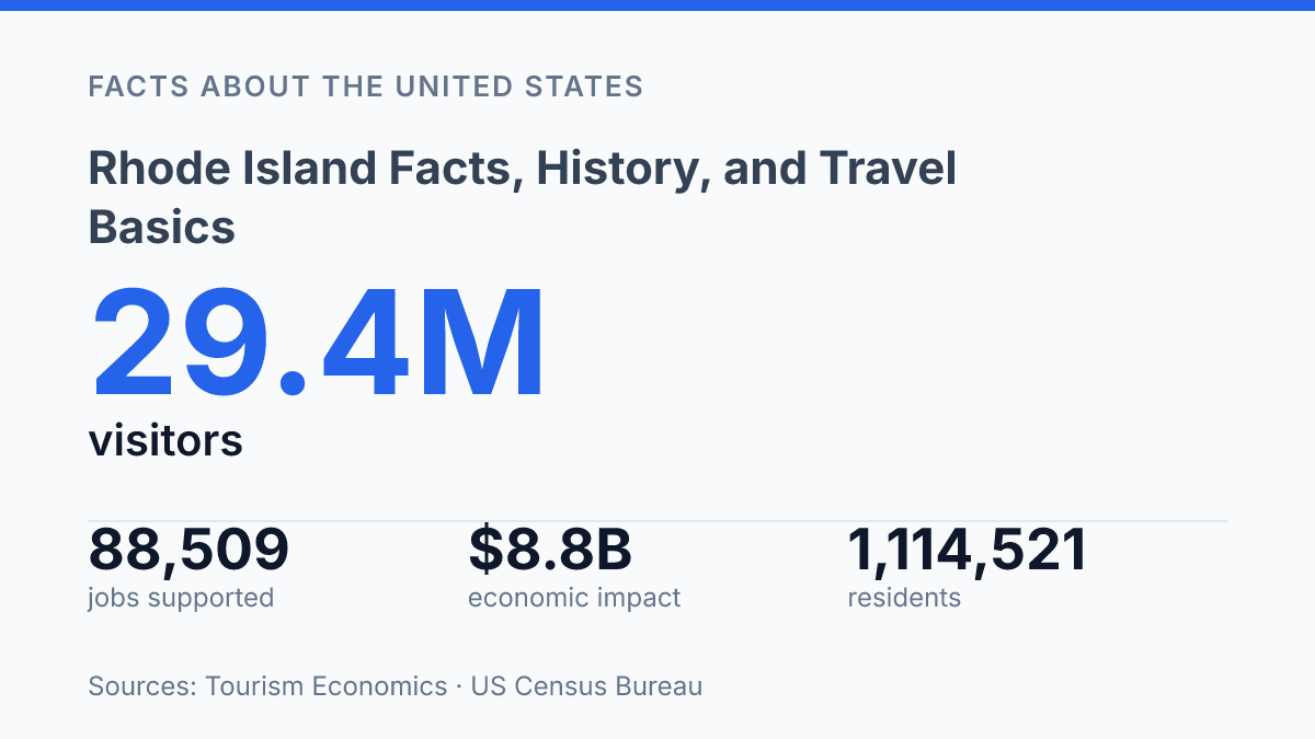
Rhode Island fits 1,114,521 residents into 1,033.89 square miles, making scale the first fact that explains much of the state’s history, economy, and travel patterns. Its compact size can mislead: the state combines a founding story tied to Roger Williams and religious liberty, a coastline promoted at more than 400 miles, and a capital city where more than half of residents age 5 and older spoke a language other than English at home in 2020–2024.
The “Ocean State” label, first placed on license plates in 1972, is not just branding; it reflects how maritime identity, settlement, tourism, and daily movement are closely connected. This guide explains where the state sits, how its name and institutions developed, how its economy and cities function, and what first-time visitors usually encounter.
Where it sits and what makes it distinct
A state barely larger than some counties contains open Atlantic shore, a major estuary, islands, and inland towns within a compact New England footprint. Rhode Island sits in southern New England, bordered by Massachusetts to the north and east and Connecticut to the west, with the Atlantic Ocean shaping its southern edge. Its position places it between larger regional neighbors while keeping most places in the state physically close to saltwater.
Rhode Island is the smallest U.S. state by total area, at about 1,214 square miles, but that figure can obscure how crowded and spatially varied it is. According to the U.S. Census Bureau QuickFacts, 2026/Vintage, the state had 1,114,521 residents in 2025, a 2020 land area of 1,033.89 square miles, and 1,061.4 people per square mile in 2020. That density helps explain why short distances can connect urban neighborhoods, older industrial corridors, rural edges, and shore communities rather than a single uniform setting.
The main physical organizer is Narragansett Bay, which cuts deep into the state and separates many communities by water as much as by road distance. Islands and peninsulas break up the bay, while the Atlantic coastline gives the state a distinctly maritime edge. The result is a place whose size is simple on a map but less simple on the ground: coastal exposure, sheltered bay waters, and inland towns create a sharper geographic mix than its area alone suggests.
How the state was founded and named
The colony’s official identity grew out of an exile’s settlement and an island name whose origin is still partly disputed. Roger Williams, a minister banished from Massachusetts Bay, founded Providence in 1636 after advancing a religious-liberty argument that went beyond ordinary toleration for the period. According to the state Department of State, Williams brought that vision to the colony in 1636, and the later 1663 Royal Charter formally guaranteed religious freedom.
Providence became closely associated with liberty of conscience because Williams rejected compulsory religious conformity and argued for a civil state separate from church authority. That principle made the colony a refuge for dissenters who faced punishment or exclusion elsewhere in New England, including people whose religious views did not fit Puritan orthodoxy. The reputation was not unlimited, since seventeenth-century settlement still involved disputes over land, authority, and relations with Indigenous peoples, but the legal protection of belief marked the colony as unusual in English America.
The name developed from two related colonial identities rather than from a single founding act. “Providence Plantations” referred to Williams’s mainland settlement and its associated communities, while the island name was applied to Aquidneck Island, with early explanations often linking it either to Dutch “Roodt Eylandt,” or “red island,” or to comparisons with the Greek island of Rhodes. Over time, the combined wording became the colony’s formal style.
That long-form name, “State of Rhode Island and Providence Plantations,” dated to the 1663 charter, according to the state Department of State. It preserved both strands of origin: the island designation and the Providence settlements rooted in Williams’s religious-liberty experiment. The wording remained the state’s official name for centuries before voters shortened it in 2020 by removing “and Providence Plantations,” a modern change to a colonial-era title rather than a change in the founding story itself.
Economy, cities, and daily life
More than half of Providence residents age 5 and older, 50.4% in 2020–2024, spoke a language other than English at home, according to U.S. Census Bureau QuickFacts. The city is both the capital and the largest municipality, with an estimated 195,310 residents in 2025. Its role is larger than its residential count suggests because state government, hospitals, universities, courts, finance offices, and cultural institutions all draw workers, students, patients, and visitors into the city on a daily basis.
Other population centers serve different functions within the same urban network. Warwick and Cranston are major residential and commercial communities tied closely to the Providence labor market, with shopping districts, municipal services, and commuter routes shaping much of daily life.
Newport has a different profile: it is a major population center, but its economy is especially visible through tourism, hospitality, preservation, marine activity, and seasonal employment. That mix gives the state a pattern in which work, services, and housing demand are spread across several cities, yet still concentrated enough that commuting corridors and housing costs are recurring practical concerns.
Recent output data show an economy broader than its size might imply. Current-dollar state GDP reached $83.956 billion in 2025, up from $80.381 billion in 2024, according to Federal Reserve Bank of St. Louis data from the U.S. Bureau of Economic Analysis. Healthcare and education are central because of the concentration of hospitals, colleges, and professional services around the capital region, while tourism and other service industries support employment in coastal, urban, restaurant, retail, lodging, and entertainment settings.
Tourism Economics and the state commerce agency reported 29.4 million visitors in 2024, with $6.0 billion in visitor spending and 88,509 jobs supported, equal to about 13.0% of all state jobs. The result is a diversified service-based economy, but one whose strongest job clusters still pull many residents toward a small number of metro-area centers.
What visitors typically see first
The “Ocean State” label is tied to ordinary travel experience as much as branding: RI.gov says the phrase first appeared on license plates in 1972, and the tourism division promotes more than 400 miles of coastline. That scale helps explain why many first impressions are maritime, even when a trip begins inland at an airport, rail station, or downtown hotel. Coastal drives, harbor views, ferries, and beach traffic shape the way visitors encounter the state more than a single monument or central resort district.
Newport is usually the best-known historic stop because its Gilded Age mansions sit close to an active harbor and exposed Atlantic edges. House museums such as The Breakers and streets around Bellevue Avenue connect the city’s elite summer-colony history with a compact coastal setting, so architecture, sailing culture, and shoreline walks tend to be experienced together rather than as separate attractions. This combination is why Newport often functions as the state’s shorthand for preserved wealth, maritime recreation, and historic tourism.
Providence presents a different first view, centered on arts venues, restaurants, colleges, and riverfront public spaces rather than beach travel. The downtown and nearby neighborhoods draw attention through galleries, performance spaces, independent dining, and events along the urban rivers, including WaterFire when it is scheduled. For visitors who arrive through T.F. Green International Airport or by train, the capital’s riverfront areas often provide the first concentrated sense of the state’s cultural life before any trip to the shore.
Seasonal travel patterns are especially visible around Block Island and the southern shoreline, where beaches, ferries, marinas, and vacation rentals bring a pronounced summer rhythm. Places along the south coast can feel comparatively quiet outside peak months, then much busier when beach weather, school breaks, and ferry schedules align. The state’s compact geography makes Newport, Providence, Block Island connections, and shore communities relatively easy to combine, but that same compactness means summer demand can make short distances feel less simple than they appear on a map.
Why the state’s scale keeps shaping the next decision
The next useful way to read the state is as a place where small distances intensify policy and travel choices. A rise in current-dollar GDP to $83.956 billion in 2025 and a visitor economy supporting 88,509 jobs in 2024 point to an economy that benefits from access, but the same geography puts pressure on housing, roads, shorelines, and historic districts.
For Rhode Island, the practical question is rarely whether identity comes from the coast, Providence, or colonial civic history. It is how those assets are managed within 1,033.89 square miles, where local decisions can change the experience of residents and visitors in a visible way.
Frequently Asked Questions
Q: What is Rhode Island best known for?
A: Rhode Island is best known for being the smallest U.S. state, its long Atlantic coastline, and its colonial-era history. It is also closely associated with Newport’s historic mansions and sailing culture. These features make it a compact state with a strong coastal and heritage identity.
Q: Why is Rhode Island called an island if it is not one?
A: The name comes from early colonial naming history rather than the state’s current geography. One common explanation links it to the Island of Rhodes, while another connects it to Aquidneck Island, which was once called Rhode Island. The modern state includes islands, but most of its land is on the mainland.
Q: What is the capital of Rhode Island?
A: Providence is the capital and largest city. It serves as the state’s main center for government, education, and business activity. Its role in the state is significant because many major institutions are concentrated there.
Q: When did Rhode Island become a state?
A: Rhode Island ratified the U.S. Constitution on May 29, 1790, becoming the 13th and final original colony to join the Union. That late ratification reflected its strong preference for local autonomy. The date is a key part of the state’s political history.
Q: What should travelers know before visiting Rhode Island?
A: Rhode Island is compact, so many destinations can be reached in a short drive. Coastal weather can change quickly, especially near the ocean, so seasonal planning matters. Newport, Providence, and the beaches are among the most visited areas, each offering a different travel experience.