
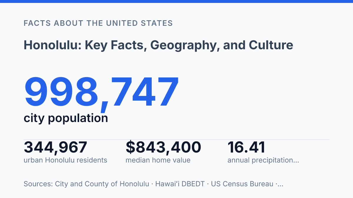
Honolulu begins with a geographic complication: the urban Census Designated Place had 344,967 residents in 2024, while the City and County of the same name governed nearly 600 square miles across all of Oʻahu. That distinction matters because Hawaii has no incorporated places recognized by the Census Bureau, so the place name can mean a dense urban core, a county government, a visitor district, or the island’s main civic center depending on context.
The city’s role is rooted in political history, including King Kamehameha III’s 1845 move of the royal residence from Lahaina, but its present character is just as data-rich: 35.0% of residents age 5 and older spoke a language other than English at home in recent Census estimates. This article explains the geography, growth, culture, climate, and travel access that make the city both a local home base and Hawaii’s primary gateway.
Where Honolulu is and what defines it
The same place-name does unusually complex work: it identifies Hawaiʻi’s capital, a south-shore urban core, and an islandwide county-level government rather than a mainland-style municipality. The city is the capital of Hawaii and the county seat of the county that carries its name, giving it both state-level political importance and local administrative significance.
Physically, the capital sits on the southeastern coast of Oʻahu, facing the Pacific from a narrow coastal plain backed by volcanic ridges and valleys. Diamond Head is the best-known landform at the eastern edge of the urban area, while Honolulu Harbor anchors the older waterfront and helps explain why the settlement developed around a protected maritime site rather than an inland center.
The urban census-designated place had 344,967 residents on July 1, 2024, down 1.7% from April 2020 and equal to 34.5% of Oʻahu’s population; because Hawaiʻi has no incorporated places recognized by the Census Bureau, this urban area is a Census Designated Place rather than a conventional city government, according to Hawaiʻi DBEDT / Hawaiʻi State Data Center. That classification is more than a technicality: population counts, maps, and comparisons with mainland cities can refer either to the compact urban core or to the wider consolidated jurisdiction.
This layered geography is central to understanding the city’s role in U.S. geography. It is not only a state capital on an island in the central Pacific, but also the principal civic and administrative reference point for Oʻahu, where local identity, government boundaries, and physical setting overlap in ways that are less straightforward than in many incorporated mainland cities.
How the city grew into Hawaii’s main hub
The city’s rise was anchored less by a single downtown industry than by three institutions clustered along a short coastal corridor: a commercial harbor, a government center, and Pearl Harbor.
Political centrality took shape before the modern state existed. King Kamehameha III moved the royal residence from Lahaina to the city in 1845, according to the U.S. National Park Service, placing court activity, administration, and diplomatic contact closer to the port. Statehood in 1959 then formalized the city’s position within the United States, strengthening its role as the place where state agencies, federal offices, legal institutions, and business services concentrated.
Honolulu Harbor gave that political center a commercial base. During the plantation era, sugar and pineapple production depended on ocean shipping for exports, imported equipment, fuel, food, and labor movement, and the port became the practical interface between island agriculture and Pacific markets. That function encouraged banks, insurers, wholesalers, ship agents, and government customs activity to cluster nearby, making the waterfront more than a local harbor district.
Military strategy added a separate source of influence. Pearl Harbor’s value came from its mid-Pacific position, which made it useful for naval logistics, repair, supply, and fleet operations between the continental United States and Asia. The 1941 attack made the harbor central to Hawaiʻi’s modern history, but its strategic significance also continued after World War II through permanent federal defense infrastructure and employment tied to the armed forces.
The same concentration that made the city the islands’ main hub also created exposure to outside forces. A local economy tied closely to port flows, federal spending, government administration, and long-distance transport can be affected by shipping disruptions, defense policy shifts, energy costs, or downturns in Pacific commerce. The scale of local governance reinforces that centrality: the City and County’s FY2024 citizen-centric report describes a jurisdiction of nearly 600 square miles, meaning many islandwide decisions and services are connected back to the same metropolitan core.
Daily life, culture, and local identity
More than one in three residents age 5 and older spoke a language other than English at home in 2020–2024 estimates, according to U.S. Census Bureau QuickFacts. That figure, 35.0%, helps explain why daily life is shaped by more than a simple English-versus-Hawaiian frame. The same census source estimated that 27.6% of residents were foreign-born, pointing to an urban community formed through Indigenous continuity, immigration, military movement, interisland ties, and long-standing Pacific connections.
Local identity is often described through broad Asian-Pacific or Polynesian labels, but those categories can flatten the city’s social history. Native Hawaiian families, Japanese American communities, Filipino residents, Chinese families, and Pacific Islander groups all contribute distinct institutions, foods, religious practices, festivals, and neighborhood networks. The result is not a single blended culture so much as a layered civic identity in which ancestry, language, and local upbringing often matter alongside legal citizenship or place of birth.
Cultural institutions make that layered identity visible in public life. ʻIolani Palace, completed in 1882, anchors the history of the Hawaiian Kingdom and remains one of the clearest reminders that the city’s political culture predates U.S. statehood. Bishop Museum preserves major collections related to Hawaiian and Pacific history, natural science, and material culture, while the University of Hawaiʻi at Mānoa supports research, language study, and public programming tied to Asia, Oceania, and Indigenous Hawaiʻi.
Everyday culture also operates through local speech and social codes rather than only through formal institutions. Hawaiʻi Creole English, often called Pidgin, is widely associated with plantation-era multilingual contact and remains an important marker of local belonging, even when Standard English is used in schools, government, and business. Hawaiian words and place names are part of ordinary public language as well, though fluency in Hawaiian is far less common than casual cultural use of Hawaiian terms.
Weather, travel access, and what makes it practical to visit
NOAA’s airport climate normals put annual rainfall at only 16.41 inches, a relatively dry figure for a tropical destination and a useful clue to why outdoor visitor activity is not confined to a narrow season. The 1991–2020 normals, reported by NOAA’s National Centers for Environmental Information, also show measurable rain on 89.2 days per year, meaning showers occur but total accumulation remains modest compared with many humid tropical locations. This pattern supports year-round travel demand, especially in coastal areas where beach, dining, and open-air activities are central to the visitor economy.
Air access is concentrated through Daniel K. Inouye International Airport, the state’s main aviation gateway and the practical entry point for most arrivals. The Hawaiʻi Department of Transportation Airports Division reported 18,401,002 passengers from January through October 2025, up 1% from the same period in 2024. That volume helps explain why the city functions as a travel hub far beyond its resident population, with connections linking Hawaiʻi to the continental United States, Asia, Oceania, and other islands in the state.
Waikiki Beach illustrates the city’s practical appeal because it combines a recognizable shoreline with dense nearby services, transit options, restaurants, and public amenities in a compact area. The Honolulu Zoo, located near the eastern end of Waikiki, adds another easily reached destination within the same visitor district. These places matter not only as attractions but as examples of how many visitor activities are clustered close to one another, reducing the need for long daily transfers once travelers have arrived.
The main constraint is geographic rather than climatic. Mild weather makes visitation possible across the calendar, but an island location generally means longer flight times and higher air-travel costs than many comparable U.S. urban destinations. That combination gives the city a distinctive travel profile: relatively dependable outdoor conditions after arrival, paired with a greater upfront commitment to reach the islands in the first place.
Why the boundary changes the facts
The most useful way to understand the city is to treat every fact as boundary-dependent. A housing figure, airport total, rainfall normal, or population estimate can describe different realities depending on whether the subject is the urban core, Waikīkī, greater Oʻahu, or the county government. That distinction will matter more as visitor volume, housing costs, and infrastructure demands keep shaping local decisions.
A place with 16.41 inches of average annual rainfall at the airport can still face water, land-use, and affordability pressures that are not visible in a beach image or a travel itinerary. The practical consequence is simple: precise geography produces more accurate expectations.
Frequently Asked Questions
Q: Is Honolulu a city or a state capital?
A: Honolulu is both a city and the capital of Hawaii. It also serves as the center of government, commerce, and transportation for the state. That dual role makes it one of the most significant urban areas in the Pacific.
Q: Where is Honolulu located in Hawaii?
A: Honolulu is on the island of Oʻahu, along the southeastern coast. Its coastal position has shaped its development as a port city and tourist hub. The surrounding ocean and mountains also influence local weather and land use.
Q: What is Honolulu known for culturally?
A: Honolulu reflects a mix of Native Hawaiian, Asian, and mainland U.S. influences. This is visible in its food, language, festivals, and everyday customs. The city’s cultural profile is closely tied to Hawaii’s broader history of migration and exchange.
Q: How does Honolulu differ from other Hawaiian destinations?
A: Honolulu is the most urbanized part of Hawaii, with a denser population and more developed infrastructure than many other islands or towns. It combines government functions, business activity, and tourism in a single center. That makes it more metropolitan in character than resort-oriented areas elsewhere in the state.
Q: What landmarks or attractions are most associated with Honolulu?
A: Honolulu is closely associated with Waikīkī, Diamond Head, and Pearl Harbor. These places represent different parts of the city’s identity, from beach tourism to natural features and historic sites. Together, they help explain why the city draws both visitors and residents.