
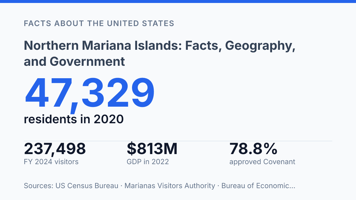
The Northern Mariana Islands occupy a political category that can be missed by ordinary maps: a 14-island U.S. commonwealth in the western Pacific whose residents became U.S. citizens in 1986 but do not have state-level representation in federal elections. Saipan is the main hub, with Tinian and Rota among the other inhabited islands, and recent visitor data show how closely the commonwealth is tied to Asian air routes and tourism markets. Its modern status rests on the 1975 Covenant, approved by 78.8% of voters in a plebiscite with unusually high registration and turnout.
That legal foundation helps explain why geography, citizenship, language, and economic dependence fit together differently here than in a U.S. state. The article examines the islands’ location, commonwealth government, population profile, and the practical limits of political participation under the U.S. system.
Where the Northern Mariana Islands are located
The Northern Mariana Islands sit just west of the Mariana Trench, putting a U.S. commonwealth beside one of Earth’s deepest ocean features rather than near any continental mainland. The archipelago lies in the western Pacific Ocean, north of Guam, along the same island arc that forms the Marianas. This position matters in practical terms because distance, ocean exposure, and limited flat land shape how people move between islands and where permanent settlement can concentrate.
A 2026 release from the Marianas Visitors Authority describes the commonwealth as a 14-island archipelago that includes Saipan, Tinian, and Rota, with direct air links from Tokyo-Narita, Guam, and other Asian gateways. Saipan functions as the main hub because it has the largest concentration of residents, government functions, airport access, and services. Tinian and Rota are the other principal inhabited islands, while the smaller northern islands extend the chain across a much wider area of open ocean than their land area alone suggests.
The islands are not geologically uniform. The northern part of the chain is more strongly volcanic, with steeper profiles, rugged slopes, and less extensive coastal plain.
Farther south, islands such as Saipan, Tinian, and Rota include substantial limestone and coral-derived formations, including raised terraces and reef-fringed coasts. This mix affects settlement because flatter limestone benches and protected coastal areas are easier to build on than steep volcanic ground, while reefs and lagoons can create sheltered marine approaches where conditions allow.
Geography also limits how evenly development can spread. Narrow coastal zones, cliffs, reef margins, and exposure to tropical storms constrain where roads, ports, housing, and utilities can be placed.
The result is a pattern in which population and services are highly concentrated on the main island, while smaller islands remain more dependent on interisland transport and weather-sensitive connections. In spatial terms, the commonwealth is small; in logistical terms, its islands are separated by enough ocean to make access a central feature of daily administration and economic life.
How the commonwealth status works
In a 1975 plebiscite, 78.8% of voters approved the political agreement that still defines the commonwealth’s relationship with the United States, according to the CNMI Law Revision Commission. The Northern Mariana Islands became a U.S. commonwealth under the Covenant, with core provisions taking effect in 1978. The arrangement created a permanent political union with the United States while preserving a measure of internal self-government.
Residents became U.S. citizens on November 4, 1986, a change tied to the Covenant’s phased implementation. The commonwealth has its own constitution, an elected governor, and an elected legislature that handles local lawmaking, budgeting, public services, and many domestic policy choices. This structure gives the territorial government authority over day-to-day governance rather than placing all administrative decisions directly under federal control.
Congress still retains significant authority because the commonwealth is a U.S. territory rather than a state. Federal power is especially clear in areas such as defense, foreign affairs, citizenship and nationality, federal courts, and laws that Congress expressly applies to the territory. At the same time, the Covenant says certain fundamental provisions can be changed only with the consent of both the U.S. government and the CNMI government, which makes the arrangement more specific than ordinary federal statute alone.
Federal law does not always operate in the same way as it does in states. Immigration, labor standards, taxation, customs treatment, and federal benefit programs have all involved special rules or transition arrangements at different points.
Representation also differs: the commonwealth has a delegate in the U.S. House, but delegates do not vote when the House is acting as the full House of Representatives, according to the U.S. House. The result is a status that combines local autonomy with congressional oversight, creating a political relationship that resembles statehood in some daily functions but remains constitutionally distinct.
Population, language, and economy
The census count shows how concentrated community life is: more than nine in ten CNMI residents lived on one island in 2020. According to the U.S. Census Bureau, the commonwealth had 47,329 residents on April 1, 2020, a 12.2% decline from 2010. Saipan had 43,385 residents, making it by far the largest population center and the main setting for schools, health services, retail activity, and much of the labor market.
Language use reflects both Indigenous identity and migration. English, Chamorro, and Carolinian are important languages in public life and daily communication, including government, education, cultural events, and family settings.
Census Bureau data released in 2024 also show that 74.0% of residents age 5 and older spoke a language other than English at home; among that group, 39.0% spoke a Philippine language, and 52.5% reported speaking English “very well.” The figures point to a multilingual society rather than a simple English-versus-local-language divide.
Tourism is one of the economy’s main pillars, but its recent performance shows how exposed the islands are to shifts in travel demand. The Marianas Visitors Authority reported 237,498 visitors in fiscal year 2024, up 22% from the prior year but still 44% below fiscal year 2019. South Korea accounted for 177,943 arrivals, or 75% of the visitor market, which shows both the importance of Asian air links and the risk of dependence on a small number of source markets.
Government employment is another major source of wages and economic stability, especially because the private economy is narrow. The U.S. Bureau of Economic Analysis estimated CNMI gross domestic product at $813 million in 2022, with real GDP rising 16.7% after a steep 2020 contraction.
Local production is constrained by limited agricultural land, while food, fuel, construction materials, and many consumer goods must be imported. That dependence raises the importance of shipping costs and supply reliability in everyday prices and business planning.
How the islands differ from a U.S. state
A resident can be a U.S. citizen and still have no voting senator, no voting House member, and no Electoral College vote from the islands. That is the central practical difference between the CNMI and a state: the commonwealth is part of the United States, but it remains governed under a territorial arrangement rather than admitted to the Union as a state.
Representation is the clearest contrast. States elect two senators and voting members of the House, which has 435 voting representatives apportioned among the states. The CNMI instead has a non-voting delegate in the House; according to the U.S. House of Representatives, delegates may serve on committees and take part in legislative work, but they do not cast final votes when the House sits as the House of Representatives.
The commonwealth also has no U.S. senators. In presidential elections, residents do not vote through the Electoral College from the islands, according to the National Archives, unless they are domiciled in a state or the District of Columbia.
The legal distinction also affects administration in areas that residents of states often experience as uniform federal systems. Federal tax treatment is different from the state model because many income tax obligations are administered through the territorial tax system rather than through the ordinary combination of federal and state income taxation. At the same time, federal programs and taxes can still apply, so the difference is not a complete separation from U.S. law.
Immigration has been another practical marker of territorial status. The CNMI historically operated local immigration controls that allowed it to manage entry and foreign labor rules in ways not available to states. Federal immigration law was later extended more fully, with the transition beginning in 2009, but the history shows how territorial arrangements can produce policy differences even where U.S. citizenship and national sovereignty are shared.
Where political status meets economic exposure
The commonwealth’s future is likely to be shaped less by a single constitutional label than by how several pressures interact: tourism recovery, demographic change, federal authority, and local consent under the Covenant. A place with U.S. citizenship, no Electoral College vote, and a nonvoting House delegate does not fit neatly into ordinary state-versus-country categories. That distinction matters for interpreting statistics as well as laws.
A rebound from 237,498 visitors in FY 2024 may improve revenue, but dependence on a small number of source markets leaves public finances exposed. The most useful way to read the commonwealth is as a jurisdiction where geography and political status directly affect daily economic choices.
Frequently Asked Questions
Q: Where are the Northern Mariana Islands located?
A: The Northern Mariana Islands are a chain in the western Pacific Ocean, northeast of Guam. They form part of Micronesia and sit along a volcanic island arc. Their position places them near major Pacific sea routes, which has shaped their strategic importance.
Q: Are the Northern Mariana Islands part of the United States?
A: Yes. The Northern Mariana Islands are a U.S. commonwealth, which gives them political association with the United States while preserving a degree of local self-government. Residents are U.S. citizens by birth, and federal law applies in many areas. Certain local institutions and rules still differ from those in U.S. states.
Q: What is the capital of the Northern Mariana Islands?
A: The capital is Saipan, the largest and most populous island in the territory. It serves as the main center for government, business, and transportation. As a result, it is the primary entry point for most visitors and official activity.
Q: What is the climate like in the Northern Mariana Islands?
A: The islands have a tropical marine climate with warm temperatures throughout the year. Rainfall is influenced by seasonal patterns, and typhoons can affect the region, especially during the wetter months. This climate supports coral reefs and coastal ecosystems, but it also creates exposure to storm damage.
Q: How are the Northern Mariana Islands governed?
A: The territory has its own local government, including elected officials and a legislature, under a political arrangement with the United States. Federal responsibilities such as defense and many immigration matters are handled by the U.S. government. That division means local policy is shaped by both territorial institutions and federal authority.