
American Samoa is the only U.S. territory south of the equator, yet its 86 square miles of land are paired with 114 square miles of reef habitat. That contrast helps explain why a small Pacific territory can carry geographic, ecological, legal, and cultural significance out of proportion to its land area. The territory consists of five volcanic islands and two coral atolls in the Samoan island chain between Hawaiʻi and New Zealand, with reefs that support about 200 coral species and 890 fish species.
Its status is just as distinctive: it is an unincorporated and unorganized U.S. territory where many people born locally are U.S. nationals rather than U.S. citizens. The facts that follow connect location, constitutional status, local government, language, work, and demographic pressure to show how this territory functions in practice, not just how it appears on a map.
Where American Samoa Is and What It Includes
A territory with only 86 square miles of land covers a much wider physical setting because its islands and atolls are spread across the South Pacific rather than clustered around one shore. American Samoa lies south of the equator and east of Samoa, within the broader Polynesian region. According to the NOAA Office of National Marine Sanctuaries, it is the only U.S. territory south of the equator and consists of seven land masses: five volcanic islands and two coral atolls in the 301-mile, or 485-kilometer, Samoan volcanic island chain, roughly midway between Hawaiʻi and New Zealand.
How the Territory Fits Into the United States
Birth in the territory does not automatically carry the same citizenship result as birth in a state. The United Nations described it in 2025 as an “unincorporated and unorganized” U.S. territory, a status that places it under U.S. sovereignty without making it an incorporated part of the country for all constitutional purposes. People born there are generally U.S. nationals rather than U.S. citizens if neither parent is a U.S. citizen, though adults can vote in territorial elections, including for the territory’s non-voting delegate to the U.S. House of Representatives.
Federal oversight runs principally through the U.S. Department of the Interior, which administers the federal government’s relationship with several island territories through its insular affairs functions. That oversight does not erase local government.
The territory has its own constitution, elected officials, and legislature, known as the Fono, whose structure reflects both U.S.-style representative institutions and Samoan customary authority. According to United Nations reporting, the Fono includes an 18-member Senate selected by county councils and a 20-member House elected by popular vote, with a separate non-voting delegate for Swains Island; senators must be matai, or traditional chiefs.
The territory is also legally distinct from the independent nation of Samoa. The two share deep cultural and historical connections, but they are separate political entities: one is under U.S. sovereignty, while Samoa is a sovereign state with its own citizenship, government, and international legal personality.
This distinction matters because laws, voting rights, passports, migration rules, and federal programs are not interchangeable between the two jurisdictions. The result is a political status that is neither equivalent to statehood nor comparable to independence, but instead shaped by U.S. territorial law, local institutions, and Samoan customary governance.
Population, Culture, and Daily Life
The 2020 census counted 49,710 residents, a population small enough for village and family networks to remain highly visible in public life. Census figures place the territory closer in scale to a small city than to most U.S. states or territories, which helps explain why customary relationships can have practical importance beyond private family life. Public decisions, land use, church activity, education, and local leadership often intersect through overlapping household, village, and official structures.
Language use reflects the same dual pattern. Samoan remains the main language of everyday household life, while English is used across administration, schooling, law, and wider U.S. communications.
According to the U.S. Census Bureau’s 2024 release of 2020 Island Areas Census data, 96.7% of people age five and older in households spoke a language other than English at home; among that group, 90.9% spoke Samoan, and 54.6% spoke English less than “very well.” This does not mean English is absent from public life, but it shows that education and government operate in a community where Samoan-language fluency is central to daily communication.
The organizing cultural framework is fa’a Samoa, often translated as “the Samoan way.” Its practical importance lies in obligations to extended family, respect for village authority, and customary approaches to land.
Extended families are not only social units but also sources of support, status, responsibility, and dispute resolution. Village authority, exercised through chiefly and communal structures, helps shape expectations around conduct, service, and local decision-making.
Communal land is one of the clearest points where custom and administration meet. Land is commonly understood through family and village relationships rather than only through individual ownership, which affects housing, inheritance, development, and outside investment.
Modern schools, courts, agencies, and elected offices operate alongside these traditional structures, so daily life is not a simple split between custom and U.S.-style government. It is a layered system in which formal institutions often have to work through social patterns that long predate the territory’s present political status.
Economy, Work, and Main Challenges
A single tuna cannery can carry unusual weight in the territory’s labor market, export earnings, and port activity. The StarKist facility in Pago Pago is the central private-sector anchor, linking local employment to fishing fleets, cold storage, maintenance work, shipping services, and food-processing supply chains. Fish canning and processing also has its own wage category under federal rules; the U.S. Department of Labor listed the industry rate at $6.36 per hour in 2024, showing how closely the territory’s wage structure is tied to a narrow set of regulated industries.
Public employment and federal spending form the other major pillar of the economy. The territorial government is a large employer, and federal programs support core services such as education, health, infrastructure, and emergency response. This relationship gives the territory access to U.S. funding streams and institutions that many small island economies do not have, but it also means government finances can be sensitive to grant levels, program rules, and the local tax base.
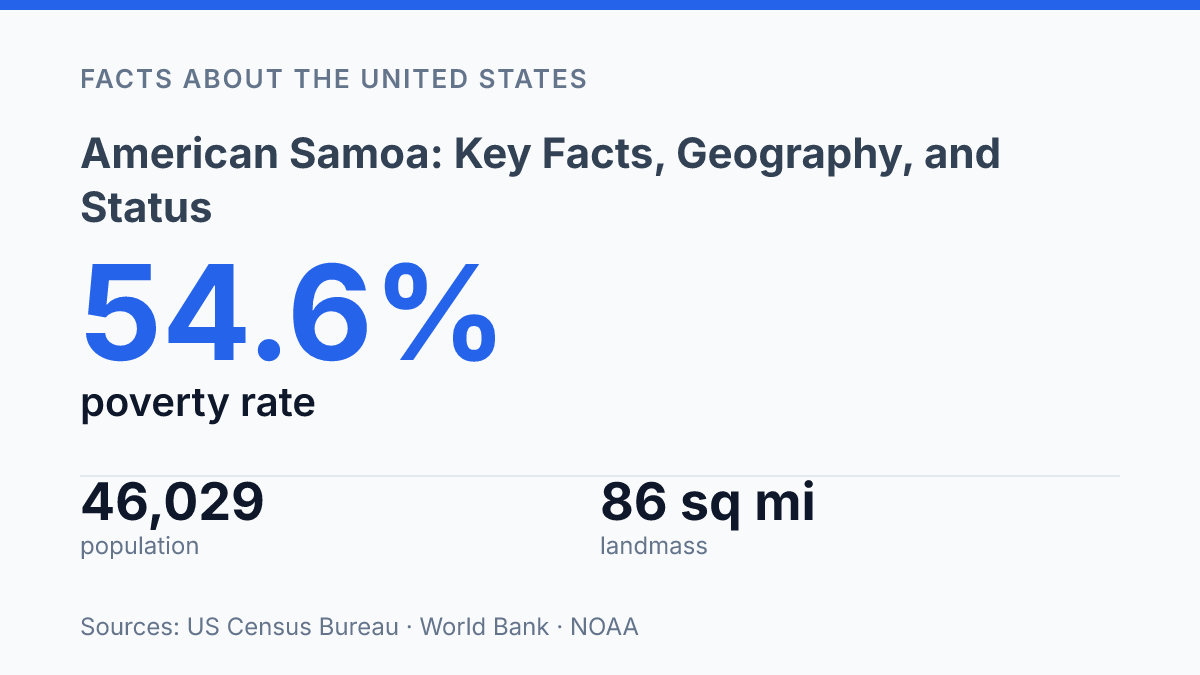
Economic hardship remains visible in household and labor-market data. According to the U.S. Census Bureau’s 2024 release of Island Areas Census data, the poverty rate was 54.6% among people in households for whom poverty status was determined, median household income was $28,352, and unemployment was 13.2% among people age 16 and older in the civilian labor force. These figures point to a labor market where formal jobs exist, but wages and household resources are constrained by the limited scale of the economy.
Distance and land scarcity raise costs across nearly every sector. Many consumer goods, construction materials, fuel, machinery, and medical supplies must be imported, so shipping schedules and freight costs affect prices paid by households, businesses, and government agencies. Limited developable land also restricts agriculture, large-scale manufacturing, warehousing, and housing expansion, leaving fewer options for diversification beyond public services, fishing-related activity, retail, and small local enterprises.
The result is an economy with meaningful institutional support but a narrow commercial base. Tuna processing and public-sector work provide stability, yet dependence on imported goods, high transport costs, and a small export base leave local incomes and government revenues exposed to changes outside the territory’s direct control.
Why scale changes the meaning of each policy choice
Future decisions about the territory will depend on how legal status, economic limits, and local culture are weighed against one another. A wage rule, a migration trend, or a federal funding formula can carry different effects in a place with 46,029 residents, net migration of -1,051, and a poverty rate above half of the measured household population.
The same is true of language access: when Samoan remains the dominant home language, public services and education cannot be assessed through English-only assumptions. The practical consequence is clear: policy for American Samoa works best when its small scale is treated not as a footnote, but as a condition that changes the impact of nearly every decision.
Frequently Asked Questions
Q: Is American Samoa a U.S. territory or a state?
A: American Samoa is an unincorporated U.S. territory, not a state. It has a local government and sends a nonvoting delegate to the U.S. House of Representatives. Its political status is distinct from the fifty states, which affects some federal rights and rules.
Q: Where is American Samoa located in the Pacific Ocean?
A: American Samoa is in the South Pacific Ocean, east of the International Date Line and south of the equator. It lies southeast of the main Samoan islands and consists of several volcanic islands and coral atolls. Its location places it in a remote part of Polynesia.
Q: What islands make up American Samoa?
A: The territory includes Tutuila, Aunu’u, the Manu’a Islands, and several smaller islets. Tutuila is the largest and most populous island, and it contains the territorial capital, Pago Pago. The smaller islands are less developed and have lower population densities.
Q: What is American Samoa known for geographically?
A: American Samoa is known for steep volcanic mountains, coastal valleys, and coral reef systems. Much of the land is mountainous, which limits large-scale development but supports a strong coastal and marine environment. The territory also includes American Samoa National Park, which protects both terrestrial and marine habitats.
Q: Do people born in American Samoa have U.S. citizenship?
A: People born in American Samoa are generally U.S. nationals, not U.S. citizens, unless they obtain citizenship through another legal path. This status gives them some U.S. rights, such as the ability to live and work in the United States, but not full citizenship by birth. The distinction is a central feature of the territory’s legal status.