
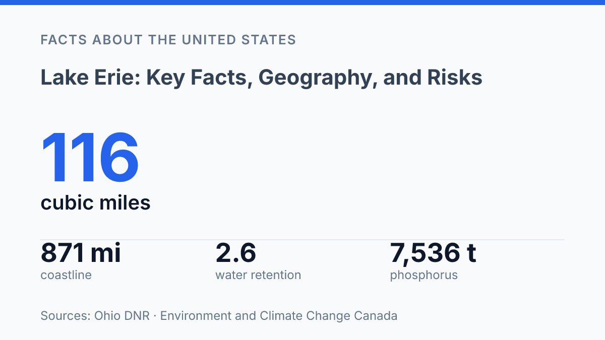
Lake Erie holds only 3% of the Great Lakes’ total water volume, yet its 2.6-year water-retention time makes changes in pollution, runoff, and bloom conditions show up faster than they do in deeper lakes such as Superior or Michigan. That short turnover helps explain why a lake with an 871-mile coastline and a 30,140-square-mile watershed remains so closely watched by scientists, port authorities, anglers, and shoreline communities.
The same geography also concentrates risk: phosphorus inputs reached 7,536 tonnes in 2024, still far below the 2019 peak but high enough to keep cyanobacterial blooms in focus. The key facts point to a lake defined by scale, speed, and exposure.
Where Lake Erie sits and what borders it
Lake Erie is not bordered by a single dominant jurisdiction; its shores are divided among four U.S. states and one Canadian province. The lake lies between Ohio, Pennsylvania, New York, and Michigan on the U.S. side and Ontario on the Canadian side, making it both a regional water body and part of the international boundary between the United States and Canada.
In a 2026 coastal overview, the Ohio Department of Natural Resources reports that the lake’s coastline totals 871 miles, with Ohio alone accounting for 312 miles; the same source identifies a 30,140-square-mile watershed extending across Ohio, Indiana, Michigan, New York, Pennsylvania, and Ontario. Those figures show that the lake’s geographic footprint reaches well beyond its immediate shoreline, especially through river systems and drainage areas that connect inland communities to the basin.
The western end is linked to the Detroit River, which connects the lake system with waters flowing from the upper Great Lakes through the Detroit corridor. At the eastern end, the Niagara River carries outflow toward Lake Ontario, while the Welland Canal provides the major navigable connection around Niagara Falls. These waterways help define the lake not only as a bordered basin but also as a through-route between larger freshwater and transportation systems.
Major shoreline and near-shore cities mark the lake’s political and economic edges. Cleveland and Toledo anchor much of Ohio’s coast, Erie sits on Pennsylvania’s short frontage, Buffalo stands near the eastern outlet in New York, and Windsor is tied to the western connecting-waterway corridor in Ontario. This geography makes jurisdictional boundaries easy to map but harder to manage in practice, because state, provincial, and federal authorities all have roles in decisions affecting navigation, shoreline use, habitat, and public access.
How Lake Erie differs from the other Great Lakes
Although it ranks fourth among the Great Lakes by surface area, Lake Erie contains only 3% of the system’s total water volume, according to the Ohio Department of Natural Resources. That mismatch between broad surface and limited volume is central to its physical character: the lake covers about 9,910 square miles, yet it holds about 116 cubic miles of water, far less than the deeper lakes in the same system.
Its defining distinction is depth. The lake is the shallowest of the five Great Lakes, with a mean depth of about 62 feet and a maximum depth of about 210 feet.
By comparison, the other Great Lakes have substantially deeper basins, so their water columns store more heat, mix differently, and generally change temperature more slowly. This helps explain why Erie often warms earlier in spring and can respond more sharply to cold snaps, storms, and seasonal turnover.
Shallow water also supports higher biological productivity because sunlight can penetrate a larger share of the water column, especially across the lake’s broad western basin. Warmer temperatures, stronger light availability, and frequent mixing create conditions that can support abundant plankton, aquatic plants, and fish production. In this sense, the lake’s productivity is not incidental; it is tied directly to basin shape, depth, and water residence.
The same features make the lake comparatively sensitive. Ohio DNR reports a water-retention time of about 2.6 years, the shortest among the Great Lakes, meaning water moves through the basin more quickly than in deeper lakes.
Faster flushing can allow conditions to change sooner after wet years, dry periods, or shifts in runoff, but it also means seasonal variability can be pronounced. Ice cover, nearshore temperatures, turbidity, and biological activity can all shift noticeably from year to year because the lake has less depth and stored water volume to buffer those changes.
Why algae blooms remain a major concern
A toxin measured at a drinking-water intake in 2014 turned a seasonal bloom problem into a public-health emergency for Toledo. That August, harmful algal toxins associated with cyanobacteria, especially microcystin, prompted officials to tell hundreds of thousands of residents not to drink tap water until treatment and testing showed the supply was safe. The episode remains a defining example of why blooms are treated as a drinking-water, public-health, and local-economy risk rather than only a visible nuisance on the water’s surface.
The main driver is excess phosphorus, particularly from farm fields and wastewater sources that enter tributaries before reaching the lake. Fertilizer, manure, treated wastewater, failing septic systems, and storm-related overflows can all add nutrients, but agricultural runoff is especially significant in the western basin because large areas drain through intensively farmed land. Warm water, calm conditions, and lake circulation affect whether cyanobacteria multiply rapidly, yet those conditions do not replace the role of nutrients; they help determine how strongly the available phosphorus is converted into bloom biomass.
The recurring problem area is the western basin near Maumee Bay, where the Maumee River watershed delivers a large share of the nutrient load during spring and early-summer runoff events. Heavy rain can wash dissolved and particulate phosphorus from fields into ditches, streams, and rivers within a short period, creating the nutrient pulse that supports later blooms. This timing matters because management gains can be offset in unusually wet years, even when monitoring, forecasting, and treatment responses have improved.
Recent data show progress but not a resolved problem. Environment and Climate Change Canada reported that the lake received 7,536 tonnes of total phosphorus in 2024, a substantial decline from the 2019 peak, while binational plans still aim for a roughly 40% reduction from 2008 baseline levels in the western and central basins, according to U.S. EPA and Environment and Climate Change Canada reporting.
NOAA’s final 2025 assessment found the western-basin cyanobacterial bloom had a severity index of 2.4, lower than 2024’s 4.2, based on satellite-estimated biomass during the peak 30 days. Those milder recent scores show that forecasting and nutrient controls can reduce risk, but the persistence of bloom-favorable runoff conditions keeps harmful algae near the top of the lake’s management concerns.
Fishing, shipping, and recreation on the lake
A single 2025 Seaway traffic report shows Erie ports moving cargo in volumes ranging from hundreds of thousands of tonnes to nearly 1,850,088 tonnes, underscoring that the lake remains a working transportation corridor as well as a recreation resource. Commercial vessels use the Welland Canal to connect with the St. Lawrence route, while the Detroit and St. Clair river system links Erie traffic with the upper Great Lakes. That network keeps bulk commodities such as coal, grain, aggregates, salt, and project cargo moving between inland industrial centers and wider North American markets, according to the Great Lakes St. Lawrence Seaway System’s 2025 traffic report published in 2026.
Sport fishing is a second major economic pillar, especially where charter fleets, bait shops, marinas, fish-cleaning stations, lodging, and restaurants cluster around productive fishing grounds. Walleye and yellow perch are among the best-known target species, and their popularity turns biological productivity into a measurable tourism economy. In 2024, there were 984 Ohio-based licensed charter boat captains, the highest count in more than two decades, and more than 500,000 anglers fish Ohio waters of the lake each year, according to Lake Erie Shores & Islands.
Recreation broadens that economic base beyond angling. Presque Isle State Park supports beach use, boating, birding, cycling, and marina-related activity, while Cedar Point draws large seasonal visitor flows that support hotels, restaurants, ferry services, shoreline businesses, and municipal tax bases. These hubs show how the lake functions as infrastructure for leisure economies, not only as scenery.
The same nearshore conditions that make Erie accessible and productive also create management pressures. Fishing success can vary by season, weather can quickly limit small-craft use and commercial schedules, and heavy recreation concentrates stress on beaches, wetlands, launch ramps, and fish habitat. The economic value of shipping, angling, and tourism therefore depends on navigation maintenance, fishery management, water-quality controls, and protection of the shoreline places that attract visitors in the first place.
Why the lake’s fast turnover keeps the stakes visible
The lake’s future will be shaped less by any single bloom season than by whether annual evidence begins to move in the same direction across borders. A mild bloom in one year can coexist with persistent nutrient pressure, while a moderate forecast can reflect weather as much as long-term management.
That makes trend tracking more useful than isolated headlines: phosphorus loads, spring rainfall, satellite bloom severity, fishery data, and port activity all need to be read together. The short 2.6-year retention time gives managers a rare advantage among the Great Lakes because improvements, setbacks, and policy gaps can become visible within a few seasons rather than a generation.
Frequently Asked Questions
Q: How deep is Lake Erie compared with the other Great Lakes?
A: Lake Erie is the shallowest of the Great Lakes, with an average depth of about 19 metres. That shallow profile makes it warmer and more responsive to wind than the deeper lakes, which helps explain its rapid weather changes and wave conditions.
Q: Why does Lake Erie develop harmful algal blooms?
A: Warm temperatures, shallow water, and nutrient runoff from the watershed all support algal growth. When phosphorus from agricultural and urban sources enters the lake, blooms can become more frequent and severe, especially in summer. The main concern is that some blooms produce toxins that affect drinking water, recreation, and aquatic life.
Q: Which cities are located on Lake Erie?
A: Major cities on Lake Erie include Cleveland, Buffalo, Erie, Toledo, and Windsor on the Canadian side of the Detroit River system nearby. The lake’s shoreline is heavily populated because it supports shipping, water supply, fisheries, and tourism. That concentration of settlement also increases pressure from runoff, development, and industrial activity.
Q: Is Lake Erie safe for swimming and boating?
A: Conditions vary by location and season. Swimming may be discouraged during harmful algal blooms, high bacteria readings, or after heavy rain, while boating risks rise when strong winds create steep waves across the shallow lake. Local advisories are the most reliable source for current safety conditions.
Q: What problems threaten Lake Erie today?
A: The main pressures are nutrient pollution, invasive species, habitat loss, and climate-driven warming. These factors can reduce water quality, alter fish populations, and increase the frequency of bloom events. Management efforts now focus on cutting runoff and protecting shoreline and wetland habitat.