
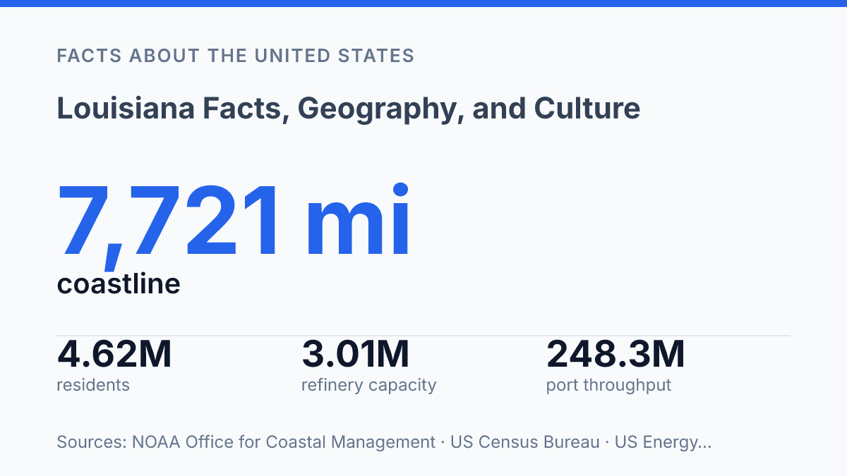
Louisiana has 7,721 miles of coastline, a NOAA figure that helps explain why water shapes so much of the state’s geography, economy, and public risk. That shoreline count is not just a map detail; it connects the Mississippi River, Gulf ports, wetlands, fisheries, storm exposure, and energy infrastructure into one operating system. The state profile is equally layered.
The U.S. Census Bureau estimated 4,618,189 residents in 2025, while historical records show that people of African ancestry made up 51% of New Orleans’ population by the time of the 1803 Purchase. Those numbers point to a place where location, demography, and colonial rule produced distinctive foodways, language patterns, legal traditions, and settlement forms. The article examines how physical setting, state facts, French-Spanish-African influences, ports, agriculture, refineries, wetlands, and coastal pressure fit together rather than treating them as separate background details.
Where Louisiana sits and why its location matters
The Mississippi River meets the Gulf of Mexico through a low, shifting delta that makes the state both a freight gateway and one of the nation’s most water-exposed places. This position in the Gulf South connects inland North America to ocean routes, because river traffic can move south toward the Gulf while coastal channels and ports handle cargo moving in and out of the region.
The state’s coastline is not a simple edge on a map; it is a complex system of bays, marshes, barrier islands, and deltaic waterways. The NOAA Office for Coastal Management, 2026 page/accessed lists 7,721 miles of coastline for Louisiana, a figure that helps explain why navigation, fisheries, wetlands, energy facilities, and storm exposure are so closely tied together here. The same coastal reach that supports maritime activity also increases vulnerability when hurricanes push water inland or when heavy river flows coincide with coastal surge.
State borders add another layer to its geographic role. Texas lies to the west, Arkansas to the north, and Mississippi to the east, placing the state between the western Gulf, the lower Mississippi Valley, and the Deep South. These boundaries matter for road, rail, pipeline, and river connections, but water remains the defining axis of movement.
New Orleans sits near the river’s lower course and close to Lake Pontchartrain, giving it access to both inland waterways and Gulf-facing routes. Baton Rouge, farther upriver, occupies a strategic point where river transport, state government, and inland commerce intersect. Lake Pontchartrain also shapes the geography of the New Orleans area by separating parts of the metropolitan region from lands to the north while linking surrounding communities through bridges, shorelines, and drainage systems.
This geography creates a persistent contrast. Access to the Gulf and the Mississippi River has made the state important for shipping and port activity, but low elevation, delta subsidence, wetlands loss, and tropical storms mean that transport advantages come with recurring flood and hurricane risk.
Louisiana facts and state profile
Louisiana’s latest Census estimate puts the state below its 2020 population base, at 4,618,189 residents as of July 1, 2025, according to U.S. Census Bureau QuickFacts. The same estimate shows a 0.9% decline from the April 1, 2020 estimates base, making recent population change part of the state profile rather than a static background figure.
The capital is Baton Rouge, while New Orleans is the largest city and the state’s most recognizable urban center. That distinction matters for reading population patterns: the New Orleans metropolitan area holds a large share of residents, public institutions, employers, and cultural activity, yet many parishes remain much less densely populated. The result is a state profile that combines one dominant urban concentration with extensive small-town and rural governance needs.
The state is nicknamed the Pelican State, a reference to the brown pelican, which also appears in official state symbolism. Louisiana entered the Union on April 30, 1812, becoming the 18th state. Its local government structure is also distinctive because it is divided into parishes rather than counties, with 64 parishes serving the role county governments fill in most other states.
Basic demographic and civic facts therefore point to a state with a clear administrative center, a larger cultural and population hub, and a settlement pattern that is uneven across local jurisdictions. Those markers help explain why statewide policy often has to account for both dense urban service demands and smaller parishes with different fiscal, infrastructure, and population pressures.
How French, Spanish, and African influences shaped daily life
By 1803, 51% of the leading colonial city’s 8,056 residents were either enslaved people of African ancestry or free people of color, according to a New Orleans & Company history page, making African influence central rather than peripheral to the region’s cultural formation. French and Spanish rule supplied administrative, religious, and legal frameworks, but African and Afro-Caribbean communities shaped speech, foodways, rhythm, public celebration, and market life in ways that became part of everyday culture.
Language is one of the clearest traces of that layered past. Louisiana French persisted in families, churches, music, and local storytelling even as English became dominant in schools and government.
The state’s civil-law heritage is another marker: private-law areas such as property, succession, and obligations are organized through a civil code tradition influenced by French and Spanish law, unlike the common-law systems that predominate in most other states. This does not mean the state operates outside the American legal system; rather, it preserves a distinctive legal vocabulary and structure within it.
Cajun and Creole traditions developed through overlapping but not identical histories. Cajun culture is closely tied to Acadian-descended and other francophone rural communities, especially across south-central and southwestern areas.
Creole identity has carried several meanings over time, often linked to locally born communities with French, Spanish, African, Caribbean, and Native American connections. The contrast matters because the state’s cultural identity is often compressed into one famous city, while Acadiana and nearby prairie, bayou, and small-town communities remain central to language preservation, dance music, food traditions, and local festivals.
Food and music show how these influences became ordinary social practice rather than museum pieces. Gumbo and jambalaya reflect blended French, Spanish, African, and Indigenous foodways without belonging neatly to a single source tradition.
Zydeco grew from Black Creole dance music, with accordion and percussion driving social gatherings, while jazz drew on African American performance traditions, brass-band culture, blues, ragtime, and improvisation. Festival customs work in a similar way: Carnival parades, rural Mardi Gras runs, fais do-do dances, and parish fairs all turn cultural inheritance into repeated public practice.
Economy, wetlands, and recurring environmental pressure
Port of South Louisiana reported 248,253,326 short tons of total throughput in calendar year 2025, a scale that shows why the lower Mississippi River shipping corridor remains central to the state’s economy. The port also recorded 3,534 vessel calls and 53,499 barge calls, according to its 2025 tonnage report, reflecting a freight system that depends on both oceangoing ships and inland river movement. Grain, petrochemicals, fuel, fertilizer, and industrial inputs move through this corridor, linking agricultural regions and manufacturing sites to Gulf export routes.
Why water remains the state’s governing fact
The next useful measure of the state is not only what it contains, but how much of it can be maintained, moved, restored, or protected. In 2025, the coastal restoration authority reported 12 new construction projects, 9,216 acres restored or enhanced, and 10.5 million cubic yards of sediment placed. Those figures show a state actively rebuilding parts of its physical base while still depending on ports, refineries, farms, and waterways that face rising environmental strain.
This tension does not reduce the state to risk. It makes geography a continuing civic and economic calculation, where decisions about sediment, shipping channels, flood defenses, and land use will shape daily life as clearly as older colonial boundaries once did.
Frequently Asked Questions
Q: What is Louisiana best known for?
A: Louisiana is best known for its French and Spanish colonial history, its ties to the Mississippi River, and its distinctive cultural mix shaped by Cajun, Creole, African, and Caribbean influences. New Orleans is especially associated with jazz, Mardi Gras, and a strong culinary tradition. These features make the state stand out culturally even among other Southern states.
Q: Why is Louisiana called a delta state?
A: Much of southern Louisiana sits in the Mississippi River delta and along the Gulf Coast. That geography has produced wetlands, bayous, marshes, and a landscape that changes over time through flooding, sediment movement, and coastal erosion. The same conditions support rich fisheries and wildlife while also making the coast more vulnerable to land loss.
Q: What are the main regions of Louisiana?
A: Louisiana is commonly divided into North, Central, and South Louisiana, with each region showing different settlement patterns and cultural influences. North Louisiana is more closely associated with uplands and inland river systems, while South Louisiana includes the deltaic and coastal areas. This regional variation helps explain differences in food, dialect, and local traditions across the state.
Q: What languages are commonly associated with Louisiana culture?
A: English is the dominant language, but French and Louisiana Creole remain important parts of the state’s heritage. Their presence reflects earlier colonial settlement and long-standing local communities that preserved distinct speech forms. In practice, language in Louisiana is closely tied to identity, family history, and regional culture.
Q: How has Louisiana’s geography affected its economy?
A: Louisiana’s waterways have long supported shipping, oil and gas activity, fishing, and agriculture. The Mississippi River provides a major transportation route, while coastal waters support seafood industries that are central to local economies. At the same time, flood risk and coastal erosion raise infrastructure costs and affect long-term planning.