
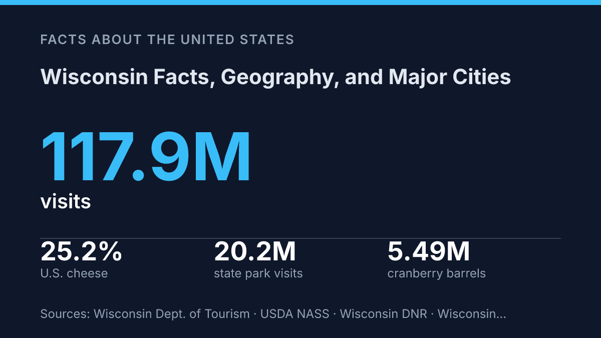
Wisconsin pairs a 2025 population estimate of 5,972,787 with 54,167.14 square miles of land, giving it the profile of a mid-sized state with unusually strong ties to space, water, and production. More than 800 miles of Great Lakes shoreline shape its borders and water supply, while manufacturing still supports about 458,400 jobs, far more than leisure and hospitality. The state’s familiar dairy image is also only part of the picture: in 2024 it produced 25.2% of all U.S. cheese and 61% of the nation’s cranberries.
Those figures explain why geography, industry, agriculture, and tourism cannot be separated neatly here. The state’s major cities, lakeshores, farms, factories, parks, and cultural attractions form a connected economic and physical map, rather than a collection of unrelated facts.
State facts at a glance
With just under 6 million residents spread across more than 54,000 square miles, the state has a lower-density profile than its two largest urban anchors might suggest. The state’s 2025 population estimate was 5,972,787, and its 2020 land area was 54,167.14 square miles, according to U.S. Census Bureau QuickFacts, 2026 / 2025 estimate. Taken together, those figures imply roughly 110 residents per square mile, a useful shorthand for understanding the state’s mix of metropolitan areas, small cities, towns, farmland, forests, and lake country.
The state capital is Madison, while Milwaukee is the largest city. That pairing separates political identity from population scale: Madison serves as the seat of state government and a major university center, while Milwaukee anchors the state’s largest urban economy. Detailed city profiles belong elsewhere, but the contrast helps frame the state’s civic and population structure at a glance.
Wisconsin entered the Union on May 29, 1848, becoming the 30th state. Because the population figure above is an estimate and the land-area figure comes from the 2020 census geography, density comparisons should be read with the source years in mind rather than treated as a single fixed census-year measurement.
Where Wisconsin is and what it borders
More than 800 miles of Great Lakes shoreline give the state a freshwater edge that few inland U.S. states can match. Wisconsin sits in the Upper Midwest, between the Mississippi River system to the west and the Great Lakes to the east and north, a position that links it both to interior agricultural regions and to wider lake-based transportation networks.
Its land borders connect it to four states: Minnesota on the west, Iowa on the southwest, Illinois on the south, and Michigan along the north and northeast. The Mississippi River forms much of the western boundary with Minnesota and Iowa, while the southern line ties the state closely to northern Illinois. The Michigan border is different in character because it connects through the Upper Peninsula region as well as Great Lakes waters, reinforcing the state’s northern orientation.
The eastern shoreline on Lake Michigan is central to the state’s physical and economic geography. According to the Wisconsin Department of Natural Resources, more than 1.6 million residents receive drinking water from Lake Superior or Lake Michigan, showing that the lakes are not only scenic boundaries but also major public water sources. Their ports, beaches, fisheries, and shoreline communities support shipping, recreation, and tourism, while also shaping local weather through lake-effect moderation and seasonal snowfall in some areas.
That water access does not define the whole state equally. Away from the Great Lakes, the interior is more strongly shaped by farmland, forests, rivers, and smaller lakes than by maritime activity. This creates a useful geographic contrast: the state has a Great Lakes identity along its edges, but much of its inland character remains tied to agriculture, timberland, and rural settlement patterns typical of the Upper Midwest.
Economy, agriculture, and signature industries
The state produced 25.2% of all U.S. cheese in 2024, giving its dairy reputation a measurable foundation rather than just a marketing identity. According to the USDA National Agricultural Statistics Service’s Dairy Products 2024 Summary, total U.S. cheese output reached 14.2 billion pounds, and this state remained the country’s leading cheese producer. That scale helps explain why cheese plants, milk hauling, dairy processing, and related cold-chain logistics remain visible parts of the rural and small-city economy.
Dairy, however, is not a complete description of the employment base. Manufacturing supported about 458,400 jobs in the latest U.S. Bureau of Labor Statistics state table, extracted on September 3, 2026, exceeding leisure and hospitality employment by more than 165,000 jobs.
The Federal Reserve Bank of St. Louis, using U.S. Bureau of Economic Analysis data, reported manufacturing GDP at $75.4789 billion at a seasonally adjusted annual rate in Q4 2025. Those figures show that factory production is not merely a legacy industry; it remains one of the state’s central economic pillars.
Industrial activity is concentrated in several long-established production corridors. Milwaukee has deep ties to machinery, metalworking, brewing, food processing, and industrial equipment, while Fox Valley communities are closely associated with paper products, packaging, converting, and related supply chains. These hubs link urban labor markets with nearby transportation routes and agricultural inputs, which helps explain why food manufacturing and traditional industrial production often overlap rather than operate as separate economic stories.
Crop agriculture also extends well beyond milk production. Cranberries are the clearest example: state agriculture officials and USDA NASS reported 5.49 million barrels in 2024, equal to 61% of U.S. output, with utilized production valued at $218 million.
Corn, soybeans, feed crops, dairy farms, food processors, and specialty producers together create a broader farm economy than the cheese identity alone suggests. The result is a mixed economic profile in which dairy remains the strongest public symbol, while manufacturing and specialized agriculture supply much of the underlying economic weight.
Cities, culture, and well-known attractions
Tourism alone generated a record $27 billion in total economic impact in 2025, about $74 million per day, according to the state tourism department. That scale helps explain why the best-known destinations often appear alongside the major cities: visitor spending is tied not only to scenery and seasonal recreation, but also to museums, sports venues, restaurants, festivals, and university events.
Milwaukee and Madison function as the state’s two most important urban centers, but they project different identities. Milwaukee is the more industrial and commercial city, with a lakefront museum district, major performance venues, and a long association with brewing, motorcycles, and working-class sports culture. Madison, by contrast, is shaped by government institutions, the University of Wisconsin-Madison, and an isthmus setting that places civic buildings, student life, and lake recreation close together.
The Green Bay Packers give the state one of its clearest national cultural markers. Founded in 1919, the team is unusual in major American professional sports because it is publicly owned through a nonprofit corporate structure rather than controlled by a single private owner. Lambeau Field is therefore more than a stadium in tourism terms; it is a civic symbol that draws visitors to a comparatively small city and reinforces the state’s association with loyalty, winter football, and community identity.
Door County shows how a single destination can carry a large share of the state’s recreational image without representing all of it. The peninsula is known for shoreline villages, orchards, lighthouses, fish boils, boating, and summer arts activity, making it one of the most recognizable vacation areas in the region. Even so, much of the state’s identity remains dispersed across smaller cities, inland lakes, farm counties, forests, and local festivals, which means the best-known attractions are only the most visible part of a wider cultural geography.
What the figures suggest about Wisconsin’s next decade
The next useful measure of the state will be how well it balances growth with the resources that define it. Record tourism spending, heavy park use, major manufacturing output, and dependence on Great Lakes water all point to the same practical issue: prosperity is tied to assets that require maintenance, planning, and restraint.
A factory expansion, a dairy supply chain, a cranberry marsh, and a lakefront tourism season may appear separate, but each depends on transportation, water quality, labor, and land decisions. The state’s identity is durable because it is not built on one sector, yet that same variety makes its future a matter of coordination rather than simple growth.
Frequently Asked Questions
Q: What is Wisconsin known for geographically?
A: Wisconsin is known for its mix of freshwater shoreline, forests, farmland, and glacially shaped terrain. Its position in the Upper Midwest also gives it access to both Lake Michigan and Lake Superior, which affects climate, shipping, and recreation.
Q: What are the largest cities in Wisconsin?
A: Milwaukee is the largest city, and Madison is the state capital and second-largest city. Other major urban centers include Green Bay, Kenosha, and Racine, which serve as regional hubs for industry, education, and transportation.
Q: How many Great Lakes does Wisconsin border?
A: Wisconsin borders two Great Lakes: Lake Michigan and Lake Superior. This shoreline supports ports, fishing, tourism, and lake-effect weather patterns that influence nearby communities.
Q: What part of the state is most populated?
A: Population is concentrated in the southeastern part of the state, especially around Milwaukee and the Madison area. That pattern reflects the location of major job centers, transportation routes, and universities.
Q: What natural features shape Wisconsin’s terrain?
A: Glaciation shaped much of Wisconsin’s land, leaving behind rolling hills, moraines, wetlands, and thousands of lakes. These features affect drainage, soil quality, and land use, which is why agriculture and outdoor recreation are both so prominent.