
Utah added an estimated 8.2% to its population base in five years, however… it still spreads fewer than 40 people across each square mile.
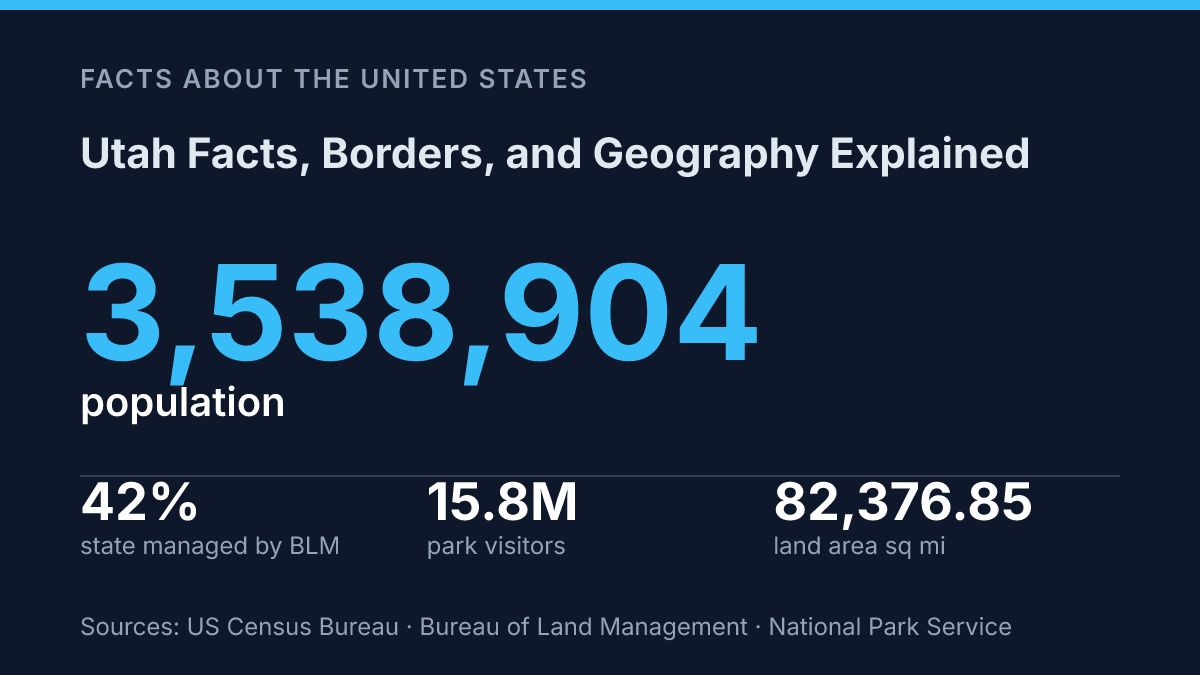
The U.S. Census Bureau put the state at 3,538,904 people on July 1, 2025. That’s fast growth on a very large map.
The geography explains the contradiction. This is Mountain West country, but not one single kind of West. Six borders pull it toward Idaho ranchlands, Nevada basins, Colorado peaks, Arizona desert, Wyoming high country, and New Mexico at the Four Corners.
Then the ground changes again: plateau, basin, mountains. A 60-mile transition zone all press into one state.
In my honest opinion, the surprise isn’t that people search for quick facts first. It’s that the quick facts point to a much stranger place than the outline on a school map suggests.
Where Utah sits in the Mountain West
Utah has more than 82,376.85 square miles of land and not a single mile of ocean coastline. That combination matters.
It makes the state feel far from the edges of the country. It also gives the map its hard inland character.
The U.S. Census Bureau places the state in the Mountain Division, part of the broader Mountain West subregion of the Western United States, according to its 2021 geography guidance. That label isn’t just paperwork. It puts the state among places defined by interior basins, elevated terrain, dry air, and long distances between major population centers.
A landlocked position can make the state look isolated at first glance. But that same inland setting is the reason its geography feels so distinct. Without an ocean edge softening the picture, the contrast comes from inside the state itself: high desert, mountain ranges, and large salt flats all sit within one regional frame.
That mix also explains why people picture the state in such different ways. Some think first of dry open ground. Others imagine steep ranges or pale salt flats that look almost blank on the horizon. In my view, the most useful way to understand the state is as an interior crossroads, not as a remote blank space on the map.
The Four Corners and Utah’s neighbors
At the Four Corners, a state line doesn’t behave like a line at all. It collapses into one surveyed point. Utah is one of the Four Corners states, sharing a border at that region with Arizona, Colorado, and New Mexico.
That makes the corner more than a photo stop. It gives the state a rare place in U.S. geography: a direct connection to the Southwest and the interior West at once.
The map looks simple from far away. The border story gets messier when you zoom in.
Beyond that corner, the state also borders Wyoming to the northeast, Idaho to the north, and Nevada to the west. So it can look central on a regional map, but its edges pull it toward five full neighboring states, plus the point contact with New Mexico. In my honest opinion, that mix is what makes its location more interesting than a plain rectangle on a classroom wall.
Federal geography reinforces that wider connection. The 2021 guidance from the U.S. Census Bureau, 2021/updated geography guidance page places the Mountain Division as an 8-state subdivision of the West that includes Arizona, Colorado, Idaho, Montana, Nevada, New Mexico, Utah, and Wyoming.
The list matters because it shows the state isn’t boxed into one identity. Its borders link it to desert states, mountain states, and fast-growing western corridors at the same time.
Why Utah’s geography stands out
A desert on paper shouldn’t have ski basins above 8,000 feet and a salt lake so large it changes how the map reads. This state does.
The state includes parts of the Great Basin and the Colorado Plateau. That split explains much of its odd visual identity.
The west leans toward enclosed basins, dry air, and water that often has nowhere to drain. The south and east rise into tablelands, cliffs, arches, and canyons cut into stacked rock.
According to the state geological survey, the transition between Basin-and-Range country and the Colorado Plateau is about 100 km, or 60 miles, wide. That is not a neat line on the ground. It is a zone where the place changes character fast.
The Great Salt Lake gives the northern interior its most unusual anchor. By area, it is the largest saltwater lake in the Western Hemisphere.
That sounds like a water-rich signature. The opposite is true.
Its saltiness comes from closed-basin geography: water flows in, evaporation takes water out, and minerals stay behind. The lake looks like abundance from a distance. Up close, it tells a sharper story about dryness.
What people get wrong is the flat-desert cliché. Dry does not mean low. Empty does not mean simple.
Elevation shifts create ski terrain, cold plateaus, warm canyon country, and exposed rock within one state. In my humble opinion, that vertical contrast matters more than any postcard view.
Rivers still shaped famous canyons, but many of the state’s most recognized features come from aridity, uplift, and elevation more than from a river-heavy setting. The dry climate leaves rock exposed. High ground changes temperature, snowpack, and vegetation over short distances.
Tourism numbers show how strongly that physical setting defines public identity. The National Park Service reported 15.8 million visits to national parks in the state in 2024, with visitor spending tied to billions in economic output.
People do not come only to see desert. They come to see what dry land does when it rises, breaks, and refuses to look predictable.
Fast facts people look for first
The quick answer most people want is also the cleanest: Utah became the 45th U.S. state on January 4, 1896. The capital is Salt Lake City. That pairing gives you the basic civic frame before the map starts doing the heavier work.
Population gives the next useful reference point. The 2020 census counted 3,271,616 residents, according to the U.S. Census Bureau. By July 1, 2025, Census Bureau QuickFacts estimated the state at 3,538,904 people, up 8.2% from the 2020 estimates base.
That growth is the tension in the state’s story. It ranks as one of the country’s fastest-growing states, but its identity still comes from geography first. People may arrive for jobs, housing, schools, or outdoor access… yet the place is still understood through its terrain before anything else.
In my view, that’s why the quick facts only get you halfway. The date, capital, and population answer the search box. The stronger memory comes from how those facts sit inside a state where settlement patterns, travel routes, and public attention still bend around physical space.
What the map asks you to notice next
Maps get more useful when you treat them as decisions, not decorations. If you’re planning a route, a report, or a move, start with land control and distance.
The Bureau of Land Management oversees 22.8 million acres here. That changes roads, access, fire risk, and where towns can grow.
Tourism adds another layer but not a simple one. National parks drew visitors in 2024 at a scale that supports local economies, yet crowds concentrate in fragile places.
The same is true at Four Corners Monument: one point looks simple. The surrounding region carries Native governance, state lines, and tourist expectations at once.
In my humble opinion, read the border as a clue, not an answer.
Frequently Asked Questions
Q: What states border Utah?
A: Utah shares borders with six states. It touches Arizona, Colorado, New Mexico, Wyoming, Idaho, and Nevada. That mix matters because Utah sits right in the center of the Four Corners region, not off to one side.
Q: Is Utah a landlocked state?
A: Yes, Utah is landlocked. It has no direct access to the ocean, so all major shipping and travel connections depend on roads, rail, and airports. That inland position shapes how people think about the state far more than most maps suggest.
Q: Which region of the United States is Utah in?
A: Utah is in the Mountain West subregion of the Western United States. That puts it in a part of the country known for high elevation, wide-open desert, and mountain terrain. In my view, that mix gives the state a sharper identity than people expect.
Q: Is Utah one of the Four Corners states?
A: Yes, Utah is one of the Four Corners states. It shares that distinction with Arizona, Colorado, and New Mexico. The corner itself is famous. The bigger story is how Utah connects to three different neighboring states at once.
Q: What is Utah known for geographically?
A: Utah is known for its inland location, mountain setting, and border with six states. Utah sits in the Mountain West, and 6 neighboring states shape how people move through it and around it. the Four Corners region is the detail most people recognize first. The full border layout tells you more.