
Jarvis Island sits 1,305 nautical miles south of Honolulu, a distance that helps explain why this U.S. possession is accessible only by ship and permit. Its land area is small, but the federal refuge tied to it is overwhelmingly marine: 1,273 acres are terrestrial, while 428,580 acres are submerged. That contrast is central to understanding the island’s status.
A place once claimed for guano in 1857, and mined for roughly 300,000 tons before the late nineteenth century, is now managed as a protected refuge within a much larger Pacific conservation system. Its modern significance rests less on settlement or infrastructure than on reefs, seabirds, legal status, and environmental change. The island’s location, acquisition, present condition, and ecological role show how a remote coral island can carry strategic, historical, and scientific weight far beyond its shoreline.
Where Jarvis Island is located
A U.S. possession smaller than many airport runways sits more than a thousand nautical miles from Honolulu in one of the least populated parts of the Pacific. Jarvis Island is in the South Pacific Ocean, roughly midway between Hawaii and the Cook Islands, within the central Pacific zone often grouped with other remote equatorial islands. Its position places it far from regular commercial routes and close enough to the equator that maps commonly describe it by reference to oceanic coordinates rather than nearby population centers.
The distance from Hawaii gives a clearer sense of its isolation than a regional label alone. The national refuge is 1,305 nautical miles south of Honolulu and is accessible only by ship and by permit, according to the U.S. Fish & Wildlife Service. That access constraint reflects geography as much as administration: there is no resident population, no public airport, and no ordinary visitor infrastructure.
Administratively, the island is a U.S. unincorporated uninhabited island, meaning it is under U.S. sovereignty but is not part of any state and has no permanent local civilian community. In geographic terms, it is extremely small, with a land area of about 1.75 square miles, or 4.5 square kilometers. The contrast between its tiny surface area and its remote position helps explain why the island can be obscure on general maps while still appearing in official navigation, territorial, and federal management records.
How the island became a U.S. territory
A deposit of bird guano, rather than settlement or military occupation, supplied the legal trigger for the United States claim to the island. The governing law was the U.S. Guano Islands Act of 1856, which allowed U.S. citizens to assert claims over guano-rich islands not under another government’s jurisdiction. Under that statute, according to U.S. Fish and Wildlife Service and GovInfo conservation-plan history, Alfred G. Benson and Charles H. Judd officially claimed Jarvis on February 5, 1857.
Guano had substantial commercial value in the 19th century because it was used as fertilizer before synthetic alternatives became widely available. Mining began in 1858 and continued until 1879, with about 300,000 tons removed during that period, according to the same conservation-plan history. This extraction-based origin explains why the island entered U.S. records even though it did not develop as a populated possession with a conventional local economy.
The island’s administrative purpose later shifted from resource removal to federal conservation management. On June 27, 1974, the Secretary of the Interior designated the island and its 3-nautical-mile territorial sea as part of the National Wildlife Refuge System, according to the U.S. Fish and Wildlife Service. That designation placed its day-to-day management under the U.S. Fish and Wildlife Service, the federal agency responsible for refuge protection, access controls, and conservation planning.
The contrast between the original claim and the present status is central to understanding its U.S. connection. The 19th-century claim was tied to a market for seabird deposits, while modern administration is directed toward protecting habitat and surrounding marine resources rather than supporting commercial extraction. The legal chain therefore begins with a commodity statute but now operates through wildlife refuge authority.
What the island looks like today
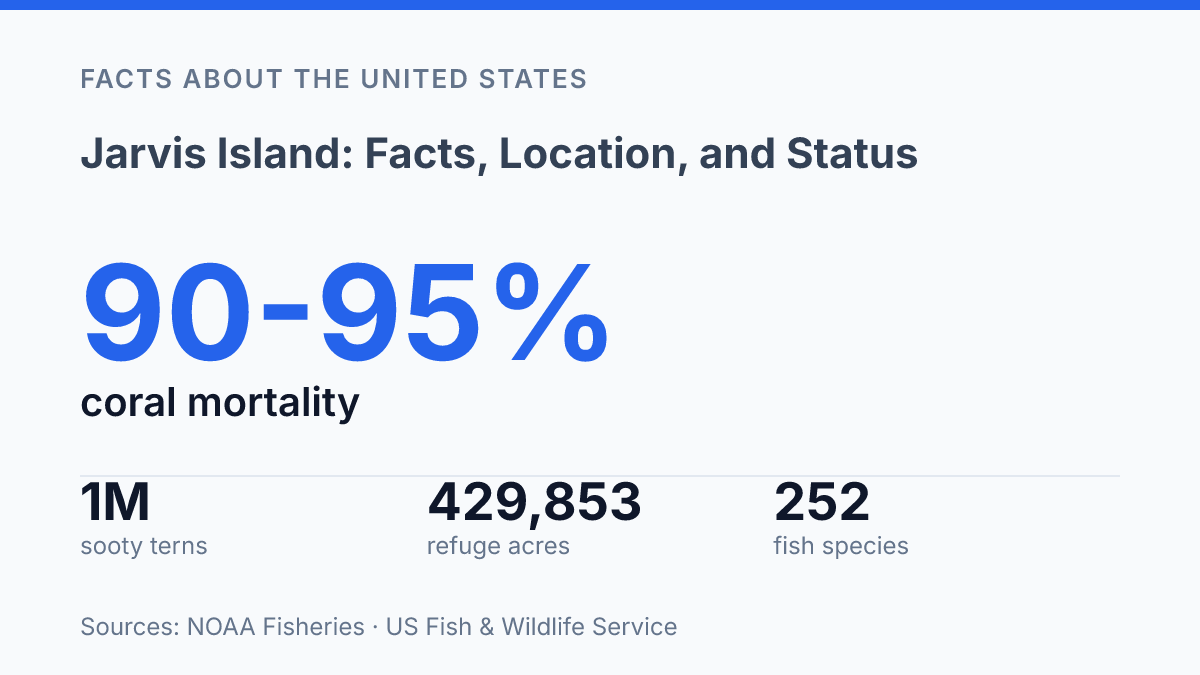
The refuge is overwhelmingly ocean: the U.S. Fish & Wildlife Service reports 429,853 acres in total, but only 1,273 acres of that is dry land. That imbalance is visible in the island’s character. It is a low, arid coral-and-sand island rather than a habitable tropical landmass, with sparse vegetation, intense exposure, and no reliable natural freshwater source to support a resident population.
On land, the surface is shaped by coral rubble, sand, and dry coastal conditions more than by soil development or permanent cover. These conditions help explain why the island remains uninhabited despite earlier human use: even basic settlement would require imported water, supplies, shelter, and transport support. The physical environment does not provide the resources that usually allow a remote island community to persist.
Human traces remain, but they are remnants rather than active infrastructure. Conservation and refuge histories identify vestiges associated with guano extraction, along with the former Millersville settlement site established in 1935 during a short-lived colonization effort. Such features mark past occupation and work on the island, yet they do not indicate a functioning settlement, port, airfield, or permanent support system today.
The island’s present condition is defined as much by protection as by isolation. It forms part of the Pacific Remote Islands Marine National Monument framework, placing the surrounding marine environment within a wider conservation system rather than treating the island as a development site.
That protected status gives ecological weight to an otherwise harsh place. NOAA Fisheries documented severe coral bleaching there in May 2016, estimating 90–95% coral mortality and noting that recovery is still being assessed, which shows that the surrounding reef environment is both biologically significant and vulnerable.
Why Jarvis Island matters now
A place with no resident community can still matter because its legal status protects breeding colonies, reef ecosystems, and a defined part of U.S. territorial administration. Jarvis is one of the U.S. Minor Outlying Islands, the small group of remote island possessions that remain under U.S. sovereignty without the political structure of a state or populated territory. That classification keeps the island visible in federal law, mapping, statistics, and conservation planning even though ordinary civilian activity there is minimal.
The strongest present-day case for the island’s significance is ecological. According to the U.S. Fish and Wildlife Service, its surrounding reef supports 252 fish species and at least 9 algae species, while 14 seabird species nest on the island.
The sooty tern colony is especially large, with an estimated 1 million birds, making the refuge valuable as a breeding site rather than as a conventional human-use area. In practical terms, the island’s lack of development is part of its function: fewer introduced pressures mean habitat can be managed primarily for native wildlife and marine systems.
Restricted access reinforces that conservation purpose. Public entry is highly limited and, for general visitors, usually prohibited unless federal authorization is granted for approved management, research, or related official work. This is not a travel-access problem so much as a protection measure, since nesting seabirds, fragile coral communities, and invasive-species risks can be affected by even small numbers of landings.
The island also has scientific value because remote protected areas provide reference points for wider ocean change. NOAA Fisheries has treated the broader protected Pacific island system that includes Jarvis as significant for monitoring reefs, seabirds, fish populations, and climate-related stress. The result is a sharp contrast: the island has little direct civilian use, but its protected habitat, federal status, and role in long-term environmental observation make it more than an empty mark on a map.
What the reef may signal next
The next questions around Jarvis Island are less about access than measurement: how quickly damaged coral communities recover, whether seabird colonies remain stable, and how protection works across waters too remote for routine observation. The island’s value lies partly in its isolation, but that same isolation makes trend data harder to gather and slower to verify.
As warming seas test reefs across the central Pacific, a site that recorded 90–95% coral mortality in 2016 may become most useful as an early indicator. The practical consequence is clear: continued protection matters, but so does sustained monitoring capable of detecting change before recovery, decline, or adaptation becomes visible at larger scales.
Frequently Asked Questions
Q: Where is Jarvis Island located?
A: Jarvis Island is a remote unincorporated territory of the United States in the central Pacific Ocean. It lies near the equator, southwest of Hawaii and north of the Line Islands. Its isolation is one reason it has remained largely undeveloped.
Q: Who owns Jarvis Island today?
A: Jarvis Island is administered by the United States as an unincorporated territory. It is not a state, and it does not have a permanent civilian population or local government. Management has focused on conservation and federal oversight rather than settlement.
Q: Is anyone living on Jarvis Island?
A: No permanent population lives on Jarvis Island. Human activity is generally limited to occasional scientific, conservation, or government visits. The lack of freshwater and the island’s remote setting make long-term habitation impractical.
Q: What is Jarvis Island known for?
A: Jarvis Island is best known for its role as a protected Pacific territory and wildlife habitat. Historical references also include 19th-century guano mining, which shaped early exploitation of the island. Today, its status as an isolated conservation area is more significant than any settlement history.
Q: Can people visit Jarvis Island?
A: Visits are highly restricted and not comparable to ordinary tourism. Access is typically limited to authorized personnel for research, conservation, or official purposes. Its protected status and remoteness mean there is no public travel infrastructure.