
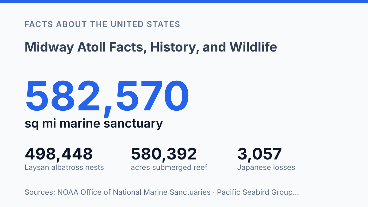
Midway Atoll covers 580,392 acres of reef and ocean, yet its dry land amounts to only about 1,549 acres across three low islands. That imbalance explains much of its significance: a small, remote place about 1,350 miles northwest of Honolulu carries military history, ecological weight, and modern management challenges far beyond its size. In 1942, U.S. codebreakers at Station Hypo helped identify the Japanese target and timing before the Battle of Midway, setting up one of the Pacific War’s decisive clashes.
Eight decades later, the atoll sits within Papahānaumokuākea National Marine Sanctuary, a 582,570-square-mile protected area designated in 2025. Its present-day story is shaped by albatross census counts, reef protection, storm risk, invasive mice, and the continued presence of Henderson Field, where aircraft operations must account for one of the Pacific’s densest seabird environments.
Where Midway Atoll sits and why it matters
Midway Atoll’s dry ground covers only about 1,549 acres, while its associated submerged reef and ocean extend across 580,392 acres, according to Recreation.gov / U.S. Fish & Wildlife Service. That imbalance explains much of the atoll’s modern identity: it is physically small, but administratively and geographically tied to a much larger protected Pacific area.
The atoll sits in the North Pacific Ocean near the northwestern end of the Hawaiian archipelago, roughly 1,350 miles northwest of Honolulu. Its three main land areas are Sand Island, Eastern Island, and Spit Island, with Sand Island historically carrying most of the built infrastructure. This position places the atoll far from major population centers but along oceanic routes that have long mattered for trans-Pacific movement.
Administrative responsibility today rests with the U.S. Fish and Wildlife Service, which manages the refuge and national memorial within Papahānaumokuākea Marine National Monument. The surrounding protected framework is also linked to Papahānaumokuākea National Marine Sanctuary, designated in 2025 as America’s 18th national marine sanctuary and covering 582,570 square miles of Pacific waters around Hawaiʻi. The result is an unusual governance setting in which conservation management, historic preservation, aviation safety, and access control intersect on a remote federal territory.
Strategic value came from geography before it came from infrastructure. Midway served U.S. Pacific navigation by offering a fixed point between Hawaiʻi and Asia, and military planners later developed that location into a forward operating site.
The former Naval Air Facility on Sand Island reflected the same logic: a small atoll could matter because aircraft, ships, and communications networks needed reliable positions across immense ocean distances. That strategic role belongs to the atoll’s geography rather than to its size, which is why a sparsely inhabited place became central to U.S. Pacific planning and remains closely managed today.
How the Battle of Midway changed the Pacific War
Six months after Pearl Harbor, the U.S. Navy turned a planned Japanese offensive into a carrier defeat that Japan could not readily replace. The battle fought in June 1942 did not end the Pacific War, but it changed its direction by blunting Japan’s ability to dictate the next phase of operations. According to The National WWII Museum, Japanese losses included about 3,057 men, hundreds of aircraft, one cruiser, and four Japanese aircraft carriers, while U.S. losses were about 362 men, one carrier, one destroyer, and 144 aircraft. The imbalance mattered because aircraft carriers had become the central striking force in the Pacific, and trained aircrews and carrier decks were harder to replace than many surface ships.
American intelligence shaped the battle before the first aircraft launched. Codebreakers at Station Hypo identified the Japanese target, estimated the attack date as June 4 or 5, 1942, and reconstructed much of the Imperial Japanese Navy’s order of battle, according to The National WWII Museum. That information allowed U.S. commanders to position carriers with unusual confidence rather than merely react to a larger opposing fleet.
Intelligence did not guarantee victory, but it narrowed uncertainty at a moment when timing, search patterns, and carrier readiness could decide the outcome within minutes.
The destruction of Akagi, Kaga, Sōryū, and Hiryū showed both the power and instability of naval air warfare. Carrier aircraft could cripple capital ships beyond visual range, yet the battle also exposed how vulnerable flight decks, fueled aircraft, and ordnance handling could be under sudden attack. Historians therefore treat Midway as a strategic turning point without reducing it to a single cause. U.S. codebreaking, Japanese command choices, pilot performance, search failures, and the evolving doctrine of carrier aviation all shaped the result. Its continuing study reflects that combination: a clear outcome produced by a compressed series of decisions under conditions of incomplete information.
Wildlife, reefs, and the scale of protection
In 2024, counters recorded 498,448 Laysan albatross nests on the atoll, making the islands one of the most concentrated seabird breeding sites in the Pacific, according to the Pacific Seabird Group’s North Pacific Albatross Working Group. The same census recorded 27,562 black-footed albatross nests, while other nesting species include Bonin petrels, white terns, tropicbirds, noddies, and frigatebirds. These colonies depend on open nesting ground, low human disturbance, and access to productive feeding areas far beyond the shoreline, so the value of the atoll is ecological rather than simply terrestrial.
The surrounding reefs add a second layer of significance because they connect coral habitat, lagoon waters, reef fish, sea turtles, and marine mammals within the Northwestern Hawaiian Islands ecosystem. Endangered Hawaiian monk seals use the area for resting, pupping, and foraging, placing the atoll within the recovery range of one of the world’s rarest seal species. Coral reefs also function as physical habitat and nursery space, but their condition is tied to wider ocean processes that local managers cannot fully control.
Formal protection changed the scale at which conservation operates. Papahānaumokuākea Marine National Monument was established in 2006, bringing the atoll’s reefs and surrounding waters into a broader protected system where extraction and disturbance are tightly limited.
That status reduces direct local pressure on wildlife and reef communities, but it does not isolate the ecosystem from drifting plastics, abandoned fishing gear, severe storms, or invasive species. The Pacific Seabird Group reported that a winter storm in 2024 destroyed most nests in one major black-footed albatross monitoring plot, while mouse attacks later killed more than 30 adult albatrosses and contributed to over 180 abandoned nests in a small area of Sand Island.
The result is a protected refuge with unusually high biological value and persistent conservation exposure. Legal protection can limit human access and safeguard habitat, yet the atoll’s position in the North Pacific also means it receives impacts carried by currents, weather, and species introduced long before present-day management began.
What remains on the atoll today
The clearest sign that the atoll is still managed, not inhabited, is that its runway remains operational under rules shaped as much by birds as by aircraft. The present human presence is a small rotating group of refuge staff, contractors, scientists, and visiting specialists, not a permanent civilian town. Housing, work buildings, utilities, and maintenance areas exist to support conservation, safety, and basic operations rather than settlement or commercial growth.
Aviation infrastructure remains the most visible part of the human footprint. Henderson Field, the surviving airstrip, has a 7,800-by-150-foot asphalt runway, according to AirNav data drawn from FAA records in 2026. The same source lists heavy bird-strike hazards and notes that approved operations are restricted to darkness during the main November-to-June seabird season, a rule that reflects the scale of wildlife activity around the runway.
Harbor facilities and service roads also remain, but their function is practical and limited. They support supply movements, vessel operations, fuel handling, equipment transport, and repair work needed to keep essential facilities running in an isolated setting. This infrastructure gives managers enough capacity to conduct fieldwork and respond to hazards, while still keeping the built footprint relatively small compared with the former operational use of the islands.
Environmental monitoring is one of the main reasons people are present. The long-running albatross nest census has been conducted since 1991, according to federal refuge reporting, and field teams also track habitat conditions, invasive-species risks, shoreline change, debris, and the status of sensitive wildlife. Such work makes the atoll less of a closed relic than an active management site, where recovery depends on repeated measurement and intervention.
Access is tightly controlled under federal conservation oversight. General tourism and casual landing are not treated as ordinary uses; entry is generally limited to approved agency work, permitted research, authorized support operations, and emergency needs. The result is a place with remnants of airfield and harbor infrastructure but little conventional settlement, where preservation of wildlife habitat and historic resources depends on a carefully limited human presence.
What protection has to account for next
The next measure of the atoll’s significance will come from how well protection works under pressure. Legal boundaries can restrict extraction across vast waters, but they cannot by themselves keep nests above floodwater, remove invasive threats, or make an active runway harmless to birds. The 2024 breeding season showed that a single winter storm and localized mouse attacks can alter outcomes within weeks, even at a site monitored for decades.
That makes the atoll less a preserved relic than a live management test: history fixed its global name, but biology now sets the daily terms. The practical consequence is clear enough at Henderson Field, where even access to a 7,800-foot runway depends on darkness, season, and birds.
Frequently Asked Questions
Q: Where is Midway Atoll located?
A: Midway Atoll is a remote U.S. territory in the North Pacific Ocean, northwest of the Hawaiian Islands. It sits near the midpoint between North America and Asia, which is how it received its name. Its isolation has shaped both its strategic history and its wildlife value.
Q: Why is Midway Atoll historically significant?
A: Midway Atoll is best known for its role in World War II, especially the Battle of Midway in 1942. That battle marked a major turning point in the Pacific War by limiting Japanese naval expansion. The atoll’s history also reflects its earlier use as a naval and aviation outpost.
Q: What kinds of wildlife live on Midway Atoll?
A: Midway Atoll is a major seabird habitat, with large breeding populations of albatrosses and other nesting birds. It also supports marine life in the surrounding waters, including threatened and protected species. Its ecological importance comes from its relatively undisturbed nesting areas and open-ocean setting.
Q: Can people visit Midway Atoll?
A: Public access is highly restricted and generally limited to guided tours or special permissions. The atoll is managed primarily for wildlife conservation, so visits are controlled to reduce disturbance to nesting birds and fragile habitats. That means tourism is possible, but it is not comparable to a typical island destination.
Q: Why is conservation important on Midway Atoll?
A: Conservation is essential because the atoll contains sensitive nesting habitat and is exposed to marine debris, invasive species, and the effects of climate change. Protecting the site helps maintain its seabird colonies and broader ocean ecosystem. It also preserves a historically significant location that has both natural and cultural value.